7 Best Cultural Space Mapping Examples
Maps aren’t just geographical toolsâthey’re cultural artifacts that reveal how different societies view and organize space. While Western cartography typically prioritizes north-up orientation and precise mathematical projections, cultures worldwide have developed dramatically different approaches to representing their environments. From Indigenous songlines that map spiritual journeys to Islamic maps placing Mecca at the center of the world, these diverse mapping traditions challenge your assumptions about what constitutes “accurate” spatial representation.
Understanding these cross-cultural perspectives transforms how you think about navigation, territory, and the relationship between people and place. These mapping differences aren’t simply artistic choices but reflect fundamental worldviews about direction, distance, and the meaning of space itself.
Disclosure: As an Amazon Associate, this site earns from qualifying purchases. Thank you!
Aboriginal Australian Songlines: Navigating Through Ancestral Stories
Aboriginal Australian songlines represent one of the world’s most sophisticated spatial mapping systems, encoding complex geographical knowledge within oral traditions that span tens of thousands of years.
P.S. check out Udemy’s GIS, Mapping & Remote Sensing courses on sale here…
Sacred Geography and Dreamtime Narratives
Songlines map spiritual landscapes through interconnected paths that crisscross the Australian continent. These invisible highways trace the journeys of ancestral beings during Dreamtime creation stories, linking sacred sites across thousands of kilometers. Each songline carries specific ceremonial knowledge about water sources, seasonal changes, and territorial boundaries. You’ll find that these oral maps contain detailed topographical information encoded in verses that describe landforms, vegetation patterns, and astronomical alignments with remarkable precision.
Traditional Wayfinding Techniques
Aboriginal navigators use songlines as mental GPS systems combining auditory memory with environmental observation. Traditional wayfinding relies on singing specific song cycles that correspond to geographical features like rock formations, water holes, and seasonal landmarks. You can trace entire continental routes by following sequential verses that describe terrain changes, weather patterns, and resource locations. These techniques integrate multiple sensory inputs including wind patterns, star positions, animal behavior, and seasonal indicators to create comprehensive navigation frameworks.
Navigate with ease using this 7-inch GPS navigator, featuring real-time voice guidance and pre-loaded 2025 maps. Customize routes based on your vehicle type to avoid restrictions and receive speed & red light warnings.

Modern Applications in Contemporary Mapping
Contemporary cartographers increasingly recognize songlines as valuable data sources for ecological and cultural mapping projects. Modern GIS applications now incorporate traditional ecological knowledge from songlines to identify biodiversity hotspots, migration corridors, and climate adaptation strategies. You’ll see collaborative mapping initiatives that combine GPS technology with Aboriginal knowledge holders to create hybrid maps serving both conservation and cultural preservation goals. These projects demonstrate how indigenous spatial concepts can enhance scientific understanding of landscape connectivity and environmental management.
Explore and map the wilderness for the Queen in Cartographers! Draw unique terrain shapes and score points based on randomly selected goals each game, but beware of monster ambushes.

Inuit Mental Maps: Surviving Arctic Landscapes Through Spatial Memory
Inuit communities have developed sophisticated mental mapping systems that enable navigation across featureless Arctic terrain where traditional landmarks disappear with changing seasons. These cognitive maps integrate multiple environmental indicators to create reliable spatial frameworks for survival in one of Earth’s most challenging environments.
Seasonal Navigation Patterns
Inuit navigators track seasonal wind patterns and snow formations to maintain directional awareness across vast Arctic expanses. You’ll find that experienced hunters memorize prevailing wind directions for each season, using sastrugi (wind-carved snow ridges) as compass references. They identify specific snow crystal formations that indicate wind patterns and temperature changes. Traditional knowledge holders teach navigation through seasonal star positions, with constellations serving as celestial roadmaps. These patterns create redundant navigation systems that function even when individual environmental markers change or disappear completely.
Ice Condition Mapping Methods
Inuit ice specialists develop detailed mental maps of sea ice conditions that change daily based on temperature, currents, and wind. You observe how elders classify over 30 different ice types, each requiring specific travel techniques and safety protocols. They monitor ice sounds, colors, and surface textures to assess thickness and stability. Traditional terminology describes ice formation stages, from nilas (thin elastic ice) to multiyear ice formations. These specialists share ice condition knowledge through oral reports that function as real-time navigation updates for hunting and travel routes.
Community-Based Spatial Knowledge Systems
Inuit communities maintain collective spatial knowledge through storytelling networks that preserve navigation wisdom across generations. You participate in knowledge-sharing sessions where hunters describe route conditions, weather patterns, and animal behavior observations. Elders embed geographical information within traditional stories that serve as mnemonic devices for remembering complex spatial relationships. Community meetings function as information exchanges where multiple perspectives create comprehensive environmental awareness. These systems ensure that critical navigation knowledge survives individual memory limitations and continues serving community survival needs.
Polynesian Stick Charts: Ocean Navigation Through Tactile Mapping
Polynesian navigators developed stick charts as three-dimensional maps that translate oceanic wave patterns into tactile representations. These sophisticated navigation tools represent thousands of years of maritime knowledge encoded in bamboo and shells.
Wave Pattern Recognition Techniques
Wave pattern recognition forms the foundation of Polynesian stick chart navigation through systematic observation of ocean swells. You’ll find that master navigators identify four primary wave types: trade wind swells, storm swells, refracted waves, and reflected waves from distant islands. Each wave pattern creates distinct rhythmic motions that navigators feel through their vessels.
Achieve a flawless, even complexion with e.l.f. Flawless Satin Foundation. This lightweight, vegan formula provides medium coverage and a semi-matte finish for all-day wear, while hydrating your skin with glycerin.

Polynesian wayfinders train for years to recognize subtle wave interference patterns that indicate nearby landmasses. You can detect islands up to 30 miles away by observing how ocean swells bend and reflect off underwater reefs and shorelines.
Island Position Mapping Methods
Island position mapping relies on curved sticks that represent wave swells and shells that mark specific island locations within the archipelago. You’ll notice that horizontal sticks indicate consistent ocean swells while diagonal pieces show wave interference patterns created by land obstacles.
Marshall Islands navigators create detailed stick charts covering hundreds of square miles of ocean territory. Each chart encodes precise relationships between islands, with cowrie shells positioned at exact intersections where wave patterns converge. You can read these charts by running your fingers along the bamboo framework to understand directional wave flows.
Cultural Transmission of Maritime Knowledge
Cultural transmission preserves stick chart knowledge through apprenticeship systems that span multiple generations of master navigators. You’ll discover that each navigator family guards specific chart-making techniques and wave-reading secrets as inherited intellectual property.
Traditional navigation schools require students to memorize hundreds of wave patterns before touching actual stick charts. Young navigators spend years observing ocean conditions with experienced mentors who share knowledge through hands-on demonstration rather than written instruction. This oral tradition ensures that critical maritime wisdom survives within tight-knit island communities.
Islamic Cartography: Religious Orientation in Medieval Mapping
Islamic cartographers developed distinctive mapping traditions that placed spiritual significance at the center of geographical representation. You’ll find these medieval maps prioritize religious orientation over mathematical precision, creating spatial frameworks that reflect Islamic worldviews.
Mecca-Centered World Representations
Mecca-centered maps position the holy city at the world’s center, establishing a spiritual hierarchy of space that differs fundamentally from Western cartographic conventions. You’ll notice these maps, like the 12th-century works of al-Idrisi, arrange continents around Mecca as the focal point. Islamic cartographers created circular world maps called mappa mundi that place the Kaaba at the geometric center, with trade routes radiating outward like spokes. These representations reflect the Islamic concept of Mecca as Umm al-Qura (Mother of Cities), emphasizing religious geography over mathematical accuracy.
Qibla Direction Mapping Systems
Qibla maps serve as directional tools for determining prayer orientation toward Mecca from any location on Earth. You’ll find these specialized maps include compass roses and directional lines that help Muslims calculate the correct prayer direction. Medieval Islamic scholars like al-Biruni developed sophisticated mathematical methods to calculate qibla directions, creating maps with radiating lines from Mecca. These cartographic tools evolved into portable instruments called qibla compasses, which travelers could use to maintain proper prayer orientation during journeys across the Islamic world.
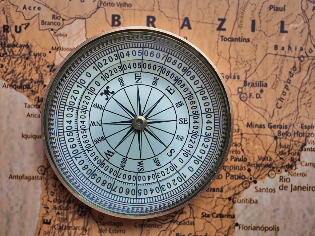
Find the Qibla direction easily with this handheld compass. Lightweight and compact, it includes a booklet for guidance.

Spiritual Geography Integration
Spiritual geography maps blend physical terrain with religious significance, creating layered representations that guide both physical and spiritual journeys. You’ll discover these maps highlight pilgrimage routes, sacred sites, and religious boundaries alongside geographical features. Islamic cartographers incorporated Quranic geography, marking locations mentioned in religious texts and connecting them through pilgrimage networks. These maps function as both navigation tools and spiritual guides, encoding religious knowledge within geographical frameworks that support the faithful in their spiritual and physical travels.
Chinese Feng Shui Maps: Harmonizing Space with Cosmic Energy
Chinese feng shui mapping represents an ancient geomantic tradition that interprets landscapes through the lens of cosmic energy flow. These maps prioritize spiritual harmony over geographical accuracy, incorporating principles of qi circulation and elemental balance.
Geomantic Landscape Analysis
Dragons and tigers dominate feng shui topographical interpretations through symbolic landscape reading. You’ll find mountains classified as protective dragon spines that channel beneficial qi energy through valleys and ridges. Water features become flowing arteries that carry prosperity or misfortune depending on their directional flow patterns. Traditional feng shui practitioners create detailed landform maps identifying auspicious burial sites, settlement locations, and agricultural zones. These geomantic surveys incorporate elevation changes, water drainage patterns, and vegetation growth as indicators of underlying energy currents that influence human fortune and environmental harmony.
Enjoy refreshing water with the Avalon Bottom Loading Water Cooler. It offers hot, cold, and room temperature options, a BioGuard anti-microbial coating, and a child safety lock for peace of mind.

Directional Significance in Spatial Planning
Compass directions carry profound spiritual meaning in feng shui spatial organization systems. You’ll encounter the luopan compass as the primary tool for creating directionally-oriented maps that align structures with cosmic forces. Each of the eight cardinal and intercardinal directions corresponds to specific life aspects like wealth, health, and relationships. Feng shui maps position buildings, roads, and landscape features according to these directional principles, with south representing fire energy and north symbolizing water elements. Modern feng shui consultants still use traditional compass readings to create site analysis maps for urban planning and architectural design projects.
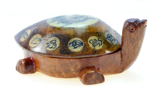
Attract good luck and longevity with this Feng Shui wooden turtle compass. Its compact size (3.5 x 2.5 x 1.5 inches) makes it perfect for any space.
Balance Principles in Environmental Mapping
Yin-yang duality governs feng shui environmental mapping through complementary landscape elements. You’ll observe how practitioners map the balance between mountain yang energy and water yin energy to identify optimal locations for human habitation. These maps highlight the interplay between active landscape features like peaks and ridges against passive elements such as valleys and lakes. Five-element theory further refines spatial analysis by categorizing terrain features according to wood, fire, earth, metal, and water characteristics. Feng shui environmental maps serve as guides for maintaining ecological harmony while supporting human prosperity through strategic landscape modification and preservation techniques.
Native American Sacred Geography: Mapping Spiritual Landscapes
Native American tribes developed sophisticated spatial knowledge systems that map ceremonial sites, migration routes, and territorial boundaries according to spiritual relationships rather than geometric precision. These sacred geography systems encode thousands of years of cultural wisdom into landscape-based navigation frameworks.
Ceremonial Site Identification Systems
Identify sacred sites through landscape feature recognition that connects spiritual significance with topographical markers. You’ll find tribes use natural formations like prominent rocks, water sources, and elevated viewpoints as ceremonial anchors. Document these locations through oral traditions that link creation stories to specific geographical coordinates. Navigate between sacred sites using sight lines and astronomical alignments that create spiritual pathways across tribal territories. Preserve ceremonial knowledge through storytelling networks that embed geographical information within religious practices, ensuring sacred site locations remain accessible to tribal members.
Seasonal Migration Route Documentation
Track seasonal movements through landscape-based wayfinding systems that combine resource availability with spiritual obligations. You’ll discover tribes document migration timing using celestial observations and environmental indicators like plant flowering cycles. Map traditional hunting grounds through oral histories that preserve knowledge of animal behavior patterns and seasonal resource distribution. Connect migration routes with ceremonial calendars that synchronize spiritual practices with geographical movements across ancestral territories. Maintain route knowledge through generational teaching systems that embed geographical information within cultural storytelling traditions.
Tribal Territory Boundary Concepts
Define territorial boundaries through natural feature recognition rather than surveyed property lines, using rivers, ridgelines, and distinctive landmarks as boundary markers. You’ll observe tribal territories incorporate sacred sites as anchor points that establish cultural ownership patterns. Negotiate boundary agreements through ceremonial protocols that acknowledge spiritual relationships between tribes and their ancestral landscapes. Respect overlapping territorial claims through seasonal usage rights that allow multiple tribes to access shared hunting grounds. Document boundary knowledge through place-name systems that encode territorial information within indigenous language structures, preserving geographical relationships across generations.
European Renaissance Cartography: Scientific Precision Meets Cultural Bias
Renaissance cartographers revolutionized mapmaking by introducing mathematical precision while simultaneously embedding their cultural worldviews into global representations. You’ll find that these maps reflect both scientific advancement and European perspectives that shaped colonial expansion.
Mercator Projection Cultural Implications
Mercator’s 1569 projection distorts landmass sizes to favor European nations, making Greenland appear larger than Africa despite being 14 times smaller. You’ll notice how this projection places Europe at the world’s center while exaggerating northern hemisphere territories. Maritime nations like Britain and the Netherlands appear disproportionately large, reinforcing European dominance in global trade. Colonial powers used this visual distortion to justify territorial expansion, presenting their homelands as geographically significant on world maps.
Colonial Mapping Perspectives
Colonial maps systematically erased indigenous place names and territorial boundaries, replacing them with European designations that reflected ownership claims. You’ll observe how cartographers depicted “empty” lands despite thriving native populations, using blank spaces to suggest available territory for settlement. Terra nullius concepts appeared on maps as unexplored regions, legally justifying colonization through cartographic representation. These maps prioritized European settlements, trade routes, and resource extraction sites while minimizing indigenous geographic knowledge and established territories.
Eurocentrism in Global Representations
European world maps consistently positioned their continent at the center of global representations, establishing a visual hierarchy that reflected political power. You’ll find that Renaissance cartographers oriented maps with Europe prominently displayed while relegating other continents to peripheral positions. The Prime Meridian’s placement through Greenwich, England reinforced British naval supremacy and temporal authority over global navigation. These maps depicted European cities with detailed accuracy while representing African, Asian, and American territories with simplified, often inaccurate geographic features.
Conclusion
These diverse mapping traditions reveal that your understanding of space extends far beyond simple geography. Each culture’s approach to mapping reflects deeper values about relationships between people land and the cosmos.
When you explore these alternative cartographic systems you discover that accuracy isn’t just about mathematical precision. Indigenous songlines Polynesian stick charts and feng shui maps demonstrate sophisticated spatial knowledge that serves practical spiritual and ecological purposes.
Your awareness of these cross-cultural mapping approaches can transform how you perceive your own environment. They remind you that every map tells a story about the people who created it and their unique relationship with the world around them.
Frequently Asked Questions
What are songlines and how do they function as maps?
Songlines are Aboriginal Australian spatial mapping systems that encode geographical knowledge within oral traditions spanning tens of thousands of years. They map spiritual landscapes through interconnected paths tracing ancestral beings’ journeys during Dreamtime creation stories. Each songline contains ceremonial knowledge about water sources, seasonal changes, and territorial boundaries, with detailed topographical information embedded in verses that function as mental GPS systems.
How do Inuit communities navigate the Arctic without traditional landmarks?
Inuit navigators use sophisticated mental mapping systems that track seasonal wind patterns, snow formations, and environmental indicators like sastrugi and star positions. They classify over 30 different ice types and share knowledge through oral reports that serve as real-time navigation updates. Community-based storytelling networks preserve this navigation wisdom across generations, ensuring survival in featureless Arctic terrain.
What are Polynesian stick charts and how do they work?
Polynesian stick charts are three-dimensional maps made from bamboo and shells that translate oceanic wave patterns into tactile representations. They encode thousands of years of maritime knowledge, helping navigators recognize four primary wave types to identify nearby landmasses. These charts illustrate relationships between islands and wave swells, allowing navigators to read ocean conditions by touch during sea voyages.
How does Islamic cartography differ from Western mapping traditions?
Islamic cartography prioritizes spiritual significance over mathematical precision, often positioning Mecca at the world’s center to establish a spiritual hierarchy of space. These maps, including 12th-century works by al-Idrisi, arrange continents around Mecca, reflecting Islamic concepts of the holy city as Umm al-Qura (Mother of Cities). Qibla maps serve as directional tools for prayer orientation.
What is feng shui mapping and how is it applied?
Feng shui mapping is an ancient Chinese geomantic tradition that interprets landscapes through cosmic energy flow, emphasizing spiritual harmony over geographical accuracy. These maps incorporate qi circulation and elemental balance principles, classifying mountains as protective dragon spines and water features as flowing arteries. Modern consultants use these principles in urban planning and architectural design for environmental harmony.
How do Native American tribes use sacred geography for mapping?
Native American tribes develop spatial knowledge systems mapping ceremonial sites, migration routes, and territorial boundaries based on spiritual relationships rather than geometric precision. They identify sacred sites through natural landscape features, document seasonal migration routes based on resource availability and spiritual obligations, and define territorial boundaries through natural features rather than surveyed lines.
What cultural biases exist in European Renaissance cartography?
Renaissance cartography embedded European cultural worldviews into global representations, with the Mercator projection distorting landmass sizes to favor European nations and placing Europe at the world’s center. Colonial mapping systematically erased indigenous place names and territorial boundaries, depicting “empty” lands to justify colonization while establishing visual hierarchies that reflected European political power and dominance.
Why are alternative mapping traditions important to understand?
Alternative mapping traditions challenge conventional notions of “accurate” spatial representation by revealing diverse cultural worldviews regarding navigation, territory, and space significance. Understanding these systems reshapes our relationship with environments, demonstrates sophisticated indigenous knowledge systems, and shows how spiritual, cultural, and practical considerations can be integrated into spatial understanding beyond Western mathematical precision.