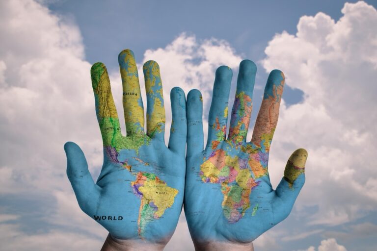
7 Best Cartographic Art for Visual Storytelling
Maps tell stories beyond geography and throughout history artists have transformed legendary cartographic tales into stunning visual masterpieces. From ancient sea monsters lurking in uncharted waters to mythical cities that captured explorers’ imaginations these artistic interpretations bring folklore to life through creative expression. You’ll discover how seven remarkable artists have reimagined the world’s most captivating map legends turning historical mysteries into breathtaking works of art.
Disclosure: As an Amazon Associate, this site earns from qualifying purchases. Thank you!
Ancient Maritime Monsters: Dragons and Sea Serpents in Medieval Maps
Medieval cartographers transformed unknown ocean territories into artistic canvases filled with mythical creatures. These maritime monsters served dual purposes as decorative elements and navigational warnings for sailors venturing into uncharted waters.
Explore and map the wilderness for the Queen in Cartographers! Draw unique terrain shapes and score points based on randomly selected goals each game, but beware of monster ambushes.

Leviathans of the Deep Blue
Medieval mapmakers depicted massive sea dragons with serpentine bodies stretching across entire ocean sections. You’ll find these creatures on maps like the Carta Marina (1539), where multi-headed beasts emerge from churning waves with intricate scales and fearsome expressions. Norse mythology heavily influenced these representations, with artists incorporating kraken-like tentacles and whale-sized proportions. The Hereford Mappa Mundi features a prominent sea serpent coiled around Britain’s coastline, demonstrating how cartographers used mythical creatures to fill vast oceanic spaces while creating visual landmarks for navigation.
P.S. check out Udemy’s GIS, Mapping & Remote Sensing courses on sale here…
Decorative Dangers and Symbolic Warnings
Renaissance cartographers used sea monsters as sophisticated warning systems for maritime hazards. You’ll notice these creatures positioned strategically near rocky coastlines, treacherous currents, and known shipwreck locations. The famous phrase “Here be dragons” appeared on early maps to indicate dangerous or unexplored territories, though actual dragons were more commonly illustrated than written. Artists incorporated regional folklore into their monster designs, creating unique hybrid creatures that combined local mythologies with classical sea serpent imagery. These decorative elements served practical purposes, helping sailors identify potentially hazardous waters while adding commercial appeal to expensive commissioned maps.
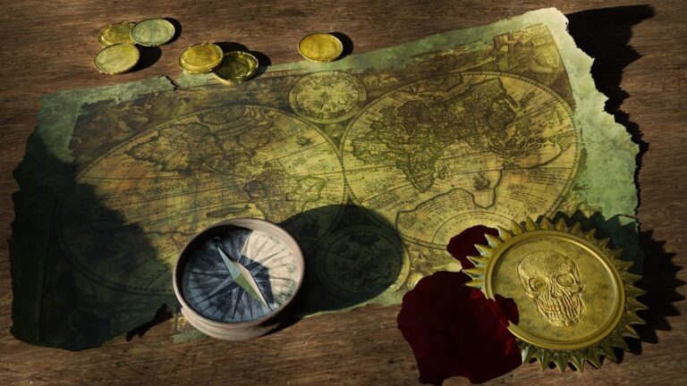
Mythical Lands and Lost Civilizations: Atlantis and El Dorado Visualizations
Artists have transformed legendary lost civilizations into compelling cartographic masterpieces, breathing visual life into Plato’s philosophical allegories and conquistador tales.
The Sunken City Beneath the Waves
Atlantis visualizations showcase elaborate underwater metropolises with crystalline domes and spiral architecture. Renaissance cartographers like Athanasius Kircher positioned the lost continent in the Atlantic Ocean, creating detailed maps with concentric rings and grand palaces. Modern artistic interpretations feature bioluminescent coral cities and submerged temples, combining archaeological accuracy with fantasy elements. These maps often include depth measurements and oceanographic features, transforming Plato’s philosophical metaphor into tangible geographic reality through intricate artistic detail.
Golden Cities of the New World
El Dorado cartographic art depicts magnificent golden cities nestled within South American mountain ranges and jungle landscapes. Colonial-era maps featured elaborate illustrations of treasure-filled temples and ceremonial lakes where gold offerings were made. Contemporary artists create layered visualizations showing both the historical Lake Guatavita and imagined golden metropolises. These artistic maps incorporate indigenous architectural styles, Spanish colonial influences, and geological features like the Andes Mountains, transforming conquistador legends into visually stunning geographic narratives.
Celestial Cartography: Zodiac Constellations and Astrological Influences
Artistic cartographers have elevated celestial maps beyond mere astronomical tools, transforming zodiac constellations into intricate visual narratives that blend scientific observation with mythological storytelling.
Star Maps as Artistic Masterpieces
You’ll discover that historical star charts showcase elaborate artistic interpretations of constellation figures, with artists like Johannes Hevelius creating ornate celestial atlases featuring detailed mythological creatures. These 17th-century masterpieces include golden lions for Leo, graceful water-bearers for Aquarius, and fierce scorpions for Scorpius. Renaissance cartographers enhanced zodiac imagery with decorative borders, compass roses, and astrological symbols that transformed functional star maps into museum-worthy artworks. Modern astronomical artists continue this tradition by incorporating digital techniques, creating luminescent constellation art that highlights stellar magnitudes through varying brightness levels and color gradients.
Blending Science with Mythology
You’ll notice how celestial cartographers expertly merge precise astronomical data with ancient mythological narratives, positioning constellation boundaries according to International Astronomical Union standards while preserving traditional figure representations. Artists incorporate Greek, Roman, and Arabic star names alongside mythological imagery, creating educational tools that honor both scientific accuracy and cultural heritage. Contemporary star map designers use parallax measurements and proper motion data to ensure stellar positions remain accurate while maintaining the artistic integrity of zodiac figures like Orion the Hunter and Cassiopeia the Queen. This fusion creates compelling visual stories that make astronomical education more engaging through artistic interpretation.
Terra Incognita: The Artistic Interpretation of Unknown Territories
Artists transformed cartographic voids into visual narratives that reveal humanity’s deepest anxieties and fantasies about unexplored regions.
Blank Spaces Filled with Imagination
Empty territories on historical maps became artistic canvases where cartographers unleashed their creative interpretations of the unknown. Medieval mapmakers filled vast African interiors with elaborate illustrations of exotic animals like elephants, lions, and mythical creatures such as cynocephali (dog-headed humans). Renaissance cartographers decorated unexplored polar regions with detailed igloos, aurora displays, and imagined Arctic civilizations. These artistic embellishments served dual purposes—warning travelers of potential dangers while satisfying public curiosity about distant lands through visual storytelling.
Indigenous Peoples as Exotic Illustrations
Native populations appeared as decorative elements in colonial-era maps, often depicted through European artistic filters that emphasized perceived exoticism. Cartographers illustrated Amazonian tribes with elaborate feathered headdresses and golden ornaments, while North American indigenous peoples appeared as noble warriors in detailed ceremonial dress. Pacific Islander communities were portrayed alongside tropical flora, creating romanticized visions of paradise that served European colonial interests. These artistic interpretations reflected contemporary European perspectives rather than authentic cultural representations, transforming living communities into ornamental map features.
Religious and Biblical Geography: Paradise and Sacred Lands
Sacred cartography transforms spiritual narratives into visual masterpieces that blend theological doctrine with artistic imagination. Medieval and Renaissance mapmakers created stunning interpretations of biblical territories that continue to inspire contemporary artists.
Garden of Eden Depictions
Garden of Eden illustrations showcase paradise through elaborate artistic cartography that merges biblical description with earthly geography. Medieval mappae mundi positioned Eden at the eastern edge of world maps, featuring four rivers flowing from a central fountain surrounded by luxuriant vegetation and exotic animals. Renaissance cartographers like Pierre d’Ailly created detailed Eden maps with precise geographical coordinates, placing paradise near the source of major Asian rivers. Modern interpretations blend archaeological research with fantastical elements, depicting crystalline waterfalls and bioluminescent flora within protected mountain sanctuaries.
Get durable, tear-resistant posters made in the USA. Each 18" x 29" poster features high-quality 3 MIL lamination for lasting protection.

Holy Land Pilgrimage Routes
Holy Land pilgrimage maps transform spiritual journeys into artistic geographic narratives that guide travelers through sacred territories. Medieval cartographers illustrated Jerusalem-centered maps featuring detailed routes from European ports to biblical sites, adorned with miniature churches and holy symbols marking significant locations. Renaissance pilgrimage charts included elevation profiles and distance calculations, decorated with elaborate compass roses and religious iconography. Contemporary artists create layered pilgrimage maps that overlay historical routes with modern transportation networks, incorporating archaeological discoveries and interfaith perspectives to honor multiple religious traditions.
Compass Roses and Wind Gods: Navigational Art as Decorative Elements
Medieval and Renaissance cartographers transformed essential navigational tools into elaborate artistic masterpieces that showcased both technical precision and creative imagination.
Personified Winds and Weather Patterns
Wind deities adorned historical maps as powerful artistic figures that guided maritime navigation while adding visual drama to cartographic compositions. European mapmakers depicted Aeolus controlling storm patterns through ornate illustrations featuring flowing robes and dynamic poses. Renaissance cartographers like Abraham Ortelius created detailed wind rose diagrams where personified winds emerged from decorative cloud formations. Trade wind patterns appeared as mythological figures blowing ships toward their destinations, while monsoon seasons were illustrated through seasonal deities controlling weather systems across oceanic trade routes.
Ornate Direction Indicators
Compass roses evolved from simple directional markers into intricate geometric artworks that combined functional navigation with decorative splendor throughout cartographic history. Medieval mapmakers created elaborate multi-layered roses featuring fleur-de-lis symbols pointing toward magnetic north and ornate crosses indicating true cardinal directions. Renaissance cartographers like Gerardus Mercator designed compass roses with up to 32 directional points, each decorated with unique artistic flourishes and heraldic symbols. Rhumb lines radiated from central compass roses in complex geometric patterns, creating visual networks that transformed navigational charts into mathematical art pieces combining practical sailing directions with aesthetic beauty.
Modern Digital Resurrections: Contemporary Artists Reimagining Historical Map Legends
Today’s digital artists combine cutting-edge technology with centuries-old cartographic legends to create immersive experiences that bring mythical territories to life. These contemporary masters use advanced software and interactive media to resurrect ancient map mysteries for modern audiences.
Digital Art Meets Ancient Cartography
Digital artists now transform historical map legends using sophisticated 3D modeling software and AI-powered design tools. You’ll find contemporary creators like David Rumsey and Strange Maps using Photoshop and Cinema 4D to reconstruct Atlantis with photorealistic underwater cities. These artists layer historical cartographic elements with modern satellite imagery, creating hybrid visualizations where medieval sea monsters swim through Google Earth landscapes. Digital colorization techniques bring faded manuscript maps to life, while procedural generation software creates endless variations of legendary territories like El Dorado’s golden cities.
Interactive Installations and Virtual Reality
VR technology enables you to walk through legendary cartographic realms previously confined to flat map surfaces. Artists like Casey Reas create interactive installations where visitors navigate through digitally reconstructed Terra Incognita using motion sensors and haptic feedback. Museums now feature VR experiences that transport you inside medieval mappae mundi, allowing exploration of the Garden of Eden or encounters with cartographic dragons. These installations combine historical accuracy with artistic interpretation, using Unity and Unreal Engine to create immersive worlds where you can experience the wonder medieval travelers felt when viewing these legendary territories.
Protect your property with this wireless driveway alarm system. It features a long 1/2-mile range and a motion sensor that detects movement up to 50 feet away, reducing false alarms.

Conclusion
These seven artistic interpretations demonstrate how mapmakers throughout history have transformed cartographic legends into captivating visual narratives. You’ve witnessed how mythical sea creatures evolved from navigational warnings into decorative masterpieces and how lost civilizations like Atlantis found new life through artistic imagination.
The fusion of art and cartography continues to evolve with modern digital tools. Today’s artists build upon centuries of tradition while incorporating cutting-edge technology to create immersive experiences that honor both historical accuracy and creative expression.
Your understanding of these legendary maps reveals more than geographical knowledge—it uncovers humanity’s eternal desire to visualize the unknown and transform mysteries into art. These cartographic legends remind you that every map tells a story and every unexplored territory holds infinite artistic possibilities.
Frequently Asked Questions
What is the connection between art and cartography?
Art and cartography intersect when artists creatively interpret legendary map tales, transforming mythical elements like sea monsters and legendary cities into stunning visual masterpieces. Historical cartographers used maps as artistic canvases, blending geographical knowledge with imaginative storytelling to create both functional and decorative works.
How did medieval cartographers depict sea monsters on maps?
Medieval cartographers illustrated sea monsters like dragons and serpents on maps to fill unknown ocean territories and serve as visual landmarks. These creatures appeared on famous maps like the Carta Marina and Hereford Mappa Mundi, often strategically placed near dangerous coastlines as warning systems for maritime hazards.
What does “Here be dragons” mean on old maps?
“Here be dragons” indicated unexplored territories on historical maps, showcasing areas where cartographers had limited geographical knowledge. This phrase represented the blending of regional folklore with classical imagery, where mythical creatures filled empty spaces and warned travelers of potential dangers in uncharted regions.
How are legendary lost civilizations depicted in cartographic art?
Lost civilizations like Atlantis and El Dorado are visualized through intricate maps featuring elaborate underwater cities with crystalline domes and magnificent golden cities within lush landscapes. Artists blend archaeological accuracy with fantasy elements, incorporating indigenous styles and geological features to create compelling geographic representations.
What is celestial cartography and how is it artistic?
Celestial cartography combines scientific star observation with mythological storytelling, creating ornate star charts that feature detailed constellation figures. Artists like Johannes Hevelius created elaborate celestial atlases with decorative borders and astrological symbols, transforming functional astronomical maps into museum-worthy artworks.
How did cartographers handle empty spaces on historical maps?
Cartographers transformed empty territories into artistic canvases filled with exotic animals, mythical creatures, and imagined civilizations. Medieval mapmakers decorated African interiors with elaborate illustrations, while Renaissance cartographers filled polar regions with Arctic civilizations, satisfying public curiosity about unexplored areas.
What is sacred cartography?
Sacred cartography blends theological doctrine with artistic imagination to create visual representations of spiritual narratives. This includes depictions of the Garden of Eden positioned at world map edges, Holy Land pilgrimage routes adorned with religious symbols, and contemporary interpretations that honor multiple religious traditions.
How do modern artists reimagine historical map legends?
Contemporary digital artists use 3D modeling software, AI tools, and virtual reality to resurrect ancient map mysteries. They create immersive experiences like photorealistic underwater Atlantis cities and interactive installations, blending historical accuracy with artistic interpretation to offer fresh perspectives on legendary cartographic tales.