7 Ways How to Choose the Right Map Projection for Your Project
Choosing the wrong map projection can distort your data beyond recognition and mislead your audience. The bottom line: Every map projection sacrifices something – whether it’s area accuracy, shape preservation, or distance measurements – so you need to match your projection to your project’s specific goals.
Your choice depends on what you’re mapping, where it’s located, and what story you’re trying to tell. A global climate visualization demands different projection considerations than a local hiking trail map or a navigation app for city streets.
Disclosure: As an Amazon Associate, this site earns from qualifying purchases. Thank you!
Understanding the Fundamentals of Map Projections
Map projections form the mathematical foundation that enables you to display Earth’s curved surface on flat media, whether digital screens or printed materials.
P.S. check out Udemy’s GIS, Mapping & Remote Sensing courses on sale here…
Achieve a flawless, even complexion with e.l.f. Flawless Satin Foundation. This lightweight, vegan formula provides medium coverage and a semi-matte finish for all-day wear, while hydrating your skin with glycerin.

What Are Map Projections and Why They Matter
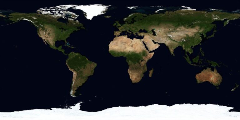
Map projections transform Earth’s three-dimensional spherical surface into two-dimensional representations through mathematical formulas. You’ll encounter this transformation challenge in every mapping project, from web applications to field surveys. Each projection method prioritizes different spatial properties – area accuracy, shape preservation, or distance measurements. Your choice directly impacts how users interpret geographic relationships, data patterns, and spatial analysis results in your final mapping product.
The Mathematical Challenge of Flattening Earth
Flattening Earth’s curved surface creates unavoidable geometric distortions because you’re mathematically impossible to preserve all spatial properties simultaneously. You’re working with approximately 6,371 kilometers of radius translated into flat coordinates through complex trigonometric calculations. Different projection families – cylindrical, conic, and azimuthal – approach this challenge using distinct geometric principles. Each method redistributes distortion across your map area, concentrating accuracy in specific regions while sacrificing precision elsewhere.
Common Distortion Types in Map Projections
Shape distortion occurs when angular relationships change between your source sphere and final projection, affecting how landmasses appear relative to their true forms. You’ll notice area distortion when relative sizes become disproportionate – Greenland appearing larger than Africa in Mercator projections exemplifies this issue. Distance distortion affects measurements between points, while direction distortion alters bearing calculations. Understanding these four distortion types helps you evaluate which projection best serves your project’s accuracy requirements and user expectations.
Identifying Your Project’s Primary Purpose
Your project’s primary purpose determines which geometric properties you’ll prioritize and which distortions you can accept in your final map.
Navigation and Wayfinding Applications
Navigation applications demand direction and distance accuracy above all other considerations. You’ll need projections that preserve angles and minimize distance distortion within your area of interest. Mercator projections excel for marine navigation because they maintain constant compass bearings as straight lines. Transverse Mercator works best for land-based navigation in north-south oriented regions, while Lambert Conformal Conic serves east-west corridors effectively. Your GPS applications and routing software typically use these conformal projections to ensure accurate turn-by-turn directions and distance calculations.
Data Visualization and Statistical Mapping
Statistical mapping requires area preservation to accurately represent quantitative data across geographic regions. You’ll distort your data interpretation if population density or economic indicators appear larger in certain map areas due to projection effects. Equal-area projections like Albers or Mollweide prevent visual bias in choropleth maps and dot density visualizations. Albers Conic Equal Area works exceptionally well for continental-scale data in mid-latitude regions, while cylindrical equal-area projections suit global datasets. Your audience needs to compare values accurately across different geographic areas without projection-induced distortion.
Educational and Reference Materials
Educational maps prioritize shape recognition and familiar continental outlines for student comprehension. You’ll balance multiple geometric properties to create maps that look “correct” to your audience while maintaining educational value. Robinson and Natural Earth projections offer excellent compromises for world maps in textbooks and atlases. These pseudo-cylindrical projections minimize overall distortion while preserving recognizable landmass shapes. Regional educational materials benefit from appropriate conic projections that maintain familiar geographic relationships within the study area.
Learn world geography with The World Game! Identify countries, flags, and capitals while boosting memory skills in this fun, educational card game for 2-5 players ages 8+.

Artistic and Decorative Cartography
Artistic cartography emphasizes visual appeal and creative expression over strict geometric accuracy. You’ll select projections that enhance your map’s aesthetic qualities and support your artistic vision. Azimuthal projections create dramatic polar perspectives for wall art and decorative pieces. Historical projections like heart-shaped cordiform or oval-shaped Mollweide add distinctive character to artistic works. Interrupted projections allow creative arrangements of continental masses, while custom projection parameters let you optimize the visual composition for your specific artistic goals.
Analyzing Your Geographic Area of Interest
Your geographic area of interest directly determines which projection families will work best for your mapping project. The spatial extent and location of your data fundamentally shape how different projections handle distortion across your study area.
Global Coverage Requirements
Global projections sacrifice local accuracy for worldwide coverage, making them ideal for international datasets and comparative studies. Interrupted projections like Goode’s Homolosine minimize distortion across continents while creating gaps in ocean areas. Robinson and Natural Earth projections offer balanced compromises for world maps, though they introduce moderate distortion everywhere. For global thematic mapping, consider Mollweide or Eckert IV projections when area accuracy matters more than shape preservation.
Continental and Regional Focus Areas
Continental-scale projects benefit from conic projections that follow the natural curvature of large landmasses. Albers Equal Area Conic works exceptionally well for North America, preserving area relationships crucial for demographic and environmental data. Lambert Conformal Conic maintains shape accuracy across mid-latitude regions, making it standard for aviation charts and meteorological maps. For regions spanning multiple continents, consider Universal Transverse Mercator (UTM) zones or custom oblique projections centered on your area.
Local and Urban Planning Scales
Local mapping projects require projections that minimize distortion within small geographic areas. State Plane Coordinate Systems provide highly accurate measurements for US-based projects, with each zone optimized for specific regions. Transverse Mercator projections excel for north-south oriented areas, while Lambert Conformal Conic works better for east-west extents. Urban planners often use local coordinate systems that maintain survey-grade accuracy within city boundaries, ensuring precise measurements for infrastructure planning.
Polar Region Considerations
Polar projections address the extreme distortion that occurs at high latitudes in standard projections. Stereographic projections centered on the poles maintain shape relationships while compressing scale toward the edges. Universal Polar Stereographic (UPS) provides standardized coordinates for Arctic and Antarctic regions beyond UTM coverage. Lambert Azimuthal Equal Area projections preserve area relationships in polar regions, making them valuable for climate research and ice coverage analysis.
Evaluating Different Projection Categories
Understanding the strengths and limitations of each projection category helps you match technical requirements with geographic constraints. Each category performs optimally within specific latitude ranges and project scales.
Cylindrical Projections for Equatorial Regions
Cylindrical projections work best for equatorial and tropical mapping projects where east-west extent dominates your coverage area. The Mercator projection excels for marine navigation charts and web mapping applications like Google Maps, preserving angles and bearing measurements. Web Mercator (EPSG:3857) has become the standard for online mapping platforms, while UTM zones provide high accuracy for regional surveys. These projections maintain straight meridians and parallels, making them ideal for datasets spanning multiple time zones along the equator.
Conic Projections for Mid-Latitude Areas
Conic projections deliver optimal accuracy for continental-scale projects in temperate regions between 30° and 60° latitude. Lambert Conformal Conic preserves shapes and angles, making it perfect for weather mapping and aviation charts across North America. Albers Equal Area Conic maintains area relationships for statistical mapping and choropleth visualizations of demographic data. State Plane Coordinate Systems in the United States typically use conic projections for their zones, providing survey-grade accuracy for engineering and cadastral mapping applications.
Azimuthal Projections for Polar Views
Azimuthal projections excel for polar regions and hemisphere-wide analysis where traditional projections create severe distortion. Polar Stereographic projection serves as the standard for Antarctic and Arctic research, maintaining true directions from the center point. Lambert Azimuthal Equal Area works well for continent-centered views and global distance calculations from a specific location. These projections place one hemisphere’s worth of data on a circular map, making them valuable for satellite imagery analysis and polar climate visualization.
Pseudocylindrical Projections for World Maps
Get durable, tear-resistant posters made in the USA. Each 18" x 29" poster features high-quality 3 MIL lamination for lasting protection.

Pseudocylindrical projections balance global distortion for world-scale thematic mapping and educational materials. Robinson projection provides visually appealing world maps with moderate distortion across all properties, commonly used in atlases and wall maps. Mollweide projection preserves areas accurately for global statistical comparisons and density mapping. Natural Earth projection offers even lower distortion for reference maps, while interrupted projections like Goode’s Homolosine minimize continental distortion by introducing strategic breaks in ocean areas.
Explore the world with this 36"x24" physical wall map featuring current geographic details and Earth elevation profiles. Printed on rolled paper in the U.S.A. using the Robinson Projection.

Assessing Distortion Priorities for Your Needs
Understanding which distortions matter most for your project determines the optimal projection choice. You’ll need to rank area accuracy, shape preservation, distance measurements, and directional reliability based on your mapping objectives.
Preserving Area Accuracy (Equal-Area Projections)
Equal-area projections maintain proportional relationships between geographic features, making them essential for statistical mapping and thematic visualization. You’ll find Albers Equal Area Conic ideal for continental analysis, while Mollweide works well for global demographic data. Lambert Azimuthal Equal Area excels when mapping polar regions or hemispheric datasets. These projections prevent visual misrepresentation of data values, ensuring your audience correctly interprets spatial relationships and comparative statistics across different regions.
Maintaining Shape Fidelity (Conformal Projections)
Conformal projections preserve local angles and shapes, making them crucial for navigation and detailed regional analysis. You’ll use Mercator for marine navigation where bearing accuracy matters most, while Transverse Mercator suits topographic mapping and cadastral surveys. Lambert Conformal Conic provides excellent shape preservation for mid-latitude regions like North America. These projections maintain familiar coastline appearances and geographic feature recognition, though they sacrifice area accuracy at larger scales.
Plan your next adventure with the 2025 National Geographic Road Atlas, covering the United States, Canada, and Mexico. Its durable, folded format (11 x 15 in) makes it ideal for hiking and camping trips.

Keeping Distance Measurements True (Equidistant Projections)
Equidistant projections maintain accurate distance measurements from one or more central points, making them valuable for logistics and accessibility analysis. You’ll apply Azimuthal Equidistant when measuring distances from a specific location, such as radio transmission ranges or emergency response coverage. Equidistant Cylindrical works for simple world maps where meridian spacing matters. These projections excel in applications requiring precise distance calculations but compromise other geometric properties across the entire map extent.
Balancing Multiple Properties (Compromise Projections)
Compromise projections minimize overall distortion by accepting moderate distortions across all properties rather than eliminating specific types entirely. You’ll choose Robinson for general reference maps requiring balanced aesthetics, while Natural Earth provides excellent visual appeal for thematic world maps. Winkel Tripel offers another balanced approach favored by National Geographic. These projections work best when you need reasonable accuracy across multiple geometric properties without prioritizing any single characteristic.
Considering Your Target Audience and Medium
Your projection choice directly impacts how effectively your map communicates with its intended audience. Different user groups expect specific visual conventions and technical standards that influence projection selection.
Professional GIS Users and Technical Applications
Professional GIS users require projections that maintain spatial accuracy and coordinate system compatibility. You’ll need to match your projection to existing organizational standards and database systems. Technical applications demand projections with minimal distortion in measurement calculations. Consider State Plane Coordinate Systems for local government projects or UTM zones for engineering applications. These users expect precise coordinate transformations and documented spatial reference information that supports their analytical workflows.
General Public and Educational Content
General audiences respond best to familiar-looking projections that minimize visual confusion. You should choose projections like Robinson or Natural Earth that present recognizable continental shapes. Educational content benefits from compromise projections that balance multiple properties without extreme distortions. Avoid technical projections that create unusual landmass appearances. Your projection choice affects map readability and public understanding of geographic relationships displayed in your visualization.
Print Media Limitations and Requirements
Print production constrains your projection options through physical size and resolution limitations. You’ll face challenges with projections that create extreme aspect ratios or require large format printing. Consider how your chosen projection fits standard paper sizes and binding requirements. Print maps need projections that maintain legibility at reduced scales. Graticule spacing and coordinate grid appearance become critical factors when your map transitions from digital design to physical reproduction.
Digital Platform Capabilities and Standards
Digital platforms offer expanded projection flexibility through interactive zoom capabilities and real-time reprojection. You can leverage Web Mercator for seamless integration with online mapping services and tile servers. Digital formats support dynamic projection switching based on scale or geographic focus. Consider your platform’s technical limitations regarding coordinate system support and rendering performance. Mobile applications may require projections optimized for specific device orientations and screen dimensions.
Testing Popular Projection Options
Testing projection options through practical implementation reveals how each performs under real-world conditions. You’ll discover that hands-on evaluation often uncovers subtle differences that specifications alone can’t convey.
Mercator for Web Mapping and Navigation
Mercator projection excels in web mapping applications because it maintains consistent zoom behavior across all latitudes. You’ll find that Google Maps, OpenStreetMap, and most tile-based systems use Web Mercator (EPSG:3857) for its mathematical simplicity. Navigate using this projection for marine charts where straight-line courses represent true compass bearings. Remember that area distortion increases dramatically toward the poles, making Greenland appear larger than Africa despite being one-eighth its actual size.
Robinson for General Reference Maps
Robinson projection provides balanced visual appeal for world maps by compromising between different distortion types rather than eliminating any single one. You’ll appreciate its curved meridians and pleasant oval shape that makes continents appear familiar and proportional. Create atlas pages and educational materials using Robinson because it minimizes the jarring distortions that other projections introduce. Note that this projection sacrifices mathematical precision for aesthetic coherence, making it unsuitable for quantitative analysis or precise measurements.
Albers Equal Area for Statistical Data
Albers Equal Area Conic projection preserves area relationships essential for choropleth maps and demographic visualizations. You’ll achieve accurate statistical comparisons when mapping population density, election results, or economic data across large regions. Configure the projection with two standard parallels that bracket your study area for optimal accuracy. Recognize that this projection distorts shape and distance but maintains the proportional relationships critical for data interpretation, making density calculations and area-based statistics reliable.
Lambert Conformal Conic for Regional Maps
Lambert Conformal Conic projection maintains angular relationships and shape accuracy across mid-latitude regions, making it ideal for state and provincial mapping. You’ll find this projection used extensively in State Plane Coordinate Systems because it minimizes distortion within specific zones. Set standard parallels at one-sixth and five-sixths of your region’s latitudinal extent for optimal results. Leverage its conformal properties for engineering projects, urban planning, and detailed topographic mapping where precise angles and local shape preservation are paramount.
Utilizing Modern Tools and Resources
Modern cartographic workflows benefit from sophisticated software libraries and digital resources that streamline projection selection and implementation.
GIS Software Projection Libraries
ArcGIS Pro includes comprehensive projection libraries with over 4,000 coordinate systems, while QGIS offers similar functionality through its PROJ database integration. You’ll find GDAL/OGR provides command-line projection transformation capabilities for batch processing workflows. These platforms feature built-in distortion visualization tools that help you compare multiple projections simultaneously. Most software packages now include automatic projection suggestions based on your data’s geographic extent and intended use case.
Online Projection Comparison Tools
Projection Wizard (projectionwizard.org) analyzes your geographic area and suggests optimal projections based on distortion criteria. You can use Map Projections interactive tools to visualize how different projections affect your specific region. Cartographic Boundaries websites offer real-time comparison views showing multiple projections side-by-side. These platforms calculate distortion statistics automatically, eliminating manual measurement requirements. Browser-based tools now support direct data upload for customized projection recommendations.
Professional Cartographic Guidelines
USGS mapping standards specify projection requirements for federal datasets, while ISO 19111 provides international coordinate reference system guidelines. You should consult EPSG registry documentation for authoritative projection parameter definitions. Professional organizations like CaGIS publish best practices for specific mapping applications. Military mapping standards through NIMA/NGA offer detailed technical specifications for defense cartography. These resources ensure your projection choices meet industry compliance requirements.
Industry-Specific Recommendations
Navigation applications typically require Web Mercator (EPSG:3857) for tile-based mapping systems and GPS compatibility. Statistical agencies recommend Albers Equal Area projections for demographic data visualization and census mapping. Environmental monitoring projects often use UTM zones for field data collection and scientific analysis. Urban planning departments frequently specify State Plane Coordinate Systems for local government applications. Aviation charts must conform to ICAO standards using specific Lambert Conformal Conic parameters.
Conclusion
Selecting the right map projection isn’t just a technical decision—it’s a strategic choice that determines how effectively your map communicates its intended message. By understanding your project’s core purpose audience and geographic scope you’ll make informed decisions that enhance both accuracy and user experience.
Remember that there’s no perfect projection only the most appropriate one for your specific needs. Whether you’re prioritizing statistical accuracy for data visualization or shape preservation for navigation the key lies in identifying which spatial properties matter most to your users.
The tools and resources available today make projection selection more accessible than ever. Take advantage of modern GIS software online comparison tools and established industry guidelines to streamline your workflow and ensure professional results that meet both technical standards and user expectations.
Frequently Asked Questions
What is a map projection and why is it important?
A map projection is a mathematical method that transforms Earth’s three-dimensional spherical surface into a two-dimensional flat representation. It’s crucial because it determines how accurately different spatial properties like area, shape, distance, and direction are preserved in your map. The right projection ensures your map effectively communicates its intended message and maintains the accuracy needed for your specific use case.
How do I choose the right map projection for my project?
Start by identifying your project’s primary purpose: navigation requires direction accuracy (use Mercator), statistical mapping needs area preservation (use equal-area projections like Albers), and educational maps benefit from recognizable shapes (use Robinson). Consider your geographic area of interest, target audience, and the type of data you’re mapping to make the best choice.
What are the main types of map projection families?
The three main projection families are cylindrical (best for equatorial regions), conic (ideal for mid-latitude continental areas), and azimuthal (optimal for polar regions). Each family handles Earth’s curvature differently and redistributes distortion in unique ways. Pseudocylindrical projections offer a fourth option, providing balanced world map representations for thematic mapping.
What distortions occur when creating map projections?
All map projections introduce distortions because it’s impossible to flatten a sphere perfectly. The four main types are: shape distortion (objects appear stretched or compressed), area distortion (regions appear larger or smaller than reality), distance distortion (measurements become inaccurate), and direction distortion (angles and bearings change). Understanding these trade-offs helps you select appropriate projections.
Which projection should I use for navigation purposes?
For marine navigation, use the Mercator projection as it preserves direction and allows straight-line plotting of compass bearings. For land navigation and local mapping, choose Transverse Mercator, which maintains accuracy for smaller areas. State Plane Coordinate Systems work best for highly accurate local navigation projects within specific regions.
What’s the best projection for statistical or thematic mapping?
Use equal-area projections like Albers Equal Area Conic for continental data or Mollweide for global statistics. These projections preserve area relationships, ensuring that data representations remain proportionally accurate. This prevents misleading visualizations where some regions might appear more or less significant than they actually are in your statistical analysis.
How does the geographic area affect projection choice?
Global projects require world projections like Robinson or interrupted projections like Goode’s Homolosine. Continental-scale mapping works best with conic projections (Albers, Lambert Conformal Conic). Local projects benefit from State Plane systems or UTM zones. Polar regions need specialized azimuthal projections like Stereographic to minimize high-latitude distortion.
What tools can help me select and implement map projections?
Modern GIS software like ArcGIS Pro and QGIS include extensive projection libraries and distortion visualization tools. Online resources like Projection Wizard provide automated recommendations based on your area of interest. These tools offer real-time comparison views, distortion statistics, and coordinate transformation capabilities to streamline your projection selection and implementation process.
Should I consider my audience when choosing a projection?
Absolutely. Professional GIS users need spatially accurate projections that maintain coordinate system compatibility. General audiences benefit from familiar-looking projections that enhance readability and comprehension. Consider whether your map will be printed (limiting size and resolution) or digital (allowing interactive features and real-time reprojection) when making your selection.
Can I use different projections for different parts of my project?
Yes, complex projects often benefit from multiple projections. You might use one projection for overview maps and another for detailed insets. Digital platforms allow real-time reprojection, letting users switch between projections based on their needs. However, maintain consistency within individual map sheets and clearly document any projection changes to avoid confusion.