7 Citizen Science Examples That Transform Digital Maps
You’re witnessing a mapping revolution where everyday people are becoming the cartographers of tomorrow. Citizen science has transformed how we create and update maps by harnessing the collective power of volunteers who contribute data from their smartphones and local observations. These collaborative projects are producing more accurate and comprehensive maps than traditional methods ever could alone.
Explore and map the wilderness for the Queen in Cartographers! Draw unique terrain shapes and score points based on randomly selected goals each game, but beware of monster ambushes.

From tracking wildlife migrations to mapping disaster zones in real-time, citizen scientists are filling critical gaps in our understanding of the world around us. The combination of accessible technology and passionate volunteers has democratized cartography in ways that seemed impossible just a decade ago.
Disclosure: As an Amazon Associate, this site earns from qualifying purchases. Thank you!
What Is Citizen Science in Cartographic Projects?
Citizen science in cartographic projects transforms ordinary people into active contributors to mapping initiatives. You’ll find volunteers using their smartphones and local knowledge to create detailed geographic datasets that professional cartographers then integrate into comprehensive mapping solutions.
P.S. check out Udemy’s GIS, Mapping & Remote Sensing courses on sale here…
Experience vivid content on the Galaxy A16 5G's 6.7" display and capture stunning photos with its triple-lens camera. Enjoy peace of mind with a durable design, six years of updates, and Super Fast Charging.

Defining Citizen Science and Mapping
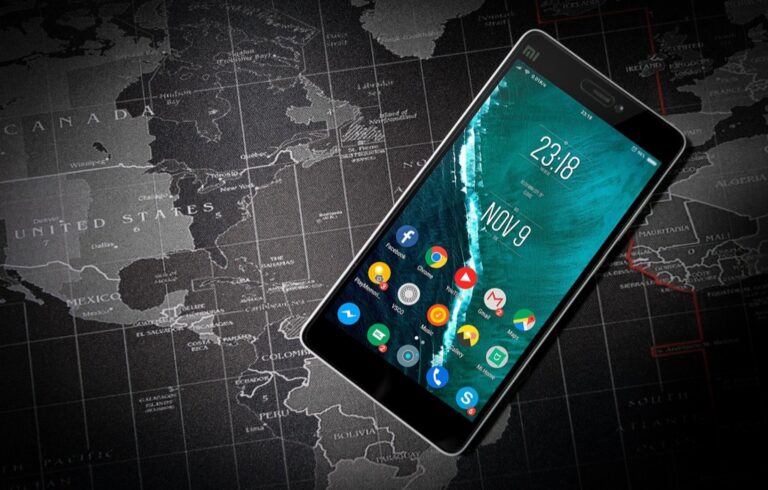
Citizen science mapping involves non-professional volunteers collecting geographic data through structured protocols and digital platforms. You contribute observations about everything from road conditions to wildlife sightings using apps like iNaturalist or eBird. Your smartphone‘s GPS capabilities automatically capture precise location coordinates while you document features that traditional mapping surveys might miss. This collaborative approach generates massive datasets that update faster than conventional cartographic methods, creating dynamic maps that reflect real-world changes as they happen.
The Role of Technology in Modern Cartographic Crowdsourcing
Technology platforms enable seamless data collection and quality control in citizen science mapping projects. You can access user-friendly mobile applications that guide data collection through standardized forms and photo uploads. Cloud-based systems like OpenStreetMap and Mapillary automatically sync your contributions with global databases, while machine learning algorithms validate data accuracy by cross-referencing multiple volunteer submissions. GPS-enabled devices ensure spatial precision, while built-in cameras document visual evidence that professional cartographers use to verify mapping accuracy before incorporating citizen-generated data into official map products.
Track your valuables in real-time with this mini GPS tracker, using Apple's Find My network without monthly fees. Its compact, magnetic, and waterproof design easily attaches to vehicles and other assets.

OpenStreetMap: The World’s Largest Collaborative Mapping Project
You’ll find OpenStreetMap stands as the most successful example of citizen science cartography, with over 10 million registered contributors creating the world’s most comprehensive free geographic database.
How Volunteers Build the Global Map Database
Contributors upload GPS traces from smartphones and handheld devices to capture road networks, footpaths, and building outlines across urban and remote areas. Mappers use satellite imagery from Bing, Esri, and Mapbox to digitize features like buildings, landuse boundaries, and waterways through the browser-based iD editor. Field surveyors collect attribute data including street names, business hours, and accessibility information using mobile apps like StreetComplete and Vespucci. Quality control specialists validate edits through tools like Osmose and JOSM’s validation functions, ensuring geometric accuracy and tag consistency across the database.
Impact on Navigation and Emergency Response Systems
Navigation platforms including Garmin, MapQuest, and Foursquare rely on OpenStreetMap data to provide routing services for millions of users worldwide. Humanitarian organizations use OSM’s crisis mapping capabilities through the Humanitarian OpenStreetMap Team, enabling rapid response mapping during disasters like earthquakes in Haiti and Nepal. Emergency services access detailed building footprints, road access points, and address information that’s often more current than commercial datasets. Development agencies leverage OSM data for infrastructure planning in regions where traditional mapping resources remain limited or outdated.
eBird: Mapping Bird Distribution Through Citizen Observations
eBird transforms birdwatching into powerful cartographic science by collecting over 100 million bird observations annually from citizen scientists worldwide. Cornell Lab of Ornithology’s platform creates dynamic species distribution maps that update in real-time as observers submit their sightings.
Creating Real-Time Species Distribution Maps
You’ll find eBird’s mapping system processes citizen observations through advanced algorithms that account for detection probability and observer effort. The platform generates species abundance maps using machine learning models that analyze seasonal patterns across geographic regions. These dynamic visualizations reveal migration routes, breeding territories, and population changes with unprecedented temporal resolution, updating weekly as new observations flow into the database from over 700,000 active contributors globally.
Contributing to Conservation and Climate Research
Your eBird contributions directly support climate change research by documenting species range shifts and phenological changes across decades of data collection. Scientists use this citizen-generated mapping data to identify biodiversity hotspots, track habitat loss impacts, and prioritize conservation areas for protection efforts. The platform’s standardized protocols ensure your observations meet scientific standards, with researchers publishing over 200 peer-reviewed studies annually using eBird’s cartographic datasets to inform wildlife management decisions and policy development.
Geo-Wiki: Crowdsourcing Land Cover Validation
Geo-Wiki harnesses citizen science volunteers to validate satellite-derived land cover maps through visual interpretation of high-resolution imagery. You’ll find this platform addresses critical accuracy gaps in global land cover datasets by engaging users worldwide in ground truth verification.
Improving Satellite Data Through Ground Truth Verification
Ground truth validation transforms satellite mapping accuracy by connecting citizen observers with automated classification systems. You contribute by comparing satellite-derived land cover classifications against high-resolution imagery through Geo-Wiki’s web interface. Volunteers examine pixels flagged by algorithms as uncertain, providing human interpretation where automated systems struggle with mixed land cover types. Your visual assessments help researchers quantify uncertainty in global datasets like GlobCover and identify systematic classification errors across different biomes and geographic regions.
Applications in Environmental Monitoring and Policy
Environmental policy decisions rely on validated land cover data from citizen science contributions through Geo-Wiki campaigns. You’ll see how your validation work supports deforestation monitoring in tropical regions and urban expansion tracking for climate assessments. Researchers use citizen-verified datasets to improve carbon stock estimates and biodiversity habitat mapping for conservation planning. Policy makers access these enhanced land cover products to evaluate ecosystem service changes and inform sustainable development goals with greater confidence in data accuracy.
MapSwipe: Humanitarian Mapping for Crisis Response
MapSwipe transforms humanitarian mapping by engaging citizen scientists to identify essential infrastructure before disasters strike. You’ll contribute to life-saving maps through simple mobile interactions that support emergency response efforts worldwide.
Missing Maps Initiative and Disaster Preparedness
Missing Maps coordinates global volunteers to map vulnerable communities before crises occur. You’ll help identify buildings, roads, and critical infrastructure in areas prone to natural disasters through satellite imagery analysis. Organizations like the Red Cross rely on your contributions to plan evacuation routes and locate emergency shelters. Your mapping efforts create baseline data that enables rapid response when disasters strike unmapped regions.
Engaging Volunteers Through Mobile Technology
MapSwipe’s mobile app gamifies humanitarian mapping to attract diverse volunteer contributors. You’ll swipe through satellite images to identify features like buildings and roads using intuitive gestures similar to social media apps. The platform processes over 100,000 volunteer contributions daily through machine learning algorithms that validate your inputs. Your smartphone becomes a powerful mapping tool that requires no technical expertise while contributing to global disaster preparedness efforts.
iNaturalist: Biodiversity Mapping Through Photo Documentation
iNaturalist revolutionizes ecological mapping by transforming smartphone photography into scientific data collection. This platform connects citizen scientists worldwide to document biodiversity through geotagged photographs, creating one of the largest biological databases ever assembled.
Building Comprehensive Species Location Databases
iNaturalist’s database contains over 130 million observations from 400,000 species across every continent. You contribute by photographing organisms and uploading geotagged images that automatically populate global species distribution maps. The platform’s computer vision system suggests identifications, while expert naturalists verify observations through community consensus. These verified records become permanent additions to scientific collections, with researchers accessing real-time species occurrence data for conservation planning and ecological studies.
Supporting Scientific Research and Education
Scientists utilize iNaturalist data to track species migrations, document range shifts, and monitor invasive species spread across geographic regions. Your observations contribute to peer-reviewed research papers and government conservation reports, with over 2,000 scientific publications citing iNaturalist datasets. Educational institutions integrate the platform into biology curricula, connecting students with professional researchers through collaborative identification processes. The data supports climate change studies by documenting phenological shifts and habitat preferences across diverse ecosystems worldwide.
Kerbal Maps: Gaming Communities Creating Detailed Virtual Worlds
Gaming communities have transformed virtual world mapping into sophisticated citizen science projects that rival professional cartographic efforts. You’ll find that space simulation games like Kerbal Space Program and exploration-based titles create detailed geographic databases through collaborative player contributions.
Get durable, tear-resistant posters made in the USA. Each 18" x 29" poster features high-quality 3 MIL lamination for lasting protection.

Collaborative Mapping in Video Game Environments
Players create comprehensive atlases by documenting terrain features, resource locations, and navigation routes within virtual worlds. Gaming communities establish standardized protocols for data collection, assigning coordinates to discoveries and maintaining quality control through peer review systems. You’ll discover that successful projects like the Kerbal Space Program Community Delta-V Map showcase over 50,000 player contributions tracking celestial body characteristics. These virtual cartographers develop sophisticated mapping tools, including interactive web platforms and mobile companion apps that process player-generated geographic data. Community moderators validate submissions through verification systems, ensuring accuracy standards comparable to professional mapping organizations.
Transferring Skills to Real-World Cartographic Projects
Gaming-derived mapping skills translate directly to professional cartographic applications through spatial reasoning and collaborative data management techniques. You’ll benefit from gamers’ expertise in coordinate systems, scale relationships, and feature classification developed through virtual world exploration. Many citizen science projects recruit gaming community members because they possess advanced skills in crowdsourced data validation and quality assurance protocols. Gaming platforms teach participants to work with GPS coordinates, satellite imagery interpretation, and geographic information systems through intuitive interfaces. These transferable competencies include systematic data collection methods, collaborative editing workflows, and community-driven accuracy verification that enhance real-world mapping initiatives like OpenStreetMap and humanitarian crisis response projects.
Project BudBurst: Phenology Mapping for Climate Studies
Project BudBurst transforms seasonal observations into comprehensive climate change datasets by engaging thousands of citizen scientists in phenological mapping. You’ll discover how this National Science Foundation-supported initiative creates detailed geographic representations of biological timing shifts across North America.
Achieve a flawless, even complexion with e.l.f. Flawless Satin Foundation. This lightweight, vegan formula provides medium coverage and a semi-matte finish for all-day wear, while hydrating your skin with glycerin.

Tracking Seasonal Changes Through Citizen Observations
You contribute to phenological mapping by recording first leaf dates, flowering times, and fruit development stages for specific plant species in your region. Citizen scientists upload observations through the BudBurst mobile app, documenting timing changes in native plants like lilacs, honeysuckles, and oaks. Your data points create geographic patterns that reveal how climate change shifts seasonal timing across different latitudinal zones. Scientists process over 15,000 annual observations to generate maps showing earlier spring emergence and delayed autumn dormancy patterns.
Creating Maps of Plant and Animal Life Cycles
You help create detailed life cycle maps by recording breeding behaviors, migration arrivals, and reproductive timing for target species throughout your local area. BudBurst researchers transform your observations into interpolated surfaces that visualize phenological timing across geographic gradients. Your contributions generate maps showing how elevation, latitude, and urban heat islands influence biological cycles. Scientists use these citizen-generated datasets to create predictive models that forecast species range shifts and ecosystem disruptions under changing climate conditions.
Conclusion
The future of mapping lies in your hands â literally. These seven citizen science projects demonstrate how your smartphone observations and local knowledge are revolutionizing cartography at an unprecedented scale.
You’re witnessing a fundamental shift where traditional mapping barriers have dissolved. Whether you’re documenting wildlife migrations through eBird or validating land cover data through Geo-Wiki your contributions create datasets that surpass what professional cartographers could achieve alone.
Your participation in these projects extends far beyond simple data collection. You’re building the foundation for disaster response planning climate change research and biodiversity conservation efforts that protect communities worldwide.
The democratization of mapping means that accurate geographic information is no longer limited by funding or institutional access. Your local expertise combined with accessible technology creates more comprehensive and current maps than ever before possible.
Frequently Asked Questions
What is citizen science mapping?
Citizen science mapping is a process where non-professional volunteers collect geographic data using smartphones and digital platforms. Contributors use their local knowledge to document everything from road conditions to wildlife sightings through structured protocols. This collaborative approach creates detailed geographic datasets that are integrated into global databases like OpenStreetMap, democratizing cartography through accessible technology.
How does OpenStreetMap work?
OpenStreetMap (OSM) is the world’s largest collaborative mapping project with over 10 million contributors creating a free geographic database. Volunteers upload GPS traces, use satellite imagery to digitize features, and collect data through mobile apps. Quality control specialists ensure accuracy, while navigation platforms and humanitarian organizations rely on OSM data for routing services and crisis mapping.
What makes eBird valuable for scientific research?
eBird collects over 100 million bird observations annually from citizen scientists worldwide, creating real-time species distribution maps through advanced algorithms. The platform reveals migration routes, population changes, and supports climate change research by documenting species range shifts. Standardized protocols ensure scientific accuracy, helping researchers make informed wildlife management and conservation decisions.
How does MapSwipe help with disaster preparedness?
MapSwipe engages citizen scientists to identify essential infrastructure through a gamified mobile app where volunteers swipe through satellite images. Processing over 100,000 daily contributions, it helps organizations like the Red Cross plan evacuation routes and locate emergency shelters. Machine learning algorithms validate inputs, enhancing global disaster preparedness through the Missing Maps Initiative.
What is iNaturalist and why is it important?
iNaturalist transforms smartphone photography into scientific data collection, creating one of the largest biological databases with over 130 million observations from 400,000 species. Users photograph organisms and upload geotagged images that populate global species distribution maps. Computer vision aids identification while experts verify observations, supporting research on species migrations and climate change impacts.
How do gaming communities contribute to mapping?
Gaming communities in space simulation games like Kerbal Space Program create detailed geographic databases by documenting terrain features and navigation routes. They establish standardized data collection protocols and maintain quality control through peer review systems. Skills developed in gaming environments translate to real-world cartographic applications, with many gamers contributing to OpenStreetMap and humanitarian mapping projects.
What role does technology play in citizen science mapping?
Technology enables citizen science mapping through user-friendly mobile applications that facilitate data collection and cloud-based systems that integrate contributions into global databases. Machine learning algorithms validate data accuracy and process large volumes of volunteer contributions. GPS capabilities, satellite imagery, and computer vision systems enhance the efficiency and reliability of citizen-generated mapping efforts.