7 Best Typography Tips for Map Design
The right typography can make or break your map’s effectiveness. Whether you’re designing for tourists navigating a new city or researchers analyzing complex data, your font choices directly impact how quickly and accurately users can extract information from your cartographic work.
Smart typography adaptation goes beyond simply picking readable fonts. You need to consider your audience’s visual preferences, technical constraints, and cognitive load to create maps that truly serve their specific needs and goals.
Disclosure: As an Amazon Associate, this site earns from qualifying purchases. Thank you!
Consider Age Demographics When Selecting Font Sizes and Styles
Age demographics play a crucial role in determining optimal typography choices for your maps. Different age groups have distinct visual needs and reading preferences that directly impact map usability and comprehension.
P.S. check out Udemy’s GIS, Mapping & Remote Sensing courses on sale here…
Choose Larger Font Sizes for Senior-Friendly Maps
Senior users require font sizes of 14-16 points minimum to ensure comfortable reading without strain. You’ll want to select serif fonts like Times New Roman or Georgia that provide better letter recognition for aging eyes. Avoid condensed typefaces and maintain consistent spacing between labels to prevent visual confusion. Consider increasing line spacing by 25% above standard settings to accommodate reduced visual acuity common in older demographics.
Opt for High-Contrast Typography for Children’s Educational Maps
Learn world geography with The World Game! Identify countries, flags, and capitals while boosting memory skills in this fun, educational card game for 2-5 players ages 8+.

Children’s maps benefit from bold, sans-serif fonts like Arial or Verdana in sizes 12-14 points with high contrast ratios of at least 7:1. You should use bright, saturated colors for text that stand out against neutral backgrounds. Implement rounded letterforms and avoid italicized text that can create reading difficulties. Add simple icons alongside text labels to support early reading skills and maintain visual interest.
Balance Readability with Visual Appeal for Adult Professional Maps
Professional adult audiences expect clean, modern typography that conveys authority while remaining highly legible. You’ll achieve this balance using fonts like Helvetica or Calibri in 10-12 point sizes with moderate contrast ratios of 4.5:1. Implement a clear hierarchy using font weights and sizes to distinguish between primary labels, secondary information, and reference data. Maintain consistent alignment and spacing to create professional presentation standards.
Adapt Typography Based on Cultural and Language Preferences
Typography choices must respect cultural contexts and language-specific requirements to create maps that serve global audiences effectively.
Incorporate Local Script Variations for International Audiences
You’ll need to accommodate different writing systems when designing maps for multilingual regions. Arabic, Chinese, and Cyrillic scripts require specific font families that support extended character sets. Use Unicode-compliant fonts like Noto Sans or Adobe Arabic to ensure proper glyph rendering. Consider script-specific spacing requirements, as Arabic requires more vertical space while Chinese characters need uniform square spacing for optimal readability.
Adjust Reading Direction for Right-to-Left Language Maps
Right-to-left languages like Arabic and Hebrew require fundamental layout adjustments beyond simple text direction changes. Position your legend and scale bar on the left side of the map to match natural reading flow. Arrange hierarchical elements from right to left, placing primary labels before secondary information. Use fonts like Tahoma or Arial Unicode MS that handle bidirectional text properly, ensuring numbers and Latin characters maintain correct orientation within RTL text blocks.
Select Culturally Appropriate Font Families
Cultural typography preferences vary significantly across regions and can affect map comprehension. Western audiences prefer clean sans-serif fonts like Helvetica for modern professional maps, while East Asian markets often favor fonts with subtle serif details that complement traditional design aesthetics. Consider local government standards – European mapping agencies typically use specific font families for official cartographic products. Test your font choices with native speakers to avoid cultural misinterpretations or readability issues.
Modify Text Hierarchy for Different Skill Levels
Your typography hierarchy directly impacts how users process map information based on their navigation experience and technical knowledge.
Simplify Information Layers for Beginner Map Users
Reduce visual clutter by limiting text layers to three hierarchy levels maximum. Use bold 14-16 point fonts for primary features like major roads and cities, medium 12-point fonts for secondary elements, and lighter 10-point fonts for supplementary details. Eliminate technical abbreviations and replace them with full words like “Street” instead of “St.” to prevent confusion among casual map users.
Create Advanced Labeling Systems for Expert Navigation
Implement detailed nomenclature using specialized typography that conveys technical precision. Include coordinate references, elevation markers, and grid systems using condensed 8-9 point fonts like Arial Narrow. Layer multiple information types through color-coded text hierarchies – blue for hydrographic features, brown for topographic data, and black for infrastructure. Expert users expect comprehensive labeling that supports precise navigation and data interpretation.
Use Progressive Information Disclosure Techniques
Design scalable typography systems that reveal information based on zoom levels and user interaction. Start with large 16-point labels for major landmarks at overview scales, then progressively add medium 12-point street names and small 9-point building numbers at detailed scales. Implement hover states and click-to-reveal functionality for complex data layers, allowing users to access deeper information without overwhelming the initial view.
Customize Typography for Specific Use Case Scenarios
Different mapping scenarios demand distinct typographic approaches to ensure optimal functionality and user comprehension.
Design Emergency-Response Maps with High-Visibility Text
Emergency maps require maximum readability under stress conditions. Use high-contrast color combinations like white text on dark red backgrounds for critical warnings, with minimum 16-point bold sans-serif fonts such as Arial Black. Implement standardized emergency symbols alongside text labels, ensuring visibility from distances up to 10 feet. Apply consistent color coding—red for danger zones, yellow for caution areas, and green for safe zones—while maintaining WCAG AA contrast ratios of 4.5:1 minimum.
Optimize Tourist Maps with Landmark-Focused Typography
Tourist-oriented typography should emphasize memorable locations and intuitive navigation. Use larger 14-18 point fonts for major attractions, implementing visual hierarchy through font weight variations rather than size changes alone. Select friendly sans-serif typefaces like Open Sans or Roboto that work across multiple languages. Incorporate icon-text combinations for restaurants, hotels, and transportation hubs, positioning labels consistently to the upper-right of symbols to maintain scanning patterns familiar to international travelers.
Create Technical Maps with Precision-Based Font Choices
Technical mapping applications demand precise, unambiguous typography that supports data accuracy. Implement monospace fonts like Consolas or Monaco for coordinate displays and measurement values to ensure consistent character spacing. Use condensed fonts such as Arial Narrow for dense label areas while maintaining 8-point minimum sizes for regulatory compliance. Apply systematic abbreviation standards following USGS guidelines, and employ consistent decimal precision formatting—typically three decimal places for coordinates and two for elevation measurements.
Adjust Typography for Various Physical Environments
Physical environments dramatically affect map typography performance, requiring specific adaptations to maintain readability across different conditions and viewing contexts.
Enhance Outdoor Map Readability with Weather-Resistant Design
Outdoor map typography must withstand challenging environmental conditions including direct sunlight, moisture, and varying light levels. Use high-contrast font combinations with minimum 4.5:1 contrast ratios between text and background colors. Select condensed sans-serif fonts like Roboto Condensed or Arial Narrow at 12-14 point sizes for optimal legibility in bright conditions. Implement white text halos or drop shadows to separate labels from complex background imagery, ensuring readability against varied terrain textures and satellite imagery.
Optimize Indoor Navigation with Space-Appropriate Text Sizing
Indoor navigation maps require typography adjustments based on viewing distances and ambient lighting conditions typical of enclosed spaces. Use larger font sizes ranging from 16-20 points for wayfinding signs viewed from 6-10 feet away. Select fonts with open letterforms like Open Sans or Source Sans Pro to maintain clarity under fluorescent lighting. Implement progressive text scaling that increases label sizes for primary navigation routes while keeping secondary information at 12-14 point sizes to prevent visual clutter in confined spaces.
Design Vehicle-Friendly Typography for Dashboard Integration
Vehicle dashboard typography demands instant readability during brief glances while driving. Use bold, wide fonts like Highway Gothic or DIN at minimum 14-16 point sizes to ensure legibility at arm’s length. Implement high luminance contrast with light text on dark backgrounds to reduce eye strain during night driving. Design typography hierarchies that prioritize turn-by-turn directions with 18-20 point fonts while keeping street names at 14-16 points, allowing drivers to quickly process critical navigation information without extended focus periods.
Incorporate Accessibility Standards for Inclusive Map Design
Your typography choices must meet established accessibility standards to ensure all users can effectively read and navigate your maps regardless of their visual abilities.
Meet ADA Compliance Requirements for Text Contrast
ADA compliance demands minimum contrast ratios of 4.5:1 for normal text and 3:1 for large text on your map labels. You’ll need to test color combinations using tools like WebAIM’s Contrast Checker to verify compliance. Dark text on light backgrounds typically achieves better contrast ratios than reversed combinations. Consider using #000000 black text on #FFFFFF white backgrounds for maximum accessibility, especially for critical navigation elements like street names and landmark labels.
Implement Screen Reader Compatible Typography
Screen readers require properly structured text hierarchy and descriptive labeling to interpret your map content accurately. You should embed alt-text descriptions for all typography elements and use semantic markup that identifies heading levels clearly. Avoid decorative fonts that screen readers can’t process effectively. Choose system fonts like Arial or Helvetica that screen reading software recognizes consistently. Include text descriptions for color-coded information since screen readers can’t interpret visual cues alone.
Protect your eyes with RaoOG blue light blocking reading glasses. Featuring flexible spring hinges for a comfortable fit and accurate magnification for clear, distortion-free vision.

Design for Color-Blind and Visually Impaired Users
Color-blind users need typography solutions that don’t rely solely on color differentiation to convey important map information. You should use pattern fills, different font weights, or varied text sizes to distinguish between map categories. Test your typography choices using color-blindness simulators like Coblis or Color Oracle. Implement high-contrast font pairings and avoid red-green color combinations for text elements. Consider adding texture patterns or symbols alongside colored text to provide multiple visual cues for map interpretation.
Leverage Technology-Specific Typography Adaptations
Modern mapping platforms require distinct typography approaches based on their technical capabilities and user interaction patterns. Your font choices must align with device constraints and display technologies to maintain optimal readability.
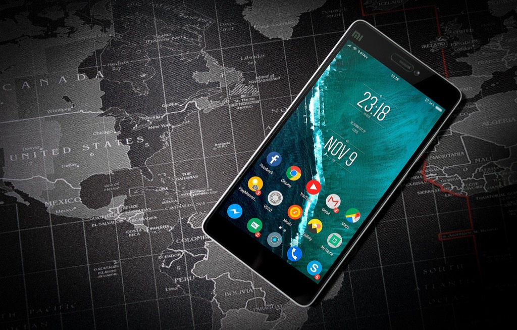
Optimize Typography for Mobile Device Constraints
Mobile map typography demands compact, high-contrast fonts that remain legible on small screens. Sans-serif fonts like Roboto or system fonts perform best at 12-14 point sizes, while you should limit text hierarchy to two levels maximum. Optimize touch targets by maintaining 44-pixel minimum spacing around interactive text elements. Consider condensed font variants for dense information areas, but avoid decorative typefaces that become illegible at mobile resolutions.
Design Print-Friendly Typography with Resolution Considerations
Print maps require 300 DPI typography optimization with serif fonts like Times New Roman or Georgia for body text readability. Increase font sizes by 20-30% compared to digital versions, using 10-12 points for primary labels and 8-10 points for secondary information. Ensure adequate line spacing (1.2-1.5x font size) and avoid pure black text on white backgrounds—use 90% black instead. Test print proofs at actual size to verify legibility across different paper stocks and printing methods.
Create professional documents with Neenah 90 lb white index cardstock. This 8.5" x 11" pack of 300 sheets delivers high-resolution images and jam-free printing on both inkjet and laser printers.

Create Interactive Map Typography with Hover and Zoom Features
Interactive maps benefit from scalable typography systems that adapt to zoom levels and user interactions. Implement CSS transforms for smooth font scaling during zoom operations, maintaining readability at 50-200% zoom ranges. Design hover states with subtle font weight increases or color changes rather than size modifications. Use progressive disclosure techniques—reveal detailed labels only at appropriate zoom thresholds. Consider implementing fade-in animations for text elements to prevent visual clutter during rapid zoom changes.
Conclusion
Your typography choices ultimately determine whether your map serves its intended purpose or becomes a barrier to understanding. By considering your audience’s age demographics and technical expertise you’ll create more effective navigation experiences that resonate with users.
Remember that cultural sensitivity and accessibility standards aren’t optional extras – they’re essential components of professional map design. Whether you’re designing for emergency responders or tourists your font selections should prioritize clarity over aesthetics.
The key to successful map typography lies in testing your choices with real users from your target audience. What looks perfect on your screen might not work in bright sunlight or on a small mobile device so always validate your decisions through practical application.
Frequently Asked Questions
What is the most important factor when choosing typography for map design?
The most important factor is understanding your target audience and their specific needs. Different users like tourists, researchers, or emergency responders require different typographic approaches. Consider factors like age demographics, technical expertise, cultural background, and the physical environment where the map will be used to ensure optimal readability and effectiveness.
What font sizes work best for different age groups on maps?
For senior-friendly maps, use larger font sizes of 14-16 points with serif fonts like Times New Roman. Children’s maps benefit from bold, sans-serif fonts like Arial in 12-14 point sizes with high contrast. Adult professional maps work well with clean fonts like Helvetica in 10-12 point sizes, focusing on readability and visual hierarchy.
How should typography be adapted for multilingual maps?
Use Unicode-compliant fonts like Noto Sans or Adobe Arabic for proper glyph rendering across different scripts. For right-to-left languages, position legends and scale bars appropriately and use fonts that handle bidirectional text correctly. Always test font choices with native speakers to avoid readability issues and cultural misinterpretations.
What typography hierarchy should beginners versus expert map users have?
Beginners need simplified information with maximum three hierarchy levels: bold 14-16 point fonts for primary features, medium 12-point for secondary elements, and lighter 10-point for details. Expert users can handle advanced labeling systems with detailed nomenclature, color-coded text hierarchies, and progressive information disclosure based on zoom levels.
How does the physical environment affect map typography choices?
Outdoor maps need high-contrast fonts and condensed sans-serif options like Roboto Condensed for bright conditions. Indoor maps require larger fonts with open letterforms for fluorescent lighting. Vehicle dashboard maps need bold, wide fonts with high luminance contrast for instant readability while driving, prioritizing critical navigation information.
What accessibility standards should map typography meet?
Map typography must meet ADA compliance with proper text contrast ratios, verified using tools like WebAIM’s Contrast Checker. Use structured text hierarchy for screen readers, descriptive labeling, and avoid relying solely on color differentiation. Include pattern fills and varied text sizes to help color-blind and visually impaired users access important information effectively.
How should typography differ between mobile, print, and interactive maps?
Mobile maps need compact, high-contrast sans-serif fonts like Roboto at 12-14 points with two-level hierarchy and adequate spacing. Print maps require 300 DPI optimization with increased font sizes and proper line spacing. Interactive maps benefit from scalable typography systems with hover features and progressive disclosure techniques that adapt to zoom levels.
What typography approach works best for emergency response maps?
Emergency response maps require high-visibility typography with bold sans-serif fonts and standardized color coding for critical warnings. Use clear, unmistakable text that can be quickly read under stress. Prioritize critical information with larger font sizes and high contrast ratios to ensure immediate comprehension during emergency situations.