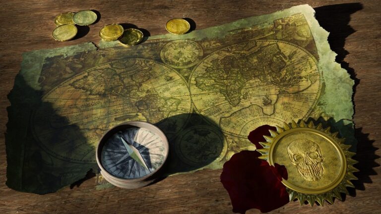
5 Best Data Integration Methods for Historical Maps
Why it matters: Historical maps tell incredible stories but they’re missing the data that makes them truly powerful for today’s researchers and enthusiasts.
Explore history's most significant maps with *Great Maps*. This book delves into cartographic masterpieces and their historical context.

The big picture: You can transform dusty old maps into dynamic research tools by layering modern datasets like census information demographics and environmental data directly onto historical cartography.
What’s next: We’ll show you five practical ways to bridge centuries of information and create maps that reveal patterns connections and insights you never knew existed.
Disclosure: As an Amazon Associate, this site earns from qualifying purchases. Thank you!
P.S. check out Udemy’s GIS, Mapping & Remote Sensing courses on sale here…
Layering Real-Time Environmental Data Over Historical Landscapes
Modern environmental sensors and satellite data create unprecedented opportunities for temporal analysis when combined with historical cartographic records. You’ll discover how current environmental conditions compare to past patterns recorded in vintage maps.
Measure temperature, humidity, pressure, and VOC gases with the BME680 environmental sensor. It supports I2C and SPI communication and is compatible with 3.3V/5V systems, including Raspberry Pi, Arduino, and ESP32.

Temperature and Climate Pattern Overlays
Temperature overlays reveal dramatic climate shifts when you compare NOAA’s current weather station data against historical temperature records embedded in old agricultural maps. You can use QGIS’s temporal controller to animate temperature changes across decades, showing how growing zones have shifted northward since the 1900s. Weather APIs like OpenWeatherMap provide real-time data that highlights seasonal variations your historical maps couldn’t capture, creating compelling visualizations of climate change impacts on specific regions.
Get real-time weather data with the Ambient Weather WS-2902. This WiFi-enabled station measures wind, temperature, humidity, rainfall, UV, and solar radiation, plus it connects to smart home devices and the Ambient Weather Network.

Population Density Comparisons Across Centuries
Population density mapping becomes powerful when you overlay current census data from the American Community Survey onto historical settlement patterns. You’ll identify urban sprawl trajectories by comparing 1880 population centers with today’s demographic heat maps using tools like ArcGIS Pro’s demographic layers. Modern mobile phone location data and social media check-ins provide additional population indicators that contrast sharply with historical maps showing sparse frontier settlements, revealing centuries of migration and urbanization patterns.
Natural Disaster Frequency and Impact Analysis
Disaster frequency analysis transforms when you combine FEMA’s current hazard maps with historical disaster records documented in vintage cartographic surveys. You can overlay USGS real-time earthquake data and flood monitoring systems onto maps showing historical disaster zones, revealing changing risk patterns over time. Modern satellite imagery from sources like Landsat shows current flood plains and fire-prone areas that weren’t visible to historical mapmakers, helping you identify how natural disaster impacts have evolved across centuries.
Incorporating Social Media and Digital Footprints Into Period Maps
Modern social media platforms and digital footprints create unprecedented opportunities to enrich historical maps with contemporary human experiences and memories tied to specific locations.
Geotagged Content Analysis for Historical Context
You can extract geotagged posts from platforms like Instagram, Twitter, and Flickr to understand how people currently experience historical locations. These digital footprints reveal which aspects of historical sites resonate most with modern visitors through hashtag analysis and photo content examination. Mining location-based social media data helps identify cultural memory patterns and highlights areas where historical significance intersects with contemporary relevance, creating valuable context layers for period maps.
Digital Storytelling Through Location-Based Social Data
You’ll discover that aggregating user-generated content creates compelling narrative overlays for historical maps through location-based storytelling. Social media check-ins, reviews, and shared experiences at historical sites provide modern perspectives on past events and locations. Platforms like Foursquare and Google Places offer rich datasets showing how contemporary communities interact with historical spaces, while crowdsourced photo collections reveal visual changes over time that complement traditional historical documentation.
Community Memory Mapping Projects
Community-driven mapping initiatives allow you to collect oral histories, family stories, and local memories tied to specific geographical coordinates. Digital platforms like StoryMapJS and ArcGIS StoryMaps enable residents to contribute location-based narratives that bridge historical records with lived experiences. These collaborative projects often uncover previously undocumented historical details and create participatory archives where community members share photographs, documents, and stories that enrich the historical context of period maps.
Utilizing Satellite Imagery and GPS Technology for Historical Accuracy
You can leverage modern satellite imagery and GPS technology to verify historical map features with unprecedented precision. These tools bridge the gap between archival cartography and contemporary spatial data.
Ground-Truthing Historical Boundary Lines
Satellite imagery verification transforms boundary accuracy in historical maps through high-resolution comparison datasets. You’ll access USGS Earth Explorer or Google Earth Engine to overlay contemporary boundaries with historical demarcations. GPS field verification confirms disputed boundary locations using sub-meter accuracy receivers. Modern surveying tools reveal historical surveyor errors, property line shifts, and administrative boundary changes. Digital elevation models expose terrain features that influenced original boundary placement decisions.
Archaeological Site Verification and Documentation
Archaeological site validation uses multispectral satellite data to confirm historical map locations and uncover unmarked sites. You’ll employ LiDAR datasets to penetrate vegetation and reveal structural foundations invisible on period maps. Thermal infrared imagery detects subsurface archaeological features through temperature variations. Ground-penetrating radar GPS coordinates integrate with historical site markers for precise documentation. Time-series satellite analysis tracks site preservation status and modern encroachment patterns affecting historical accuracy.
Achieve a flawless, even complexion with e.l.f. Flawless Satin Foundation. This lightweight, vegan formula provides medium coverage and a semi-matte finish for all-day wear, while hydrating your skin with glycerin.

Infrastructure Development Timeline Visualization
Infrastructure timeline mapping combines historical transportation networks with contemporary satellite imagery to track development patterns. You’ll layer decades of aerial photography to visualize road construction, railroad expansion, and urban growth sequences. Digital terrain models reveal how topography influenced historical route selection and modern infrastructure placement. GPS tracking of existing infrastructure remnants validates historical map accuracy. Temporal satellite datasets document infrastructure abandonment, replacement, and adaptive reuse over multiple centuries.
Track vehicles and assets with the LandAirSea 54 GPS Tracker. Get real-time location alerts and historical playback using the SilverCloud app, with a long-lasting battery and discreet magnetic mount.

Embedding Economic and Demographic Statistics Into Vintage Cartography
You can transform historical maps into powerful analytical tools by overlaying modern economic and demographic datasets. This integration reveals temporal patterns that static historical records can’t capture alone.
Trade Route Analysis with Modern Commerce Data
You’ll discover fascinating patterns when comparing historical trade routes with contemporary shipping and logistics data. Modern port statistics from the World Bank reveal how ancient maritime corridors still influence today’s global commerce networks. Current freight flow data from the Bureau of Transportation Statistics shows surprising continuities—many routes that connected ancient civilizations remain vital commercial arteries. You can overlay container ship tracking data onto 18th-century merchant marine charts to visualize how technological advances reshaped but didn’t eliminate traditional trading relationships.
Learn to navigate confidently with this guide to nautical charts! Understand both electronic and paper charts, including a complete reference to Chart #1 symbols and abbreviations.

Immigration Pattern Tracking Across Time Periods
You can map immigration flows across centuries by combining historical census records with current American Community Survey data. Modern demographic datasets reveal how traditional settlement patterns persist—Irish immigrants still concentrate in areas their 19th-century predecessors established. Current migration data from the Census Bureau shows how historical ethnic enclaves evolved into today’s diverse neighborhoods. You’ll uncover generational movement patterns by overlaying contemporary population statistics onto Ellis Island arrival records and historical immigration maps.
Industrial Growth Mapping Using Current Economic Indicators
You can visualize industrial evolution by layering modern economic data onto historical manufacturing maps. Current Bureau of Labor Statistics employment data reveals how former textile regions transformed into technology hubs. Modern GDP statistics by county show economic shifts—areas that powered the Industrial Revolution now lead in different sectors. You’ll identify persistent industrial corridors by comparing historical factory locations with contemporary manufacturing employment data from the Economic Census.
Creating Interactive Digital Platforms for Historical Map Exploration
Digital platforms transform static historical maps into dynamic research environments where users can manipulate data layers and explore temporal relationships. These interactive systems enable real-time data integration with historical cartographic materials.
Virtual Reality Historical Neighborhood Tours
VR platforms like Unity 3D and Unreal Engine let you reconstruct historical neighborhoods using period maps as foundational blueprints. You can overlay modern street-level imagery from Google Street View API with historical photographs to create immersive temporal transitions. Oculus for Business and HTC Vive Pro provide the hardware foundation for these experiences. Walking through Victorian-era districts while simultaneously viewing current conditions reveals urban evolution patterns that static maps cannot convey.
Augmented Reality Historical Landmark Identification
AR applications using ARCore and ARKit frameworks enable real-time historical overlay identification through smartphone cameras. You can integrate Mapbox AR with historical map datasets to trigger contextual information when users point devices at specific locations. Vuforia provides robust image recognition capabilities for historical building identification. These tools automatically detect architectural features and display corresponding historical map annotations, creating seamless bridges between past and present spatial contexts.
Crowdsourced Historical Data Collection Tools
Platform development using Django and PostgreSQL enables community-driven historical data collection through web-based interfaces. You can implement Leaflet.js mapping libraries with OpenStreetMap base layers to create collaborative annotation systems. Firebase real-time databases support simultaneous multi-user editing of historical map features. These crowdsourcing tools validate historical map accuracy through collective knowledge while building comprehensive digital archives of local historical information.
Conclusion
These five integration methods transform static historical maps into powerful analytical tools that bridge centuries of human experience. You now have practical approaches to layer modern datasets onto historical cartography creating dynamic resources for research and storytelling.
The combination of satellite imagery census data social media insights economic indicators and interactive platforms opens unprecedented opportunities for historical analysis. You can reveal patterns that were previously hidden and make connections across time periods that would otherwise remain unnoticed.
Your historical maps don’t have to remain artifacts of the past. By applying these modern data integration techniques you’ll create living documents that speak to contemporary audiences while preserving the rich heritage these maps represent.
Frequently Asked Questions
What are the main benefits of overlaying modern data on historical maps?
Overlaying modern data transforms static historical maps into dynamic research tools that reveal new patterns and connections. This integration allows researchers to compare past and present conditions, uncover temporal trends, and gain deeper insights into how landscapes, populations, and environments have evolved over time.
How can environmental data enhance historical maps?
Environmental data like temperature records, precipitation patterns, and satellite imagery can be layered over historical maps to show climate changes over time. NOAA data overlays reveal dramatic climate shifts, while disaster frequency comparisons highlight changing risk patterns and environmental impacts across centuries.
What types of social media data can be integrated with historical maps?
Geotagged content from platforms like Instagram, Twitter, and Facebook can enrich historical maps with contemporary human experiences. This includes location-based posts, check-ins, and user-generated content that reveal modern visitors’ connections to historical sites and cultural memory patterns.
How do satellite imagery and GPS improve historical map accuracy?
Modern satellite imagery and GPS technology allow for unprecedented precision in verifying historical map features. High-resolution satellite comparisons can confirm boundary locations, reveal unmarked archaeological sites, and validate infrastructure networks depicted in period maps with centimeter-level accuracy.
What role does demographic data play in historical map analysis?
Contemporary demographic data reveals how historical settlement patterns have evolved into modern communities. By overlaying current census information with historical records, researchers can track immigration patterns, urban sprawl, population density changes, and the transformation of neighborhoods over time.
How can economic datasets enhance understanding of historical trade routes?
Modern trade and logistics data can reveal enduring patterns in historical commerce routes. By overlaying contemporary shipping lanes, transportation networks, and economic indicators onto historical maps, researchers can demonstrate how ancient trade corridors continue to influence today’s global commerce.
What interactive technologies are available for historical map exploration?
Interactive digital platforms, virtual reality (VR), and augmented reality (AR) applications transform static maps into immersive experiences. These technologies allow users to manipulate data layers, explore temporal relationships, reconstruct historical neighborhoods, and overlay past information onto present-day locations in real-time.
How can communities contribute to historical map enhancement?
Crowdsourced platforms enable community-driven annotation and validation of historical maps. Local residents can contribute oral histories, family records, and personal knowledge to create participatory archives that bridge official historical records with lived experiences and community memory.