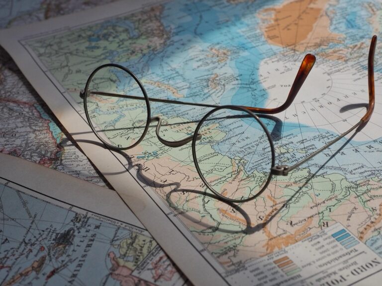
7 International Map Styles That Transform Visual Design
Why it matters: Map design isn’t just about showing where things are â it’s an art form that varies dramatically across cultures and reflects unique perspectives on how we navigate our world.
The big picture: From Japan’s minimalist transit maps to Europe’s ornate historical cartography, international mapping styles offer a treasure trove of creative inspiration that extends far beyond geography into graphic design, data visualization, and storytelling.
What’s ahead: You’ll discover seven distinct international mapping approaches that can transform how you think about visual communication, whether you’re designing infographics, planning user interfaces, or simply looking to expand your creative toolkit.
Disclosure: As an Amazon Associate, this site earns from qualifying purchases. Thank you!
P.S. check out Udemy’s GIS, Mapping & Remote Sensing courses on sale here…
Explore Traditional Japanese Cartographic Aesthetics
Japanese cartographic traditions offer profound insights into minimalist design principles that can transform your contemporary mapping projects. These time-honored approaches emphasize clarity through reduction rather than addition.
Study Minimalist Line Work and Symbolic Representation
Examine traditional Japanese maps’ selective line weights and purposeful symbol placement. These cartographic works use thin, deliberate strokes to define boundaries while employing distinctive symbols for temples, mountains, and water features. You’ll notice how Japanese mapmakers prioritize essential geographic information over decorative elements, creating navigation tools that communicate complex spatial relationships through simplified visual language. Study historic examples like Edo-period city maps to understand how strategic symbol placement guides the viewer’s eye through urban landscapes without overwhelming detail.
Incorporate Zen Philosophy Into Spatial Design
Apply Zen concepts of negative space and visual balance to enhance your map’s readability. Traditional Japanese cartography embraces ma (negative space) as an active design element, allowing geographic features to breathe within the composition. You can implement this philosophy by increasing white space around critical map elements, reducing visual clutter through selective data inclusion, and creating hierarchical information layers that reveal themselves progressively. This approach transforms dense geographic datasets into contemplative visual experiences that invite deeper spatial understanding rather than demanding immediate comprehension.
Discover European Medieval Map Artistry
Medieval European cartographers combined functional geography with artistic expression, creating maps that served as both navigation tools and decorative masterpieces. Their ornate approach offers modern designers rich inspiration for transforming utilitarian maps into visually compelling works.
Analyze Illuminated Manuscript Techniques
Medieval mapmakers employed gold leaf accents and vibrant pigments to highlight important geographic features and settlements. You’ll find intricate lettering styles that transform place names into decorative elements, while miniature illustrations of buildings, animals, and mythical creatures populate map margins. These illuminated details create visual hierarchy through color intensity and ornamental complexity, guiding viewers’ attention to significant locations while maintaining artistic beauty throughout the composition.
Adapt Decorative Border Elements for Modern Projects
Medieval maps featured elaborate border designs with geometric patterns, heraldic symbols, and compass roses that frame geographic content effectively. You can incorporate these ornamental frames into contemporary infographics, using simplified versions of Gothic arches, Celtic knots, or scrollwork patterns. Modern applications include creating decorative headers for digital maps, adding vintage-inspired borders to data visualizations, and using medieval-style corner elements to establish visual boundaries in complex geographic layouts.
Learn From Indigenous Australian Songline Mapping
Indigenous Australian mapping traditions offer profound insights that challenge conventional Western cartographic approaches. These ancient systems integrate storytelling, navigation, and cultural knowledge into comprehensive spatial frameworks.
Understand Narrative-Based Geographic Storytelling
Songline mapping transforms geographic features into narrative threads that connect places through ancestral stories and cultural meaning. You’ll discover how traditional Aboriginal maps embed travel routes within creation stories, where each landmark carries specific ceremonial significance and practical navigation data. These maps function as multi-layered information systems, encoding seasonal patterns, water sources, and cultural protocols within memorable story structures. Modern cartographers can adapt this approach by incorporating narrative elements that help users understand geographic relationships through connected experiences rather than isolated data points.
Apply Dreamtime Concepts to Creative Cartography
Dreamtime mapping concepts emphasize the interconnectedness of time, space, and cultural memory within geographic representation. You can integrate these principles by creating maps that show multiple temporal layers simultaneously, revealing how landscapes change across seasons, years, or historical periods. Aboriginal cartographic traditions demonstrate how spiritual geography overlays physical terrain, suggesting design approaches that incorporate cultural significance alongside topographic data. This methodology encourages you to consider how maps can represent non-linear relationships between places, creating visual narratives that connect distant locations through shared cultural or ecological themes.
Study Soviet-Era Propaganda Map Design
Soviet cartographers mastered the art of ideological messaging through bold visual communication techniques. Their maps transformed geographic information into powerful political statements that influenced public perception across multiple continents.
Examine Bold Color Schemes and Typography Choices
Red dominates Soviet propaganda maps as the primary color for communist territories and influence zones. You’ll notice how cartographers used deep crimson to represent socialist nations while contrasting them with muted grays for capitalist countries. Cyrillic typography features heavy, sans-serif fonts that project authority and permanence. Bold lettering scales create visual emphasis on Soviet achievements like industrial centers and transportation networks. Yellow and gold accents highlight agricultural success and natural resources within communist borders.
Utilize Strategic Visual Hierarchy Principles
Soviet maps employ dramatic size variations to manipulate viewer perception of geographic importance. You can observe how Moscow appears disproportionately large compared to Western capitals, creating psychological emphasis on Soviet power. Radiating lines from major cities suggest influence and control extending outward. Arrow symbols direct attention toward areas of communist expansion or military success. Strategic placement of emblems and symbols reinforces ideological messages while maintaining the appearance of objective cartographic data.
Investigate Islamic Golden Age Cartographic Innovations
Islamic scholars during the 9th to 13th centuries revolutionized cartography by combining scientific precision with artistic beauty. You’ll discover techniques that merge mathematical accuracy with decorative elements that transform maps into visual masterpieces.
Research Geometric Pattern Integration Methods
Geometric tessellations form the foundation of Islamic cartographic design, where repeating patterns create visual harmony across map surfaces. You can study star-and-polygon motifs that medieval cartographers used to fill ocean areas and border regions. Interlacing geometric bands separate different geographic zones while maintaining visual continuity throughout the composition. Examine how radial symmetry patterns emanate from important cities like Baghdad or Cairo, emphasizing their cultural significance. Hexagonal and octagonal frameworks organize territorial boundaries in ways that balance aesthetic appeal with geographic accuracy, creating maps that function as both navigation tools and decorative art.
Achieve a flawless, even complexion with e.l.f. Flawless Satin Foundation. This lightweight, vegan formula provides medium coverage and a semi-matte finish for all-day wear, while hydrating your skin with glycerin.

Explore Mathematical Precision in Artistic Expression
Proportional scaling systems in Islamic maps demonstrate how mathematical principles enhance visual storytelling without sacrificing cartographic accuracy. You’ll find that golden ratio applications govern the placement of major geographic features, creating naturally pleasing compositions that guide the viewer’s eye. Trigonometric calculations determine the precise angles of decorative compass roses and directional indicators. Algebraic grid systems underlie seemingly organic calligraphic text placement, ensuring readability while maintaining artistic flow. Geometric construction methods control the size relationships between cities, mountains, and bodies of water, producing maps where mathematical order creates visual beauty that rivals illuminated manuscripts.
Analyze Scandinavian Functional Design Approaches
Scandinavian cartographers excel at creating maps that prioritize clarity over ornamentation, stripping away visual noise to reveal essential geographic information. This Nordic design philosophy transforms complex spatial data into intuitively readable navigation tools.
Observe Clean Layout and Efficient Information Display
Scandinavian maps demonstrate exceptional whitespace management, allowing geographic features to breathe without visual clutter. You’ll notice how Swedish transit maps use generous margins and strategic spacing between route lines, creating visual hierarchy that guides your eye naturally through the information.
Nordic cartographers employ restrained color palettes, typically limiting schemes to 3-4 primary colors that serve distinct functional purposes. Each color carries specific meaning – blue for water features, green for parks, red for major transit routes – eliminating guesswork about map elements.
Implement User-Centric Navigation Solutions
Scandinavian mapping prioritizes wayfinding efficiency through simplified iconography and consistent symbol systems. Danish cycling maps exemplify this approach, using standardized pictograms that communicate route difficulty, surface type, and amenities without requiring text explanations.
Explore Denmark and Copenhagen by bike with this durable, folded map. Featuring English, German, and Danish, it's perfect for navigating cycling routes.

You’ll find Norwegian topographic maps excel at layered information architecture, presenting elevation data through subtle contour styling that doesn’t overpower trail markers or safety information. This user-first methodology ensures critical navigation details remain accessible under various lighting conditions and stress situations.
Learn essential map reading and navigation skills with this U.S. Army guide. Designed for practical use, it provides clear instructions for navigating any terrain.

Examine Latin American Folk Art Map Traditions
Latin American folk art mapping traditions offer vibrant alternatives to conventional cartographic design through their celebration of cultural identity and community narratives.
Study Vibrant Color Palettes and Cultural Symbols
Incorporate bold, saturated hues that reflect the region’s textile traditions and ceremonial artwork. Mexican Huichol yarn paintings use electric blues, magentas, and yellows to represent sacred geography, while Peruvian textile maps employ earth tones like terracotta and ochre alongside bright accent colors. You’ll find success adapting these high-contrast color relationships for data visualization projects.
Experience authentic Mexican artistry with this handmade Huichol yarn painting. Each piece features vibrant, symbolic designs and includes the artist's signature, ensuring a unique and meaningful work of art.

Integrate symbolic elements from pre-Columbian iconography and colonial religious art. Aztec directional glyphs, Andean stepped patterns, and Mayan astronomical symbols create distinctive visual markers that enhance geographic meaning while celebrating cultural heritage.
Create vibrant art on various surfaces with this 36-color acrylic marker set. The soft brush tips allow for precise lines and blending, while the visual ink window prevents unexpected interruptions.

Integrate Community-Based Storytelling Elements
Transform maps into narrative vessels by incorporating oral tradition structures found throughout Latin American communities. Mexican community maps often feature sequential imagery that guides viewers through historical events, seasonal celebrations, and migration patterns within a single geographic framework.
Layer multiple timeframes within your cartographic design, following traditions where Guatemalan highland communities create maps showing ancestral territories alongside contemporary boundaries. This temporal layering technique helps users understand how places evolve while maintaining cultural continuity and community memory.
Conclusion
These international mapping traditions offer you a wealth of creative possibilities beyond traditional cartographic approaches. Whether you’re drawn to Japanese minimalism’s contemplative spaces or Latin American folk art’s vibrant storytelling you’ll find techniques that can transform your visual projects.
The key lies in understanding how each culture approaches spatial relationships differently. Soviet propaganda maps teach you about visual hierarchy while Scandinavian design shows you the power of functional clarity. Islamic geometric patterns demonstrate mathematical beauty and Indigenous Australian traditions reveal how maps can carry deeper narratives.
You don’t need to replicate these styles exactly. Instead extract the underlying principles that resonate with your creative vision. Experiment with combining elements from different traditions to develop your own distinctive approach to visual communication that honors both functionality and cultural richness.
Frequently Asked Questions
What makes map design an art form that varies across cultures?
Map design reflects cultural perspectives on navigation, storytelling, and spatial understanding. Different cultures prioritize various elements – Japan emphasizes minimalism, Europe showcases decorative artistry, Indigenous Australians integrate storytelling, and Latin American traditions celebrate community narratives. These diverse approaches demonstrate how cartography extends beyond pure functionality to become a medium for cultural expression and visual communication.
How do Japanese mapping principles influence modern design?
Japanese cartographic aesthetics emphasize minimalist design through selective line work, purposeful symbolism, and strategic use of negative space. Drawing from Zen philosophy, these maps prioritize clarity over detail, using thin strokes and essential geographic information. Modern designers can apply these principles to create contemplative visual experiences that transform complex data into readable, balanced compositions.
What can modern designers learn from European medieval maps?
Medieval European maps combined functional geography with artistic expression through illuminated manuscript techniques. They used gold leaf accents, vibrant pigments, intricate lettering, and decorative borders with geometric patterns and heraldic symbols. Modern designers can adapt these ornamental elements for contemporary infographics and data visualizations, creating visual hierarchies that guide attention while maintaining aesthetic beauty.
How do Indigenous Australian mapping traditions differ from Western approaches?
Indigenous Australian mapping integrates storytelling, navigation, and cultural knowledge through Songline mapping, which transforms geographic features into narrative threads. These maps encode seasonal patterns, cultural protocols, and creation stories within memorable structures. They represent non-linear relationships between places and reveal multiple temporal layers, challenging conventional Western cartographic approaches with comprehensive spatial frameworks.
What design techniques did Soviet-era propaganda maps use?
Soviet maps employed bold visual communication through dominant red coloring for communist territories, heavy sans-serif Cyrillic typography, and strategic visual hierarchy manipulation. They depicted Moscow disproportionately large to emphasize power, used muted grays for capitalist countries, and incorporated symbols reinforcing ideological messages while maintaining the appearance of objective cartographic data.
How did Islamic Golden Age cartographers balance art and science?
Islamic scholars (9th-13th centuries) merged scientific precision with artistic beauty through geometric patterns, tessellations, and star-and-polygon motifs. They applied mathematical principles including the golden ratio and trigonometric calculations to enhance visual storytelling while ensuring cartographic accuracy. This approach created visual harmony and emphasized cultural significance in map design.
What defines Scandinavian functional design in cartography?
Scandinavian cartography prioritizes clarity through generous whitespace management, restrained color palettes with distinct functional purposes, and user-centric navigation solutions. Examples include Swedish transit maps with strategic spacing, simplified Danish cycling map iconography, and Norwegian topographic maps with layered information architecture ensuring accessibility in various conditions.
How do Latin American folk art traditions enhance map design?
Latin American mapping traditions use bold, saturated color palettes and symbolic elements from pre-Columbian iconography and colonial religious art. These maps integrate community-based storytelling, transforming cartography into narrative vessels that layer multiple timeframes. They reflect textile traditions while celebrating cultural identity and helping users understand place evolution through community memory.