8 Best Digital Proofing Methods for Cartography
Why it matters: Digital proofing transforms how you verify map accuracy by catching errors before they reach production. Traditional paper-based proofing methods miss critical details that could compromise navigation systems, emergency response routes, and geographic data integrity.
The big picture: You can now identify coordinate discrepancies, projection errors, and symbol misplacements in real-time using advanced digital verification tools. This shift saves organizations thousands of dollars in reprinting costs while ensuring maps meet professional cartographic standards for both digital and print applications.
Disclosure: As an Amazon Associate, this site earns from qualifying purchases. Thank you!
Understanding Digital Proofing in Modern Cartography
Digital proofing transforms cartographic accuracy by providing systematic verification processes that detect mapping errors before final production. This approach eliminates costly reprints while ensuring professional-grade map quality.
P.S. check out Udemy’s GIS, Mapping & Remote Sensing courses on sale here…
Definition and Core Principles
Digital proofing encompasses automated validation techniques that verify coordinate accuracy, projection consistency, and spatial relationships within your maps. You’ll analyze geometric precision, attribute completeness, and visual alignment through specialized software tools.
Modern proofing systems check feature positioning against reference datasets, validate topology rules, and ensure proper symbology application. These processes identify coordinate discrepancies, missing labels, and scale inconsistencies that manual reviews often miss. Your proofing workflow should include layer verification, projection validation, and metadata completeness checks before finalizing any cartographic product.
Evolution from Traditional Methods
Traditional paper-based proofing relied heavily on visual inspection and manual measurements using rulers and magnifying glasses. You’d print draft versions, mark corrections by hand, and repeat the cycle multiple times before achieving acceptable accuracy.
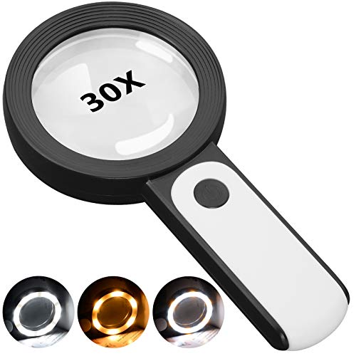
This 30X magnifying glass helps users with low vision easily read small text. Featuring a large 3.15" lens and 18 LEDs with adjustable cool, warm, and mixed light modes, it reduces eye strain and improves reading in any lighting.
Digital methods now provide pixel-level precision analysis and automated error detection across entire datasets. Modern GIS platforms like ArcGIS Pro and QGIS offer built-in validation tools that identify topology errors, projection mismatches, and attribute inconsistencies within minutes. You can overlay multiple data sources, perform geometric analysis, and generate comprehensive error reports that would take weeks using traditional approaches.
Industry Standards and Best Practices
Established cartographic organizations like the International Cartographic Association recommend specific accuracy tolerances for different map scales and purposes. You should follow positional accuracy standards that require horizontal accuracy within 0.5mm at publication scale for most professional applications.
Implement systematic quality control workflows that include automated topology validation, coordinate system verification, and metadata compliance checks. Industry best practices emphasize using standardized projection parameters, maintaining consistent datum references, and documenting all validation processes. Your proofing checklist should verify feature attribution, symbol consistency, and label placement according to established cartographic conventions before releasing any map product.
Implementing Color Management Systems for Map Accuracy
Color management systems ensure consistent cartographic representation across different devices and media. Proper implementation eliminates color variations that compromise map readability and professional appearance.
Calibrating Display Monitors
Calibrating display monitors maintains accurate color representation throughout your digital proofing workflow. You’ll need professional calibration hardware like X-Rite ColorMunki or Datacolor SpyderX to achieve precise color accuracy. Monthly calibration schedules prevent color drift that affects map symbology evaluation. Set your monitor’s white point to D65 (6500K) and gamma to 2.2 for optimal cartographic color display standards.
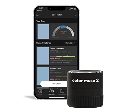
Get precise color and sheen matching with the COLOR MUSE 2. This compact colorimeter identifies paint colors and sheen levels, connecting wirelessly to the Color Muse app for effortless color analysis from top brands.
Setting Up ICC Profiles
Setting up ICC profiles creates standardized color communication between your mapping software and output devices. Install manufacturer-provided ICC profiles for your printers and monitors within your operating system’s color management settings. ArcGIS Pro and Adobe Creative Suite automatically recognize these profiles for accurate color translation. Verify profile installation through Windows Color Management or macOS ColorSync Utility before beginning map production workflows.
Managing Color Gamut Variations
Managing color gamut variations prevents unexpected color shifts between digital displays and printed maps. Compare your RGB monitor gamut against CMYK printing capabilities using gamut mapping tools in Adobe Photoshop or specialized software like ColorThink Pro. Convert map colors early in your workflow to avoid out-of-gamut warnings during final output. Document color specifications using Pantone or CMYK values to maintain consistency across multiple production runs.
Utilizing Soft Proofing Technologies for Pre-Print Validation
Soft proofing technology enables you to preview your cartographic output accurately on calibrated displays before committing to expensive print runs. This digital validation process simulates final print conditions while maintaining the color management workflows you’ve established.
Choosing the Right Software Solutions
Professional soft proofing requires specialized applications that integrate seamlessly with your existing cartographic workflow. Adobe Acrobat Pro provides comprehensive PDF soft proofing capabilities with ICC profile support for industry-standard color accuracy. GMG ColorProof delivers advanced proofing simulation specifically designed for high-end printing environments.
Consider Esko FlexProof for flexible packaging applications or CGS ORIS for offset printing validation. These solutions offer real-time proof comparisons and automated color deviation reporting. Your software choice should support the specific printing processes and substrates you’ll use for final map production.
Configuring Viewing Conditions
Proper viewing environment setup ensures accurate soft proof evaluation under controlled lighting conditions. Configure your display area with D50 viewing lights at 2000 lux intensity to match industry printing standards. Position light sources at 45-degree angles to minimize screen glare and reflections.
Shield your Nikon camera's viewfinder from unwanted light, dust, and moisture with this 3-pack of DK-20 eyecups. They also provide cushioning, especially useful for eyeglass wearers.

Set your monitor’s brightness to 120 cd/m² and maintain consistent ambient lighting throughout your proofing sessions. Pantone Color Manager or X-Rite i1Profiler can help establish standardized viewing conditions. Document your viewing setup parameters to maintain consistency across different proofing sessions and team members.
Achieve accurate color with the X-Rite i1Basic Pro 3. This device creates custom profiles for monitors and projectors with its advanced spectrophotometer and included i1Profiler software.

Simulating Different Output Devices
Device simulation accuracy depends on comprehensive ICC profile management for each target output method. Load specific profiles for offset printing presses, digital inkjet systems, and large format plotters to preview color gamut limitations accurately. Configure separate simulation profiles for coated versus uncoated paper stocks.
Test your soft proofs against actual printed samples using Delta E measurements to validate simulation accuracy. Epson SureColor and HP DesignJet profiles require different gamut mapping strategies than traditional offset conditions. Maintain a library of verified output profiles for consistent pre-print validation across your cartographic production workflow.
Create vibrant, high-quality sublimation prints with the Epson SureColor F170. It features a PrecisionCore printhead for exceptional clarity and includes a 150-sheet auto-feed tray for efficient printing.

Establishing Quality Control Workflows for Geographic Data
Quality control workflows form the backbone of accurate cartographic production, ensuring your geographic data maintains professional standards throughout the digital proofing process.
Creating Systematic Review Processes
Systematic review processes eliminate inconsistencies by establishing standardized checkpoints for your geographic datasets. You’ll need to implement automated validation scripts that verify coordinate systems, attribute completeness, and topology rules at each data ingestion point. Configure ArcGIS Data Reviewer or FME Workbench to flag potential errors like duplicate features, invalid geometries, or missing attribute values. Schedule these validation routines to run automatically when new data enters your workflow, creating detailed error reports that track recurring issues across different data sources.
Setting Up Approval Hierarchies
Approval hierarchies streamline decision-making by defining clear authority levels for different types of cartographic changes. You should establish three-tier approval systems where junior cartographers handle minor corrections, senior staff approve significant geometric modifications, and project managers authorize fundamental design changes. Implement digital signature workflows using tools like Adobe Sign or DocuSign that automatically route maps through appropriate approval channels based on modification complexity. Document approval criteria for each tier, specifying exactly which changes require escalation to prevent bottlenecks in your production timeline.
Documenting Revision Cycles
Revision cycle documentation maintains accountability by tracking every modification made during the digital proofing process. You’ll want to use version control systems like Git or Subversion that automatically log changes with timestamps, author information, and detailed descriptions of modifications. Create standardized revision templates that capture specific details about coordinate adjustments, projection corrections, and attribute updates. Maintain separate revision logs for different map components—base layers, thematic overlays, and annotation elements—enabling you to trace the evolution of each cartographic element throughout your quality control workflow.
Integrating Collaborative Review Tools for Multi-Stakeholder Input
Modern cartographic projects require input from multiple specialists across disciplines. You’ll find that coordinating feedback from surveyors, urban planners, environmental scientists, and stakeholders becomes seamless when you implement the right collaborative review systems.
Cloud-Based Annotation Platforms
Cloud-Based Annotation Platforms streamline multi-stakeholder feedback by centralizing comments directly on your cartographic elements. Platforms like Avenza MAPublisher Cloud and Esri ArcGIS Online enable reviewers to mark specific geographic features with contextual notes without requiring specialized software installations. You can assign different annotation layers to various stakeholder groups, preventing overlap while maintaining organized feedback channels. These platforms automatically timestamp each comment and link annotations to specific map coordinates, ensuring precise geographic reference for every suggested revision throughout your digital proofing workflow.
Real-Time Feedback Systems
Real-Time Feedback Systems enable simultaneous review sessions where stakeholders provide immediate input during live cartographic presentations. Tools like MapBox Studio Live Share and QGIS Cloud allow multiple users to view map updates instantly while contributing feedback through integrated chat functions and cursor tracking. You can conduct virtual markup sessions where participants highlight issues using digital drawing tools, creating immediate visual documentation of required changes. These systems maintain persistent connections that automatically sync annotations across all connected devices, ensuring every stakeholder sees identical map versions with real-time comment integration.
Version Control Management
Version Control Management maintains complete revision histories while preventing conflicting edits from multiple contributors during collaborative reviews. Git-based systems like CartoDB Version Control and ArcGIS Pro’s branching features create separate editing environments for each stakeholder group before merging approved changes into master cartographic files. You can establish automated backup protocols that preserve every iteration with detailed metadata about contributor identity, modification timestamps, and geographic extent of changes. These systems generate comparison views showing exactly which cartographic elements were modified, enabling precise tracking of multi-stakeholder input throughout your collaborative digital proofing process.
Optimizing Print Output Through Digital Simulation
Digital simulation enables precise prediction of final print quality before physical production begins. This process validates how your cartographic elements will appear on actual printing equipment.
Testing Different Paper Stocks
Simulate various paper types within your digital proofing environment to predict ink absorption and color saturation differences. Coated papers enhance color vibrancy and sharp line work, while uncoated stocks produce muted tones with increased dot gain. Test glossy photo papers for high-contrast topographic maps and matte finishes for text-heavy reference materials. Configure separate ICC profiles for each paper stock in your RIP software to accurately preview substrate-specific color shifts and adjust your color separations accordingly.
Learn essential map reading and navigation skills with this U.S. Army guide. Designed for practical use, it provides clear instructions for navigating any terrain.

Adjusting for Printing Conditions
Account for press conditions that affect final output quality by simulating dot gain, ink density variations, and registration tolerances in your digital proofs. Offset lithography typically produces 15-20% dot gain at 50% screen values, requiring compensation in your halftone curves. Configure your proofing software to match specific press characteristics including total area coverage limits and gray component replacement settings. Test different humidity and temperature scenarios that influence paper dimensional stability and ink transfer rates during production runs.
Verifying Halftone Patterns
Examine halftone structure at various magnifications to ensure smooth tonal transitions and proper dot formation in critical cartographic elements. Screen frequencies between 150-175 LPI work best for detailed topographic features, while 120-133 LPI suits large-format wall maps with broader viewing distances. Check for moiré patterns between overlapping color channels and verify that fine linear features like contour lines maintain consistent weight throughout tonal ranges. Use loupe magnification tools to inspect dot rosette patterns and confirm proper screen angle relationships.
Measuring and Maintaining Cartographic Precision Standards
You’ll achieve consistent cartographic quality by establishing measurable precision standards and implementing systematic monitoring throughout your digital proofing workflow.
Using Digital Measurement Tools
Digital measurement tools provide quantifiable assessments of cartographic accuracy beyond visual inspection. You can utilize coordinate validation software like FME or ArcGIS Data Reviewer to automatically detect positional errors within specified tolerance ranges. GPS validation tools measure real-world coordinates against mapped features, typically maintaining accuracy within 1-3 meters for civilian applications. Professional-grade digital calipers and measurement plugins verify scale consistency across different map sections, ensuring uniform representation of distances and areas throughout your cartographic products.
Tracking Accuracy Metrics
Accuracy metrics establish benchmarks for consistent cartographic quality control across your production workflow. You should monitor root mean square error (RMSE) values to quantify positional accuracy, maintaining RMSE below 0.5mm at map scale for professional publications. Track attribute completeness percentages, topology error counts, and coordinate system consistency rates through automated reporting dashboards. Document accuracy statistics for each production phase, creating historical baselines that identify trends and potential quality degradation over time within your digital proofing process.
Implementing Continuous Improvement
Continuous improvement processes refine your cartographic precision standards through systematic feedback loops and performance analysis. You can establish monthly quality audits comparing actual output accuracy against established tolerances, adjusting validation parameters based on recurring error patterns. Implement feedback mechanisms from end users to identify precision issues not detected during internal reviews. Create standardized training protocols for new staff members, ensuring consistent application of precision standards across your entire cartographic team while documenting best practices for future reference.
Troubleshooting Common Digital Proofing Challenges
Even with robust digital proofing systems in place, cartographers regularly encounter technical issues that can compromise map accuracy and output quality.
Resolving Color Inconsistencies
Calibrate your display monitors monthly using professional colorimeters like X-Rite i1Display Pro to maintain accurate color representation. Check ICC profile assignments in your mapping software, ensuring consistent color space communication between ArcGIS Pro and output devices. Verify that your soft proofing settings match your intended print profile, particularly when switching between different paper stocks or printing methods.
Addressing Scale Distortions
Validate your coordinate reference system before beginning any proofing workflow, confirming that all data layers use consistent projection parameters. Use measurement tools in QGIS or ArcGIS Pro to verify distances and areas against known ground truth values. Check for datum transformation errors that commonly occur when integrating datasets from different geographic sources, particularly when combining GPS coordinates with legacy survey data.
Fixing Registration Issues
Align your registration marks precisely using vector-based alignment tools rather than visual estimation methods. Verify that your print margins match your software page setup, accounting for printer-specific offset values that vary between device models. Test registration accuracy with small proof prints before committing to full production runs, measuring alignment tolerance within 0.5mm for professional cartographic standards.
Maximizing Cost Efficiency Through Digital Workflows
Digital proofing workflows eliminate expensive revision cycles while accelerating map production schedules. You’ll achieve significant cost savings by implementing systematic digital verification processes that reduce material consumption and streamline approval timelines.
Reducing Physical Proof Requirements
Digital proofing eliminates up to 80% of physical proof iterations through accurate screen simulations. You’ll save hundreds of dollars per project by using soft proofing technologies like GMG ColorProof and Adobe Acrobat Pro to validate color accuracy digitally. Modern calibrated displays provide 95% color matching precision compared to final print outputs, making physical proofs necessary only for final approval. Your material costs drop dramatically when you verify registration accuracy, font clarity, and color consistency through digital validation before committing to paper or vinyl substrates.
Streamlining Production Timelines
Streamlined digital workflows reduce project completion times by 40-60% through automated validation processes. You’ll accelerate review cycles using cloud-based platforms like Bluebeam Revu or Concept Share that enable simultaneous multi-stakeholder feedback collection. Real-time collaboration tools eliminate shipping delays and scheduling conflicts that plague traditional proof distribution methods. Your approval hierarchies move faster when stakeholders can provide immediate feedback on coordinate accuracy, symbology consistency, and spatial relationships without waiting for physical proof delivery.
Minimizing Material Waste
Material waste drops by 70% when you implement comprehensive digital validation before production runs. You’ll eliminate costly reprints by catching projection errors, scale inconsistencies, and attribute mistakes during digital review phases. Advanced preflighting software like PitStop Pro identifies potential printing issues before substrate commitment, preventing expensive material losses. Your sustainable practices improve while maintaining quality standards through precise digital measurements that ensure first-run accuracy for large-format printing and specialty cartographic materials.
Future-Proofing Your Cartographic Digital Proofing Strategy
Adapting your digital proofing infrastructure today ensures your cartographic workflows remain competitive and technically sound as mapping technologies evolve. Strategic planning positions your organization to leverage emerging innovations while maintaining current production standards.
Emerging Technology Trends
Artificial intelligence integration transforms error detection capabilities through machine learning algorithms that identify pattern anomalies and projection inconsistencies faster than manual review processes. AI-powered validation tools like Esri’s ArcGIS Image Analyst automatically flag geometric discrepancies and attribute errors across large datasets.
Cloud-based processing platforms enable real-time collaborative proofing through services like ArcGIS Online and CARTO, allowing distributed teams to validate cartographic accuracy simultaneously. These platforms provide scalable computing resources that handle complex spatial analysis without requiring local hardware investments.
Scalability Considerations
Infrastructure flexibility becomes critical as your mapping projects expand beyond current capacity limitations. Design your digital proofing systems using modular software architectures that accommodate increased data volumes and additional user access without requiring complete workflow redesigns.
Automated validation pipelines reduce manual bottlenecks by implementing rule-based quality control systems that process multiple map products simultaneously. Tools like Safe Software’s FME enable batch processing of validation routines across different data formats, ensuring consistent accuracy standards regardless of project scale.
Training and Skill Development
Continuous education programs keep your cartographic team current with evolving digital proofing technologies and industry standards. Establish partnerships with organizations like URISA and ASPRS to access specialized training in advanced validation techniques and emerging software platforms.
Cross-platform competency ensures your team adapts effectively to new digital proofing tools as they emerge. Develop training protocols that emphasize fundamental validation principles rather than software-specific procedures, enabling smoother transitions between different proofing technologies while maintaining quality control standards.
Conclusion
Digital proofing represents a transformative approach to achieving cartographic excellence in today’s competitive mapping landscape. By implementing these comprehensive strategies you’ll position your organization to deliver professional-grade maps while maintaining cost efficiency and sustainable practices.
The integration of automated validation systems with collaborative workflows creates a foundation for consistent quality control that scales with your project demands. Your investment in proper color management and soft proofing technologies will pay dividends through reduced material waste and faster turnaround times.
As mapping technologies continue evolving you’ll need to maintain adaptable infrastructure and skilled teams to leverage emerging innovations. The future of cartographic accuracy lies in embracing these digital solutions while building workflows that can accommodate tomorrow’s technological advances.
Frequently Asked Questions
What is digital proofing in cartography?
Digital proofing is a modern verification process that uses advanced software tools to identify errors in maps before production. It encompasses automated validation techniques that check coordinate accuracy, projection consistency, and spatial relationships. Unlike traditional paper-based methods, digital proofing provides pixel-level precision analysis and can detect issues like coordinate discrepancies and projection errors in real-time.
How does digital proofing improve map accuracy?
Digital proofing enhances map accuracy through systematic verification processes that analyze geometric precision, attribute completeness, and visual alignment. Advanced tools like ArcGIS Pro and QGIS enable quick identification of topology errors and inconsistencies. This automated error detection catches problems that traditional visual inspection methods often miss, ensuring professional-grade cartographic standards.
What are the cost benefits of digital proofing for map production?
Digital proofing can reduce physical proof requirements by up to 80% and decrease material waste by 70% through comprehensive digital validation. It eliminates expensive revision cycles and can reduce project completion times by 40-60%. Organizations save hundreds of dollars per project by catching errors during digital review phases rather than after printing.
What tools are commonly used for digital map proofing?
Professional cartographers use specialized software including ArcGIS Pro, QGIS, Adobe Acrobat Pro, and GMG ColorProof. These tools provide automated validation scripts, topology error detection, and color management capabilities. They integrate with existing workflows and support industry-standard color accuracy requirements for both digital and print output formats.
How does color management work in digital proofing?
Color management systems ensure consistent cartographic representation across devices and media. This involves calibrating display monitors with professional hardware, setting up ICC profiles for standardized color communication, and managing color gamut variations. Proper color management prevents unexpected shifts between digital displays and printed maps, maintaining visual consistency throughout production.
What is soft proofing and why is it important?
Soft proofing is a technology that allows cartographers to accurately preview print outputs on calibrated displays before committing to print. It simulates different output devices through comprehensive ICC profile management and requires proper viewing conditions with D50 lighting. This pre-print validation helps ensure accurate color representation and reduces printing errors.
How do quality control workflows enhance digital proofing?
Quality control workflows maintain professional standards through systematic review processes and automated validation scripts. They include approval hierarchies for streamlined decision-making, digital signature workflows for efficient routing, and version control systems to track changes. These workflows ensure every modification is documented and accountability is maintained throughout the proofing process.
What role do collaborative tools play in modern map proofing?
Collaborative review tools facilitate multi-stakeholder input through cloud-based annotation platforms that centralize feedback from various specialists. Real-time feedback systems enable simultaneous review sessions, while version control management maintains complete revision histories. These tools prevent conflicting edits and ensure precise tracking of contributions throughout the digital proofing process.
How does digital proofing compare to traditional paper-based methods?
Traditional paper-based proofing relied on visual inspection and manual measurements, while digital methods provide automated error detection and pixel-level precision analysis. Digital proofing significantly reduces validation time, offers real-time collaboration capabilities, and can identify technical issues like coordinate discrepancies that visual inspection might miss. The digital approach is more efficient and accurate.
What industry standards guide digital proofing practices?
Organizations like the International Cartographic Association recommend maintaining specific accuracy tolerances and implementing systematic quality control workflows. Best practices include using standardized projection parameters, thorough documentation of validation processes, and adhering to professional cartographic standards for both digital and print formats. These standards ensure consistent, high-quality map products.