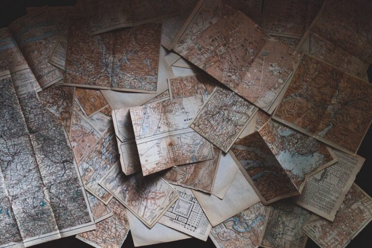
5 Ideas for Visualizing Identity Through Border Maps That Reveal Hidden Patterns
You live in a world where borders define more than just political boundaries—they shape identity culture and belonging in ways that traditional maps can’t capture. Border visualization has evolved beyond simple lines on paper into powerful tools that reveal hidden stories about migration heritage and community connections.
Modern cartographers and data artists are revolutionizing how we understand geographical identity through innovative mapping techniques. These creative approaches transform abstract concepts like cultural diaspora and ancestral roots into compelling visual narratives that resonate with diverse audiences.
Whether you’re exploring your family’s migration patterns or examining broader demographic shifts these five visualization methods will help you see borders as dynamic spaces where identities intersect and evolve.
Disclosure: As an Amazon Associate, this site earns from qualifying purchases. Thank you!
P.S. check out Udemy’s GIS, Mapping & Remote Sensing courses on sale here…
Understanding the Connection Between Borders and Identity Visualization
Geographic boundaries and personal identity share an intricate relationship that extends far beyond administrative lines on maps. Modern visualization techniques reveal how these connections manifest in human experience and cultural expression.
The Role of Geographic Boundaries in Shaping Cultural Identity
Political borders create distinct cultural landscapes that influence language patterns, economic opportunities, and social structures within defined territories. Cross-border communities often develop hybrid identities that reflect influences from multiple nations, creating complex demographic patterns visible through population density maps and linguistic distribution data.
Historical boundary changes leave lasting cultural imprints on regional identities, particularly in areas where borders shifted due to conflicts or political agreements. These transitions generate unique mapping opportunities to visualize cultural persistence, showing how communities maintain traditions despite changing political sovereignty through generational settlement patterns and cultural institution locations.
How Maps Serve as Visual Narratives of Belonging
Contemporary mapping techniques transform abstract identity concepts into compelling visual stories through layered demographic data, migration flow charts, and cultural landmark distributions. Interactive border maps can display multiple identity layers simultaneously, allowing viewers to explore how ethnic enclaves, religious communities, and linguistic groups intersect across political boundaries.
Digital cartography enables dynamic storytelling about belonging through time-series visualizations that track population movements, cultural diffusion patterns, and community formation processes. These narrative maps often incorporate census data, immigration records, and cultural surveys to create comprehensive visual accounts of how borders influence human connections and community development across generations.
Creating Personal Heritage Border Maps to Trace Ancestral Journeys
Personal heritage mapping transforms genealogical research into compelling visual narratives that reveal how borders shaped your family’s story. This approach combines traditional cartographic methods with modern data visualization to create meaningful connections between geographic boundaries and ancestral movements.
Mapping Family Migration Patterns Across Generations
Start by plotting documented migration routes using GIS software like ArcGIS or QGIS to create layered timeline maps. Import family records into spreadsheet templates with columns for departure dates, arrival locations, and border crossings. Use arrow symbols and dotted lines to represent different generations’ movements, scaling line thickness to indicate family group sizes. Connect major stopping points with curved paths rather than straight lines to show realistic travel routes that followed rivers, mountain passes, or established trade corridors during specific historical periods.
Incorporating DNA Data and Historical Records
Combine autosomal DNA results with historical boundary data to create accuracy-driven heritage visualizations. Upload DNA ethnicity percentages into mapping software and overlay them with period-accurate political boundaries from sources like the Digital Atlas of Roman and Medieval Civilizations. Cross-reference immigration records from Ellis Island, ship manifests, and census data to verify migration timing against changing border configurations. Use transparency layers to show confidence levels where DNA evidence aligns with documented historical movements across former empires and dissolved political entities.
Explore ancient history with this combination map and timeline poster. Featuring civilizations like Rome, Egypt, and the Aztecs, the color-coded design connects the map to the timeline.

Using Color Coding to Represent Different Ancestral Lines
Develop consistent color schemes that distinguish paternal and maternal lineages while maintaining visual clarity across multiple generations. Assign warm colors (reds, oranges) to paternal lines and cool colors (blues, greens) to maternal branches, using color intensity to represent genetic contribution percentages. Create legend systems that accommodate complex inheritance patterns, employing gradient fills for mixed ethnicities and pattern overlays for adopted family lines. Apply color-blind friendly palettes using tools like ColorBrewer to ensure accessibility while maintaining distinct visual separation between different ancestral pathways and geographic regions.
Designing Community Identity Maps That Highlight Neighborhood Boundaries
Community identity maps reveal the invisible boundaries that define how residents experience their neighborhoods. These visualizations capture the social fabric that extends beyond official administrative lines.
Identifying Informal Borders Within Urban Spaces
Informal boundaries emerge through daily interactions and shared experiences rather than municipal planning. You’ll find these borders along commercial strips where languages change, at the edges of school catchment areas, or where architectural styles shift dramatically. Walking surveys combined with resident interviews help identify these transition zones. Document crossing points where pedestrian patterns change, noting how foot traffic flows differently between perceived neighborhoods. Use GPS tracking data from mobile apps to visualize actual movement patterns that reveal community edges.
Track vehicles and assets with the LandAirSea 54 GPS Tracker. Get real-time location alerts and historical playback using the SilverCloud app, with a long-lasting battery and discreet magnetic mount.

Showcasing Cultural Enclaves and Ethnic Communities
Cultural enclaves create distinct geographic patterns through business clusters, religious institutions, and residential concentrations. Map ethnic restaurants, specialty grocery stores, and cultural centers to identify community cores. You’ll discover how language signage patterns shift across blocks, creating visual borders between communities. Overlay demographic census data with business licensing information to highlight cultural density gradients. Include community festivals and cultural events as temporal layers that strengthen neighborhood identity boundaries throughout the year.
Mapping Local Landmarks That Define Community Identity
Local landmarks serve as reference points that residents use to define their neighborhood boundaries. Churches, schools, parks, and historic buildings anchor community identity more effectively than street names. You’ll find that corner stores, community gardens, and neighborhood bars often mark informal territory limits. Document these landmarks through resident surveys asking “What defines your neighborhood?” Incorporate elevation data to show how natural features like hills or waterways create psychological boundaries that influence community self-perception.
Developing Interactive Digital Border Maps for Cultural Storytelling
Interactive digital platforms transform static boundary data into engaging narratives that reveal the complex relationships between geography and identity. Modern web-based mapping solutions enable storytellers to present multilayered cultural information through user-driven exploration.
Utilizing GIS Technology for Dynamic Visualization
Geographic Information Systems provide the foundation for creating responsive border visualizations that adapt to user interactions. You’ll need to leverage platforms like ArcGIS Online or QGIS with web mapping plugins to build dynamic interfaces. Layer historical census data with contemporary demographic information to show population shifts across boundaries. Implement time sliders that animate territorial changes over decades, revealing how cultural communities expand and contract. Use vector tiles for smooth zooming between regional and neighborhood scales, ensuring your audience can explore identity patterns at multiple geographic levels.
Achieve a flawless, even complexion with e.l.f. Flawless Satin Foundation. This lightweight, vegan formula provides medium coverage and a semi-matte finish for all-day wear, while hydrating your skin with glycerin.

Adding Multimedia Elements Like Photos and Audio Narratives
Multimedia integration transforms technical boundary data into human stories that resonate with diverse audiences. You can embed oral history recordings directly into map markers, allowing users to hear firsthand accounts of border crossings and cultural transitions. Incorporate historical photographs that show how landscapes changed as boundaries shifted, creating visual anchors for abstract demographic data. Use popup windows to display family documents, immigration papers, and community artifacts that illustrate personal connections to geographic spaces. Deploy 360-degree photography at significant border locations to provide immersive experiences that connect viewers to specific places.
Creating Clickable Regions That Reveal Identity Stories
Interactive polygon features enable detailed exploration of how borders shape cultural experiences within specific geographic areas. You should design clickable boundary zones that trigger detailed information panels containing demographic breakdowns, cultural practices, and historical context. Program hover effects that highlight cross-border connections, showing how communities maintain relationships despite political divisions. Create nested geographic hierarchies where users can click from country-level borders down to neighborhood boundaries, revealing identity patterns at each scale. Implement search functionality that allows users to locate specific ethnic enclaves, religious communities, or linguistic groups within your mapped regions.
Constructing Artistic Border Collages That Blend Geographic and Personal Elements
Creating artistic collages transforms traditional border mapping into deeply personal visual narratives that honor both geographic accuracy and individual storytelling.
Combining Traditional Cartography With Personal Artifacts
You’ll achieve powerful visual impact by layering historic topographic maps with family photographs and documents. Start with USGS quadrangle sheets as your base layer, then incorporate passport stamps, immigration papers, and handwritten letters that trace your family’s border crossings. Scan these artifacts at 300 DPI to maintain detail when overlaying onto map sections. Use transparency techniques to blend personal documents with geographic features, creating connections between specific locations and family memories that crossed those boundaries.
Learn essential map reading and navigation skills with this U.S. Army guide. Designed for practical use, it provides clear instructions for navigating any terrain.

Using Mixed Media to Represent Identity Layers
Mixed media techniques allow you to represent complex identity intersections through tactile elements and varied textures. Apply fabric pieces from traditional clothing to represent cultural heritage zones, while using thread or yarn to trace migration routes across continents. Incorporate soil samples from ancestral lands or pressed flowers native to border regions. Layer watercolor washes over map sections to show emotional connections to places, then add collaged newspaper clippings in multiple languages to represent linguistic diversity within border communities.
Create vibrant watercolor art with this portable set. It includes 40 colors (metallic & fluorescent), a brush pen, watercolor paper, and more, all in a stylish tin box.

Incorporating Symbolic Colors and Textures
Color psychology and texture choices communicate identity themes more effectively than words alone. Use warm earth tones like ochre and sienna for homeland connections, while cooler blues and grays represent transitions and uncertainty during border crossings. Apply rough textures through sand or salt mixed with paint to show challenging terrain, contrasted with smooth metallic leafing for aspirational destinations. Create visual hierarchy by using saturated colors for current identity markers and muted tones for historical elements, allowing viewers to distinguish temporal layers within your border narrative.
Establishing Virtual Identity Borders Through Social Media Mapping
Social media platforms create invisible territories where communities form around shared interests, cultural backgrounds, and geographic connections. You can map these digital boundaries to reveal how online identity transcends traditional geographic limitations.
Visualizing Online Communities and Digital Territories
Platform-specific community mapping reveals distinct digital territories through hashtag networks and user interactions. You’ll identify cultural clusters by analyzing location tags, language patterns, and shared content themes across Instagram, Twitter, and Facebook. Geographic visualization tools like Gephi help you map follower relationships that span continents while maintaining cultural connections. These digital territories often mirror real-world migration patterns, creating virtual neighborhoods where diaspora communities maintain cultural identity through shared posts, events, and digital gathering spaces.
Mapping Social Networks Across Geographic Boundaries
Cross-border social network analysis tracks how relationships transcend political boundaries through family connections, professional networks, and cultural affiliations. You can visualize friendship patterns using Facebook’s social graph data or LinkedIn professional connections to identify transnational identity clusters. Network visualization software like Cytoscape reveals how individuals maintain multiple cultural identities through different online communities. These mapping techniques expose virtual borders that don’t align with national boundaries, showing how digital relationships create new forms of cultural territory.
Creating Heat Maps of Digital Identity Presence
Digital presence heat mapping quantifies identity expression intensity across different online platforms and geographic regions. You’ll track posting frequency, engagement rates, and cultural content sharing to identify digital identity hotspots using tools like Tableau or ArcGIS Online. Location-based social media data reveals where specific cultural groups maintain strongest digital presence, creating visual representations of virtual identity concentration. These heat maps highlight digital cultural centers that may differ significantly from physical community locations, showing how online identity creates new territorial patterns.
Conclusion
These border visualization techniques transform abstract concepts of identity into tangible visual experiences that resonate with viewers on multiple levels. Whether you’re exploring your family’s migration story through heritage mapping or discovering how your neighborhood’s invisible boundaries shape daily life you’re participating in a powerful form of cultural documentation.
The digital age has expanded these possibilities beyond traditional cartography. You can now create interactive maps that tell evolving stories or design artistic collages that blend personal artifacts with geographic data. Social media mapping reveals entirely new forms of identity borders that exist solely in virtual spaces yet profoundly impact real-world communities.
Your exploration of identity through border visualization isn’t just about creating compelling visuals—it’s about understanding the complex relationships between place belonging and cultural expression. These mapping techniques offer fresh perspectives on how borders continue to shape human experience in our interconnected world.
Frequently Asked Questions
What are identity borders and how do they differ from political borders?
Identity borders represent cultural, social, and personal boundaries that define communities and individual belonging. Unlike political borders marked by official lines, identity borders are fluid and invisible, shaped by shared experiences, language, heritage, and cultural practices. They can transcend or exist within political boundaries, creating unique spaces where communities develop hybrid identities and connections.
How can I map my family’s migration patterns and heritage?
Start by gathering family documents, DNA data, and historical records. Use GIS software to plot ancestral journeys on maps, incorporating color coding for different family lines. Combine traditional cartographic methods with modern visualization tools to create accurate heritage maps that show how geographic boundaries influenced your family’s story across generations.
What tools are needed to create interactive digital border maps?
You’ll need Geographic Information Systems (GIS) software, web-based mapping platforms, and demographic data sources. Popular tools include ArcGIS, QGIS, and web solutions like Mapbox or Leaflet. These platforms allow you to layer historical and contemporary data, create clickable regions, and incorporate multimedia elements like photos and oral histories for engaging storytelling.
How do community identity maps reveal neighborhood boundaries?
Community identity maps use walking surveys, GPS tracking, and local observations to document invisible boundaries within neighborhoods. They identify cultural enclaves, business clusters, and social gathering spaces that create distinct geographic patterns. These maps reveal how daily interactions and shared experiences form informal borders that extend beyond official administrative lines.
What are virtual identity borders in social media?
Virtual identity borders are digital territories formed by online communities around shared interests and cultural backgrounds. They exist across social media platforms through hashtag networks, user interactions, and digital engagement patterns. These virtual boundaries often transcend physical borders, creating transnational identity clusters and new forms of cultural expression and connection.
How can artistic border collages represent personal identity?
Artistic border collages combine geographic maps with personal artifacts like passport stamps, family photos, and cultural objects. Use mixed media techniques, incorporating fabric, soil samples, and historical documents to create tactile representations of identity intersections. Color psychology and texture help communicate emotional ties to places and distinguish between historical and contemporary elements.
What techniques help visualize cross-border communities?
Use layered demographic data, population heat maps, and network analysis to show how communities span political boundaries. Interactive mapping tools can display migration patterns, cultural diffusion, and relationship networks. Incorporate multimedia storytelling elements and create visualizations that track population movements and cultural connections across generations and geographic regions.