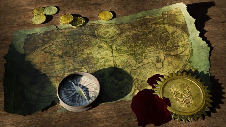
6 Best Map Design Strategies for Immersive Navigation
Why it matters: You’re designing the next breakthrough immersive experience but your map feels flat and uninspiring. The right mapping approach can transform passive observers into active explorers who feel genuinely connected to your virtual world.
The big picture: Whether you’re crafting a VR adventure or an interactive museum exhibit your map serves as the invisible guide that shapes every user decision. Smart designers know that memorable experiences start with thoughtful navigation that feels natural rather than forced.
What’s next: These six proven strategies will help you create maps that don’t just show directions—they tell stories and build emotional connections that keep users engaged long after the experience ends.
Disclosure: As an Amazon Associate, this site earns from qualifying purchases. Thank you!
P.S. check out Udemy’s GIS, Mapping & Remote Sensing courses on sale here…
Interactive Digital Maps That Respond to User Actions
Interactive digital maps transform static navigation into dynamic experiences that adapt to your users’ behaviors. These responsive mapping systems create deeper engagement by providing real-time feedback and personalized content delivery.
Real-Time Environmental Changes
Your digital maps can mirror actual environmental conditions through live data integration. Connect weather APIs to display current precipitation, temperature variations, or wind patterns that affect user routes. Implement time-of-day lighting changes that reflect actual sunrise and sunset times for your mapped locations. Use IoT sensors to show real-time crowd density at popular destinations, helping users avoid congested areas. These environmental updates create authentic experiences that match users’ physical surroundings.
Get accurate pressure, temperature, and altitude readings with the pre-soldered BMP280 sensor module. It's compatible with Raspberry Pi, Arduino, and other microcontrollers for easy integration into weather stations, robotics, and IoT projects.

Touch and Gesture-Based Navigation
Design intuitive gesture controls that respond to pinch-to-zoom, swipe, and tap interactions across your map interface. Implement multi-touch support for users to rotate 3D terrain models or tilt perspectives using two-finger gestures. Create hover effects that reveal additional information when users pause over specific map elements. Add pressure-sensitive interactions for devices that support force touch, allowing deeper content layers through varying touch intensity. These natural input methods reduce the learning curve for new users.
Enhance your tabletop games with this set of six highly detailed, 3D printed stone boulder terrain pieces. Perfect for 28mm miniatures, these paintable PLA plastic models add immersive scenery to any battlefield.
Dynamic Content Updates
Configure your maps to refresh content based on user preferences, location data, and behavioral patterns. Pull real-time social media feeds to show current events or user-generated content at specific map coordinates. Integrate booking systems that display live availability for restaurants, tours, or accommodations directly within map popups. Set up automatic content filtering that adjusts displayed information based on user demographics, interests, or previous interactions. These updates ensure your map content remains current and personally relevant.
Augmented Reality Maps That Overlay Digital Information
AR mapping technology transforms physical spaces into information-rich environments by superimposing contextual data onto real-world locations. You’ll find these overlays particularly effective for creating layered experiences that blend physical navigation with digital storytelling.
Location-Based Digital Markers
Position digital waypoints at specific coordinates to trigger contextual information when users approach designated areas. Your AR markers can display historical photos, audio narratives, or interactive content based on GPS coordinates and compass orientation. Configure proximity triggers between 3-15 meters for optimal activation, ensuring users don’t miss critical information while maintaining natural exploration flow. Popular platforms like ARKit and ARCore provide robust tracking for outdoor implementations.
3D Object Placement and Visualization
Anchor three-dimensional models and visualizations to specific geographic coordinates for immersive spatial storytelling. You can reconstruct historical buildings, display underground infrastructure, or visualize future development plans directly in users’ camera views. Use LiDAR scanning data to ensure accurate surface detection and occlusion handling. Tools like Unity’s AR Foundation and Mapbox enable precise world-scale AR placement with centimeter-level accuracy when combined with RTK GPS positioning.
Achieve a flawless, even complexion with e.l.f. Flawless Satin Foundation. This lightweight, vegan formula provides medium coverage and a semi-matte finish for all-day wear, while hydrating your skin with glycerin.

Interactive Storytelling Elements
Embed narrative components that respond to user movement and interaction patterns throughout the mapped environment. Your storytelling system can adapt plot progression based on the sequence of locations visited, creating personalized narrative paths. Implement branching dialogue trees, character interactions, and environmental triggers that activate through gesture recognition or device orientation. Consider using spatial audio positioning to enhance immersion and guide users toward story elements naturally.
Multi-Sensory Maps That Engage All Five Senses
Multi-sensory mapping transforms traditional navigation into immersive experiences that activate multiple sensory channels simultaneously. You’ll engage users more deeply by incorporating tactile feedback, spatial audio, and environmental stimuli that create memorable wayfinding experiences.
Tactile Texture Integration
Tactile mapping incorporates physical textures and haptic feedback to convey spatial information through touch. You can embed raised surfaces, varied materials, and vibration patterns into interactive displays that help users distinguish between terrain types, elevation changes, and landmark boundaries. Modern haptic controllers and textured overlays create authentic sensations like rough mountain paths or smooth water surfaces. Smart mapping kiosks now feature pressure-sensitive surfaces that respond to touch intensity, while wearable haptic devices provide directional feedback through subtle vibrations that guide users along predetermined routes.
Control haptic motors easily with the DRV2605L module. It uses I2C communication and features an IN pin for versatile control, including analog audio input.
Audio Cues and Soundscapes
Audio mapping layers create spatial awareness through directional sound cues and environmental audio that corresponds to map locations. You’ll position 3D audio elements that trigger as users approach specific coordinates, delivering location-specific information through binaural sound design. Soundscapes can include ambient forest sounds for park areas, urban traffic noise for city districts, or historical audio recordings for heritage sites. Spatial audio technology enables precise sound positioning that helps users orient themselves within mapped environments, while adaptive volume controls adjust audio intensity based on proximity to mapped features.
Scent and Temperature Variations
Scent-enabled mapping systems release location-appropriate aromas that correspond to mapped environments and enhance spatial memory formation. You can integrate scent dispensers that activate based on user proximity to specific map regions, releasing ocean salt air for coastal areas or pine scents for forested zones. Temperature mapping uses localized heating and cooling elements to simulate environmental conditions, creating warm spots for desert regions or cool zones for mountain areas. These sensory triggers work alongside traditional visual mapping to create stronger memory anchors and more intuitive navigation experiences.
Collaborative Maps That Allow Multiple User Input
Collaborative mapping transforms individual navigation into shared experiences where multiple users contribute data and insights simultaneously. These interactive platforms create living documents that evolve through collective input.
Real-Time Shared Editing Features
Simultaneous editing capabilities allow multiple users to modify map elements while viewing changes instantly across all connected devices. You’ll see cursor positions of other editors and receive live notifications when someone adds points of interest or adjusts route information. Platforms like Google My Maps and ArcGIS Online enable teams to collaborate on custom overlays, with version control systems preventing conflicts when multiple users edit the same geographic area. These features support synchronized drawing tools, shared annotation layers, and real-time coordinate updates that maintain data accuracy across all user sessions.
Community-Driven Content Creation
User-generated mapping content transforms visitors into active contributors who enhance map accuracy through local knowledge and firsthand experiences. You can establish crowdsourcing protocols that encourage users to submit photos, reviews, and location updates while maintaining quality through community moderation systems. OpenStreetMap exemplifies this approach, where local contributors add detailed business information, trail conditions, and accessibility features that professional surveyors might miss. Community mapping initiatives create sustainable data collection networks that continuously improve map relevance and cultural authenticity through distributed expertise.
Social Interaction and Communication Tools
Integrated communication features enable map users to share discoveries and coordinate activities through embedded messaging and social sharing capabilities. You can implement location-based chat functions that activate when users reach specific coordinates, along with group planning tools for coordinating meetups and shared navigation routes. These systems support real-time location sharing, collaborative waypoint creation, and social media integration that amplifies user engagement. Comment threads attached to map markers create ongoing discussions about locations, while push notifications alert group members to important updates or changes in shared itineraries.
Gamified Maps That Incorporate Gaming Elements
Transform your mapping experience into an engaging adventure by incorporating gaming mechanics that motivate exploration and discovery. Gaming elements turn routine navigation into purposeful quests that reward curiosity and achievement.
Quest-Based Navigation Systems
Design your map with structured missions that guide users through specific routes while revealing location-based stories. Create branching pathways where completing one objective unlocks new destinations, similar to role-playing game progression systems. Implement waypoint systems that provide narrative context at each stop, transforming simple directions into engaging storylines. Examples include treasure hunt applications like Geocaching or educational tours that reveal historical facts through sequential discovery points.
Retrieve lost items in tight spaces with this telescoping magnetic pickup tool. It features a strong magnet, extendable handle, and bright LED flashlight for easy retrieval in any environment.

Achievement and Reward Mechanisms
Integrate digital badges and progress tracking that acknowledge user milestones throughout their mapping journey. Award points for visiting unique locations, discovering hidden features, or completing specific challenges within your mapped environment. Create tiered reward systems where accumulated achievements unlock exclusive content, advanced features, or special map layers. Popular applications like Foursquare and Strava demonstrate how location-based achievements encourage repeated engagement and exploration of new areas.
Competitive and Challenge Features
Incorporate leaderboards that rank users based on exploration metrics, distance traveled, or challenges completed within your mapped space. Design time-based challenges that encourage users to reach destinations efficiently or discover specific locations within set parameters. Enable social comparison features where friends can compete in mapping-related activities like photo challenges, location check-ins, or route optimization contests. These competitive elements drive engagement through friendly rivalry and community participation.
Personalized Maps That Adapt to Individual Preferences
Personalized mapping systems analyze user data to create tailored navigation experiences that evolve with individual needs and preferences. These adaptive maps learn from your interactions to provide increasingly relevant and customized guidance.
AI-Driven Content Customization
AI-powered mapping algorithms analyze your location history and preferences to curate relevant points of interest. Machine learning models process data from your previous routes, dwell times, and selected destinations to predict future navigation needs. Systems like Google Maps’ personalized recommendations and Apple Maps’ Siri Suggestions demonstrate how artificial intelligence filters billions of location data points to surface restaurants, attractions, and services that match your established patterns. These algorithms continuously refine their understanding of your preferences through feedback loops and behavioral analysis.
User Behavior Analysis Integration
Behavioral tracking systems monitor your movement patterns to optimize route suggestions and interface elements. Analytics platforms collect data on your walking speed, preferred transportation methods, and typical travel times to customize navigation timing and route complexity. Heat mapping technology identifies your most frequently visited locations and commonly used pathways to prioritize relevant map layers and information density. Advanced systems like Strava’s Global Heatmap and location intelligence platforms use aggregated user behavior data to improve routing algorithms and predict optimal travel patterns for similar user profiles.
Adaptive Interface Design
Dynamic interface systems modify map layouts and information hierarchy based on your usage patterns and accessibility needs. Responsive design frameworks adjust zoom levels, icon sizes, and text contrast according to your interaction history and device preferences. Contextual UI elements appear and disappear based on your current activity and location relevance, reducing cognitive load while maintaining essential navigation functionality. Platforms like Citymapper and Transit demonstrate adaptive interfaces that reorganize transportation options and map elements based on your commuting patterns and time-sensitive needs.
Conclusion
These six mapping strategies offer you powerful tools to transform ordinary navigation into extraordinary experiences. You’ll find that combining multiple approaches—like layering AR elements with gamified features or integrating multi-sensory components with collaborative tools—creates the most compelling results.
Your success depends on understanding your audience’s needs and choosing technologies that enhance rather than complicate their journey. Start with one or two techniques that align with your project goals and gradually expand your implementation.
The future of immersive mapping lies in personalization and seamless integration. As you develop your maps focus on creating experiences that feel intuitive and meaningful to your users rather than simply showcasing technical capabilities.
Frequently Asked Questions
What is immersive mapping and how does it enhance user experience?
Immersive mapping transforms traditional navigation into engaging experiences by combining visual elements with interactive features. Instead of static maps, users become active participants through dynamic content, storytelling elements, and multi-sensory feedback. This approach creates memorable experiences that foster emotional connections, making navigation more intuitive and enjoyable while providing contextual information that adapts to user behaviors and preferences.
How do interactive digital maps differ from traditional static maps?
Interactive digital maps respond to user actions in real-time, adapting content based on behaviors and preferences. They integrate live data like weather conditions and crowd density, offer touch and gesture-based navigation, and provide dynamic content updates. Unlike static maps that show fixed information, interactive maps create personalized experiences that evolve with user interactions and environmental changes.
What is augmented reality (AR) mapping and what are its benefits?
AR mapping overlays digital information onto physical spaces, blending real-world navigation with virtual elements. It uses location-based markers to trigger contextual information, places 3D objects at specific coordinates, and integrates interactive storytelling that adapts to user movement. This technology creates layered experiences that enhance spatial understanding while providing immersive narratives tied to physical locations.
How does multi-sensory mapping work and what senses does it engage?
Multi-sensory mapping engages all five senses to create immersive navigation experiences. It incorporates tactile feedback through haptic technology, spatial audio cues for directional guidance, scent-enabled systems that release location-appropriate aromas, and temperature variations that simulate environmental conditions. This comprehensive sensory approach creates stronger memory anchors and more intuitive navigation experiences than visual-only systems.
What is collaborative mapping and how does it benefit users?
Collaborative mapping enables multiple users to contribute data and insights simultaneously, transforming individual navigation into shared experiences. Features include real-time editing capabilities, community-driven content creation, and integrated social interaction tools. This approach enhances map accuracy through local knowledge, enables users to share discoveries, and creates opportunities for coordinated activities and location-based communication.
How do gamified maps make navigation more engaging?
Gamified maps incorporate gaming elements like quest-based navigation systems, achievement rewards, and competitive features. Users complete structured missions that reveal location-based stories, earn digital badges for milestones, and participate in leaderboards and time-based challenges. These elements transform routine navigation into exciting adventures, encouraging exploration and creating friendly competition among users.
What role does AI play in personalized mapping systems?
AI analyzes user data to curate relevant points of interest and predict future navigation needs through machine learning models. It processes location history, travel patterns, and preferences to optimize route suggestions and adapt interface designs. AI-driven personalization ensures maps display information most relevant to individual users, creating tailored experiences that improve over time through continuous behavioral analysis.
Can mapping systems adapt to accessibility needs?
Yes, modern mapping systems incorporate adaptive interface design that modifies layouts and information hierarchy based on user accessibility requirements. They offer dynamic systems that adjust visual elements, provide alternative navigation methods, and integrate assistive technologies. These features ensure that mapping experiences are inclusive and accessible to users with diverse needs and abilities.