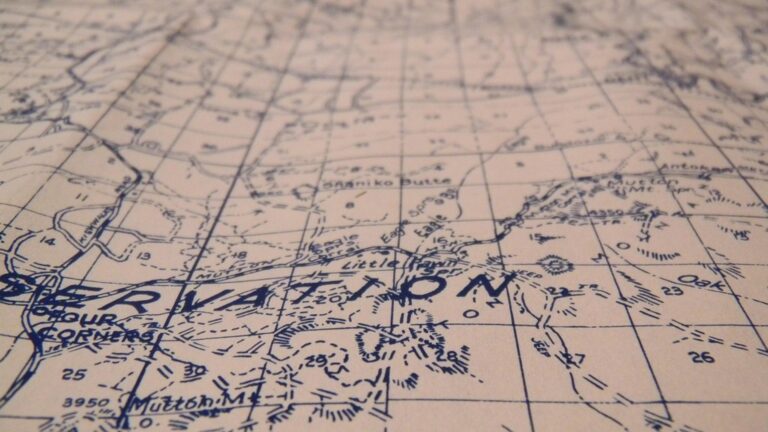
7 Best Cartography Education Strategies
Why it matters: Traditional cartographic education often focuses on technical precision but creativity transforms students into innovative mapmakers who can visualize complex spatial relationships in groundbreaking ways.
The big picture: You’re seeing a shift in geography classrooms where educators blend artistic expression with scientific rigor to prepare students for careers in data visualization, urban planning, and digital mapping.
What’s next: These seven proven strategies will help you unlock your students’ creative potential while maintaining the analytical foundations that make effective cartographers.
Achieve a flawless, even complexion with e.l.f. Flawless Satin Foundation. This lightweight, vegan formula provides medium coverage and a semi-matte finish for all-day wear, while hydrating your skin with glycerin.

Disclosure: As an Amazon Associate, this site earns from qualifying purchases. Thank you!
P.S. check out Udemy’s GIS, Mapping & Remote Sensing courses on sale here…
Integrate Interactive Digital Mapping Tools
Digital mapping platforms transform passive cartographic learning into hands-on creative exploration. These tools bridge the gap between traditional map-making techniques and modern visualization demands.
Utilize Web-Based GIS Platforms for Student Projects
ArcGIS Online and QGIS Cloud provide accessible entry points for student cartographers without requiring expensive software installations. You’ll find these platforms offer customizable symbology options, layer styling controls, and collaborative workspace features that encourage creative problem-solving. Students can experiment with color schemes, typography choices, and data classification methods while working with real-world datasets from census bureaus, environmental agencies, and municipal governments.
Incorporate Virtual Reality Mapping Experiences
Google Earth VR and ArcGIS 360 VR immerse students in three-dimensional spatial environments where they can examine terrain relationships and urban planning scenarios. You can design assignments where students create virtual field trips, explore historical landscape changes, or analyze geographic phenomena from multiple perspectives. These platforms help students understand scale relationships, topographic complexity, and spatial patterns that traditional flat maps can’t effectively communicate.
Implement Story Map Creation Assignments
Esri Story Maps and MapBox Storytelling combine narrative elements with interactive cartographic content to develop students’ communication skills. You’ll guide students through projects that integrate multimedia content, sequential map reveals, and data-driven storytelling techniques. These assignments challenge students to consider audience engagement, information hierarchy, and visual flow while maintaining cartographic accuracy and appropriate scale representation.
Understand the structure of a one-hour TV drama pilot. This book provides a guide to story mapping for television.

Encourage Field-Based Mapping Exercises
Moving beyond digital interfaces, hands-on fieldwork transforms students from passive observers into active cartographic practitioners. Field-based exercises bridge the gap between theoretical mapping concepts and real-world spatial analysis challenges.
Organize Community Mapping Workshops
Community mapping workshops connect students with local stakeholders while developing practical surveying skills. You’ll partner with neighborhood organizations, historical societies, or environmental groups to document community assets, accessibility challenges, or cultural landmarks. Students use handheld GPS units, measuring tapes, and field notebooks to collect spatial data that addresses genuine community needs. These collaborative projects teach students how cartographic decisions impact real people while building relationships between academic institutions and local communities.
Stay connected anywhere with this compact satellite communicator. Enjoy two-way messaging, interactive SOS, and TracBack routing for confident navigation. Battery lasts up to 14 days in tracking mode.

Design Treasure Hunt Mapping Activities
Treasure hunt mapping activities combine navigation skills with creative problem-solving in familiar campus or neighborhood environments. You’ll create multi-stage challenges where students use compass bearings, coordinate systems, and landmark triangulation to locate hidden checkpoints. Each checkpoint presents mapping puzzles that require students to interpret topographic symbols, calculate distances using map scales, or identify geographic features using aerial imagery. These gamified exercises make fundamental cartographic concepts memorable while encouraging teamwork and spatial reasoning development.
Facilitate Environmental Data Collection Projects
Environmental data collection projects engage students in scientific fieldwork while teaching proper data gathering protocols. You’ll organize stream quality assessments, urban heat island measurements, or biodiversity surveys that require GPS coordinate recording, systematic sampling methods, and field sketch mapping. Students learn to maintain data accuracy standards, document field conditions, and integrate ground-truth observations with satellite imagery. These projects demonstrate how cartographers contribute to environmental monitoring while developing critical thinking skills about data quality and spatial representation.
Implement Collaborative Mapping Projects
Collaborative mapping projects transform your classroom into a dynamic workspace where students pool their diverse skills to create comprehensive cartographic solutions. These team-based initiatives mirror professional mapping environments where cartographers regularly work with specialists from multiple disciplines.
Foster Cross-Disciplinary Team Mapping
Cross-disciplinary teams blend geography students with peers from urban planning, environmental science, and data analytics programs to tackle complex mapping challenges. You’ll assign roles like data collection specialist, GIS analyst, and visualization designer to leverage each student’s academic strengths. These partnerships recreate professional mapping workflows where cartographers collaborate with engineers, sociologists, and public health experts. Students develop communication skills essential for translating technical cartographic concepts across different professional vocabularies while producing maps that address real-world interdisciplinary problems.
Create Peer Review Mapping Sessions
Peer review sessions establish structured feedback loops where students evaluate each other’s cartographic work using professional quality standards. You’ll provide evaluation rubrics covering symbology consistency, data accuracy, and visual hierarchy to guide student assessments. These sessions teach students to identify cartographic errors, suggest design improvements, and articulate technical feedback constructively. Students rotate through different reviewer roles—technical accuracy checker, design critic, and usability tester—developing critical analysis skills essential for professional map production and collaborative cartographic workflows.
Articulate! is a fast-talking description game for 4+ players. Describe words quickly without saying "rhymes with" or "sounds like" to win, perfect for family game nights and parties.

Develop Group Cartographic Problem-Solving Tasks
Group problem-solving tasks challenge student teams to address complex spatial questions requiring multiple analytical approaches and collaborative decision-making. You’ll present scenarios like urban evacuation planning or wildlife corridor mapping that demand integrated solutions combining fieldwork, data analysis, and visualization strategies. Teams must negotiate conflicting data sources, reconcile different analytical methods, and synthesize findings into coherent cartographic products. These collaborative challenges develop project management skills while teaching students to balance individual expertise with group consensus in professional mapping environments.
Introduce Alternative Mapping Mediums
Moving beyond traditional digital platforms opens new creative pathways for your cartographic education program. You’ll discover that alternative mediums challenge students to think spatially while developing tactile skills that strengthen their overall mapping comprehension.
Explore Hand-Drawn Artistic Cartography
Hand-drawn maps reconnect students with the foundational skills of traditional cartography while fostering personal artistic expression. You can introduce watercolor techniques for elevation representation, pen-and-ink methods for detailed coastline work, and charcoal sketching for terrain visualization. Students develop spatial awareness through direct mark-making while learning how line weight, color choice, and symbolic representation communicate geographic information effectively.
Experiment with 3D Printed Topographic Models
3D printed terrain models transform abstract elevation data into tangible learning tools that students can touch and examine. You’ll help students convert digital elevation models into printable files using software like Terrain2STL or TouchTerrain. These physical models reveal landform relationships that traditional flat maps can’t convey, allowing students to understand watershed boundaries, ridge systems, and valley networks through direct manipulation.
Enhance your tabletop games with this set of six highly detailed, 3D printed stone boulder terrain pieces. Perfect for 28mm miniatures, these paintable PLA plastic models add immersive scenery to any battlefield.
Utilize Mixed Media Collage Mapping Techniques
Mixed media collage mapping combines traditional cartographic elements with unconventional materials like fabric, newspaper clippings, and natural objects. You can guide students to create thematic maps using magazine cutouts for population density, sandpaper for desert regions, or cotton for cloud cover patterns. This technique encourages creative problem-solving while reinforcing the connection between geographic phenomena and their symbolic representation.
Incorporate Game-Based Learning Approaches
Gamification transforms abstract cartographic concepts into engaging challenges that maintain student motivation while reinforcing essential spatial thinking skills.
Design Cartographic Escape Room Challenges
Create time-pressured scenarios where student teams solve sequential mapping puzzles to “escape” fictional geographic crises. Design challenges that require coordinate system conversions, scale calculations, and projection identification to unlock digital clues. Use platforms like Breakout EDU or custom Google Forms sequences to automate hint delivery and progress tracking. Integrate real cartographic tools like GPS units, compass readings, and topographic map interpretation into physical puzzle stations for authentic problem-solving experiences.
Create Interactive Map-Making Board Games
Develop tabletop games that simulate real cartographic decision-making through resource management and spatial strategy mechanics. Design gameplay where students collect survey data, manage projection distortions, and balance accuracy against visualization clarity to score points. Incorporate chance elements like weather delays or equipment failures that mirror real fieldwork challenges. Use modular board designs that allow different geographic regions and mapping scenarios, encouraging repeated play with varied learning outcomes.
Develop Digital Mapping Competition Platforms
Build online tournaments using web-based GIS platforms where students compete in timed cartographic challenges across multiple skill categories. Create leaderboards for tasks like fastest accurate digitization, most creative symbology design, or best data visualization storytelling. Leverage platforms like ArcGIS Online’s sharing capabilities or custom web applications to host head-to-head mapping contests. Design seasonal championships that progress from basic skills competitions to complex multi-dataset integration challenges requiring advanced spatial analysis techniques.
Connect Mapping to Real-World Applications
Real-world mapping partnerships bridge the gap between classroom theory and professional cartographic practice, giving students authentic project experience while building valuable community connections.
Partner with Local Government Planning Departments
Planning departments offer students direct exposure to municipal cartographic workflows through zoning analysis projects and development impact assessments. You’ll connect students with professional planners who guide them through land use mapping challenges using actual city datasets. These partnerships typically involve students creating neighborhood development proposals or analyzing traffic pattern impacts, giving them hands-on experience with regulatory mapping requirements while building professional networks that often lead to internship opportunities.
Collaborate with Environmental Conservation Organizations
Conservation groups provide students with real environmental mapping challenges that combine scientific data collection with spatial analysis techniques. You’ll work with organizations to develop habitat mapping projects where students track wildlife corridors or monitor water quality changes over time. These collaborations often include field data collection using GPS units and environmental sensors, allowing students to understand how cartographers contribute to conservation efforts while developing skills in environmental data visualization and ecological mapping protocols.
Measure temperature, humidity, pressure, and VOC gases with the BME680 environmental sensor. It supports I2C and SPI communication and is compatible with 3.3V/5V systems, including Raspberry Pi, Arduino, and ESP32.

Engage with Historical Society Preservation Projects
Historical societies offer unique opportunities for students to digitize historical maps and create interactive preservation documentation using archival cartographic materials. You’ll guide students through georeferencing historical maps to modern coordinate systems while preserving cultural heritage through digital mapping techniques. These projects typically involve creating story maps that combine historical photographs with contemporary spatial data, teaching students about temporal mapping concepts while contributing to community preservation efforts that showcase local history through modern cartographic storytelling methods.
Foster Personal Narrative Through Cartography
Personal storytelling transforms cartographic education from technical exercise into meaningful exploration of identity and place connection.
Encourage Autobiographical Mapping Projects
Autobiographical mapping projects connect your students’ personal experiences with spatial analysis skills through meaningful place-based narratives. You’ll guide students through creating maps that document their life journeys, family migration patterns, or significant locations that shaped their identity. Students develop stronger emotional connections to cartographic principles while practicing coordinate systems, scale relationships, and symbolic representation. These projects enhance spatial thinking by requiring students to analyze personal geographic patterns and translate subjective experiences into objective cartographic elements.
Develop Cultural Heritage Map Storytelling
Cultural heritage mapping combines genealogical research with advanced cartographic techniques to preserve and visualize family or community histories. You’ll teach students to interview relatives, research historical records, and digitize archival materials to create comprehensive heritage maps. Students learn data collection protocols while exploring immigration routes, settlement patterns, and cultural landscape changes over time. These storytelling maps incorporate historical basemaps, demographic data layers, and multimedia elements that document cultural traditions, strengthening students’ understanding of temporal cartographic analysis.
Create Emotional Geography Visualization Exercises
Emotional geography exercises challenge your students to map intangible concepts like comfort zones, stress patterns, or happiness levels across familiar spaces. You’ll introduce specialized visualization techniques including heat mapping, isoline creation, and qualitative symbology to represent emotional data spatially. Students develop innovative approaches to abstract data visualization while learning statistical interpolation methods and symbolization principles. These exercises strengthen critical thinking about subjective data representation and expand students’ conceptual understanding of how cartographers can visualize non-physical geographic phenomena.
Conclusion
Transforming your cartographic curriculum doesn’t require abandoning traditional methods—it’s about enriching them with creative approaches that engage today’s learners. By implementing these seven strategies you’ll create an educational environment where technical precision meets innovative thinking.
Your students will develop not just mapping skills but also critical problem-solving abilities collaboration techniques and communication expertise. These enhanced capabilities will serve them well whether they pursue careers in urban planning environmental science or emerging fields like location-based technology.
The key lies in balancing creativity with cartographic fundamentals. When you give students opportunities to explore express and experiment within structured frameworks you’re preparing them for a profession that increasingly values both analytical rigor and innovative approaches to spatial challenges.
Frequently Asked Questions
What is the main goal of integrating creativity into cartographic education?
The main goal is to combine artistic expression with scientific rigor to better prepare students for modern careers in data visualization, urban planning, and digital mapping. This approach helps students develop both creative problem-solving skills and the analytical abilities necessary for effective cartography while making learning more engaging and memorable.
Which digital tools are recommended for interactive mapping education?
Key digital tools include web-based GIS platforms like ArcGIS Online and QGIS Cloud for student projects, virtual reality mapping tools such as Google Earth VR and ArcGIS 360 VR, and storytelling platforms like Esri Story Maps and MapBox Storytelling. These tools transform passive learning into hands-on exploration with real-world datasets.
How do story maps enhance cartographic education?
Story maps combine narrative elements with interactive cartographic content, enhancing students’ communication skills while maintaining cartographic accuracy. They allow students to create compelling presentations that blend geographic data with storytelling, preparing them for professional environments where effective communication of spatial information is crucial.
What are the benefits of field-based mapping exercises?
Field-based mapping exercises help students transition from passive observers to active cartographic practitioners. They provide hands-on experience with surveying skills, data collection protocols, and real-world problem-solving while connecting classroom learning to practical applications in environmental monitoring and community mapping projects.
How do collaborative mapping projects prepare students for professional environments?
Collaborative projects create dynamic classroom environments where students work in cross-disciplinary teams, mimicking professional mapping environments. They develop communication, critical analysis, and project management skills through peer review sessions and group problem-solving tasks, preparing them for careers requiring teamwork and integrated solutions.
What role do alternative mapping mediums play in cartographic education?
Alternative mediums like hand-drawn artistic cartography, 3D printed topographic models, and mixed media collage mapping help students develop tactile skills and spatial thinking. These approaches reconnect students with traditional cartographic techniques while encouraging creative problem-solving and personal expression in geographic representation.
How does game-based learning enhance cartographic education?
Game-based learning transforms abstract cartographic concepts into engaging challenges through escape room puzzles, interactive board games, and digital competition platforms. These approaches maintain student motivation while reinforcing essential spatial thinking skills and creating memorable learning experiences that deepen understanding of cartographic principles.
Why are real-world partnerships important in cartographic education?
Partnerships with local government, environmental organizations, and historical societies provide authentic project experiences and professional networking opportunities. Students gain practical skills through zoning analysis, habitat mapping, and historical digitization projects while contributing to meaningful community initiatives and understanding cartography’s societal role.
How do personal narrative projects enhance cartographic learning?
Personal narrative projects, including autobiographical mapping and cultural heritage visualization, help students develop emotional connections to cartographic principles. These projects combine personal experiences with spatial analysis skills, fostering deeper understanding of identity, culture, and emotional landscapes through geographic representation and storytelling techniques.