7 Unconventional Map Theme Ideas That Transform Personal Projects
Why it matters: Traditional maps show roads and landmarks but your personal mapping projects can tell much more compelling stories about your life and interests.
The big picture: Creative cartographers are ditching standard geographic templates to design maps that capture everything from emotional journeys to favorite pizza spots across town.
What’s next: These seven unconventional themes will transform how you think about mapping your world and give your next project the unique edge it deserves.
Disclosure: As an Amazon Associate, this site earns from qualifying purchases. Thank you!
P.S. check out Udemy’s GIS, Mapping & Remote Sensing courses on sale here…
Create a Map of Your Emotional Journey Through Life
Your emotional landscape tells a story that traditional maps can’t capture. This personal cartography approach transforms abstract feelings into visual geography using the places where pivotal moments occurred.
Track Significant Life Events by Location
Plot your major milestones on a base map using chronological markers. Add graduation locations with academic symbols, first job sites with career icons, and relationship milestones with heart markers. Connect these points with colored lines showing your movement through different life phases. Include specific dates and brief descriptions for each marker to create a comprehensive timeline of your personal evolution across geographic space.
Mark Places That Shaped Your Personal Growth
Identify locations where transformative experiences occurred and assign them growth-themed symbols. Use mountain icons for overcoming challenges, lightbulb markers for moments of clarity, and tree symbols for periods of steady development. Include childhood homes, mentorship locations, travel destinations that broadened perspectives, and places where you faced significant fears. Layer these markers with transparency effects to show overlapping influences in areas where multiple growth experiences happened.
Color-Code Different Emotional Experiences
Assign distinct color schemes to represent various emotional states throughout your journey. Use warm reds and oranges for passionate experiences, cool blues for periods of calm reflection, and vibrant greens for times of hope and renewal. Apply gradient effects between locations to show emotional transitions, with darker shades representing intense feelings and lighter tones indicating subtle emotional shifts. Create a legend explaining your personal color associations to help viewers understand your emotional mapping system.
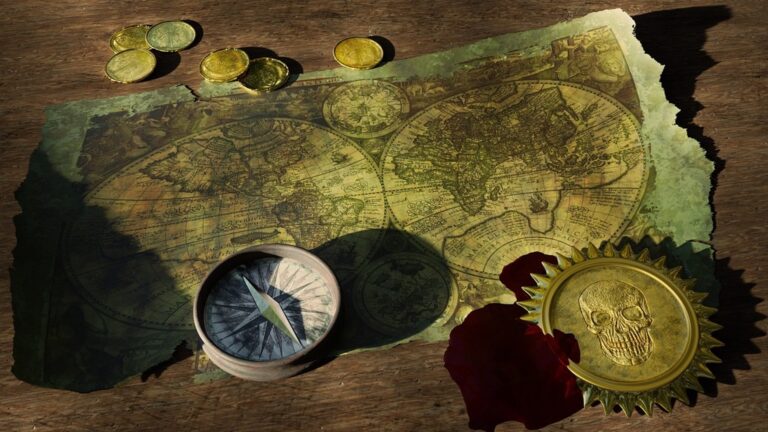
Design a Fantasy World Map Based on Your Favorite Books
Fantasy literature offers rich geographical inspiration that translates beautifully into personal mapping projects. You’ll create immersive cartographic experiences by transforming beloved fictional worlds into detailed geographic representations.
Combine Elements from Multiple Fantasy Universes
Merge diverse fantasy realms by selecting complementary geographical features from different book series. You might place Tolkien’s Shire alongside Narnia’s Lantern Waste or connect Brandon Sanderson’s Shattered Plains with Terry Pratchett’s Ankh-Morpork. Establish consistent scale relationships between borrowed elements and create transition zones that blend different artistic styles. Use elevation profiles and climate patterns to justify how these disparate worlds connect logically. Document your source materials and maintain geographic consistency across merged boundaries.
Add Your Own Creative Locations and Landmarks
Expand existing fantasy worlds with original settlements, mountain ranges, and mystical locations that fit each universe’s established geography. You’ll design taverns, ruins, and hidden valleys that complement canonical locations while filling narrative gaps. Consider population density, trade routes, and resource distribution when placing new settlements. Create detailed legends explaining your additions and their relationships to existing lore. Use established naming conventions and architectural styles to maintain authenticity across your original contributions.
Include Character Movement Paths and Story Arcs
Track protagonist journeys by plotting character routes across your fantasy map using distinctive line styles and directional markers. You’ll visualize major plot points, battle locations, and character meetings through symbolic annotations along each path. Color-code different characters’ travels and include timeline markers to show simultaneous events. Add elevation profiles to demonstrate challenging mountain passes or river crossings that shaped story outcomes. Create detailed route legends explaining transportation methods, travel duration, and significant encounters along each character’s path.
Map Your Family’s Migration History Across Generations
Genealogical mapping transforms family history research into compelling visual narratives that reveal migration patterns spanning centuries.
Research Ancestral Origins and Immigration Routes
Start with reliable genealogical databases like FamilySearch, Ancestry.com, and Ellis Island records to identify departure and arrival points. Immigration manifests often contain ship routes and dates that pinpoint exact travel paths. Census records from different decades show progressive family movements across regions. Parish registers and naturalization documents provide additional location markers. Cross-reference multiple sources to verify migration timelines and eliminate research errors.
Document Cultural Influences from Each Location
Plot cultural markers at each family settlement location using distinct symbols for religious institutions, cultural organizations, and community centers your ancestors established or joined. Immigration waves often created ethnic neighborhoods that influenced family traditions. Document language changes, naming patterns, and occupational shifts that occurred in different regions. Marriage records reveal cultural integration patterns when families intermarried with local populations, creating unique cultural fusion points.
Create Visual Timelines of Family Movements
Layer temporal data using color-coded routes that represent different time periods or family branches on your base map. Migration arrows should vary in thickness to show family group sizes during each movement. Add date labels at key waypoints where families established temporary or permanent settlements. Timeline annotations can highlight historical events like gold rushes, wars, or economic opportunities that triggered family relocations across generations.
Build a Culinary Adventure Map of Local Food Discoveries
Transform your neighborhood into a delicious treasure hunt by mapping the culinary landscape around you. This approach combines geographic exploration with gastronomic discovery, creating a personalized guide that captures your unique taste journey.
Mark Hidden Gem Restaurants and Food Trucks
Start by plotting lesser-known establishments that locals frequent but tourists rarely discover. Use GPS coordinates to mark food trucks that rotate locations, noting their weekly schedules and preferred parking spots. Create symbols for different establishment types – hole-in-the-wall diners, family-owned ethnic restaurants, and pop-up vendors. Include operating hours and seasonal availability to help you plan future visits. Document the discovery story behind each location, whether you found it through word-of-mouth recommendations or accidental exploration.
Create Categories for Different Cuisine Types
Develop a color-coding system that represents various culinary traditions across your mapped area. Assign distinct colors for Italian, Mexican, Asian fusion, barbecue, and regional specialties that reflect your local food culture. Create subcategories within broader cuisine types – separate Thai from Vietnamese establishments, or distinguish between Neapolitan and Sicilian pizza styles. Use different marker shapes to indicate dining formats like fine dining, casual restaurants, takeout counters, or food market vendors. This classification system helps you identify cuisine gaps in your neighborhood exploration.
Include Personal Ratings and Memorable Dining Experiences
Add rating scales from 1-10 for food quality, service, and atmosphere at each mapped location. Document specific dishes that stood out during your visits, including seasonal specialties or chef recommendations that made lasting impressions. Note memorable dining companions and special occasions tied to each restaurant, creating emotional connections to geographic locations. Record price ranges using dollar sign symbols to help with future planning. Include photos of signature dishes or restaurant atmospheres directly on your digital map to trigger taste memories when reviewing your culinary adventures.
Construct a Map of Abandoned and Forgotten Places
Forgotten places offer compelling cartographic subjects that reveal hidden historical layers in your landscape. These sites create powerful visual narratives about societal change and time’s passage.
Research Local Ghost Towns and Ruins
Start your research with historical surveys and county records to identify abandoned settlements in your region. State archives and local historical societies maintain detailed records of former communities that disappeared due to economic shifts or natural disasters.
Use USGS historical topographic maps to compare current landscapes with past settlements. These maps reveal foundations, road networks, and infrastructure remnants that modern maps omit, providing precise coordinates for field verification.
Learn essential map reading and navigation skills with this U.S. Army guide. Designed for practical use, it provides clear instructions for navigating any terrain.

Document Urban Decay and Historical Sites
Focus on industrial sites and transportation infrastructure that shaped regional development patterns. Former railway stations, mining operations, and manufacturing complexes offer rich mapping opportunities with clear geographical boundaries.
Record GPS coordinates for each location using handheld units or smartphone apps with offline capability. Document structural conditions, accessibility routes, and seasonal visibility factors that affect site documentation quality.
Experience vivid content on the Galaxy A16 5G's 6.7" display and capture stunning photos with its triple-lens camera. Enjoy peace of mind with a durable design, six years of updates, and Super Fast Charging.

Add Photography and Historical Context
Capture wide-angle shots that show spatial relationships between abandoned structures and surrounding landscapes. These images provide scale references and contextual information that enhance your map’s interpretive value.
Research each site’s operational timeline and closure circumstances through newspaper archives and municipal records. Layer this temporal data onto your base map using color-coded symbols that represent different historical periods and abandonment causes.
Develop a Map of Your Personal Skill Development Journey
Your skill development creates a unique geographic narrative that spans classrooms, workshops, and real-world experiences across multiple locations. This unconventional mapping approach transforms your learning history into a visual journey that reveals patterns in how and where you’ve grown professionally.
Plot Where You Learned Different Abilities
Document specific coordinates where you acquired each skill using GPS coordinates or address markers on your base map. Mark your high school chemistry lab for analytical thinking, the community college where you learned AutoCAD, and the coffee shop where you mastered Excel formulas through online tutorials.
Categorize skills by acquisition method using distinct symbols – formal education locations get academic building icons, while self-taught abilities earn book symbols at your study locations. Professional workshops and conferences deserve their own specialized markers to distinguish structured learning from independent skill development.
Connect Skills to Specific Locations and Teachers
Draw connection lines between related skills and their geographic origins to reveal your learning network patterns. Connect your photography skills learned at the downtown art center to your graphic design abilities acquired at the university extension campus across town.
Add instructor information as map annotations next to each learning location, including names and specialties of key teachers who shaped your development. Label your mentor’s office where you learned project management, and mark the workshop space where that ceramics instructor taught you patience and precision through hands-on practice.
Track Your Educational and Professional Growth
Create temporal layers showing skill progression over time using color-coded routes that connect your learning locations chronologically. Start with elementary school basics in light blue, progress through high school skills in green, and advance to professional certifications in deep red.
Build skill complexity indicators by varying symbol sizes based on proficiency levels achieved at each location. Small dots represent introductory skills while large circles mark locations where you achieved mastery or certification. This visual hierarchy reveals your most significant learning environments and growth acceleration points throughout your development journey.
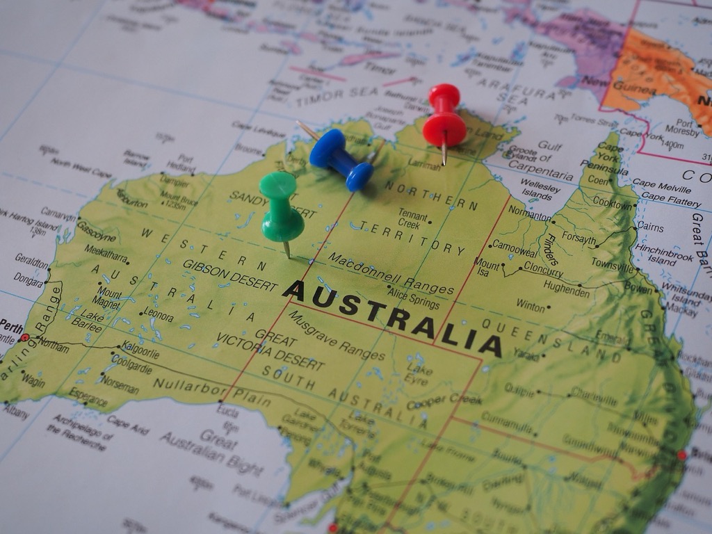
Create a Dream Destination Map for Future Adventures
Transform your wanderlust into a visual masterpiece by plotting every destination you’ve ever dreamed of visiting. This mapping approach turns abstract travel desires into concrete geographic planning while revealing patterns in your exploration preferences.
Research Bucket List Locations Worldwide
Start with comprehensive destination databases like UNESCO World Heritage Sites and National Geographic’s travel archives to identify must-visit locations. Use travel forums such as TripAdvisor and Lonely Planet to discover hidden gems that align with your interests. Document each destination with GPS coordinates and brief descriptions of unique attractions. Create categories for different travel experiences like cultural immersion, adventure activities, and natural wonders. Research visa requirements and seasonal considerations for each location to inform your planning timeline.
Plan your perfect trip with Lonely Planet's Where to Go When. This month-by-month guide features 300+ destinations to help you discover the best places to travel, any time of year.

Plan Realistic Travel Routes and Timelines
Connect destinations using logical geographic clusters to maximize efficiency and minimize travel costs. Group nearby locations into multi-destination trips spanning 7-14 days each. Use flight comparison tools and overland transportation networks to identify practical routing options. Create color-coded timeline phases representing different life stages when you’ll tackle specific regions. Factor in career milestones and life changes that might influence your travel availability. Build flexibility into your routing by identifying alternative destinations within each geographic cluster.
Include Budget Estimates and Travel Tips
Calculate comprehensive cost estimates for each destination including flights, accommodation, food, and activities based on current exchange rates. Research seasonal price variations to identify optimal booking windows for each location. Document visa costs, vaccination requirements, and travel insurance considerations for international destinations. Include practical tips like local customs, tipping practices, and communication apps for each region. Create budget categories ranging from backpacker to luxury experiences to accommodate changing financial circumstances throughout your travel timeline.
Conclusion
These seven unconventional mapping themes transform ordinary cartography into deeply personal storytelling tools. You’ll discover that mapping your emotional journey or genealogical roots creates visual narratives far more meaningful than traditional geographic representations.
Your personal maps become powerful reflection instruments that reveal patterns you might never notice otherwise. Whether you’re tracking culinary adventures or documenting abandoned places your exploration takes on new dimensions when visualized geographically.
The beauty of unconventional mapping lies in its flexibilityâyou can combine themes or adapt them to match your unique interests and experiences. Start with one theme that resonates most strongly with you and watch as your personal cartography skills develop naturally.
Your maps will become treasured keepsakes that capture not just locations but the stories behind them.
Frequently Asked Questions
What are unconventional mapping themes beyond traditional road maps?
Unconventional mapping themes include emotional journey mapping, fantasy world cartography based on favorite books, genealogical migration tracking, culinary adventure mapping, abandoned places documentation, personal skill development journeys, and dream destination planning. These creative approaches transform personal experiences, interests, and aspirations into meaningful visual narratives.
How do I create an emotional journey map of my life?
Start with a base map and plot significant life events using GPS coordinates or landmarks. Use different symbols to represent various experiences and connect them with colored lines representing different life phases. Create a color-coded legend for emotional states and include annotations about personal growth milestones.
Can I combine multiple fantasy worlds in one map?
Yes, you can merge elements from different fantasy universes by blending geographical features while maintaining logical connections. Add your own creative locations that fit within established lore, and use color-coded routes to track character movements and story arcs across the combined fantasy landscape.
What’s the best way to research family migration history for mapping?
Start with reliable genealogical databases to identify ancestral origins and immigration routes. Use various historical records to verify migration timelines and document cultural influences at each settlement location. Create visual timelines with color-coded routes representing different family branches and generations.
How do I create a culinary adventure map of my neighborhood?
Use GPS coordinates to mark restaurants, food trucks, and dining spots with categorized symbols. Implement a color-coding system for different cuisines and include personal ratings and memorable dining experiences. Transform your local area into a personalized gastronomic treasure hunt with detailed annotations.
Where can I find information about abandoned places to map?
Research local ghost towns and ruins through historical surveys, county records, and USGS historical topographic maps. Compare current landscapes with past settlements and document urban decay sites. Capture photographs to enhance interpretive value and layer temporal data showing different historical periods.
How do I map my personal skill development journey?
Document locations where you acquired skills using GPS coordinates or address markers. Categorize skills by acquisition method and connect related abilities to their geographic origins. Include information about influential teachers and create temporal layers showing skill progression with color-coded routes and varying symbol sizes.
What should I include in a dream destination map?
Plot every destination you’ve dreamed of visiting using GPS coordinates and detailed descriptions. Research bucket list locations through travel databases and forums. Plan realistic travel routes connecting destinations logically, factor in career milestones, and include budget estimates with travel tips for different financial circumstances.