7 Best Custom Mapping Examples for Digital Enhancement
You’ve probably wondered how GPS apps instantly locate your exact position or how video games create immersive virtual worlds. The secret lies in custom coordinate mapping â a powerful technique that transforms raw location data into meaningful visual representations.
Custom coordinate systems solve complex real-world problems by converting geographic coordinates into formats that work perfectly for specific applications. Whether you’re building interactive maps for your website or developing location-based mobile apps you’ll need to understand how different coordinate systems translate spatial data.
From retail store locators to emergency response systems these practical mapping examples will show you exactly how professionals leverage coordinate transformations to create accurate and user-friendly location services.
Disclosure: As an Amazon Associate, this site earns from qualifying purchases. Thank you!
P.S. check out Udemy’s GIS, Mapping & Remote Sensing courses on sale here…
Transform Geographic Data With Custom Coordinate Systems for Urban Planning
Urban planners rely on custom coordinate mapping to translate local planning grids into standardized geographic systems. These transformations enable accurate spatial analysis across different municipal datasets.
Converting City Block Coordinates to GPS Locations
You’ll convert local block numbering systems to GPS coordinates using transformation matrices that account for street grid orientation and datum shifts. Most GIS software like ArcGIS or QGIS provides coordinate transformation tools that handle these conversions automatically. Store the transformation parameters as reusable templates for consistent results across planning projects. Test your conversions against known reference points to ensure accuracy within your required tolerance levels.
Mapping Zoning Districts Using Local Grid References
You can map zoning boundaries by establishing control points between local survey grids and state plane coordinate systems. Create custom projection files that preserve area calculations for density requirements and setback measurements. Use local grid references to maintain consistency with existing property records and municipal databases. Validate your transformations by comparing calculated areas against official zoning maps to ensure regulatory compliance throughout your planning process.
Enhance Gaming Experiences Through Custom World Mapping Systems
Game developers rely on custom coordinate mapping to create seamless virtual worlds that respond accurately to player movement and interactions.
Creating Immersive Game Worlds With Unique Coordinate Frameworks
Establish world boundaries using custom coordinate systems that support massive game environments spanning thousands of virtual miles. Define origin points at strategic locations like central cities or spawn areas to minimize floating-point precision errors during gameplay. Implement hierarchical coordinate frameworks that divide large worlds into manageable sectors, allowing for efficient memory management and smooth transitions between game zones. Convert artistic design coordinates into functional game coordinates using transformation matrices that preserve visual proportions while optimizing performance. Scale coordinate values appropriately to match physics engines and collision detection systems for realistic player interactions.
Implementing Player Location Tracking in Virtual Environments
Track player positions using custom coordinate systems that integrate with game physics engines and networking protocols for multiplayer synchronization. Update player coordinates in real-time through optimized algorithms that calculate movement vectors and collision boundaries within virtual spaces. Synchronize multiplayer locations by converting local player coordinates into server-side reference systems that maintain consistency across different client connections. Store player position data using efficient coordinate compression techniques that reduce network bandwidth while preserving location accuracy. Validate coordinate boundaries to prevent players from accessing restricted areas or encountering game-breaking glitches through coordinate manipulation.
Optimize Indoor Navigation With Building-Specific Coordinate Mapping
Indoor navigation systems require precise coordinate frameworks that transform building blueprints into interactive digital maps. You’ll create custom coordinate systems that account for multi-level structures and complex interior layouts.
Designing Mall Directory Systems Using Custom Floor Coordinates
Mall directory systems transform architectural floor plans into interactive coordinate grids that guide shoppers to specific stores. You’ll establish origin points at main entrances and create zone-based coordinate systems for each wing or level. Custom mapping software converts store locations from blueprint measurements into pixel coordinates for touchscreen displays. Directory kiosks use these coordinates to generate walking paths between current location and destination stores, accounting for escalators, elevators, and accessibility routes throughout the shopping center.
Implementing Hospital Wayfinding Through Internal Grid Systems
Hospital wayfinding systems use custom coordinate mapping to navigate complex medical facilities with multiple wings, floors, and departments. You’ll create hierarchical coordinate systems that separate each building section into manageable grid zones with unique identifiers. Internal mapping frameworks convert room numbers and department codes into precise coordinate positions for digital wayfinding displays. Mobile apps integrate these custom coordinates with real-time location services, helping patients and visitors navigate between registration areas, waiting rooms, treatment facilities, and parking structures efficiently.
Revolutionize Agricultural Management Using Field-Specific Coordinate Systems
Transform traditional farming into precision agriculture by implementing coordinate systems tailored to your specific field layouts and crop requirements.
Precision Farming With Customized Plot Mapping
Create field-specific coordinate grids that align with your actual crop rows and irrigation zones rather than relying on standard GPS coordinates. You’ll establish custom origin points at field boundaries and convert GPS data into local grid systems using transformation matrices in software like ArcGIS or QGIS. This approach enables precise equipment guidance with centimeter-level accuracy for planting, fertilizing, and harvesting operations while maintaining consistent spacing between crop rows.
Crop Monitoring Through Tailored Agricultural Grids
Develop monitoring grids that correspond to your field’s unique topography and drainage patterns for accurate crop health assessment. You’ll divide fields into custom coordinate zones based on soil types, elevation changes, and historical yield data rather than uniform rectangular grids. This system allows drone surveys and satellite imagery to map directly to your management zones, enabling targeted applications of water, nutrients, and pesticides based on precise coordinate locations.
Streamline Manufacturing Operations With Custom Factory Floor Mapping
Manufacturing facilities benefit significantly from coordinate systems that align with actual production layouts rather than standard geographic references. Custom factory floor mapping creates precise digital representations of your industrial spaces for enhanced operational control.
Warehouse Inventory Tracking Using Internal Coordinate Systems
Warehouse coordinate systems transform storage areas into navigable grids that mirror your actual rack configurations and aisle layouts. You’ll establish origin points at loading docks and create zone-based coordinates that correspond to specific storage sections like A1-B15 or Level-2-Zone-C.
Modern warehouse management systems integrate these custom coordinates with RFID tracking and barcode scanners to provide real-time inventory locations. Your picking teams can navigate directly to precise coordinates while automated systems update stock levels based on exact grid positions rather than vague area descriptions.
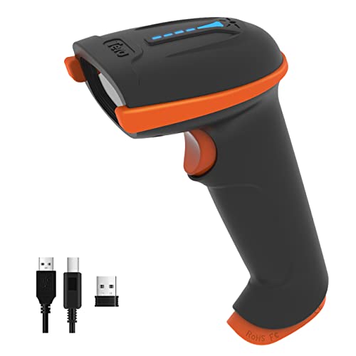
This Tera barcode scanner offers reliable 1D barcode scanning with both wireless (2.4Ghz) and USB connectivity. Enjoy extended use with its long-lasting battery and protective, shock-resistant design.
Assembly Line Optimization Through Custom Production Mapping
Production line mapping creates coordinate frameworks that follow your manufacturing workflow from raw materials to finished products. You’ll map each workstation’s exact position and establish coordinate paths that match conveyor belt routes and quality control checkpoints.
This mapping enables predictive maintenance scheduling by tracking equipment coordinates and monitoring production bottlenecks at specific line positions. Your facility managers can analyze workflow efficiency using coordinate-based data to identify optimal station spacing and reduce material handling time between production stages.
Advance Scientific Research With Laboratory Coordinate Mapping Solutions
Laboratory environments demand precision that standard coordinate systems can’t provide. Custom coordinate mapping transforms scientific research by creating specialized frameworks that align with your specific equipment and experimental requirements.
Microscopy Sample Positioning Using Custom Coordinate Frameworks
Microscopy positioning systems require coordinate frameworks that match your specimen preparation protocols and imaging equipment specifications. You’ll establish reference grids that correspond to slide mounting positions, creating reproducible sample locations for multi-session experiments. Custom coordinate mapping integrates with automated stage controllers, enabling precise navigation between predetermined observation points while maintaining consistent Z-axis depth measurements across different magnification levels.
Learn to automate lighting with this comprehensive handbook. It provides essential programming knowledge for lighting professionals and enthusiasts.

Archaeological Site Documentation Through Specialized Grid Systems
Archaeological documentation benefits from custom grid systems that align with excavation methodologies and site topography rather than standard geographic coordinates. You’ll create specialized frameworks that correspond to stratigraphic layers and excavation units, allowing precise artifact positioning within three-dimensional contexts. These custom coordinate systems integrate field measurements with digital recording equipment, enabling accurate reconstruction of archaeological contexts while maintaining compatibility with existing site databases and mapping standards.
Capture clear audio with this 64GB voice recorder. It features HD 3072kbps recording, noise cancellation, and a long-lasting battery for up to 100 hours of use.

Improve Event Management With Venue-Specific Coordinate Systems
Event venues present unique spatial challenges that require specialized coordinate mapping solutions. Custom coordinate systems transform complex venue layouts into manageable digital frameworks that streamline operations and enhance attendee experiences.
Stadium Seating Arrangements Using Custom Mapping Coordinates
Stadium coordinate systems align digital seat maps with physical venue architecture to create precise navigation frameworks. You’ll establish origin points at field center or main entrances, then map each seating section using consistent row and seat numbering that matches actual venue layout.
Custom mapping coordinates enable accurate ticket assignments by converting section-row-seat combinations into precise spatial locations. Your system integrates with ticketing platforms to generate heat maps showing attendance patterns and optimize pricing strategies based on sight lines and accessibility requirements.
Festival Layout Planning Through Tailored Coordinate Frameworks
Festival coordinate frameworks transform temporary event spaces into organized grid systems that accommodate vendor placement and crowd flow management. You’ll create custom grids that align with site boundaries, utility connections, and emergency access routes while accounting for terrain variations and weather considerations.
Tailored coordinate systems enable precise vendor positioning by converting booth assignments into exact spatial coordinates that crews can locate using GPS devices. Your framework integrates with logistics software to optimize setup schedules and create digital maps that guide attendees between stages, food vendors, and facilities.
Stay connected anywhere with this compact satellite communicator. Enjoy two-way messaging, interactive SOS, and TracBack routing for confident navigation. Battery lasts up to 14 days in tracking mode.

Conclusion
Custom coordinate mapping transforms how you interact with digital and physical spaces across countless industries. Whether you’re navigating a shopping mall optimizing crop yields or managing complex manufacturing processes these specialized systems deliver precision that standard coordinates simply can’t match.
The versatility of custom mapping extends from archaeological excavations to festival planning proving its value in both permanent and temporary applications. You’ll find that implementing these tailored coordinate systems improves accuracy reduces errors and enhances user experiences regardless of your specific field.
By understanding these practical applications you’re better equipped to identify opportunities where custom coordinate mapping could revolutionize your own projects and workflows.
Frequently Asked Questions
What is custom coordinate mapping?
Custom coordinate mapping is a system that converts geographic coordinates into specialized formats tailored for specific applications. It’s essential for GPS systems, video games, mapping software, and location-based services that require precise positioning. This process transforms standard latitude and longitude coordinates into formats that work better for particular use cases, ensuring accurate location tracking and enhanced user experiences.
Navigate with ease using this 7-inch GPS navigator, featuring real-time voice guidance and pre-loaded 2025 maps. Customize routes based on your vehicle type to avoid restrictions and receive speed & red light warnings.

How is custom coordinate mapping used in urban planning?
Urban planners use custom coordinate mapping to translate local planning grids into standardized geographic systems for accurate spatial analysis. This involves converting city block coordinates to GPS locations using transformation matrices and GIS software. Planners also map zoning districts by establishing control points between local survey grids and state plane coordinate systems, ensuring regulatory compliance and consistency with property records.
What role does coordinate mapping play in video games?
In gaming, custom coordinate mapping creates seamless virtual worlds that respond accurately to player movements. Developers establish world boundaries for expansive environments, define origin points to minimize precision errors, and implement hierarchical frameworks for efficient memory management. The system converts artistic design coordinates into functional game coordinates while optimizing performance and ensuring real-time synchronization between players.
How does custom coordinate mapping improve indoor navigation?
Custom coordinate mapping transforms building blueprints into interactive digital maps for multi-level structures. It’s used in mall directory systems to guide shoppers to stores while accounting for accessibility routes, and in hospital wayfinding systems to navigate complex medical facilities. These systems create hierarchical grid systems that enable efficient navigation between departments and services within buildings.
What are the benefits in agriculture?
Custom coordinate mapping revolutionizes farming by creating field-specific coordinate systems for precision agriculture. It enables customized plot mapping that aligns with actual crop rows and irrigation zones, providing centimeter-level accuracy for planting, fertilizing, and harvesting. Agricultural grids correspond to unique field topographies and drainage patterns, allowing targeted resource applications based on precise coordinate locations.
How is it applied in manufacturing?
In manufacturing, custom coordinate mapping streamlines operations by aligning coordinate systems with actual production layouts. Factory floor mapping creates precise digital representations of industrial spaces, while warehouse inventory tracking transforms storage areas into navigable grids reflecting actual rack configurations. Assembly line optimization establishes coordinate frameworks following manufacturing workflows, enabling predictive maintenance and efficiency analysis.
What scientific applications exist?
Scientific research utilizes custom coordinate mapping for laboratory environments requiring specialized frameworks for equipment alignment. In microscopy, custom grids ensure reproducible sample locations for experiments. Archaeological site documentation uses specialized grid systems aligned with excavation methodologies, allowing accurate artifact positioning and integration with digital recording equipment for precise documentation of findings.
How does it benefit event management?
Event management leverages custom coordinate mapping to improve operations and attendee experiences. Stadium seating arrangements use digital seat maps aligned with physical layouts for accurate ticket assignments and pricing optimization. Festival layout planning employs tailored coordinate frameworks to transform temporary spaces into organized grids for vendor placement and crowd flow management, enhancing logistics and navigation.