7 Best Specialty Inks for Cartography
Why it matters: Traditional mapping falls short when you need to showcase complex geographical data or create memorable visual experiences that truly resonate with your audience.
The big picture: Specialty inks transform ordinary maps into powerful storytelling tools that capture attention and communicate information more effectively than standard printing methods ever could.
What’s ahead: Seven innovative ink technologies can revolutionize your cartographic projects â from thermochromic options that respond to temperature changes to metallic finishes that add professional sophistication to any geographic visualization.
Disclosure: As an Amazon Associate, this site earns from qualifying purchases. Thank you!
P.S. check out Udemy’s GIS, Mapping & Remote Sensing courses on sale here…
Metallic Inks for Luxurious Cartographic Appeal
Metallic inks transform ordinary maps into sophisticated visual statements that command attention in professional presentations and high-end publications. These specialty finishes reflect light uniquely, creating depth and visual hierarchy that standard process colors can’t achieve.
Gold Ink Applications for Premium Atlas Production
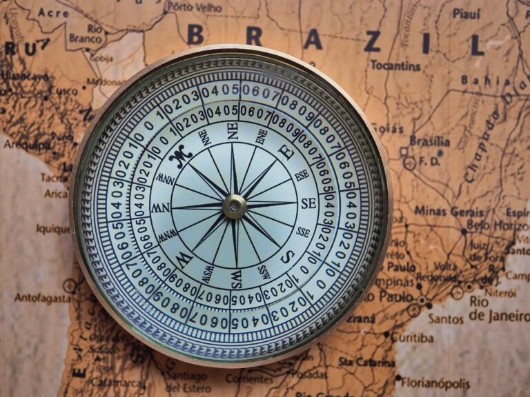
Gold metallic inks elevate atlas production by highlighting key geographic features like mountain ranges, national borders, and capital cities. You’ll find gold particularly effective for accent elements such as compass roses, title cartouches, and legend frames. Premium atlases use gold ink to distinguish primary transportation networks and UNESCO World Heritage sites, creating visual anchors that guide readers through complex geographic information while maintaining an upscale aesthetic.
Create brilliant artwork with Winsor & Newton Gold Drawing Ink. This fast-drying, 14ml bottle offers excellent adhesion and can be applied with a brush, dip pen, or airbrush.

Silver Ink Techniques for Modern Map Aesthetics
Silver metallic inks provide contemporary maps with sleek, modern appeal through subtle shimmer effects on water bodies, urban areas, and infrastructure networks. You can apply silver as spot color for highway systems, railway lines, and airport symbols to create technological sophistication. Modern cartographers use silver ink strategically on elevation contours and grid systems, enhancing readability while maintaining clean design principles that appeal to digital-native audiences.
Create stunning effects with Liquitex Iridescent Bright Silver Acrylic Ink. This highly pigmented, fluid ink offers a satin finish and mixes seamlessly with other Liquitex acrylics.

Copper Ink Usage for Vintage Map Styling
Copper metallic inks deliver authentic vintage character to historical maps and reproduction cartography through warm, aged appearance that mimics traditional engraving techniques. You’ll achieve period-appropriate styling by applying copper to topographic features, settlement markers, and decorative elements like wind roses. Copper works exceptionally well for heritage tourism maps, archaeological site documentation, and historical atlas projects where authenticity and craftsmanship storytelling enhance the overall cartographic narrative.
Create shimmering calligraphy with Dr. Ph. Martin's Iridescent Copper Plate Gold ink. This lightfast, archival-grade ink features a beautiful pearl shimmer and is perfect for brushes, airbrushes, and dip pens.

Fluorescent Inks for High-Visibility Map Elements
Fluorescent inks deliver unmatched visibility that transforms critical map elements into instantly recognizable features. These specialty inks absorb ultraviolet light and emit visible light at longer wavelengths, creating brilliant colors that command immediate attention.
Neon Colors for Emergency Route Marking
Neon orange and neon pink inks create emergency evacuation routes that stand out dramatically against standard map backgrounds. You’ll find these colors essential for disaster preparedness maps where visibility can mean the difference between safety and danger. Fire departments use neon yellow to mark hydrant locations on tactical maps, ensuring rapid identification during emergency responses. These fluorescent pigments maintain their intensity under artificial lighting conditions, making them ideal for indoor navigation displays.
UV-Reactive Inks for Special Map Features
UV-reactive fluorescent inks reveal hidden map layers when exposed to blacklight, creating dual-purpose cartographic displays. You can embed security features or supplementary information that appears only under ultraviolet illumination. Museums use these inks to highlight archaeological sites on historical maps during guided tours with UV flashlights. The phosphorescent compounds in these inks charge under normal lighting and continue glowing for several minutes, providing temporal visual effects for interactive map presentations.
Create invisible markings with COLOP UV Ink. This 25ml ultraviolet ink is only visible under UV light, perfect for discreet labeling, security, and event entry.

Safety Applications in Navigation Charts
Maritime charts utilize fluorescent inks to mark hazardous areas, shipping lanes, and rescue coordinates with enhanced visibility during low-light conditions. You’ll achieve optimal safety compliance by applying neon green inks to mark safe passages and neon red for danger zones. Coast Guard navigation aids benefit from fluorescent markers that remain visible through fog and spray conditions. Aviation sectional charts employ these inks for restricted airspace boundaries, ensuring pilots can quickly identify critical flight limitations even under cockpit lighting variations.
Magnetic Inks for Interactive Map Production
Magnetic inks represent a breakthrough in interactive cartography, enabling maps to respond to magnetic fields and create dynamic user experiences. These specialized formulations combine traditional printing capabilities with magnetic responsiveness for educational and professional applications.
MICR Technology Integration in Specialized Maps
MICR (Magnetic Ink Character Recognition) technology transforms maps into machine-readable documents for automated processing systems. You’ll find these inks particularly valuable in logistics mapping where automated sorting systems scan route codes directly from printed materials. Transportation companies use MICR-enabled maps to streamline package routing through magnetic character recognition at distribution centers. The iron oxide particles in MICR inks maintain consistent magnetic properties across temperature variations, ensuring reliable performance in industrial environments.
Magnetic Properties for Educational Map Tools
Magnetic inks enable interactive learning experiences through responsive map elements that react to magnetic wands or styluses. You can create educational materials where students manipulate magnetic markers to explore geographic relationships and spatial concepts. Classroom geography sets benefit from magnetic ink applications that allow teachers to demonstrate plate tectonics, weather patterns, and migration routes through hands-on manipulation. The magnetic strength varies based on iron content, with stronger formulations supporting heavier interactive elements while lighter concentrations work well for touch-sensitive applications.
Security Features in Sensitive Cartographic Materials
Magnetic security inks provide authentication capabilities for classified maps and sensitive geographic documents through unique magnetic signatures. You’ll implement these features in military cartographic materials where magnetic field detection prevents unauthorized reproduction or tampering. Government agencies utilize magnetic ink security strips that trigger detection systems when documents pass through unauthorized scanning equipment. The magnetic patterns remain invisible to standard copying methods while maintaining detectability through specialized magnetic field readers for document verification purposes.
Thermochromic Inks for Temperature-Responsive Maps
Create temperature-sensitive art with this thermochromic pigment powder that changes color at 88°F. This pack includes 5 vibrant color combinations perfect for resin, nail polish, and more.

Thermochromic inks revolutionize cartographic visualization by changing color in response to temperature variations. These temperature-sensitive pigments create dynamic maps that respond to environmental conditions or touch activation.
Heat-Sensitive Color Changes for Climate Visualization
Temperature-triggered color shifts transform static climate maps into dynamic visualization tools. You’ll achieve dramatic visual impact when thermochromic inks transition from blue to red as temperatures rise above 75°F. Historical climate data becomes instantly accessible through color-coded temperature zones that shift seasonally. Agricultural maps benefit significantly from these responsive inks, showing growing season patterns and frost risk areas. Urban heat island mapping gains enhanced clarity when thermochromic elements highlight temperature differentials across metropolitan areas.
Interactive Weather Map Applications
Touch-activated weather displays engage users through direct interaction with map surfaces. You can create weather station maps where finger contact reveals current temperature readings through color changes. Storm tracking becomes more intuitive when thermochromic inks show pressure system movements through temperature-responsive zones. Meteorological training materials gain effectiveness when students manipulate temperature-sensitive map overlays. Emergency management maps utilize these responsive inks to highlight heat advisory zones and cooling center locations during extreme weather events.
Educational Benefits for Geography Teaching
Student engagement increases dramatically when geography lessons incorporate temperature-responsive map elements. You’ll observe improved learning outcomes as students physically interact with climate zone demonstrations through touch-activated color changes. Seasonal migration patterns become memorable when thermochromic inks illustrate habitat temperature preferences across different regions. Ocean current instruction gains clarity through temperature-sensitive overlays showing warm and cold water movements. Geography assessments become more dynamic when students demonstrate understanding by activating thermochromic map features during presentations.
Photochromic Inks for Light-Activated Map Features
Photochromic inks respond to UV light exposure by automatically changing color, making them invaluable for maps that must function effectively across varying lighting conditions. These reactive inks transform your cartographic projects into adaptive tools that enhance navigation precision.
UV-Sensitive Elements for Outdoor Map Usage
UV-sensitive photochromic inks activate automatically when exposed to natural sunlight, revealing critical navigation features that remain invisible indoors. Trail markers printed with these inks become clearly visible during outdoor activities while staying subtle in office environments. Park service maps benefit significantly from UV-reactive boundary lines that appear only when hikers need them most, preventing visual clutter during indoor planning sessions while ensuring essential wayfinding information emerges in field conditions.
Color-Changing Properties for Day/Night Navigation
Color-changing photochromic formulations shift between contrasting hues based on ambient light levels, optimizing map readability throughout daily lighting cycles. Aviation charts utilize these inks for runway markers that appear red during daylight hours and shift to blue under artificial lighting conditions. Marine navigation benefits from photochromic depth indicators that display as green in sunlight and transition to orange under cabin lighting, ensuring consistent visibility during extended voyages across different time zones.
Specialty Applications in Tourism Maps
Tourism maps leverage photochromic technology to create engaging interactive experiences that reveal location-specific information based on lighting conditions. Heritage trail guides use UV-activated inks to display historical timeline markers that appear only when visitors explore outdoor sites during daylight hours. Restaurant district maps employ photochromic elements that highlight dining establishments during evening hours while showcasing daytime attractions under natural light, creating dynamic guides that adapt to tourists’ changing needs throughout their visit schedules.
Conductive Inks for Electronic Map Integration
Conductive inks revolutionize cartography by embedding electronic functionality directly into map surfaces, creating interactive experiences that bridge digital and physical mapping worlds.
Touch-Sensitive Map Interface Development
Touch-sensitive conductive inks transform printed maps into responsive interfaces that detect finger contact and pressure variations. You’ll create interactive touch points using silver-based conductive formulations that maintain conductivity while preserving map aesthetics. These circuits connect to microcontrollers that trigger digital responses when users touch specific geographic features. Museums and visitor centers integrate this technology to create educational displays where touching cities reveals population data or historical information through connected screens.
LED Integration for Illuminated Map Features
LED-compatible conductive inks enable seamless integration of illuminated elements that highlight critical map features without bulky wiring systems. You’ll print circuit pathways directly onto map substrates using carbon-based conductive inks that power embedded LEDs through thin, flexible connections. Transportation hubs utilize this technology for real-time status displays where route delays trigger red illumination along affected pathways. Emergency response centers implement illuminated evacuation routes that activate during crisis situations, providing clear visual guidance through battery-powered LED networks.
Smart Map Technology Applications
Smart mapping applications leverage conductive ink sensors to create responsive cartographic tools that adapt to environmental conditions and user interactions. You’ll develop proximity sensors using copper-based conductive formulations that detect approaching objects and trigger contextual information displays. Weather monitoring stations employ conductive ink grids that measure atmospheric conditions and automatically update digital map overlays with real-time meteorological data. Educational institutions create interactive geography lessons where students manipulate conductive elements to explore cause-and-effect relationships in ecological systems and urban planning scenarios.
Security Inks for Anti-Counterfeiting Map Protection
Security inks provide essential protection for sensitive cartographic materials by incorporating features that prevent unauthorized reproduction and verify document authenticity. These specialized inks transform maps into secure documents that resist counterfeiting attempts while maintaining professional appearance.
Invisible UV Inks for Authentication
Invisible UV inks embed authentication features directly into your map surfaces without affecting the document’s visible appearance. These inks remain completely transparent under normal lighting conditions but reveal verification patterns when exposed to ultraviolet light sources. You’ll find UV authentication particularly valuable for classified military maps, proprietary survey data, and restricted-access geographic documentation. The invisible nature allows security verification without compromising the map’s visual design or readability.
Color-Shifting Inks for Document Security
Create vibrant, color-changing art with this set of 5 iridescent alcohol inks. Each bottle features a precision tip and safety lock cap for easy, mess-free application on resin, tumblers, and more.

Color-shifting inks create dramatic authentication effects by changing appearance when viewed from different angles or under varying light sources. These optically variable inks display distinct color transitions that prove extremely difficult to replicate using standard printing techniques. You can apply color-shifting properties to borders, legends, or specific geographic features to create tamper-evident security features. The visual transformation provides immediate verification of document authenticity while adding sophisticated visual appeal to your cartographic projects.
Watermark Integration Techniques
Watermark integration combines traditional paper watermarking with specialized security inks to create multi-layered authentication systems. These techniques embed subtle geographic patterns or institutional logos directly into the map substrate using semi-transparent security inks. You’ll achieve optimal results by coordinating watermark placement with critical map elements to ensure authentication features don’t interfere with data interpretation. The integration process requires precise registration between ink layers and watermark positioning to maintain both security effectiveness and cartographic clarity.
Conclusion
These seven specialty inks represent the future of cartographic excellence. You’re no longer limited to basic printing methods when creating maps that need to stand out and perform specific functions.
Whether you’re developing educational materials interactive displays or secure documentation these advanced ink technologies give you the tools to create truly exceptional cartographic experiences. Your maps can now respond to environmental conditions provide enhanced security features and engage users in ways traditional printing simply can’t match.
The investment in specialty inks transforms your cartographic projects from simple reference materials into dynamic interactive tools. You’ll find these technologies particularly valuable when your maps need to serve multiple purposes or operate in challenging environments where standard inks fall short.
Frequently Asked Questions
What are specialty inks in cartography and why are they important?
Specialty inks are innovative ink technologies that enhance traditional maps by adding interactive, visual, and functional elements. They transform static geographical data into engaging storytelling tools that capture attention and improve information delivery. These inks address limitations of conventional mapping by creating dynamic user experiences and making complex geographical data more accessible and compelling.
How do thermochromic inks work in mapping applications?
Thermochromic inks change color in response to temperature variations, creating dynamic maps that react to environmental conditions. They transform static climate maps into interactive visualization tools, showing temperature changes through color shifts. These inks are particularly valuable for agricultural mapping, urban heat island studies, and educational tools where students can interact with climate demonstrations.
What advantages do metallic inks offer for geographic visualizations?
Metallic inks elevate maps into sophisticated visual statements that command attention in professional settings. Gold inks accentuate key geographic features in premium atlases, silver provides modern aesthetics with subtle shimmer effects, and copper imparts vintage character to historical maps. These inks enhance both visual appeal and professionalism while improving readability.
How do fluorescent inks improve map visibility and safety?
Fluorescent inks deliver unmatched visibility by transforming critical map elements into instantly recognizable features. Neon colors like orange and pink effectively mark emergency evacuation routes and hazardous areas. These inks maintain intensity under artificial lighting and provide optimal visibility in low-light conditions, making them essential for disaster preparedness and navigation safety.
What makes magnetic inks revolutionary for interactive cartography?
Magnetic inks enable maps to respond to magnetic fields, creating dynamic user experiences. They integrate MICR technology for machine-readable documents, streamline logistics mapping, and provide interactive educational tools where students manipulate magnetic markers. Additionally, they offer security authentication capabilities, preventing unauthorized reproduction of sensitive cartographic materials.
How do photochromic inks enhance navigation across different lighting conditions?
Photochromic inks respond to UV light exposure by changing color, making maps function effectively in varying lighting conditions. They reveal critical features invisible indoors and activate in sunlight for outdoor activities. These inks optimize map readability throughout daily lighting cycles and create interactive tourism experiences that reveal location-specific information.
What capabilities do conductive inks bring to modern mapping?
Conductive inks embed electronic functionality directly into map surfaces, creating interactive experiences that bridge digital and physical mapping. They enable touch-sensitive interfaces that detect finger contact, integrate LED elements for illuminated features, and create smart mapping applications with environmental sensors. This technology revolutionizes educational displays and real-time status systems.
How do security inks protect sensitive cartographic materials?
Security inks prevent unauthorized reproduction and verify document authenticity through multiple protection layers. Invisible UV inks embed authentication features without affecting visible appearance, color-shifting inks change when viewed from different angles, and watermark integration combines traditional techniques with specialized inks for multi-layered security systems.