7 Best Drone Mapping Techniques
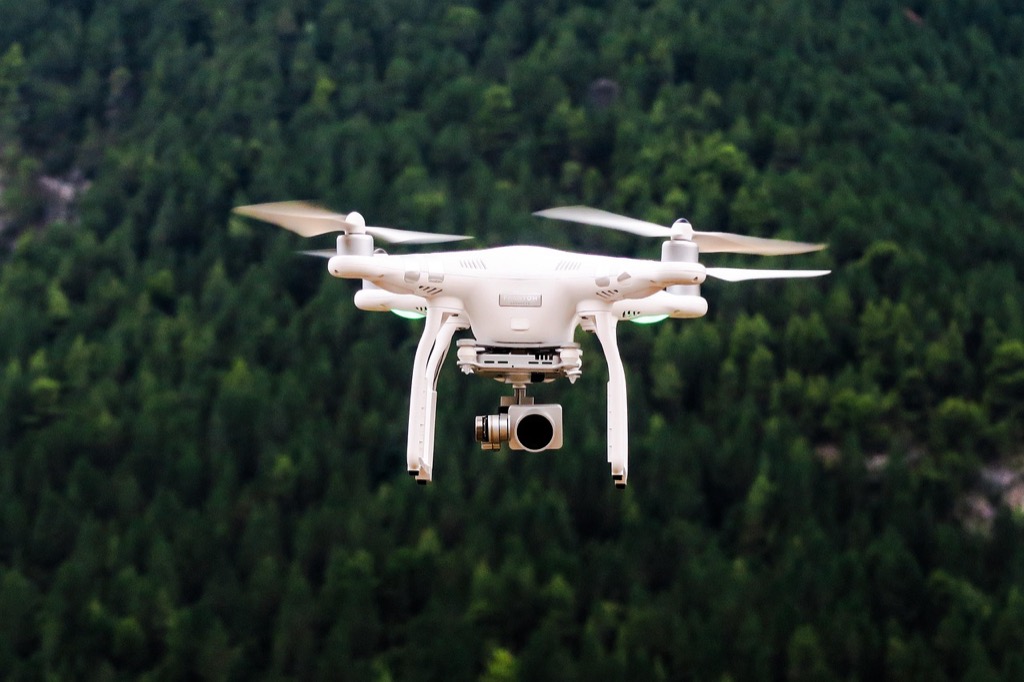
The big picture: Multi-sensor drone mapping transforms how you capture and analyze spatial data by combining multiple sensors on a single platform for unprecedented accuracy and detail.
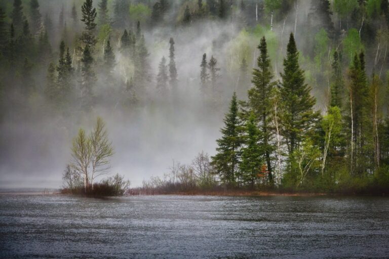
Why it matters: You’re no longer limited to basic aerial photography – today’s advanced drones integrate LiDAR thermal cameras GPS systems and hyperspectral sensors to deliver comprehensive mapping solutions that traditional single-sensor approaches simply can’t match.
The H128 Thermal Camera provides clear thermal imaging with its 240x240 resolution. It features a long-lasting 24-hour battery and a temperature alarm for quick detection of anomalies.

What’s ahead: These seven cutting-edge techniques will revolutionize your mapping projects whether you’re surveying construction sites monitoring environmental changes or conducting precision agriculture assessments.
Disclosure: As an Amazon Associate, this site earns from qualifying purchases. Thank you!
P.S. check out Udemy’s GIS, Mapping & Remote Sensing courses on sale here…
Photogrammetry and RGB Imaging: The Foundation of Drone Mapping
Achieve a flawless, even complexion with e.l.f. Flawless Satin Foundation. This lightweight, vegan formula provides medium coverage and a semi-matte finish for all-day wear, while hydrating your skin with glycerin.

Photogrammetry transforms overlapping aerial photographs into precise 3D models and maps, serving as the cornerstone technique for most drone mapping applications. RGB imaging provides the visual data foundation that enables accurate spatial measurements and detailed terrain reconstruction.
High-Resolution Image Capture Methods
Systematic flight planning ensures optimal image overlap and ground resolution for your mapping project. You’ll need 70-80% forward overlap and 60-70% side overlap to generate accurate photogrammetric models. Configure your drone’s camera settings to capture images at consistent intervals, typically every 2-3 seconds during automated flights.
Ground sampling distance (GSD) determines the level of detail in your final maps. Flying at 300 feet altitude with a standard 20-megapixel camera produces approximately 1-inch GSD, suitable for construction and surveying applications. Lower altitudes increase detail but require more flight time and battery management.
3D Point Cloud Generation Techniques
Structure from Motion (SfM) algorithms analyze overlapping images to identify common features and calculate their 3D positions. Software like Pix4D and Agisoft Metashape process hundreds of images simultaneously, generating dense point clouds with millions of georeferenced points representing terrain elevation and surface features.
Feature matching relies on distinctive visual elements across multiple images to establish spatial relationships. You’ll achieve better results by ensuring proper lighting conditions and avoiding highly reflective surfaces that can confuse the matching algorithms. Include ground control points to enhance absolute accuracy and reduce systematic errors.
Improve drone mapping accuracy with this 10-pack of numbered (0-9) 24"x24" GCP targets. Durable, waterproof Oxford cloth with high-contrast black and white design ensures clear visibility and reliable performance in various conditions.

Orthomosaic Creation and Processing
Geometric correction removes distortions caused by camera angles and terrain relief, creating uniform-scale imagery. The software projects each pixel onto a digital elevation model, ensuring consistent ground sampling distance across the entire mapped area. This process transforms perspective aerial photographs into planimetrically correct maps.
Radiometric balancing equalizes color and brightness variations between individual images captured under different lighting conditions. You’ll need to adjust exposure settings and apply color correction algorithms to create seamless orthomosaics. Modern processing software automatically handles most radiometric adjustments, but manual fine-tuning improves final image quality.
LiDAR Integration: Precision Elevation and Terrain Mapping
LiDAR technology transforms elevation mapping by delivering millimeter-level precision that photogrammetry alone can’t achieve. You’ll capture detailed terrain data even in challenging environments where traditional optical sensors struggle.
Active Laser Scanning Technology
Active laser pulses create precise distance measurements by calculating time-of-flight between sensor and ground surface. Your drone’s LiDAR system emits up to 900,000 laser pulses per second, generating dense point clouds with vertical accuracy within 2-5 centimeters. Systems like Velodyne Puck or Riegl miniVUX-1UAV provide survey-grade data collection at flight speeds up to 15 meters per second, dramatically reducing field time compared to traditional surveying methods.
Power your Velodyne VLP-16 Puck LiDAR Sensor with this T-Power charger. It's compatible with CUIINC SMIJ6-12-V-PS models and supports AC 100V-240V input.

Penetrating Vegetation for Ground Truth Data
Vegetation penetration capabilities reveal true ground surfaces beneath dense canopy cover where RGB cameras fail completely. Your LiDAR pulses penetrate forest gaps and understory, with multiple return signals differentiating between canopy layers and bare earth. This dual-return processing separates vegetation points from ground points, enabling accurate digital terrain models in forested areas. You’ll achieve 70-90% ground point detection even under moderate to dense tree cover.
High-Accuracy Digital Elevation Models
Digital elevation models from LiDAR data achieve sub-decimeter vertical precision for critical infrastructure and engineering applications. Your processed point clouds generate DTMs with 10-25 centimeter grid resolution and vertical RMSE below 15 centimeters. Software like Global Mapper or ArcGIS Pro processes these datasets into contour maps, slope analysis, and volumetric calculations. You’ll produce deliverables meeting ASPRS Class I accuracy standards for 1:2400 scale topographic mapping requirements.
Multispectral Imaging: Advanced Vegetation and Crop Analysis
Multispectral imaging extends beyond traditional RGB photography by capturing data across multiple spectral bands, revealing critical plant health information invisible to the naked eye. This technique enables precise vegetation analysis through targeted wavelength detection that photogrammetry and LiDAR cannot provide.
Near-Infrared and Red-Edge Spectral Bands
Near-infrared (NIR) sensors capture wavelengths between 750-900 nanometers, detecting healthy vegetation’s strong reflectance properties that stressed plants cannot maintain. Red-edge bands at 700-750 nanometers provide early stress detection by measuring chlorophyll absorption transitions. Modern multispectral cameras like the MicaSense RedEdge-MX capture five distinct bands simultaneously, including dedicated red-edge channels for precision agriculture applications. These spectral combinations reveal plant vigor differences weeks before visual symptoms appear, enabling proactive crop management decisions.
Capture precise crop health data with the MicaSense RedEdge. This multispectral camera provides calibrated reflectance and five narrow bands for advanced agricultural analysis.

NDVI and Vegetation Health Assessment
NDVI (Normalized Difference Vegetation Index) calculations compare near-infrared and red band reflectance values to quantify vegetation health on a scale from -1 to +1. Healthy vegetation typically shows NDVI values between 0.3-0.8, while stressed or dying plants register below 0.3. Professional mapping software like Pix4D and DroneDeploy automatically generate NDVI maps from multispectral imagery, color-coding vegetation health across entire survey areas. These standardized measurements enable consistent monitoring over time, tracking seasonal changes and identifying problem areas requiring immediate attention.
Agricultural Monitoring Applications
Agricultural drone mapping using multispectral sensors provides field-level crop monitoring with 2-5 centimeter ground sampling distance accuracy. Farmers utilize these detailed vegetation maps to optimize irrigation schedules, identify pest infestations, and calculate precise fertilizer application rates across variable terrain. Commercial operations report 15-20% yield improvements through targeted interventions based on multispectral data analysis. Insurance companies increasingly accept multispectral drone surveys as documentation for crop loss claims, while precision agriculture service providers use this technology to deliver data-driven recommendations for maximizing farm productivity and resource efficiency.
Explore multispectral image sensors using metasurfaces. This book delves into advancements in optical science and photonics.

Thermal Infrared Sensing: Heat Signature Detection and Analysis
Thermal infrared sensors capture temperature variations across landscapes and structures with remarkable precision. You’ll detect heat signatures that reveal critical information invisible to standard cameras, enabling advanced analysis for energy efficiency, infrastructure monitoring, and environmental assessment.
Temperature Gradient Mapping
Temperature gradient mapping reveals thermal variations across surveyed areas with 0.1°C accuracy using calibrated thermal sensors. You’ll identify microclimatic zones, water stress patterns in vegetation, and ground moisture variations through detailed thermal analysis. FLIR Vue Pro R cameras capture radiometric data that creates precise temperature maps, enabling you to monitor seasonal thermal changes and detect subsurface anomalies like underground utilities or geological features through consistent thermal gradient detection.
Building Energy Efficiency Surveys
Building energy efficiency surveys identify heat loss points and insulation defects through thermal imaging analysis. You’ll detect air leaks around windows, doors, and building envelopes with thermal cameras operating in the 7.5-13.5 μm wavelength range. Energy auditors achieve 95% accuracy in identifying thermal bridges and moisture intrusion using drone-mounted FLIR systems. These surveys reduce inspection time by 60% compared to ground-based methods while providing comprehensive building envelope assessments.
Infrastructure Inspection Capabilities
Infrastructure inspection capabilities extend beyond visual assessment through thermal anomaly detection in critical systems. You’ll identify overheating electrical components, pipeline leaks, and structural stress points using thermal sensors with 640×512 resolution. Utility companies report 40% faster fault detection rates using thermal drone surveys for power line inspections. Solar panel efficiency monitoring becomes precise through thermal mapping, detecting underperforming cells and connection issues across large installations.
Hyperspectral Imaging: Detailed Material Identification
Hyperspectral imaging represents the most advanced spectral analysis technique available for drone mapping, capturing data across hundreds of narrow spectral bands to identify specific materials and chemical compositions with unprecedented precision.
Hundreds of Spectral Band Analysis
Hyperspectral sensors capture 200-400 narrow spectral bands compared to multispectral systems’ 5-10 bands. You’ll achieve spectral resolution as fine as 2-5 nanometers across visible, near-infrared, and shortwave infrared ranges. Modern hyperspectral cameras like the Headwall Nano-Hyperspec generate comprehensive spectral signatures for each pixel, enabling precise material identification through advanced spectral libraries and machine learning algorithms that distinguish between materials with similar visual appearances.
Mineral Detection and Geological Surveys
Geological mapping applications utilize hyperspectral data to identify specific mineral compositions and rock formations. You can detect clay minerals, carbonates, and sulfates through their unique absorption features at specific wavelengths. Mining companies employ hyperspectral drone surveys to map ore deposits and alteration zones with 85-95% accuracy. Advanced processing techniques identify mineral assemblages invisible to traditional sensors, reducing exploration costs by 30-40% while providing detailed geological maps for resource assessment.
Environmental Contamination Assessment
Environmental monitoring leverages hyperspectral imaging to detect pollution sources and contamination levels across landscapes. You’ll identify heavy metal contamination in soils, oil spills on water surfaces, and vegetation stress from chemical exposure through spectral anomaly detection. Government agencies use hyperspectral surveys to map contaminated sites with 90% detection accuracy, enabling targeted remediation efforts. The technology distinguishes between natural and anthropogenic materials, providing critical data for environmental impact assessments and compliance monitoring.
RTK/PPK GPS Integration: Centimeter-Level Positioning Accuracy
RTK and PPK GPS integration transforms drone mapping precision from meter-level to centimeter-level accuracy. This technology foundation ensures your multi-sensor data collection meets survey-grade standards for professional mapping applications.
Real-Time Kinematic Corrections
Real-time kinematic corrections deliver instant positioning accuracy through live correction data streams from base stations. You’ll achieve horizontal accuracy within 1-2 centimeters and vertical accuracy within 2-3 centimeters during flight operations. RTK systems like DJI’s D-RTK 2 Mobile Station provide continuous corrections via radio links or cellular networks, enabling immediate data validation. Your drone receives correction signals every second, maintaining precise positioning throughout complex flight patterns. This real-time approach eliminates post-processing delays and ensures immediate quality control for time-sensitive mapping projects.
Post-Processing Kinematic Solutions
Post-processing kinematic solutions achieve superior accuracy through detailed correction calculations after flight completion. You’ll process raw GPS data using base station observations to achieve sub-centimeter positioning accuracy in optimal conditions. PPK workflows using software like Emlid Studio or Trimble Business Center compare your drone’s GPS logs with reference station data. This method provides more robust solutions in challenging environments where RTK signals face interference. Your final coordinates undergo rigorous error checking and statistical validation, ensuring consistent accuracy across entire mapping datasets.
Survey-Grade Georeferencing Standards
Survey-grade georeferencing standards ensure your drone mapping data meets professional surveying requirements. You’ll establish ground control points with known coordinates using total stations or survey-grade GPS receivers for validation. Professional workflows maintain horizontal accuracy within 2-5 centimeters and vertical accuracy within 3-7 centimeters across project areas. Your georeferencing process includes coordinate system transformations, datum adjustments, and quality assurance checks using established surveying protocols. This systematic approach enables integration with existing GIS databases and ensures compliance with engineering and construction project specifications.
Synthetic Aperture Radar (SAR): All-Weather Mapping Solutions
SAR technology revolutionizes drone mapping by penetrating clouds, fog, and adverse weather conditions that ground traditional optical systems. You’ll achieve consistent data collection regardless of atmospheric interference or lighting conditions.
Weather-Independent Data Collection
SAR systems operate effectively through cloud cover, rain, and fog using active microwave signals that penetrate atmospheric obstructions. You’ll maintain mapping schedules during challenging weather windows when optical sensors fail completely. Modern SAR-equipped drones like the Quantum Trinity deliver consistent 10-centimeter resolution data in zero-visibility conditions. Emergency response teams rely on SAR mapping during natural disasters when conventional aerial photography becomes impossible. Your operations continue uninterrupted across seasonal weather patterns and extreme atmospheric events.
Ground Deformation Monitoring
SAR interferometry detects millimeter-level ground movement by comparing phase differences between repeated radar passes over identical terrain. You’ll monitor subsidence rates in mining areas, landslide zones, and urban construction sites with unprecedented precision. Advanced processing techniques achieve measurement accuracy within 1-2 millimeters for vertical displacement detection. Infrastructure monitoring programs use SAR data to track bridge deflection, dam stability, and foundation settlement over extended timeframes. Your deformation analysis provides early warning systems for catastrophic ground failure events.
Subsurface Feature Detection
SAR signals penetrate dry soil and vegetation canopy to reveal buried archaeological structures, geological formations, and underground utilities. You’ll detect subsurface drainage patterns, ancient settlements, and mineral deposits through advanced polarimetric analysis techniques. L-band SAR frequencies achieve 2-meter penetration depth in arid environments while maintaining spatial resolution for detailed feature mapping. Archaeological surveys benefit from SAR’s ability to identify buried walls, foundations, and irrigation systems invisible to optical sensors. Your subsurface mapping capabilities extend beyond surface-level observations into hidden landscape features.
Conclusion
You now have the knowledge to leverage seven cutting-edge multi-sensor drone mapping techniques that’ll transform your spatial data collection projects. These advanced technologies deliver unprecedented accuracy and detail that traditional mapping methods simply can’t match.
By combining photogrammetry with LiDAR thermal imaging multispectral analysis hyperspectral sensing precision GPS and SAR technology you’ll achieve centimeter-level accuracy across diverse applications. Whether you’re monitoring crops inspecting infrastructure or conducting environmental assessments these integrated sensor systems provide the comprehensive data you need.
The future of drone mapping lies in this multi-sensor approach. You’ll capture more information process data faster and make better-informed decisions when you embrace these innovative techniques in your next mapping project.
Frequently Asked Questions
What is multi-sensor drone mapping and how does it differ from traditional methods?
Multi-sensor drone mapping combines various sensors like LiDAR, thermal cameras, GPS, and hyperspectral sensors on a single drone platform to capture comprehensive spatial data. Unlike traditional single-sensor methods, this approach provides superior accuracy, detail, and versatility, enabling simultaneous collection of different data types for enhanced analysis across construction, environmental monitoring, and precision agriculture applications.
How accurate is LiDAR technology in drone mapping?
LiDAR technology in drone mapping achieves millimeter-level precision with vertical accuracy within 2-5 centimeters. This active laser scanning creates dense point clouds and can penetrate vegetation to achieve 70-90% ground point detection even in dense canopies. The resulting digital elevation models (DEMs) meet stringent accuracy standards required for critical infrastructure and engineering applications.
What is NDVI and how does it help in agriculture?
NDVI (Normalized Difference Vegetation Index) is a calculation that quantifies vegetation health using multispectral imaging data, particularly near-infrared and red spectral bands. It helps farmers identify crop stress, optimize irrigation, detect pest infestations, and calculate precise fertilizer application rates. Agricultural operations using NDVI analysis have reported yield improvements of 15-20% and enhanced resource efficiency.
How does thermal infrared sensing benefit building inspections?
Thermal infrared sensing captures temperature variations with 0.1°C accuracy, making it ideal for building energy efficiency surveys. It can detect heat loss points, insulation defects, thermal bridges, and moisture intrusion with 95% accuracy. This technology provides faster fault detection in electrical components and infrastructure systems, significantly enhancing inspection efficiency and maintenance planning.
What makes hyperspectral imaging superior to traditional cameras?
Hyperspectral imaging captures data across 200-400 narrow spectral bands compared to traditional cameras’ three bands (RGB). This enables precise material identification and chemical composition analysis through advanced spectral libraries and machine learning algorithms. It’s particularly valuable for geological mapping, mineral identification, pollution detection, and environmental monitoring with unprecedented precision.
How does RTK/PPK GPS technology improve drone mapping accuracy?
RTK (Real-Time Kinematic) and PPK (Post-Processed Kinematic) GPS technologies enhance drone mapping precision from meter-level to centimeter-level accuracy. RTK provides real-time corrections achieving 1-2 cm horizontal and 2-3 cm vertical accuracy, while PPK offers superior post-flight processing accuracy. This meets professional surveying requirements and ensures seamless GIS database integration.
What advantages does SAR technology offer for drone mapping?
Synthetic Aperture Radar (SAR) technology enables all-weather data collection, penetrating clouds, fog, and adverse conditions when optical sensors fail. SAR can detect millimeter-level ground deformation, monitor subsurface features, and reveal buried structures. This ensures consistent mapping schedules regardless of weather conditions and provides valuable data for geological and infrastructure monitoring applications.
What flight planning considerations are crucial for accurate photogrammetry?
Successful photogrammetry requires optimal flight planning focusing on image overlap (typically 60-80% forward and side overlap) and appropriate ground sampling distance (GSD). High-resolution image capture with proper overlap ensures accurate 3D model generation through Structure from Motion (SfM) algorithms. Flight altitude, camera settings, and GPS positioning must be carefully coordinated for precise results.