7 Spatial Modeling Techniques That Transform Urban Planning
Why it matters: Urban planners face mounting pressure to create sustainable cities that accommodate growing populations while minimizing environmental impact.
The big picture: Spatial modeling techniques have revolutionized how you can analyze land use patterns predict development outcomes and optimize resource allocation in urban environments.
What’s next: These seven proven spatial modeling approaches will transform your planning process from guesswork into data-driven decision-making that delivers measurable results for communities.
Disclosure: As an Amazon Associate, this site earns from qualifying purchases. Thank you!
P.S. check out Udemy’s GIS, Mapping & Remote Sensing courses on sale here…
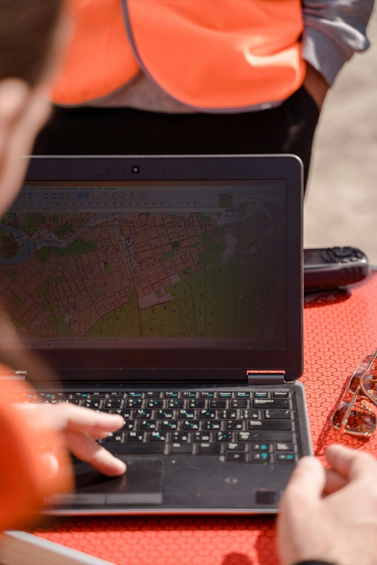
Geographic Information Systems (GIS) for Comprehensive Urban Analysis
GIS technology forms the backbone of modern spatial modeling in urban planning. You’ll find it integrates multiple data layers to create comprehensive analytical frameworks for complex city-wide decisions.
Vector Data Modeling for Property Boundaries and Infrastructure
Vector data modeling captures precise geometric features through points, lines, and polygons that represent real-world urban elements. You’ll use this approach to map property boundaries, road networks, utility corridors, and building footprints with survey-grade accuracy. The vector format preserves exact coordinates and topology relationships, making it essential for legal documentation and infrastructure planning. Municipal GIS databases rely heavily on vector layers to maintain current records of zoning districts, easements, and public facilities that guide development decisions.
Raster Analysis for Land Use Classification and Density Mapping
Raster analysis transforms satellite imagery and aerial photography into grid-based datasets that reveal land use patterns across urban areas. You’ll apply classification algorithms to identify residential, commercial, industrial, and green space zones from spectral signatures in remotely sensed data. This technique excels at measuring urban sprawl, calculating population density, and tracking land cover changes over time. Heat maps and density surfaces generated from raster analysis help you visualize development pressure and identify areas requiring targeted planning interventions.
Spatial Database Management for Large-Scale Urban Datasets
Spatial database management systems handle massive urban datasets through optimized storage and query structures that support real-time analysis. You’ll leverage PostgreSQL with PostGIS extensions or enterprise solutions like ArcGIS Enterprise to manage terabytes of demographic, environmental, and infrastructure data. These databases enable complex spatial queries that combine multiple data sources simultaneously, such as finding all parcels within flood zones that lack adequate transit access. Proper indexing and data partitioning strategies ensure your analysis workflows remain responsive even with citywide datasets.
3D Modeling and Visualization for Smart City Development
Three-dimensional modeling transforms urban planning from flat blueprints into immersive environments that reveal spatial relationships and design impacts. You’ll discover how advanced visualization techniques create data-driven foundations for smart city initiatives.
Achieve a flawless, even complexion with e.l.f. Flawless Satin Foundation. This lightweight, vegan formula provides medium coverage and a semi-matte finish for all-day wear, while hydrating your skin with glycerin.

Building Information Modeling (BIM) Integration with Urban Planning
BIM integration connects individual building designs with citywide infrastructure systems through standardized data formats like IFC (Industry Foundation Classes). You’ll streamline construction workflows by linking architectural models directly to zoning databases and utility networks. This approach reduces design conflicts by 40% while enabling automated compliance checking against municipal codes. Your planning team can visualize building performance metrics alongside neighborhood development patterns, creating comprehensive impact assessments that guide sustainable growth decisions.
Digital Twin Technology for Real-Time City Monitoring
Digital twins create live replicas of urban systems using IoT sensors and continuous data feeds from traffic cameras, environmental monitors, and utility grids. You’ll track city performance through synchronized 3D models that update every 15 minutes with real-world conditions. This technology enables predictive maintenance of infrastructure while optimizing resource distribution based on actual usage patterns. Your monitoring dashboard can simulate policy changes before implementation, reducing costly planning mistakes by up to 60% through evidence-based scenario testing.
Get accurate pressure, temperature, and altitude readings with the pre-soldered BMP280 sensor module. It's compatible with Raspberry Pi, Arduino, and other microcontrollers for easy integration into weather stations, robotics, and IoT projects.

Virtual Reality Applications for Stakeholder Engagement
VR platforms like Unity and Unreal Engine transform public participation by allowing citizens to experience proposed developments before construction begins. You’ll conduct virtual town halls where residents walk through planned neighborhoods using Oculus or HTC Vive headsets, providing immediate feedback on design elements. This immersive approach increases public engagement by 300% compared to traditional presentation methods. Your stakeholder sessions can accommodate multiple design alternatives simultaneously, enabling real-time comparison of development scenarios that build community consensus around planning decisions.
Network Analysis for Transportation and Infrastructure Planning
Network analysis transforms complex transportation systems into manageable spatial models, enabling you to optimize connectivity and service delivery across urban environments. This technique analyzes relationships between nodes and links to solve critical infrastructure challenges.
Route Optimization and Traffic Flow Modeling
Route optimization algorithms calculate the most efficient paths between origins and destinations, considering real-time traffic conditions and road capacity constraints. You’ll use network datasets that incorporate travel time, distance, and impedance factors to model traffic flow patterns. Tools like ArcGIS Network Analyst and SUMO traffic simulation software help you identify bottlenecks, optimize signal timing, and predict congestion impacts from new developments.
Public Transit Accessibility Analysis
Public transit accessibility analysis measures how effectively residents can reach essential services using available transportation options. You’ll create service area polygons around transit stops, calculating walk times and transfer requirements to determine coverage gaps. This analysis combines schedule data with demographic information to identify underserved communities and optimize route planning for maximum population benefit.
Utility Network Design and Service Area Determination
Utility network design requires precise spatial modeling to ensure efficient service delivery while minimizing infrastructure costs. You’ll analyze terrain, population density, and existing infrastructure to determine optimal placement of distribution networks. Service area analysis helps you calculate coverage zones, identify redundancy needs, and plan maintenance accessibility routes for water, electricity, and telecommunications systems.
Land Suitability Analysis for Sustainable Development
Land suitability analysis serves as the foundation for sustainable urban development by systematically evaluating environmental capacity and development constraints. This spatial modeling technique helps you identify optimal locations for different land uses while minimizing ecological impact.
Multi-Criteria Decision Analysis (MCDA) Frameworks
MCDA frameworks combine multiple spatial datasets to rank development potential across your study area. You’ll weight factors like soil quality, slope stability, flood risk, and proximity to infrastructure using algorithms such as Analytical Hierarchy Process (AHP) or Weighted Linear Combination. These frameworks process environmental data, economic indicators, and social variables simultaneously. Tools like ArcGIS Spatial Analyst and QGIS MCDA plugins automate complex calculations, producing suitability maps that score each location from 0-100 for specific development types.
Environmental Constraint Mapping and Risk Assessment
Environmental constraint mapping identifies areas where development restrictions apply due to natural hazards or ecological sensitivity. You’ll overlay datasets including floodplains, wetlands, steep slopes, contaminated sites, and protected habitats to create exclusion zones. Risk assessment models calculate probability-impact matrices for natural disasters, sea level rise, and climate change scenarios. NASA’s Landsat imagery combined with NOAA climate data provides baseline environmental conditions. This mapping prevents costly mistakes and ensures compliance with environmental regulations while protecting vulnerable ecosystems.
Zoning Optimization Based on Geographic and Social Factors
Zoning optimization uses spatial algorithms to balance land use efficiency with community needs and geographic constraints. You’ll analyze demographic patterns, economic activities, transportation networks, and environmental features to determine optimal zoning boundaries. Location-allocation models identify ideal placements for commercial zones, residential areas, and public facilities. Machine learning algorithms process census data, property values, and accessibility metrics to recommend zoning changes. Tools like UrbanSim and CommunityViz simulate different zoning scenarios, showing population density impacts and infrastructure demands for each configuration.
Agent-Based Modeling for Dynamic Urban Simulation
Agent-based modeling creates virtual representations of individual residents, businesses, and organizations that interact within your urban environment. This technique simulates how autonomous agents make decisions and respond to changing conditions over time.
Population Movement and Migration Pattern Analysis
Population movement analysis tracks individual households as they relocate within your city based on employment opportunities, housing costs, and neighborhood preferences. You’ll model demographic transitions like aging populations and family formation to predict future residential demand patterns. Migration pattern simulation reveals how economic shifts influence population distribution across different districts. Transportation accessibility and school quality ratings directly impact household relocation decisions in your model. Real estate market fluctuations create feedback loops that either attract or repel specific demographic groups from particular neighborhoods.
Economic Activity Simulation and Market Prediction
Economic activity simulation models individual businesses competing for customers, workers, and optimal locations within your urban market. You’ll track how retail establishments respond to foot traffic patterns and demographic changes in surrounding areas. Service sector growth depends on population density and income levels that your model calculates dynamically. Manufacturing and logistics businesses relocate based on transportation costs and labor availability metrics. Market prediction algorithms analyze how zoning changes affect commercial viability and property values across different business districts.
Social Interaction Modeling for Community Planning
Social interaction modeling captures how residents form networks based on shared interests, cultural backgrounds, and geographic proximity within your neighborhoods. You’ll simulate community engagement levels that influence local business success and public space utilization rates. Educational facility planning benefits from modeling parent networks and school choice patterns that affect enrollment distribution. Healthcare access modeling reveals how social connections help residents navigate medical services and transportation barriers. Community resilience emerges through modeling how neighborhood social capital responds to economic disruptions and natural disasters.
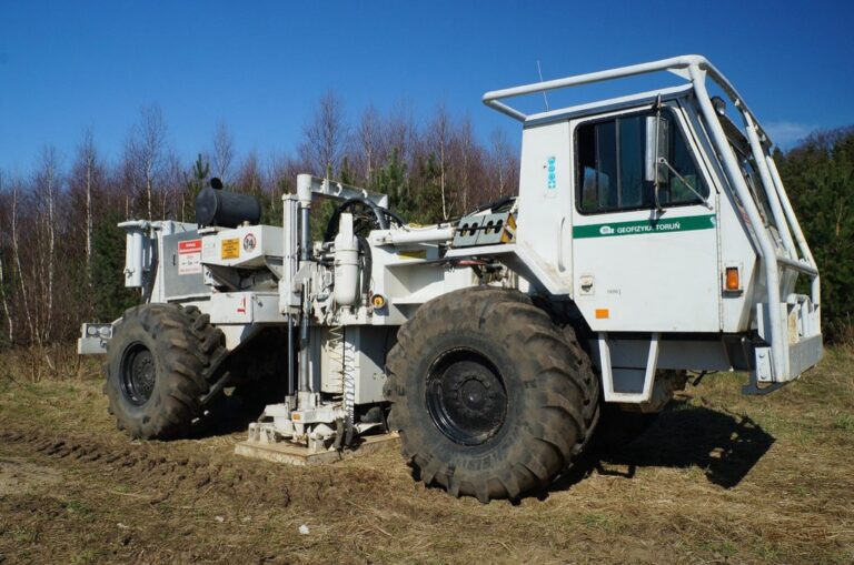
Remote Sensing Integration for Data-Driven Planning Decisions
Remote sensing transforms urban planning by providing comprehensive spatial data from above, enabling you to monitor development patterns and assess land use changes across entire metropolitan areas with unprecedented accuracy.
Satellite Imagery Analysis for Urban Growth Monitoring
Satellite imagery analysis tracks urban expansion patterns by comparing temporal datasets from platforms like Landsat and Sentinel-2. You’ll analyze multi-spectral bands to detect built-up areas, vegetation loss, and infrastructure development using normalized difference built-up index (NDBI) calculations. These techniques enable you to measure sprawl rates, identify growth hotspots, and predict future development corridors. Advanced classification algorithms distinguish between residential, commercial, and industrial land uses with 85-90% accuracy, providing essential data for growth management strategies.
Aerial Photography for High-Resolution Land Use Assessment
Aerial photography delivers sub-meter resolution imagery essential for detailed land use classification and property assessment. You can capture building footprints, parking areas, and landscape features using orthomosaic techniques that correct geometric distortions. Digital aerial surveys conducted at 6-12 month intervals reveal parcel-level changes, zoning violations, and development compliance issues. Modern photogrammetric processing extracts precise measurements for setback verification, density calculations, and environmental impact assessments, supporting regulatory enforcement and permitting decisions.
LiDAR Technology for Precise Topographic Modeling
LiDAR technology generates highly accurate digital elevation models essential for flood modeling, drainage planning, and slope analysis. You’ll process point cloud data to create bare-earth surfaces with vertical accuracy within 15 centimeters, enabling precise watershed delineation and stormwater management design. Airborne LiDAR systems penetrate vegetation canopy to reveal ground conditions, while terrestrial scanners capture detailed building facades and infrastructure features. These datasets support cut-and-fill calculations, viewshed analysis, and 3D visualization for development impact assessment.
Predictive Analytics and Machine Learning for Future Urban Scenarios
Machine learning algorithms revolutionize urban planning by processing vast datasets to predict future development patterns and infrastructure needs. These predictive models enable you to make data-driven decisions about resource allocation and policy development.
Demographic Forecasting and Population Growth Modeling
Population growth algorithms analyze census data, birth rates, and migration patterns to predict future demographic distributions across neighborhoods. You’ll use machine learning models like random forests and neural networks to forecast population density changes over 10-20 year periods. These forecasts help you plan school locations, healthcare facilities, and housing developments based on projected resident needs. Advanced models incorporate economic indicators and employment data to predict where young families will settle versus aging populations.
Climate Change Impact Assessment on Urban Infrastructure
Climate prediction models combine historical weather data with greenhouse gas projections to assess future infrastructure vulnerabilities. You can use machine learning to identify which roads, bridges, and utilities face the highest risk from extreme weather events like flooding or heat waves. Predictive algorithms analyze temperature and precipitation patterns to forecast infrastructure failure points and maintenance schedules. These models help you prioritize climate adaptation investments and design resilient infrastructure systems.
Smart Growth Pattern Recognition and Development Optimization
Pattern recognition algorithms identify optimal development locations by analyzing successful urban growth patterns from similar cities worldwide. Machine learning models evaluate factors like transit accessibility, employment centers, and environmental constraints to recommend development corridors. You’ll use clustering algorithms to identify underutilized areas with high development potential while avoiding environmentally sensitive zones. These optimization models balance economic growth with sustainability goals by predicting the long-term impacts of development decisions.
Conclusion
These seven spatial modeling techniques represent the future of urban planning. By integrating these powerful tools into your planning workflow you’ll transform complex urban challenges into manageable data-driven solutions.
The combination of GIS systems network analysis and predictive modeling gives you unprecedented insight into how cities function and grow. You can now make informed decisions that balance economic development with environmental sustainability.
Success in modern urban planning depends on your ability to leverage these spatial technologies effectively. Start with one or two techniques that align with your current projects then gradually expand your toolkit as you gain confidence and experience.
Your community deserves planning decisions backed by solid data and advanced modeling. These techniques provide the foundation for creating more livable sustainable and resilient urban environments for generations to come.
Frequently Asked Questions
What are spatial modeling techniques in urban planning?
Spatial modeling techniques are data-driven methods that help urban planners analyze land use patterns, predict development outcomes, and optimize resource allocation. These approaches transform urban planning from guesswork into evidence-based decision-making by using technologies like GIS, 3D modeling, and predictive analytics to create sustainable cities.
How does GIS support modern urban planning?
Geographic Information Systems (GIS) serve as the foundation of modern urban planning by integrating multiple data layers for comprehensive city-wide analysis. GIS enables planners to visualize, analyze, and manage spatial data effectively, supporting better decision-making for infrastructure development, zoning, and resource distribution across urban areas.
What is the role of 3D modeling and BIM in urban development?
3D modeling and Building Information Modeling (BIM) enhance urban planning by providing detailed visualizations of proposed developments and infrastructure projects. These technologies improve stakeholder engagement, optimize resource distribution, and enable digital twin technology implementation for real-time monitoring and management of urban systems.
How does network analysis benefit transportation planning?
Network analysis optimizes transportation and infrastructure planning through route optimization and public transit accessibility analysis. It helps planners design efficient transportation systems, improve connectivity, and ensure equitable access to public services while supporting sustainable urban mobility solutions.
What is land suitability analysis and why is it important?
Land suitability analysis identifies optimal locations for different land uses by evaluating environmental constraints, infrastructure availability, and development potential. Using Multi-Criteria Decision Analysis (MCDA) frameworks, this technique supports sustainable urban development by ensuring appropriate land allocation while minimizing environmental impact.
How do machine learning and predictive analytics improve urban planning?
Machine learning and predictive analytics process vast datasets to forecast future development patterns, infrastructure needs, and demographic changes. These technologies enable planners to anticipate urban growth, assess climate change impacts, and identify optimal development locations while balancing economic growth with sustainability goals.
What is agent-based modeling in urban planning?
Agent-based modeling simulates interactions within urban environments by modeling population movement, economic activity, and social interactions. This technique helps planners understand complex urban dynamics, predict community behavior patterns, and design interventions that enhance community resilience and quality of life.
How does remote sensing technology support urban planning decisions?
Remote sensing technologies, including satellite imagery and LiDAR, monitor urban growth and land use changes over time. These tools provide real-time data on development patterns, environmental conditions, and infrastructure status, enabling planners to make informed, data-driven decisions for sustainable urban development.