7 Best Typography Tips for Map Readability
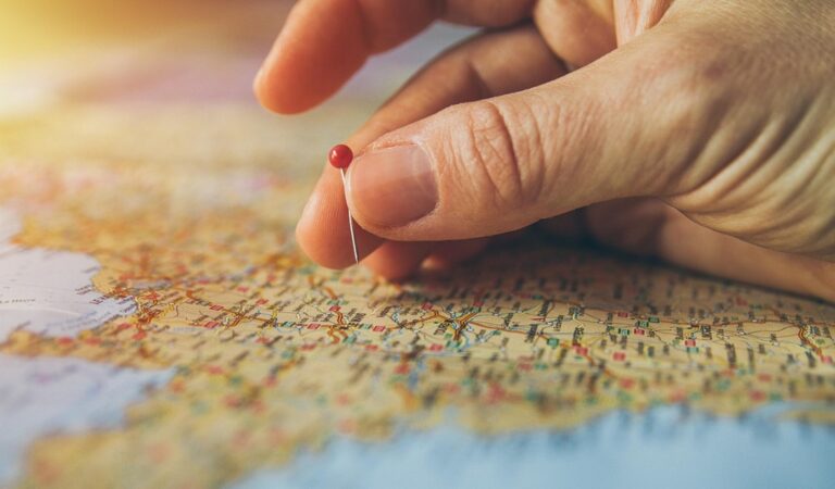
You’ve probably stared at a map wondering why some text jumps out while other labels disappear into visual chaos. Typography makes or breaks map readability — the difference between users quickly finding what they need versus abandoning your map in frustration.
Smart font choices don’t just look good; they create visual hierarchy that guides users through complex geographic information. Whether you’re designing transit maps or hiking trails your typography decisions directly impact user experience and accessibility.
The right typeface combinations can transform cluttered cartography into clear navigation tools that work across devices and user needs.
Disclosure: As an Amazon Associate, this site earns from qualifying purchases. Thank you!
P.S. check out Udemy’s GIS, Mapping & Remote Sensing courses on sale here…
Choose Sans-Serif Fonts for Clear Geographic Labels
Sans-serif fonts eliminate decorative strokes that can blur at small sizes, making them essential for geographic labels that need to remain legible across different zoom levels and display conditions.
Prioritize Helvetica and Arial for Urban Area Names
Urban area names benefit from Helvetica’s neutral letterforms and consistent spacing, which maintain clarity when overlaid on complex city backgrounds. Arial provides similar legibility advantages while offering better screen rendering on older display systems. Both fonts handle uppercase city names effectively, with Helvetica delivering slightly better visual weight distribution for major metropolitan labels. You’ll find these fonts perform exceptionally well at sizes between 10-14 points for neighborhood labels and 16-20 points for major city designations.
Select Open Sans for Digital Map Applications
Open Sans offers optimized web rendering that ensures consistent appearance across browsers and mobile devices. Its wide character spacing prevents letter collision when labels appear over varied terrain features or satellite imagery. The font’s multiple weight options allow you to create clear hierarchies between different geographic feature types – using regular weight for streets, medium for neighborhoods, and bold for major landmarks. Digital mapping platforms like Mapbox and Google Maps have adopted Open Sans variations specifically because the font maintains readability at pixel densities from 72 to 300 DPI.
Implement Serif Fonts for Historical and Cultural Context
Serif fonts bridge the gap between modern map functionality and traditional cartographic aesthetics. They’re particularly effective when your map needs to convey historical significance or cultural importance.
Use Times New Roman for Heritage Site Markers
Times New Roman establishes immediate credibility for historical locations on your maps. Its traditional serifs and authoritative appearance make it perfect for marking landmarks like Civil War battlefields, historic districts, and archaeological sites. You’ll find that this font’s familiarity helps users quickly identify locations of cultural significance, while its excellent readability ensures clear communication at various zoom levels across both print and digital formats.
Apply Georgia for Educational Map Content
Georgia delivers exceptional screen readability for educational mapping projects. Its slightly larger x-height and robust character design make it ideal for classroom maps, museum displays, and interpretive trail guides. You can use Georgia effectively for descriptive text blocks, historical timelines, and cultural annotations where readers need sustained text engagement. The font’s web-optimized design ensures consistent rendering across different devices and browsers in educational technology environments.
Utilize Script Fonts for Natural Feature Names
Script fonts add organic flow to natural feature labels, creating visual harmony between typography and landscape elements. These decorative typefaces mirror the natural curves and movements found in rivers, mountain ranges, and coastal features.
Incorporate Brush Script for River and Stream Labels
Brush Script MT captures the flowing movement of waterways through its hand-painted appearance and natural stroke variations. You’ll achieve optimal readability by using 10-12 point sizes for major rivers like the Mississippi or Colorado River, while reserving 8-10 points for smaller tributaries and creeks.
Position brush script labels to follow the natural curve of water features, ensuring each character flows with the river’s direction. This technique creates intuitive wayfinding as your eyes naturally follow both the typography and the geographic feature simultaneously.
Choose Calligraphy Styles for Mountain Range Names
Calligraphy fonts like Edwardian Script emphasize the grandeur of mountain systems while maintaining professional cartographic standards. You’ll find these elegant typefaces work best for major ranges such as the Rocky Mountains or Appalachian Mountains, where their dramatic letterforms complement towering peaks.
Apply calligraphy styles at 12-14 point sizes to ensure visibility across elevation contours and terrain shading. Position these labels along ridge lines or prominent slopes, allowing the script’s natural flow to echo the mountain’s profile and create visual connection between text and topography.
Apply Condensed Fonts for Dense Information Areas
Condensed fonts maximize space efficiency in areas where multiple labels compete for limited real estate. These vertically compressed typefaces maintain readability while allowing more text elements to coexist without overlapping.
Select Narrow Typefaces for Crowded City Centers
Narrow typefaces prevent label collision in downtown districts where street names, building identifiers, and point-of-interest markers converge. Arial Narrow and Helvetica Condensed work exceptionally well for street labels at 8-10 point sizes. You’ll achieve 30% more label density while maintaining clarity. Position these fonts along street centerlines with 2-pixel letter spacing to enhance legibility in complex urban environments.
Use Compressed Fonts for Highway and Route Numbers
Compressed fonts fit route identifiers within standard shield shapes without sacrificing visibility or regulatory compliance. Interstate Gothic and Highway Gothic deliver optimal results for route markers and exit numbers. These specialized typefaces conform to Federal Highway Administration standards while maximizing character count within confined spaces. Apply them at 12-14 point sizes with bold weight to ensure visibility at highway speeds.
Combine Font Weights to Create Visual Hierarchy
Strategic font weight combinations establish clear information prioritization across your map layers. Weight variation guides readers through complex geographic data by creating distinct visual levels.
Apply Bold Typography for Major Cities and Capitals
Bold weights immediately establish urban importance hierarchies on your cartographic displays. Apply 700-weight fonts to capital cities and metropolitan areas exceeding 500,000 population to create instant recognition points. Use bold Interstate or Helvetica Bold for state capitals, ensuring 12-14 point sizing maintains legibility at standard viewing distances. Reserve heavy weights for primary urban centers to prevent visual competition between settlement types.
Use Light Weights for Secondary Location Names
Light font weights create subtle secondary information layers without overwhelming primary features. Apply 300-weight fonts to suburban areas, small towns, and neighborhood districts to maintain hierarchical clarity. Use Open Sans Light or Helvetica Light at 9-11 point sizes for secondary settlements, ensuring adequate contrast against map backgrounds. Position light-weight labels strategically to support rather than compete with bold primary city names.
Integrate Color-Coded Typography Systems
Color-coded typography systems create intuitive navigation patterns that help users instantly categorize map features. You’ll establish visual consistency across your entire cartographic project when you assign specific colors to different geographic element types.
Assign Blue Text for Water Body Labels
Blue typography creates immediate visual connection between text and water features on your maps. You should use darker blue shades like #003366 or #1e4d72 for ocean and lake names to ensure readability against lighter water fill colors. Rivers and streams work best with medium blue text at #4682b4, which maintains visibility while following natural color associations that users expect from aquatic features.
Use Green Typography for Park and Forest Names
Green text establishes clear identification for natural recreational areas and protected lands on your maps. You’ll achieve optimal contrast by selecting forest green (#228b22) or dark olive (#556b2f) for national park labels over lighter green polygons. State parks and nature reserves benefit from medium green typography at #32cd32, creating hierarchy while maintaining the ecological color theme that users associate with outdoor spaces.
Consider Font Size Scaling for Different Map Zoom Levels
Effective typography scaling ensures your map labels remain readable across all zoom levels without overwhelming the cartographic design. You’ll need to establish a systematic approach that adjusts font sizes based on geographic scale and information density.
Implement Large Text for Continental Views
Use 14-18 point fonts for country names and major geographic features when displaying continental-scale maps. Your continental typography should emphasize major political boundaries and ocean labels with bold weights to maintain visibility at reduced scales. Apply 16-point Arial Bold for country labels and 14-point medium weight for major water bodies like the Atlantic Ocean or Mediterranean Sea. This sizing prevents text from disappearing while maintaining proper visual hierarchy between nations and smaller regional features.
Apply Small Typography for Detailed Street Maps
Scale down to 8-12 point fonts for street names and local landmarks in detailed urban mapping contexts. Your street-level typography requires condensed fonts like Arial Narrow at 10 points for primary roads and 8 points for residential streets to prevent label collision in dense city centers. Apply 9-point regular weight for neighborhood names and 8-point light weight for building numbers to maintain readability without cluttering the detailed geographic information at high zoom levels.
Conclusion
Your typography choices can transform confusing maps into powerful navigation tools that users actually want to engage with. By implementing these seven diverse approaches you’ll create visual hierarchies that guide readers naturally through complex geographic information.
Remember that effective map typography isn’t just about picking fonts—it’s about understanding how different typefaces work together to serve your users’ needs. Whether you’re designing for digital platforms or print materials the right combination of serif elegance script flow and condensed efficiency will make your maps more accessible and professional.
Start experimenting with these typography strategies today and watch how small font decisions create dramatically better user experiences across all your mapping projects.
Frequently Asked Questions
What makes typography important in map design?
Typography in map design creates visual hierarchy and enhances readability, helping users navigate complex geographic information more easily. Smart font choices transform cluttered maps into clear navigation tools, improving accessibility across various devices and user needs while ensuring information is communicated effectively.
Which fonts are best for geographic labels on maps?
Sans-serif fonts like Helvetica and Arial are ideal for geographic labels due to their clarity at small sizes and excellent legibility. For digital applications, Open Sans is recommended for its optimized web rendering and versatility in creating clear hierarchies among different geographic features.
When should serif fonts be used in map design?
Serif fonts are perfect for conveying historical and cultural context in maps. Times New Roman works well for marking heritage sites, while Georgia is excellent for educational mapping projects. These fonts add gravitas and traditional feel to historically significant locations.
How can script fonts enhance natural feature labels?
Script fonts create visual harmony with landscape elements when used for natural features. Brush Script MT is ideal for river and stream labels, following natural curves of waterways. For mountain ranges, calligraphy styles like Edwardian Script emphasize grandeur while maintaining cartographic readability standards.
What are condensed fonts used for in mapping?
Condensed fonts are essential in dense information areas, allowing multiple labels to coexist without overlapping. Arial Narrow and Helvetica Condensed work well for street labels in crowded city centers, while Interstate Gothic and Highway Gothic are perfect for route numbers, conforming to Federal Highway Administration standards.
How do font weights create hierarchy in maps?
Bold typography (700-weight fonts) establishes importance for major cities and capitals, ensuring visibility at standard viewing distances. Light font weights work for secondary locations like suburban areas and small towns, maintaining clarity without overwhelming primary features and creating clear information hierarchy.
What colors should be used for different map features?
Blue text works best for water bodies – darker shades for oceans and lakes, medium blue for rivers and streams. Green typography is ideal for parks and forests, with forest green for national parks and medium green for state parks, creating clear identification while maintaining ecological color themes.
How should typography scale across different zoom levels?
Use 14-18 point fonts with bold weights for country names on continental-scale maps to maintain visibility. For detailed street maps, scale down to 8-12 point fonts using condensed typefaces like Arial Narrow to prevent label collision in dense urban areas while ensuring readability.