9 Ways to Create Sensitive Maps of Contested Borders Like Pros
You’ve likely encountered maps that spark heated debates about territorial boundaries and sovereignty. Creating sensitive maps of contested borders requires careful navigation between political sensitivities and geographical accuracy – a challenge that cartographers and organizations face daily.
The stakes are high. One misplaced line or poorly chosen color scheme can trigger diplomatic incidents or inflame regional tensions. Whether you’re working for a news organization covering territorial disputes or developing educational materials about global conflicts you’ll need to balance factual representation with cultural awareness and political neutrality.
Disclosure: As an Amazon Associate, this site earns from qualifying purchases. Thank you!
Understanding the Complexity of Contested Border Mapping
You’ll encounter unique cartographic challenges when mapping disputed territories that extend far beyond standard geographic representation. These contested border mapping projects require balancing technical accuracy with diplomatic sensitivity while navigating competing territorial claims.
P.S. check out Udemy’s GIS, Mapping & Remote Sensing courses on sale here…
Defining Contested Territories and Disputed Boundaries
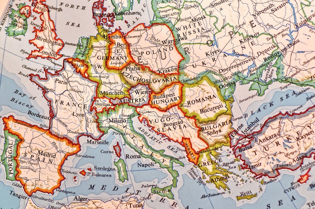
Contested territories represent regions where two or more nations claim sovereignty, creating complex mapping scenarios. You’ll find these areas include occupied territories like Crimea, divided regions such as Kashmir, and unrecognized states like South Ossetia. Disputed boundaries differ slightly – they’re specific border lines where neighboring countries disagree on exact demarcation, often involving just kilometers or even meters of territory along established frontiers.
Recognizing Political Sensitivities and Cultural Implications
Political sensitivities arise when your map choices inadvertently favor one territorial claim over another. You’ll need to consider how different line styles, colors, and labels communicate legitimacy to various audiences. Cultural implications extend beyond politics – local populations may view certain representations as erasure of their identity or historical presence. Your mapping decisions can reinforce or challenge existing power structures within contested regions.
Identifying Stakeholder Perspectives and Competing Claims
Multiple stakeholders will view your contested border maps through different lenses of legitimacy and recognition. You’ll encounter government officials seeking validation of their territorial claims, international organizations requiring neutral representations, and local communities wanting their cultural boundaries acknowledged. Competing claims often overlap geographically but differ in legal basis – some rely on historical treaties, others on ethnic demographics, and still others on effective administrative control.
Researching Authoritative Sources and Historical Context
You’ll need comprehensive research to create balanced maps of contested borders. Start by examining legal precedents and territorial histories from multiple perspectives.
Consulting International Legal Documents and Treaties
Reference UN Charter provisions and ICJ rulings when mapping disputed territories. The International Court of Justice database contains territorial decisions like the 2002 Cameroon-Nigeria boundary ruling. Treaty documents from the UN Treaty Collection provide legal frameworks for contested regions. You’ll find boundary commissions’ reports particularly valuable for understanding demarcation processes. The Permanent Court of Arbitration archives contain additional territorial dispute resolutions that inform your mapping decisions.
Analyzing Historical Maps and Territorial Evolution
Explore history's most significant maps with *Great Maps*. This book delves into cartographic masterpieces and their historical context.

Examine historical atlases spanning multiple centuries to understand territorial changes over time. The David Rumsey Map Collection offers digitized historical maps showing border evolution. Compare colonial-era boundaries with post-independence territorial claims to identify contested areas. You should analyze maps from different empires and nations to understand competing historical narratives. Administrative boundary changes often reveal the roots of modern territorial disputes.
Gathering Multiple Governmental and Institutional Perspectives
Collect official position papers from all relevant governments involved in territorial disputes. Each nation’s foreign ministry publishes boundary positions and territorial claims. International organizations like the UN Department of Political Affairs maintain databases of member state positions. You’ll need to review academic research from multiple countries to understand different historical interpretations. Survey data from polling organizations reveals local population perspectives on territorial belonging and identity.
Establishing Neutral Cartographic Standards and Conventions
Neutral cartographic standards provide the foundation for creating contested border maps that maintain credibility across different stakeholder groups. You’ll need consistent conventions that prioritize technical accuracy over political positioning.
Achieve a flawless, even complexion with e.l.f. Flawless Satin Foundation. This lightweight, vegan formula provides medium coverage and a semi-matte finish for all-day wear, while hydrating your skin with glycerin.

Adopting International Mapping Organization Guidelines
Follow ISO 19115 metadata standards to document your data sources and methodology transparently. The International Cartographic Association (ICA) provides comprehensive guidelines for handling disputed territories through standardized notation systems. UN Cartographic Section protocols offer specific symbology for areas under administration versus sovereignty claims. These established frameworks help you maintain professional credibility while avoiding inadvertent political statements through your mapping choices.
Using Standardized Symbols and Color Coding Systems
Implement dotted lines for disputed boundaries and solid lines for internationally recognized borders to distinguish territorial status clearly. Use neutral gray tones for contested areas instead of national colors that might suggest ownership. Pattern fills work effectively for overlapping claims – diagonal lines for one claimant and horizontal lines for another. Avoid red or green boundary colors as they carry political connotations in many regions. Your legend must explicitly define each symbol to prevent misinterpretation.
Implementing Consistent Scale and Projection Methods
Select appropriate map projections that minimize distortion across your area of interest rather than favoring any particular nation’s perspective. Equal-area projections like Albers Conic work well for regional contested territories. Maintain consistent scale ratios throughout your map series to ensure fair representation of all claimed areas. Document your projection parameters and datum selections in your metadata. This technical consistency demonstrates professional neutrality and allows others to verify your cartographic decisions.
Developing Diplomatic Language and Visual Representation
Effective diplomatic cartography requires careful attention to both linguistic choices and visual design elements that communicate territorial complexity without appearing to endorse specific claims.
Creating Neutral Terminology for Disputed Areas
Neutral terminology forms the foundation of diplomatic mapping by avoiding language that implies ownership or recognition. Use descriptive terms like “administered by” rather than “controlled by” when labeling contested territories. Replace possessive phrases such as “Russian Crimea” with geographical identifiers like “Crimean Peninsula” followed by administrative notes. Implement standardized terminology sets that describe territorial status objectively, such as “claimed by multiple parties” or “under provisional administration.” This approach maintains factual accuracy while respecting all stakeholder positions equally.
Using Dotted Lines and Special Boundary Markers
Dotted lines serve as the universal cartographic convention for representing disputed or contested boundaries on sensitive maps. Apply consistent line weights and dash patterns throughout your map to distinguish between recognized international borders (solid lines) and contested areas (dotted or dashed lines). Use specialized symbols like double-dashed lines for cease-fire lines or disputed administrative boundaries. Implement color-coding systems with neutral tones—grays or muted blues—to avoid suggesting political affiliations. These visual markers immediately signal territorial complexity to map users without requiring extensive textual explanations.
Create vibrant art on various surfaces with this 36-color acrylic marker set. The soft brush tips allow for precise lines and blending, while the visual ink window prevents unexpected interruptions.

Incorporating Disclaimer Text and Attribution Notes
Disclaimer text provides essential context and legal protection when mapping contested borders in professional cartographic work. Include standardized disclaimers such as “Boundary representation is not necessarily authoritative” or “Disputed areas shown for reference only” in prominent locations on your maps. Add attribution notes citing specific data sources and compilation dates to establish transparency and credibility. Position disclaimers near map legends or in corner text blocks where they’re visible but don’t interfere with geographical features. This documentation approach protects both mapmakers and users while acknowledging territorial complexities.
Incorporating Multiple Viewpoints Through Layered Mapping
Layered mapping techniques allow you to present contested territorial claims simultaneously without favoring any single perspective. This approach transforms complex geopolitical disputes into navigable visual narratives that respect all stakeholder positions.
Designing Interactive Toggle Features for Different Claims
Toggle features enable users to switch between competing territorial claims dynamically on digital maps. You’ll implement these through JavaScript libraries like Leaflet or Mapbox GL JS, creating separate data layers for each claiming party’s perspective. Design toggle buttons with neutral labels such as “View A” and “View B” rather than country names to maintain objectivity. Include metadata panels that display the legal basis and historical context for each claim when users activate specific toggles. Test toggle functionality across devices to ensure smooth transitions between different territorial representations.
Creating Side-by-Side Comparison Visualizations
Side-by-side visualizations present competing claims simultaneously using split-screen or panel layouts. You’ll configure identical base maps with synchronized zoom and pan functions to enable direct comparison between territorial interpretations. Position disputed areas centrally within each panel and use consistent symbology across both views to highlight differences effectively. Implement synchronized highlighting features that illuminate corresponding areas when users hover over specific territories. Export these comparisons as static images for print publications or embed them as interactive web components for digital platforms.
Implementing Color-Coded Sovereignty Indicators
Color-coded sovereignty indicators distinguish between different levels of territorial control and recognition status. You’ll establish a standardized color palette using neutral tones: light gray for internationally recognized borders, medium gray for de facto control, and dark gray with pattern fills for disputed claims. Apply transparency gradients to show overlapping claims while maintaining visual clarity. Create comprehensive legends that explain each color’s meaning and include pattern keys for areas with multiple competing claims. Document your color choices in metadata to ensure consistency across different map products and future updates.
Consulting with Legal Experts and Cultural Advisors
Professional cartographic accuracy demands input from specialized advisors who understand territorial law and regional sensitivities. You’ll need expert guidance to navigate complex sovereignty questions while respecting cultural perspectives.
Engaging International Law Specialists for Guidance
International law specialists provide crucial context for territorial status interpretations and boundary recognition principles. You should consult lawyers specializing in territorial disputes, UN conventions, and maritime law to understand legal precedents affecting your mapping decisions. These experts help identify which territorial claims have legal standing under international law versus administrative control, ensuring your cartographic choices align with established legal frameworks and avoid misrepresenting sovereignty status.
Collaborating with Regional Cultural Consultants
Regional cultural consultants offer essential insights into local naming conventions, cultural boundaries, and community perspectives on territorial identity. You’ll benefit from working with anthropologists, linguists, and cultural geographers familiar with contested regions to understand how local populations view territorial belonging. These consultants help identify culturally sensitive place names, traditional boundaries, and community-recognized territorial divisions that may differ from official government positions, ensuring your maps respect local cultural perspectives.
Seeking Diplomatic Mission Input and Feedback
Diplomatic missions provide official government perspectives and can review your mapping approaches before publication. You should engage with embassies, consulates, and international organizations to gather formal position statements on territorial representations. These diplomatic sources offer feedback on proposed mapping conventions, suggest appropriate disclaimer language, and help identify potential diplomatic sensitivities that could arise from specific cartographic choices, allowing you to refine your approach before final publication.
Testing Map Accuracy with Diverse Stakeholder Groups
Validating your contested border maps requires systematic testing across multiple stakeholder perspectives to identify potential biases and ensure balanced representation.
Conducting Focus Groups with Affected Communities
Focus groups with local communities provide essential ground-truth validation for your contested border representations. You’ll want to organize separate sessions for different ethnic, religious, or political groups within disputed territories to capture varying perspectives on territorial identity and boundary legitimacy. Structure these sessions around map interpretation rather than political debates, asking participants to identify inaccuracies in place names, geographic features, or administrative divisions that might affect community recognition. Document their feedback systematically, noting where community perceptions diverge from your cartographic choices and official government positions.
Gathering Feedback from International Organizations
International organizations offer neutral perspectives that can validate your diplomatic approach to contested border mapping. You should engage with UN mapping units, the International Committee of the Red Cross, and regional bodies like the African Union or ASEAN to review your cartographic standards and terminology choices. These organizations maintain their own mapping protocols for sensitive territories and can identify potential diplomatic complications before publication. Request specific feedback on your disclaimer language, sovereignty indicators, and visual representation methods to ensure alignment with international humanitarian and peacekeeping mapping practices.
Reviewing Content with Academic Geography Experts
Academic geography experts provide scholarly validation for your methodological approach and historical accuracy in contested border representation. You’ll benefit from consulting political geographers who specialize in boundary studies, territorial disputes, and sovereignty issues to review your research methodology and source documentation. Engage cartography professors to evaluate your visual design choices, symbol standardization, and technical implementation of disputed boundary representations. Schedule separate reviews with regional specialists who can assess your cultural sensitivity and historical context accuracy for specific contested areas you’re mapping.
Implementing Ongoing Updates and Revision Protocols
Your contested border maps require systematic updating protocols to maintain accuracy as political situations evolve. Establishing clear revision procedures ensures your cartographic products remain current with rapidly changing territorial realities.
Establishing Regular Review Cycles for Changing Situations
Set quarterly review schedules for actively contested territories like Kashmir and Crimea where diplomatic status changes frequently. Create monthly monitoring protocols for emerging territorial disputes that haven’t yet reached international arbitration. Document specific trigger events that require immediate map updates, including new international court rulings, ceasefire agreements, or administrative boundary changes. Assign dedicated team members to track each contested region’s political developments through official government statements and international organization reports.
Creating Version Control Systems for Map Iterations
Implement numbered version control using formats like “v2.3.1” where major numbers indicate significant territorial changes and minor numbers reflect styling updates. Maintain detailed changelog documentation that records specific boundary modifications, source updates, and stakeholder feedback incorporation. Store archived versions in secure digital repositories with metadata tags indicating publication dates, territorial status changes, and revision reasons. Create branching systems for different audience versions while maintaining master files with complete territorial claim documentation.
Monitoring Political Developments and Territorial Changes
Track official government communications from relevant foreign ministries and defense departments that announce territorial policy changes or new sovereignty claims. Subscribe to international court case updates from the International Court of Justice and regional arbitration bodies handling territorial disputes. Monitor diplomatic cables and UN Security Council resolutions that affect territorial recognition status. Establish automated alerts for news mentions of your mapped contested territories using geographic keywords and diplomatic terminology.
Conclusion
Creating sensitive maps of contested borders requires you to balance accuracy with diplomacy while maintaining professional integrity. Your success depends on thorough research comprehensive stakeholder consultation and adherence to international cartographic standards.
Remember that your mapping choices carry real-world consequences for affected communities and diplomatic relations. By implementing neutral visual conventions transparent methodologies and regular update protocols you’ll produce maps that serve their intended purpose without inflaming tensions.
The investment in proper consultation validation and ongoing maintenance will protect your credibility while ensuring your maps remain valuable resources for understanding complex territorial realities. Your commitment to neutrality and accuracy ultimately serves the greater goal of informed global discourse.
Frequently Asked Questions
What are contested borders and how do they differ from disputed boundaries?
Contested borders are regions claimed by multiple nations, such as Crimea and Kashmir, where entire territories are in dispute. Disputed boundaries refer to disagreements between neighboring countries about specific border demarcations. The key difference is scope – contested borders involve whole regions with competing sovereignty claims, while disputed boundaries focus on precise border lines between established territories.
Why is mapping contested territories considered politically sensitive?
Mapping contested territories is politically sensitive because cartographic choices can inadvertently favor one territorial claim over another. These representations affect diplomatic relations, local population identity, and international recognition. Misrepresenting boundaries can lead to diplomatic incidents, heightened regional tensions, and impact how communities perceive their territorial belonging and national identity.
What research sources should cartographers consult when mapping contested borders?
Cartographers should consult international legal documents like UN Charter provisions and ICJ rulings, historical maps showing territorial evolution, official government position papers from all claiming parties, and academic research from multiple perspectives. Additionally, they should review treaties, examine local population perspectives, and gather insights from cultural consultants to ensure comprehensive understanding.
What visual techniques help maintain neutrality in contested border maps?
Key neutral techniques include using dotted lines for disputed boundaries, employing neutral color schemes without political connotations, maintaining consistent line weights, and using standardized symbols. Cartographers should adopt “administered by” rather than “controlled by” language, include disclaimer text, and implement layered mapping systems that allow users to toggle between different territorial claims dynamically.
How often should contested border maps be updated?
Contested border maps should be updated regularly through established review cycles, particularly for actively contested territories. Cartographers must monitor political developments, track official government communications, and subscribe to updates from international courts and diplomatic bodies. Version control systems should document all iterations to maintain accuracy as territorial situations evolve rapidly.
Who should cartographers consult when creating contested border maps?
Cartographers should consult international law specialists for territorial status interpretations, regional cultural advisors for local naming conventions and community perspectives, diplomatic missions for official government positions, and academic geography experts for methodological validation. Additionally, conducting focus groups with affected communities and engaging international organizations helps ensure cultural sensitivity and accuracy.