6 Advanced Techniques for Data Normalization in Mapping That Unlock Spatial Data
The big picture: You’re drowning in messy mapping data that doesn’t play well together – different formats scales and standards creating chaos in your spatial analysis projects.
Why it matters: Advanced data normalization techniques transform your inconsistent geographic datasets into clean standardized information that actually works across platforms and applications.
What’s next: These six proven methods will help you master complex data harmonization challenges and build more reliable mapping solutions that deliver consistent results every time.
Disclosure: As an Amazon Associate, this site earns from qualifying purchases. Thank you!
P.S. check out Udemy’s GIS, Mapping & Remote Sensing courses on sale here…
Understanding Data Normalization Fundamentals in Mapping Applications
Data normalization forms the backbone of reliable spatial analysis, transforming inconsistent datasets into standardized formats that enable accurate cartographic work.
Core Principles of Data Standardization
Consistency establishes uniform attribute formats across all mapping datasets, ensuring coordinate systems align and measurement units match throughout your project. Accuracy maintains spatial precision by standardizing datum references and projection parameters to eliminate coordinate drift. Completeness fills data gaps through interpolation methods and validates attribute completeness before processing. Validation implements automated checks for geometry errors, attribute ranges, and topology violations to catch inconsistencies early in your workflow.
Common Challenges in Mapping Data Consistency
Mixed coordinate systems create alignment issues when datasets use different projections or datum references, requiring coordinate transformation before analysis. Inconsistent attribute schemas complicate data integration when field names, data types, or measurement units vary between sources. Scale mismatches occur when combining datasets collected at different resolutions, affecting feature detail and spatial accuracy. Temporal discrepancies arise from datasets collected at different time periods, creating version conflicts that impact analysis reliability and require careful timestamp management.
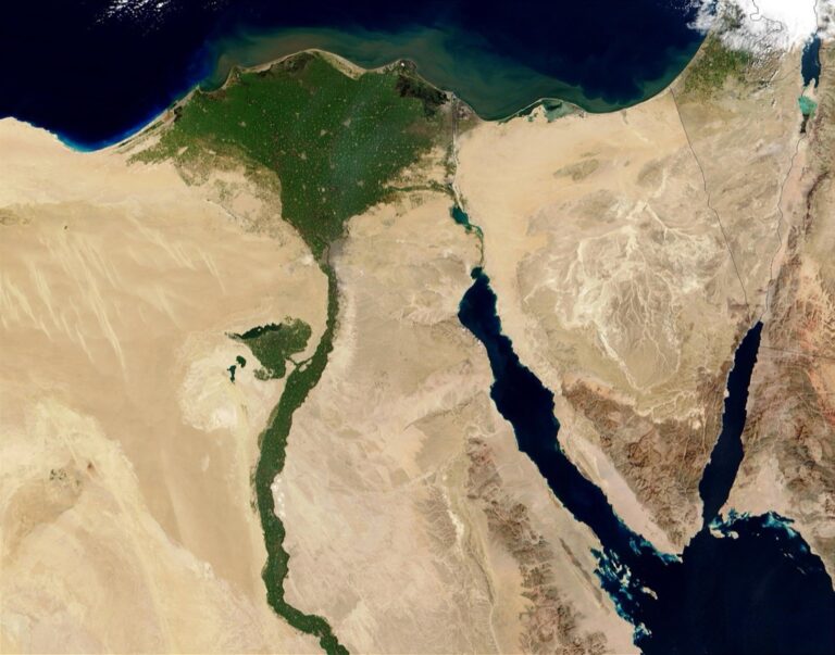
Z-Score Normalization for Geographic Coordinate Systems
Z-score normalization transforms coordinate values by calculating their distance from the mean in standard deviation units. This technique proves essential when you’re working with multi-projection datasets that require statistical standardization.
Mathematical Implementation of Standard Deviation Scaling
Calculate the z-score using the formula (X – μ) / σ where X represents your coordinate value, μ is the mean, and σ is the standard deviation. Apply this transformation to both X and Y coordinates separately to maintain spatial relationships. Most GIS platforms like ArcGIS Pro and QGIS include built-in standardization tools, but you can implement custom scripts using Python’s NumPy library for more control. Store original coordinate systems as metadata to enable reverse transformations when needed for final output generation.
Benefits for Multi-Scale Geographic Analysis
Standardized coordinates enable seamless comparison across different map scales and projection systems. You’ll achieve consistent statistical analysis when combining datasets from local surveys with regional or global datasets. The normalized values facilitate machine learning applications in spatial analysis since algorithms perform better with standardized input ranges. Z-score normalization eliminates scale bias that occurs when mixing high-precision GPS coordinates with generalized administrative boundaries, ensuring equal weight in clustering and classification algorithms.
Best Practices for Handling Outlier Coordinates
Identify outliers using the three-sigma rule where values beyond ±3 standard deviations require investigation. Review extreme coordinates manually before applying automated removal procedures, as they might represent valid but unusual geographic features. Use robust statistical measures like median absolute deviation instead of standard deviation when your dataset contains significant outliers. Document all outlier handling decisions in your metadata to maintain data lineage and enable quality control reviews during project validation phases.
Min-Max Scaling for Elevation and Terrain Data
Min-max scaling transforms elevation data into a standardized range between 0 and 1, making terrain analysis more consistent across different elevation ranges and geographic regions.
Linear Transformation Techniques for Altitude Values
Linear transformation applies the formula (value – minimum) / (maximum – minimum) to normalize elevation data within your specified range. You’ll rescale altitude values from their original units to a 0-1 range while maintaining the proportional relationships between different elevation points. This technique works particularly well for digital elevation models where you need consistent data ranges for visualization algorithms. Most GIS software like QGIS and ArcGIS Pro includes built-in normalization tools that automate these calculations for large terrain datasets.
Preserving Proportional Relationships in Topographic Maps
Learn essential map reading and navigation skills with this U.S. Army guide. Designed for practical use, it provides clear instructions for navigating any terrain.

Proportional relationships remain intact when you apply min-max scaling to elevation data, ensuring that relative height differences between terrain features stay mathematically consistent. Your normalized data maintains the same spatial relationships where a peak twice as high as another feature retains that 2:1 ratio after transformation. This preservation proves critical for slope analysis, watershed delineation, and terrain visualization where accurate relative elevations drive analytical results. You can verify proportional accuracy by comparing ratios between key elevation points before and after normalization processing.
Application in Digital Elevation Model Processing
Digital elevation models benefit from min-max scaling when you’re combining datasets from different elevation ranges or creating multi-scale terrain analyses. You’ll achieve consistent processing results when merging DEMs from mountainous regions with coastal areas by normalizing both datasets to the same 0-1 range. Modern DEM processing workflows in tools like GDAL and Python’s rasterio library support batch normalization for large terrain datasets. Your normalized elevation data enables more effective hillshade generation, contour mapping, and 3D terrain visualization across diverse topographic conditions.
Quantile-Based Normalization for Population Density Mapping
Quantile-based normalization transforms population density data by ranking values into equal-sized groups, making skewed demographic datasets more manageable for cartographic visualization. You’ll find this technique particularly effective when working with census data that contains extreme outliers or uneven population distributions.
Percentile Ranking Methods for Demographic Data
Percentile ranking divides your population density values into 100 equal groups, allowing you to classify areas based on their relative position within the dataset. You calculate percentiles by sorting density values from lowest to highest, then determining which percentage of observations fall below each data point. This method works exceptionally well with American Community Survey data, where metropolitan areas might have densities ranging from 10 to 50,000 people per square mile. You can implement percentile ranking in QGIS using the “Categorized” symbology option with quantile breaks, ensuring each category contains exactly the same number of features.
Creating Balanced Distribution Categories
Balanced distribution categories ensure equal representation across your population density classes, preventing urban areas from dominating your visualization. You achieve this by dividing your dataset into quintiles or deciles, where each category contains exactly 20% or 10% of your observations respectively. For demographic mapping projects, five-class quintile systems often provide optimal visual clarity while maintaining statistical significance. Your mapping software calculates these breaks automatically – ArcGIS Pro’s “Equal Count” classification and MapInfo’s “Equal Count” method both generate balanced categories. This approach eliminates the visual bias that occurs when a few high-density urban cores overshadow suburban and rural population patterns.
Handling Skewed Population Statistics
Skewed population statistics require quantile normalization to prevent extreme values from distorting your map classifications. You’ll encounter right-skewed distributions in most demographic datasets, where a small number of densely populated areas create long tails in your data distribution. Quantile-based methods address this by focusing on rank order rather than absolute values, ensuring rural areas with 50 people per square mile receive appropriate visual weight alongside urban centers with 25,000 people per square mile. You can validate your quantile breaks using box plots in R or Python to confirm each category captures meaningful population density ranges while maintaining cartographic balance across your study area.
Unit Vector Scaling for Directional Mapping Data
Unit vector scaling transforms directional data into standardized mathematical representations, ensuring consistent analysis across different coordinate systems and angular measurement standards.
Normalizing Compass Bearings and Flow Directions
Convert compass bearings to unit vectors by applying trigonometric functions that standardize directional measurements. Calculate the x-component using cosine values and y-component using sine values for each bearing angle. Transform flow direction data from degrees to normalized vectors ranging from -1 to 1, enabling consistent mathematical operations across datasets. Apply vector normalization to wind directions, river flows, and migration patterns to maintain directional integrity during spatial analysis operations.
Converting Angular Measurements to Standard Units
Standardize angular measurements by converting degrees to radians using the π/180 conversion factor for mathematical precision. Transform magnetic declination values into true north references to eliminate coordinate system discrepancies across mapping projects. Normalize azimuth measurements to ensure all directional data uses consistent 0-360 degree ranges or their radian equivalents. Convert grid bearings to geographic bearings using appropriate projection parameters, maintaining accuracy when merging datasets from different coordinate systems.
Applications in Wind Pattern and Traffic Flow Analysis
Analyze wind pattern data using normalized directional vectors to identify dominant flow directions and seasonal variations across meteorological stations. Process traffic flow directions by converting vehicle bearing data into standardized unit vectors for intersection analysis and route optimization studies. Visualize ocean current patterns through vector normalization techniques that highlight circulation patterns and seasonal changes in marine environments. Model pedestrian movement flows using directional scaling methods that reveal walking patterns and congestion points in urban planning applications.
Robust Scaling Techniques for Outlier-Heavy Datasets
Geographic datasets often contain extreme values that can skew traditional normalization methods. Robust scaling techniques provide reliable alternatives when standard approaches fail due to outliers in elevation, population, or environmental measurements.
Median-Based Normalization Methods
Median-centered scaling transforms your geographic data using the median value instead of the mean, providing superior resistance to extreme outliers. You’ll calculate the median absolute deviation (MAD) to create normalized values that maintain spatial relationships even when datasets contain erroneous GPS coordinates or sensor readings. This method proves especially valuable for normalizing rainfall data, where occasional extreme weather events can distort mean-based calculations. Your normalized values remain stable across different geographic regions, ensuring consistent map visualization regardless of local anomalies.
Interquartile Range Scaling Approaches
Interquartile range (IQR) scaling normalizes your data using the 25th and 75th percentiles, effectively trimming extreme values from consideration. You’ll subtract the first quartile and divide by the IQR to create standardized values between 0 and 1 for the middle 50% of your dataset. This technique excels when processing demographic data with significant income disparities or environmental measurements with seasonal extremes. Your mapping projects benefit from more balanced visual representations, as outlier neighborhoods or weather stations won’t dominate the color scheme or classification breaks.
Get real-time weather data with the Ambient Weather WS-2902. This WiFi-enabled station measures wind, temperature, humidity, rainfall, UV, and solar radiation, plus it connects to smart home devices and the Ambient Weather Network.

Protecting Against Extreme Geographic Anomalies
Anomaly detection algorithms help you identify and handle extreme geographic values before they compromise your normalization process. You’ll implement statistical tests like the modified Z-score or isolation forest algorithms to flag potential data errors, such as elevation readings below sea level in landlocked areas. Document your outlier handling decisions to maintain data lineage throughout your mapping workflow. Your quality control procedures should include visual inspection of flagged anomalies using scatter plots or box plots, ensuring legitimate extreme values aren’t mistakenly removed while protecting against measurement errors.
Feature Scaling for Multi-Attribute Spatial Analysis
Feature scaling becomes essential when you’re combining multiple data types with different measurement scales in spatial analysis. You’ll need standardized approaches to ensure each attribute contributes appropriately to your analysis without bias from varying numerical ranges.
Accurately measure ingredients with the Ultrean Digital Kitchen Scale. This stainless steel scale features multiple unit conversions (g/kg/lb/oz/ml/milk ml), a backlit display, and includes a battery.

Combining Different Data Types in Single Maps
Standardized scaling transforms disparate datasets like elevation (meters), population density (people/km²), and temperature (degrees) into comparable ranges. You’ll apply z-score normalization to demographic data while using min-max scaling for environmental variables. Mixed-scale integration requires careful consideration of each attribute’s natural distribution patterns. Census boundaries often contain population counts alongside income percentiles and housing density metrics, demanding consistent scaling approaches across all variables.
Weighted Normalization for Priority-Based Mapping
Priority weighting adjusts normalized values based on analytical importance using multiplication factors between 0.1 and 2.0. You’ll assign higher weights to critical infrastructure data while reducing emphasis on secondary demographic indicators. Risk assessment mapping typically weights hazard exposure at 0.7, vulnerability at 0.5, and historical events at 0.3. Emergency response planning benefits from weighted normalization that prioritizes hospital locations, evacuation routes, and population density over recreational facilities or commercial zones.
Integration Strategies for Complex Geographic Models
Multi-layer integration combines normalized datasets through additive or multiplicative composite indices that preserve spatial relationships. You’ll use additive methods for independent variables like soil quality plus rainfall patterns, while multiplicative approaches work better for interdependent factors. Complex environmental models often integrate normalized climate data, topographic variables, and land use classifications through weighted overlay analysis. Urban planning applications combine zoned land use, transportation accessibility, and demographic characteristics using standardized composite scoring systems.
Conclusion
Mastering these six advanced normalization techniques will transform your mapping projects from chaotic data struggles into streamlined analytical workflows. You’ll find that combining Z-score normalization with robust scaling methods creates resilient datasets that handle both standard patterns and extreme outliers effectively.
The key to successful implementation lies in selecting the right technique for your specific data characteristics. Whether you’re working with elevation models requiring min-max scaling or population datasets needing quantile-based approaches you now have the tools to make informed decisions.
Remember that effective normalization isn’t just about applying formulas—it’s about understanding your data’s unique properties and choosing methods that preserve meaningful spatial relationships. Your future mapping projects will benefit from cleaner more reliable results that support confident decision-making across various analytical scenarios.
Frequently Asked Questions
What is data normalization in mapping applications?
Data normalization in mapping applications is the process of converting inconsistent spatial datasets into standardized formats that work effectively across different platforms. It involves transforming chaotic data from various sources into clean, consistent information by applying core principles of consistency, accuracy, completeness, and validation to ensure reliable cartographic analysis.
What are the main challenges in mapping data consistency?
The primary challenges include mixed coordinate systems, inconsistent attribute schemas, scale mismatches, and temporal discrepancies. These issues create complications when combining datasets from different sources, as varying formats and standards can hinder effective spatial analysis and lead to unreliable results if not properly managed.
How does Z-score normalization work for geographic coordinates?
Z-score normalization transforms coordinate values by calculating their distance from the mean in standard deviation units. This technique standardizes coordinates by subtracting the mean and dividing by the standard deviation, enabling seamless comparisons across different map scales and projection systems for multi-scale geographic analysis.
When should I use min-max scaling for elevation data?
Min-max scaling is ideal for elevation and terrain data when you need to standardize values to a range between 0 and 1. It’s particularly useful for merging Digital Elevation Models (DEMs) from different regions with varying elevation ranges, maintaining proportional relationships between elevation points while improving visualization consistency.
What is quantile-based normalization for population density?
Quantile-based normalization transforms skewed demographic datasets by using percentile ranking methods to classify population density values into equal groups. This technique is especially valuable for census data with extreme outliers, ensuring balanced distribution categories and preventing urban areas from overshadowing suburban and rural patterns.
How does unit vector scaling help with directional mapping data?
Unit vector scaling converts directional data into standardized mathematical representations using trigonometric functions. It normalizes compass bearings and flow directions while maintaining directional integrity, making it essential for analyzing wind patterns, traffic flow, and ocean currents across different coordinate systems.
What are robust scaling techniques for outlier-heavy datasets?
Robust scaling techniques include median-based normalization and interquartile range (IQR) scaling, which focus on the middle portions of datasets rather than means. These methods are more resistant to extreme values and work well with rainfall data or other datasets containing significant outliers.
How do I combine multiple data types in spatial analysis?
Use feature scaling for multi-attribute spatial analysis to standardize different data types like elevation, population density, and temperature into comparable ranges. Apply weighted normalization to emphasize critical data based on analytical importance, and use integration strategies to combine normalized datasets through composite indices.