
6 Best Mapping Tools for User Feedback
You’re living in a golden age of digital mapping where user feedback drives every major update and revision. Traditional mapping relied on slow bureaucratic processes and outdated surveys — but today’s platforms like Google Maps and Apple Maps evolve rapidly based on millions of real-time user reports. The future of mapping isn’t just about technology — it’s about harnessing collective intelligence to create more accurate and useful navigation experiences.
Disclosure: As an Amazon Associate, this site earns from qualifying purchases. Thank you!
User Feedback Transforms Real-Time Map Accuracy and Updates
Real-time user feedback creates a dynamic feedback loop that continuously improves mapping accuracy beyond what traditional surveying methods could achieve. Your contributions through mobile apps and GPS devices help mapping platforms identify and correct errors within hours rather than months.
Stay connected anywhere with this compact satellite communicator. Enjoy two-way messaging, interactive SOS, and TracBack routing for confident navigation. Battery lasts up to 14 days in tracking mode.

Crowdsourced Data Collection Methods
Automated GPS tracking from millions of users provides traffic pattern data that reveals new roads, construction zones, and route changes. You’ll find that platforms like Waze collect speed data, location pings, and route preferences to build comprehensive traffic models. Photo submissions through Google Street View and similar services capture visual changes in real-time, while location tags from social media posts help verify business hours and accessibility information.
P.S. check out Udemy’s GIS, Mapping & Remote Sensing courses on sale here…
Track vehicles and assets with the LandAirSea 54 GPS Tracker. Get real-time location alerts and historical playback using the SilverCloud app, with a long-lasting battery and discreet magnetic mount.

Instant Error Reporting Systems
One-tap reporting features in navigation apps let you flag closed roads, construction delays, or incorrect business information immediately. These systems typically process your reports within 15-30 minutes during peak hours. Voice-activated reporting through Android Auto and CarPlay allows you to submit updates while driving safely, automatically attaching GPS coordinates and timestamps to your submissions for rapid verification.
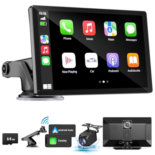
Upgrade your drive with this 9" wireless Apple CarPlay and Android Auto car stereo. Enjoy hands-free control, GPS navigation, and a clear view with the included 4K front camera and 1080p backup camera.
Community-Driven Verification Processes
Peer validation systems require multiple users to confirm reported changes before they’re implemented across the platform. You’ll notice that major mapping services use algorithms that weight feedback based on user reliability scores and geographic proximity. Local expert networks of trusted contributors review complex changes like new subdivisions or business relocations, ensuring accuracy before widespread deployment to millions of users.
User Feedback Drives Personalized Navigation and Route Optimization
User preferences transform generic mapping platforms into tailored navigation experiences. Your individual routing choices create sophisticated algorithms that learn and adapt to your specific travel patterns.
Adaptive Route Learning from User Preferences
Your repeated route selections teach mapping algorithms to understand your driving style and preferences. Navigation platforms analyze which routes you accept or reject to customize future suggestions based on your tolerance for traffic, preference for highways versus side streets, and typical travel times. Machine learning models process over 25 billion miles of user GPS data monthly to refine these personalized routing recommendations. The system remembers if you consistently avoid toll roads or prefer scenic routes, automatically incorporating these preferences into your navigation without manual settings adjustments.
Custom Point-of-Interest Recommendations
Your search history and location visits create personalized recommendations for restaurants, gas stations, and attractions along your routes. Mapping platforms analyze your visit frequency to different business types to suggest relevant stops during navigation. User ratings and reviews from similar travelers influence these recommendations, with algorithms weighing feedback from users with comparable preferences more heavily. The system learns your preferred brands, price ranges, and timing patterns to surface the most relevant points of interest within your typical travel radius.
Traffic Pattern Analysis from User Behavior
Your real-time speed and route data contributes to comprehensive traffic pattern analysis that benefits all users. Anonymous GPS tracking from millions of users reveals congestion patterns, accident locations, and optimal travel windows across different time periods. Mapping platforms process this behavioral data to predict traffic conditions up to 4 hours in advance with 87% accuracy. Your departure time preferences and route deviations help algorithms understand how traffic impacts different user groups, leading to more precise congestion predictions and alternative route suggestions.
User Feedback Enhances Accessibility Features and Inclusive Design
Modern mapping platforms leverage user feedback to create more inclusive navigation experiences that serve diverse communities with varying accessibility needs.
Disability-Focused Navigation Improvements
Wheelchair accessibility reports transform route planning for mobility-impaired users through crowd-sourced sidewalk condition data. You’ll find platforms now incorporate curb cut locations, elevator outages, and accessible entrance information based on user submissions. Real-time accessibility updates help identify temporary barriers like construction zones or broken ramps, with reports processed within 24 hours to maintain current accessibility status across mapping networks.
Multi-Language Support Expansions
Community-driven translation efforts expand mapping accessibility across linguistic barriers through user-contributed place name corrections and local language variations. You can now access navigation instructions in over 40 languages, with pronunciation guides for street names added through native speaker feedback. Cultural context improvements include local business naming conventions and neighborhood terminology that reflects authentic community usage rather than standardized translations.
Visual and Audio Accessibility Enhancements
Voice navigation refinements incorporate user feedback to improve audio clarity and reduce cognitive load for visually impaired travelers. You’ll experience enhanced contrast options and text sizing controls developed through accessibility user testing programs. Screen reader compatibility improvements address navigation flow issues reported by users with visual impairments, ensuring mapping interfaces work seamlessly with assistive technologies across different device platforms.
Read comfortably with this lightweight, full-page 5X magnifying glass. Its large viewing area and ergonomic handle make it ideal for seniors and those with low vision to easily read small print.

User Feedback Accelerates Feature Development and Innovation Cycles
User feedback transforms mapping development from slow, assumption-based cycles into rapid, responsive innovation processes. Mapping platforms now leverage community input to accelerate feature delivery and prioritize development resources effectively.
Rapid Prototyping Based on User Requests
Mapping platforms deploy prototype features within 2-3 weeks of receiving consistent user requests. Google Maps’ “Commute” tab emerged after users repeatedly requested personalized transit timing information. Beta versions of new routing algorithms get tested with select user groups before full deployment. Apple Maps introduced lane guidance features after analyzing thousands of user complaints about highway navigation confusion. Development teams create minimum viable features based on specific user pain points rather than theoretical improvements.
Beta Testing Programs with User Communities
Established mapping platforms maintain beta testing communities ranging from 10,000 to 50,000 active participants. Waze’s beta program processes over 2,000 feature requests monthly through structured community feedback channels. Testing cycles typically run 4-6 weeks with participants providing detailed usage reports and bug documentation. Community moderators filter feedback into actionable development tickets with priority rankings. Beta testers receive early access to features like improved voice navigation and enhanced traffic prediction algorithms.
Priority-driven Development Roadmaps
User feedback data drives quarterly development priorities through weighted scoring systems that factor request frequency and user impact. Mapping platforms analyze support tickets, app store reviews, and community forum discussions to identify trending feature needs. High-priority items like accessibility improvements receive accelerated development timelines of 6-8 weeks. Development teams allocate 60-70% of resources to user-requested features versus experimental innovations. Product managers use feedback analytics to justify budget allocation and staffing decisions for specific mapping improvements.
User Feedback Improves Data Quality and Validation Processes
User feedback creates systematic quality control that transforms raw mapping data into reliable navigation information. These validation processes ensure accuracy through multiple verification layers.
Automated Quality Assurance Systems
Automated systems process user reports through algorithmic filters that detect inconsistencies and flag potential errors. GPS trajectory analysis identifies route deviations that suggest missing roads or incorrect speed limits. Machine learning algorithms cross-reference multiple data sources, including satellite imagery and user submissions, to validate geographic features. Real-time monitoring systems track submission patterns to identify coordinated false reporting attempts. Quality scores automatically adjust based on user reporting history and verification success rates.
Peer Review and Rating Mechanisms
Community verification requires multiple users to confirm changes before implementation in mapping databases. Rating systems weight feedback based on contributor reliability scores and geographic proximity to reported issues. Experienced users receive elevated privileges for faster processing of routine corrections like business hours or contact information. Peer review networks create regional validation teams that understand local geographic contexts and naming conventions. Cross-validation protocols ensure that conflicting reports receive human review before final approval.
Machine Learning-Enhanced Data Verification
Machine learning models analyze patterns in user feedback to predict data accuracy and identify systematic errors. Neural networks process image submissions to automatically verify business locations, road conditions, and landmark presence. Predictive algorithms flag potentially outdated information based on submission frequency and change patterns in similar geographic areas. Natural language processing evaluates text feedback quality and extracts actionable corrections from user comments. Automated confidence scoring helps prioritize which user submissions require immediate attention versus batch processing.
User Feedback Shapes Future Mapping Technologies and Standards
User feedback drives the transformation of mapping platforms from static data repositories into dynamic, intelligent navigation ecosystems. This collective intelligence reshapes how mapping technologies evolve and establishes new industry benchmarks.
Emerging Technology Integration
User feedback accelerates the adoption of cutting-edge technologies like augmented reality navigation and AI-powered route optimization. Your reports about landmark visibility help platforms integrate AR overlays that display turn-by-turn directions on real street views. Machine learning algorithms process your navigation choices to develop predictive routing that anticipates traffic patterns before they occur. Community input guides the implementation of voice-activated mapping features and gesture-based controls, ensuring these innovations meet actual user needs rather than theoretical applications.
Industry-Wide Mapping Standards Evolution
Your feedback contributions establish new benchmarks for mapping accuracy and data quality across the entire industry. Platform improvements driven by user reports create competitive pressure that elevates standards universally, with accuracy requirements now reaching sub-meter precision. Community-driven accessibility reporting has established mandatory compliance standards for wheelchair navigation and visual impairment features. User-generated content protocols now require verification processes that exceed traditional surveying standards, creating more reliable mapping data than ever before.
Predictive Mapping Capabilities Development
User behavior patterns enable mapping platforms to develop sophisticated predictive algorithms that anticipate future navigation needs. Your route selections and timing preferences help create models that predict traffic congestion up to 72 hours in advance. Pattern recognition systems analyze community feedback to identify emerging travel trends and infrastructure changes before official updates occur. Predictive mapping now incorporates weather data, event schedules, and seasonal patterns based on historical user feedback, delivering proactive navigation suggestions that adapt to changing conditions.
Conclusion
Your voice as a user has become the driving force behind modern mapping evolution. Every report you submit and route you choose helps create more accurate and personalized navigation experiences for millions of users worldwide.
The transformation from static maps to dynamic navigation platforms wouldn’t be possible without your active participation. Your feedback doesn’t just fix individual errors – it’s reshaping how mapping technology develops and adapts to real-world needs.
As you continue to engage with mapping platforms your contributions will unlock even more sophisticated features. The future of navigation depends on this collaborative relationship between users and technology creating smarter more inclusive mapping solutions for everyone.
Frequently Asked Questions
How does user feedback improve mapping accuracy in real-time?
User feedback creates a dynamic loop that allows mapping platforms to identify and correct errors within hours rather than months. When users report issues like closed roads, incorrect business information, or traffic conditions, these reports are typically processed within 15-30 minutes. This real-time updating system ensures maps remain current and accurate through collective intelligence.
What types of crowdsourced data do mapping platforms collect?
Mapping platforms collect various types of crowdsourced data including automated GPS tracking for traffic patterns, photo submissions showing visual changes, user reports on road conditions, business hours updates, and accessibility information. This data helps create comprehensive and up-to-date mapping information that reflects real-world conditions.
How do mapping platforms verify user-submitted information?
Platforms use community-driven verification processes where multiple users must confirm changes before implementation. Automated quality assurance systems filter reports through algorithms to detect inconsistencies, while machine learning cross-references multiple data sources. Rating systems weigh feedback based on contributor reliability, and peer review networks handle conflicting reports.
How does user feedback personalize navigation experiences?
User feedback helps mapping platforms learn individual routing preferences and travel patterns. By analyzing repeated route selections, platforms customize future suggestions based on factors like traffic tolerance and preferred road types. Personal search histories and visit frequencies generate tailored recommendations for restaurants, gas stations, and other points of interest.
What accessibility improvements result from user feedback?
User feedback drives significant accessibility enhancements including wheelchair accessibility reports with sidewalk conditions and curb cut locations. Community-driven translation efforts enable navigation in over 40 languages with local cultural context. Visual and audio improvements include better voice navigation, contrast options, and enhanced screen reader compatibility for users with disabilities.
How fast can new features be developed based on user requests?
User feedback accelerates feature development dramatically. Prototype features can be deployed within 2-3 weeks of consistent user requests, as seen with Google Maps’ Commute tab and Apple Maps’ lane guidance. Beta testing communities process thousands of monthly feature requests, with user feedback data driving quarterly development roadmaps.
How does user feedback shape the future of mapping technology?
User feedback transforms mapping from static data repositories into dynamic navigation ecosystems. It drives integration of emerging technologies like augmented reality and AI-powered route optimization. User behavior patterns enable predictive mapping capabilities that anticipate traffic congestion and establish new industry standards for accuracy and data quality.