5 Methods for 3D Terrain Modeling That Create Visual Impact
Why it matters: You’re working on a game development project or architectural visualization and need realistic terrain that doesn’t look like it came from a 2005 graphics engine.
The big picture: Modern 3D terrain modeling transforms flat digital landscapes into immersive environments that captivate users and enhance project realism.
What’s ahead: We’ll break down five proven methods that’ll help you create stunning terrain models without breaking your budget or timeline.
Disclosure: As an Amazon Associate, this site earns from qualifying purchases. Thank you!
P.S. check out Udemy’s GIS, Mapping & Remote Sensing courses on sale here…
Heightmap-Based Terrain Modeling
Heightmap-based terrain modeling transforms elevation data into three-dimensional landscapes using grayscale images where pixel brightness represents altitude values. This foundational method offers precise control over terrain features while maintaining computational efficiency for real-time applications.
Achieve a flawless, even complexion with e.l.f. Flawless Satin Foundation. This lightweight, vegan formula provides medium coverage and a semi-matte finish for all-day wear, while hydrating your skin with glycerin.

Understanding Digital Elevation Models
Digital elevation models store terrain height information as numerical arrays where each data point corresponds to ground elevation at specific coordinates. You’ll encounter two primary DEM types: Digital Terrain Models (DTMs) representing bare earth surfaces and Digital Surface Models (DSMs) including vegetation and structures. Common DEM resolutions range from 1-meter LIDAR data for detailed modeling to 30-meter SRTM data for broader landscapes. Professional applications typically require DEMs with vertical accuracy within 1-3 meters depending on project specifications.
Creating Terrain From Grayscale Images
Grayscale heightmaps use pixel intensity values from 0-255 to represent elevation ranges across your terrain surface. White pixels correspond to maximum heights while black pixels represent minimum elevations with gray values creating smooth transitions between elevation zones. You can generate heightmaps from satellite imagery, topographic maps, or procedural noise functions. Most 3D applications interpret 16-bit grayscale images for enhanced elevation precision, allowing for 65,536 distinct height levels compared to 8-bit images with only 256 levels.
Learn essential map reading and navigation skills with this U.S. Army guide. Designed for practical use, it provides clear instructions for navigating any terrain.

Tools and Software for Heightmap Generation
Professional heightmap generation relies on specialized GIS software like ArcGIS Pro and QGIS for processing raw elevation data into usable terrain models. You’ll find dedicated terrain tools including World Machine for procedural landscape creation, Gaea for realistic erosion simulation, and L3DT for large-scale terrain generation. Game engines like Unity and Unreal Engine provide built-in terrain systems that directly import heightmap data. Open-source alternatives include GDAL for data conversion and Blender’s displacement modifiers for artistic terrain sculpting from heightmap sources.
Procedural Terrain Generation
Procedural terrain generation creates landscapes through mathematical algorithms rather than manual sculpting. This method uses computational rules to produce realistic terrain features automatically.
Noise Functions and Algorithms
Noise functions form the mathematical foundation of procedural terrain generation. You’ll primarily work with Perlin noise, Simplex noise, and Worley noise algorithms to create natural-looking elevation patterns. These functions generate pseudo-random values that simulate organic terrain features like hills, valleys, and ridges. Advanced implementations combine multiple noise octaves at different frequencies to achieve realistic detail levels ranging from continental mountain ranges to small surface variations.
Perlin and Simplex Noise Applications
Perlin noise excels at creating smooth, rolling terrain with natural undulations across your landscape. You can layer multiple Perlin noise functions at different scales to generate base terrain, add surface detail, and create erosion patterns. Simplex noise offers improved performance and eliminates directional artifacts common in Perlin implementations. Both algorithms work effectively in tools like Houdini, Blender’s geometry nodes, and specialized terrain software like World Machine for professional-grade results.
Automated Landscape Creation Workflows
Automated workflows streamline terrain production through node-based systems and scripting. You can establish procedural chains that generate base terrain, apply erosion simulation, distribute vegetation, and create texture masks automatically. Tools like World Machine and Gaea offer visual node editors for building complex terrain pipelines. These workflows enable rapid iteration and consistent results across large projects while maintaining artistic control over key parameters like elevation ranges and feature distribution.
Photogrammetry and Reality Capture
Photogrammetry transforms real-world photography into accurate 3D terrain models by analyzing overlapping images. This method captures existing landscapes with exceptional detail and geometric precision.
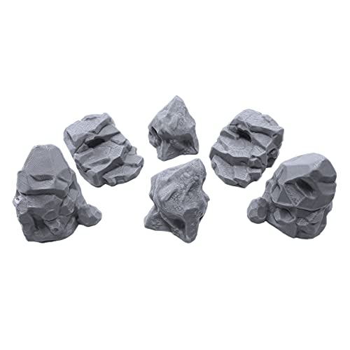
Enhance your tabletop games with this set of six highly detailed, 3D printed stone boulder terrain pieces. Perfect for 28mm miniatures, these paintable PLA plastic models add immersive scenery to any battlefield.
Aerial Photography Processing
Aerial photography processing converts drone or aircraft imagery into detailed terrain models through sophisticated computer vision algorithms. You’ll need 60-80% overlap between sequential images and 20-30% sidelap between flight lines for optimal results. Software like Pix4D, Agisoft Metashape, and RealityCapture automatically align photos, extract camera positions, and generate dense point clouds from your aerial dataset. Ground control points (GCPs) placed throughout your survey area ensure centimeter-level accuracy in your final terrain model.
Improve drone mapping accuracy with this 10-pack of numbered (0-9) 24"x24" GCP targets. Durable, waterproof Oxford cloth with high-contrast black and white design ensures clear visibility and reliable performance in various conditions.

Ground-Based Image Collection Techniques
Ground-based image collection captures terrain details from multiple terrestrial viewpoints using handheld cameras or terrestrial laser scanners. You’ll photograph your target area from various angles, maintaining consistent lighting conditions and avoiding shadows that can affect reconstruction quality. Structured light scanners and LiDAR systems provide millimeter accuracy for detailed rock formations, cliff faces, and archaeological sites. Close-range photogrammetry works best for smaller terrain features where you need ultra-high resolution surface textures and geometric detail.
This WoneNice handheld barcode scanner offers fast, reliable scanning for businesses. It's easy to install via USB and boasts a rapid 200 scans per second, compatible with Windows, Mac, and Linux.

Point Cloud to Mesh Conversion
Point cloud to mesh conversion transforms millions of 3D coordinate points into usable polygonal surfaces for terrain modeling applications. You’ll use Poisson reconstruction algorithms or Delaunay triangulation methods to create watertight meshes from your dense point clouds. CloudCompare, MeshLab, and Geomagic Wrap offer powerful decimation tools that reduce polygon counts while preserving surface detail. Your final mesh typically requires texture mapping from original photographs to create photorealistic terrain surfaces ready for game engines or visualization software.
Sculpting and Manual Modeling
Sculpting and manual modeling gives you complete artistic control over terrain creation. This hands-on approach lets you craft unique landscapes that match your creative vision perfectly.
Digital Sculpting Software Options
ZBrush leads digital sculpting with powerful terrain brushes and multi-resolution mesh support for complex landscapes. Blender’s sculpting mode offers free access to professional-grade tools including dynamic topology and texture painting capabilities. 3D-Coat specializes in voxel-based sculpting that handles terrain overhangs and caves naturally. Mudbox provides intuitive brush workflows with excellent displacement map generation for game-ready terrain assets.
Brush-Based Terrain Shaping
Standard brushes build base terrain elevation using smooth falloff patterns for natural mountain ridges and valley formations. Crease brushes carve sharp erosion channels and cliff faces that simulate weathering effects. Flatten brushes create plateaus and level surfaces for architectural integration. Noise brushes add surface variation and micro-detail that breaks up artificial smoothness. Layer multiple brush passes with varying intensities to achieve realistic geological formations.
Detail Enhancement and Refinement
Alpha textures stamp realistic rock formations and surface patterns directly onto terrain geometry for enhanced realism. Cavity masking isolates recessed areas for targeted weathering effects and moss accumulation in natural depressions. Edge detection sharpens ridgelines and cliff edges while preserving smooth transitions in valley areas. Multi-resolution sculpting adds fine surface detail without increasing base mesh complexity, maintaining performance optimization for real-time applications.
Volumetric Terrain Modeling
Volumetric terrain modeling represents the most advanced approach to creating complex three-dimensional landscapes. This method uses mathematical volumes rather than surface representations to build terrain that supports overhangs, caves, and intricate geological formations.
Voxel-Based Terrain Systems
Voxel-based systems divide terrain into three-dimensional pixels called voxels, each containing density values that determine material presence. You’ll find these systems excel at creating destructible environments and complex geological structures. Popular engines like Dual Contouring and Marching Cubes convert voxel data into renderable meshes. Games like Minecraft demonstrate voxel terrain’s flexibility, while advanced implementations use signed distance fields for smoother surfaces. You can achieve infinite detail by using octree structures that subdivide space efficiently, allowing massive worlds without performance penalties.
Boolean Operations for Landscape Features
Boolean operations let you combine, subtract, and intersect volumetric shapes to create complex terrain features. You can subtract spherical volumes to carve out craters or caves, union multiple noise functions to blend mountain ranges, and intersect geometric primitives with organic shapes. Advanced software like Houdini and MagicaVoxel support these operations natively. You’ll often combine procedural noise with boolean subtraction to create realistic erosion patterns. These operations work particularly well for architectural visualization where you need precise control over terrain modifications around structures.
Cave and Underground Structure Creation
Cave systems require volumetric approaches since traditional heightmaps can’t represent enclosed spaces. You’ll typically use flow-based algorithms that simulate water erosion to generate realistic cave networks. Worley noise creates natural-looking cavern chambers, while L-systems generate branching tunnel structures. You can combine multiple density functions to create multi-level cave systems with varying chamber sizes. Advanced techniques include using geological data to inform cave placement and implementing structural analysis to ensure realistic formations. Tools like World Creator and Gaea now include specialized cave generation modules for seamless integration with surface terrain.
Conclusion
These five terrain modeling methods offer you diverse approaches to create stunning 3D landscapes that match your project’s specific requirements. Whether you’re working on a AAA game title or an architectural visualization you’ll find the right technique to bring your vision to life.
Your choice of method depends on factors like project scope budget constraints and the level of realism you need. Heightmaps work brilliantly for large-scale terrains while photogrammetry delivers unmatched accuracy for real-world recreations.
Don’t hesitate to combine multiple techniques within a single project. You might use procedural generation for base terrain sculpting for hero areas and volumetric modeling for complex cave systems. This hybrid approach often produces the most compelling results.
The terrain modeling landscape continues evolving with new tools and techniques emerging regularly. Stay curious experiment with different workflows and remember that mastering these methods takes practice but yields incredible results for your 3D projects.
Frequently Asked Questions
What is heightmap-based terrain modeling?
Heightmap-based terrain modeling uses grayscale images to create 3D landscapes, where pixel intensity represents elevation. White pixels create high areas, black pixels form valleys, and gray values determine intermediate heights. This method offers precise control and computational efficiency, making it popular in game development and architectural visualization.
What are Digital Elevation Models (DEMs)?
Digital Elevation Models (DEMs) are datasets that represent terrain elevation data. They come in two main types: Digital Terrain Models (DTMs) showing bare earth surface, and Digital Surface Models (DSMs) including vegetation and buildings. DEMs provide accurate elevation information for creating realistic 3D terrain models.
How does procedural terrain generation work?
Procedural terrain generation creates landscapes using mathematical algorithms instead of manual sculpting. It employs noise functions like Perlin and Simplex noise to generate natural-looking elevation patterns. These algorithms can be layered and combined to create complex terrain features while allowing for rapid iteration and consistent results.
What is photogrammetry in terrain modeling?
Photogrammetry transforms real-world photography into accurate 3D terrain models by analyzing overlapping images. This technique captures landscapes with exceptional detail using drone or aircraft imagery, ground-based photography, or terrestrial laser scanners to create photorealistic terrain surfaces for games and visualization.
What are the benefits of volumetric terrain modeling?
Volumetric terrain modeling allows creation of complex 3D landscapes with overhangs, caves, and intricate geological formations. Using voxel-based systems and boolean operations, it supports destructible environments and multi-level underground structures that traditional heightmap methods cannot achieve, making it ideal for advanced game development.
Which software tools are best for terrain creation?
Popular terrain creation tools include Unity and Unreal Engine for heightmaps, World Machine and Gaea for procedural generation, ZBrush and Blender for sculpting, and specialized photogrammetry software for reality capture. Each tool offers unique strengths depending on your project requirements and workflow preferences.
Learn close-range photogrammetry and 3D imaging techniques. This textbook provides comprehensive coverage of the subject.

How do I choose the right terrain modeling method?
Choose based on your project needs: heightmaps for efficiency and large landscapes, procedural generation for rapid iteration, photogrammetry for real-world accuracy, manual sculpting for artistic control, and volumetric modeling for complex underground features. Consider your budget, timeline, and technical requirements when selecting.