7 Best Inclusive Map Design Methods
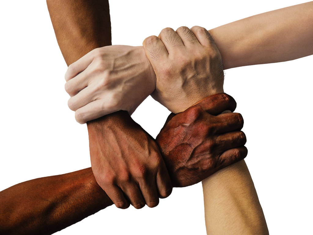
Maps aren’t just geographical tools—they’re powerful storytellers that can either honor diverse communities or perpetuate harmful stereotypes. Traditional cartography often overlooks cultural nuances and excludes marginalized voices from the design process. Understanding culturally responsive map design methods can transform how you create inclusive visualizations that respect and represent all communities accurately.
These evidence-based approaches help cartographers build trust with local populations while ensuring maps serve everyone equitably. By implementing these seven proven methods you’ll create more meaningful and accessible geographic representations that truly connect with your audience.
Disclosure: As an Amazon Associate, this site earns from qualifying purchases. Thank you!
Understanding Cultural Context in Map Design
Effective cultural context research forms the foundation of responsive cartography that serves diverse communities authentically.
P.S. check out Udemy’s GIS, Mapping & Remote Sensing courses on sale here…
Achieve a flawless, even complexion with e.l.f. Flawless Satin Foundation. This lightweight, vegan formula provides medium coverage and a semi-matte finish for all-day wear, while hydrating your skin with glycerin.

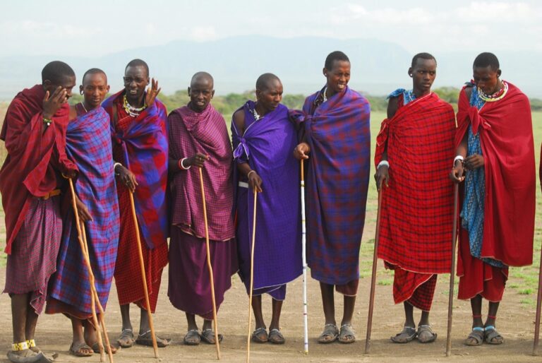
Researching Local Communities and Their Spatial Relationships
Engage directly with community members through structured interviews and focus groups to understand how they perceive and navigate their environment. Document traditional place names, sacred sites, and neighborhood boundaries that may differ from official designations. Partner with local organizations like cultural centers, religious institutions, and community groups to access authentic spatial knowledge. Map community gathering spaces including informal markets, social venues, and transit hubs that reflect actual usage patterns rather than zoned classifications.
Identifying Cultural Symbols and Visual References
Study traditional art forms and architectural elements that resonate with local populations to inform your visual vocabulary. Research color associations within specific cultures, as red symbolizes luck in Chinese communities while representing danger in Western contexts. Document indigenous iconography and geometric patterns that can enhance map aesthetics when used respectfully. Analyze existing community materials like murals, signage, and cultural publications to identify recurring visual themes that strengthen map recognition and acceptance.
Recognizing Historical and Political Sensitivities
Investigate land use conflicts and displacement histories that may influence how communities view territorial boundaries on maps. Research colonial impacts on place naming and geographic representation that continue affecting modern cartographic decisions. Identify contested areas where boundary disputes or sovereignty questions require careful diplomatic language and neutral visual treatment. Document forced relocations and urban renewal projects that created lasting community trauma around mapping and planning processes.
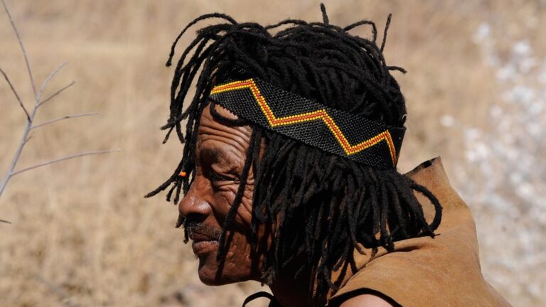
Incorporating Indigenous Knowledge Systems
Indigenous mapping traditions offer sophisticated spatial understanding that predates Western cartographic methods by thousands of years. You’ll discover that integrating these knowledge systems creates more accurate and culturally meaningful representations of landscapes.
Integrating Traditional Wayfinding Methods
Traditional wayfinding systems use environmental markers like star patterns, wind directions, and seasonal changes to navigate landscapes. You can incorporate these methods by mapping traditional travel routes, seasonal pathways, and navigation landmarks that Indigenous communities have used for generations. Document how communities read natural signs like water flow patterns, vegetation changes, and animal migration routes. Include directional systems based on cardinal directions specific to local cultures, such as sunrise-sunset orientations or mountain-based references that differ from standard north-south alignments.
Including Oral History and Place Names
Oral histories contain precise geographic information about land use patterns, seasonal activities, and historical events tied to specific locations. You should collect place names in Indigenous languages alongside their meanings, pronunciation guides, and cultural significance. Map traditional hunting grounds, fishing areas, and gathering sites based on oral accounts that span multiple generations. Include stories about landscape formation, natural disasters, and seasonal cycles that provide context for geographic features. Document how place names reflect environmental conditions, historical events, or spiritual beliefs that aren’t captured in colonial naming systems.
Respecting Sacred Sites and Cultural Boundaries
Sacred sites require special consideration for privacy, access restrictions, and spiritual protocols that affect map representation. You must work with tribal authorities and cultural leaders to determine appropriate levels of detail for sensitive locations. Some sites should remain unmapped or shown with general boundaries rather than precise coordinates. Include cultural protocols for visiting certain areas, seasonal restrictions, and ceremonial spaces that require special permissions. Respect traditional boundaries between tribal territories, hunting grounds, and resource areas that may not align with political borders but maintain cultural significance.
Adapting Visual Design Elements for Cultural Relevance
Visual design choices significantly impact how communities perceive and interact with your maps. Thoughtful adaptation of colors, symbols, and typography ensures your cartographic work resonates with diverse audiences while respecting cultural values.
Selecting Culturally Appropriate Color Schemes
Color associations vary dramatically across cultures and can trigger unintended reactions. Research community-specific color meanings before finalizing your palette – red symbolizes prosperity in Chinese culture but danger in Western contexts. Test color combinations with local focus groups to identify problematic associations. Consider religious significance, as certain colors may be reserved for sacred contexts. Use earth tones and natural palettes when working with Indigenous communities, as these often align with traditional worldviews and environmental connections.
Choosing Meaningful Icons and Symbols
Symbol recognition depends heavily on cultural familiarity and local context. Replace generic Western icons with culturally relevant imagery that reflects community practices and values. Collaborate with local artists to develop custom symbols representing important landmarks, activities, or concepts. Avoid religious symbols unless specifically requested by community members. Test icon comprehension through user studies, ensuring symbols communicate intended meanings across different age groups and literacy levels within your target community.
Using Culturally Familiar Typography and Fonts
Font selection affects both readability and cultural acceptance of your maps. Choose typefaces that support local languages and scripts, including diacritical marks and special characters. Consider reading direction preferences – Arabic and Hebrew scripts read right-to-left, affecting label placement strategies. Select fonts with appropriate formality levels for your audience and content type. Ensure sufficient contrast ratios for accessibility while maintaining cultural aesthetic preferences, particularly for communities with specific design traditions or visual sensitivities.
Engaging Community Members in the Design Process
Direct collaboration with community members transforms maps from external interpretations into authentic representations of local spatial knowledge and cultural values.
Conducting Participatory Design Workshops
Host structured workshops where community members actively contribute to map creation through hands-on activities. Set up mapping stations with large-format base maps, colored markers, and sticky notes for participants to mark important locations and add annotations. Facilitate small group sessions where 4-6 residents work together to identify key landmarks, cultural sites, and neighborhood boundaries. Document participant input through photos, audio recordings, and written notes to capture the reasoning behind spatial decisions and cultural significance of marked locations.
This 40-count set of Crayola Ultra Clean Washable Markers delivers vibrant color for all art projects. Easily washes from skin, clothing, and painted walls, making them perfect for kids ages 3 and up.

Gathering Feedback Through Cultural Liaisons
Establish partnerships with respected community leaders who serve as bridges between cartographers and local residents. Work with cultural liaisons such as tribal elders, community organizers, or religious leaders who understand both mapping concepts and local traditions. Schedule regular feedback sessions where liaisons review draft maps and provide cultural context for spatial elements. Create structured feedback forms that address color choices, symbol appropriateness, and place name accuracy to ensure culturally sensitive representation throughout the design process.
Implementing Community-Led Review Processes
Develop systematic review protocols that give communities final approval authority over map content and design decisions. Establish review committees with diverse community representation including different age groups, cultural backgrounds, and neighborhood areas. Create multiple review rounds starting with preliminary sketches, progressing through draft maps, and concluding with final design approval. Set up public display periods where draft maps are posted in community centers, libraries, and gathering spaces for broader input before publication.
Addressing Language and Translation Considerations
Language barriers can render even the most thoughtfully designed maps inaccessible to community members. You’ll need to implement comprehensive multilingual strategies that respect linguistic diversity and cultural communication patterns.
Providing Multilingual Map Labels and Legends
Multilingual labeling transforms maps into accessible tools for diverse language communities. You should prioritize the community’s primary languages alongside colonial or official languages. Place Indigenous or heritage language names prominently with colonial names as secondary labels. Design legends with parallel translations and culturally appropriate symbols. Consider script direction requirements for Arabic, Hebrew, or other right-to-left languages. Test label hierarchy with native speakers to ensure proper emphasis and readability across all language versions.
Ensuring Accurate Cultural Term Translations
Cultural terminology requires nuanced translation that preserves meaning and context. You must work directly with native speakers and cultural experts rather than relying on automated translation tools. Document place names using phonetic spelling systems accepted by the community. Avoid literal translations that lose cultural significance or sacred meaning. Create glossaries with community elders to capture traditional geographic terms. Verify translations through multiple community sources to ensure accuracy and cultural appropriateness before finalizing map content.
Accommodating Different Reading Patterns and Orientations
Reading patterns vary significantly across cultures and affect map navigation behavior. You should adjust your design layout to support both left-to-right and right-to-left reading patterns. Position key information and legends based on cultural scanning preferences. Consider vertical text orientations for languages like Chinese or Japanese. Design information hierarchy that works across different cultural visual processing patterns. Test map usability with community members to identify navigation challenges and adjust element placement accordingly.
Representing Data Through Culturally Sensitive Methods
Data representation choices can make or break community trust in your maps. You’ll need to move beyond standard visualization approaches to honor diverse cultural perspectives.
Using Culturally Appropriate Data Visualization Techniques
Choose visualization methods that align with community communication patterns and cultural frameworks. Traditional Western choropleth maps might confuse communities that conceptualize space differently. Consider using graduated symbols, flow maps, or network diagrams that better represent indigenous spatial relationships. Incorporate traditional artistic elements like geometric patterns or cultural motifs as data visualization components. Work with community artists to develop custom chart types that reflect local aesthetic traditions while maintaining statistical accuracy.
Avoiding Stereotypical or Harmful Representations
Reject deficit-based mapping that portrays communities solely through negative indicators or social problems. Avoid using red colors for poverty data or crime statistics in cultures where red symbolizes prosperity. Don’t aggregate diverse ethnic groups into oversimplified categories that erase distinct cultural identities. Screen your symbol choices for unintended cultural meanings—certain animals, shapes, or orientations may carry offensive connotations. Review historical context before displaying demographic changes that might trigger painful memories of displacement or persecution.
Balancing Accuracy With Cultural Sensitivity
Maintain statistical integrity while respecting cultural protocols around sacred or sensitive information. Use data generalization techniques like spatial aggregation to protect specific locations while preserving analytical value. Implement graduated disclosure methods that show general patterns without revealing precise coordinates of culturally significant sites. Consider temporal restrictions on certain datasets during ceremonial periods or cultural observances. Document your sensitivity adjustments transparently so users understand methodological choices without compromising protected information.
Testing and Validating Cultural Appropriateness
Testing your culturally responsive maps with actual community members reveals gaps between design intentions and real-world reception. Validation ensures your mapping work serves communities authentically rather than perpetuating harmful stereotypes.
Conducting User Testing With Target Communities
Organize small focus groups of 5-8 community members to review your draft maps in comfortable, familiar settings. Ask participants to walk through specific map tasks like finding important locations or interpreting symbols while you observe their navigation patterns. Document moments of confusion, positive reactions, and suggestions for improvement. Schedule multiple sessions with different demographic groups within the community to capture diverse perspectives. Record both verbal feedback and non-verbal reactions like hesitation when reading certain labels or difficulty understanding specific design elements.
Reviewing Maps With Cultural Experts and Elders
Partner with recognized cultural authorities, tribal elders, and community historians who possess deep knowledge of local traditions and spatial relationships. Present your maps in formal review sessions where experts can evaluate accuracy of place names, appropriateness of symbols, and potential cultural sensitivities. Request specific guidance on sacred sites, restricted areas, and ceremonial locations that require special handling. Allow adequate time for thorough examination since cultural review often involves consulting with other community members. Document all recommendations and create a formal approval process that respects traditional decision-making structures.
Iterating Based on Community Feedback
Transform community input into concrete design revisions by prioritizing feedback that addresses cultural accuracy and representation concerns. Create multiple map versions showing different approaches to problematic elements, then return to communities for additional review cycles. Track changes systematically using version control to demonstrate responsiveness to community concerns. Establish clear timelines for revisions while respecting that cultural consultation processes often require patience and multiple conversations. Share updated versions with the same community members who provided initial feedback to ensure their concerns have been properly addressed.
Conclusion
Implementing these seven culturally responsive map design methods transforms your cartographic work from generic visualizations into meaningful representations that honor diverse communities. When you prioritize community engagement and cultural sensitivity you create maps that build trust rather than perpetuate harmful stereotypes.
Your commitment to inclusive design practices doesn’t just improve map accuracy—it establishes you as a responsible cartographer who values authentic community voices. These methods require additional time and resources but the resulting maps serve communities more effectively and create lasting positive relationships.
By embracing culturally responsive design you’re contributing to a more equitable future for cartography where every community sees their stories and spaces reflected with dignity and respect.
Frequently Asked Questions
What is culturally responsive map design?
Culturally responsive map design is an approach that creates inclusive geographic visualizations by incorporating local knowledge, cultural values, and community perspectives. It moves beyond traditional cartography to ensure maps accurately represent diverse communities, respect cultural sensitivities, and engage local populations in the design process to build trust and avoid perpetuating harmful stereotypes.
Why is cultural context important in map design?
Cultural context is crucial because maps can either celebrate diverse communities or reinforce negative stereotypes. Understanding local perceptions, traditional place names, sacred sites, and cultural symbols ensures maps resonate with intended audiences. Without cultural context, maps may exclude marginalized voices, misrepresent communities, or ignore important spatial relationships that communities actually use.
How can Indigenous knowledge systems improve mapping?
Indigenous knowledge systems offer sophisticated spatial understandings that predate Western cartography. They include traditional wayfinding methods using environmental markers, seasonal travel routes, and oral histories that provide precise geographic information. Incorporating these systems creates more comprehensive maps that respect Indigenous perspectives and enhance navigation through culturally meaningful spatial relationships.
What role does community engagement play in map creation?
Community engagement transforms maps from external interpretations into authentic representations of local knowledge. Through participatory design workshops, feedback sessions with cultural liaisons, and community-led review processes, residents actively contribute to map creation. This collaborative approach ensures diverse voices are heard and grants communities final approval authority over their geographic representation.
How do visual design elements affect cultural perception of maps?
Visual elements like colors, symbols, and typography significantly impact how communities perceive and interact with maps. Culturally appropriate color schemes, meaningful icons, and familiar typefaces help maps resonate with diverse audiences. Researching community-specific color meanings and collaborating with local artists for custom symbols ensures visual elements respect cultural values and enhance accessibility.
What are the key language considerations for inclusive mapping?
Inclusive mapping requires comprehensive multilingual strategies including translated labels and legends, accurate cultural term translations, and support for different reading patterns. Working with native speakers and cultural experts ensures nuanced translations, while adjusting design layouts accommodates various reading behaviors. Proper documentation of place names in local languages preserves cultural heritage and improves accessibility.
How should sensitive data be represented in culturally responsive maps?
Sensitive data should be represented using culturally appropriate visualization techniques that align with community communication patterns. Avoid stereotypical representations and deficit-based mapping that focuses on negative indicators. Use data generalization techniques to protect sensitive information while maintaining statistical integrity, and balance accuracy with cultural sensitivity to build community trust.
What is the process for validating culturally responsive maps?
Validation involves testing maps with community members through focus groups to gather feedback on draft versions. Collaborate with cultural experts and elders to review maps for accuracy and cultural sensitivity. Create multiple design iterations based on community feedback and establish formal approval processes that respect traditional decision-making structures before finalizing maps.