7 Alternative Urban Planning Map Layouts That Transform Cities
Traditional urban planning maps aren’t cutting it anymore. You’re stuck with outdated layouts that fail to capture the complexity of modern cities or engage communities in meaningful planning discussions.
The big picture: Alternative map layouts are revolutionizing how urban planners visualize data and communicate with stakeholders. These innovative approaches transform dense information into accessible formats that tell compelling stories about your city’s future.
Why it matters: The right map layout can make or break public engagement in urban planning processes. When you present information clearly and creatively you’ll build stronger community support for development projects and create more inclusive planning conversations.
Disclosure: As an Amazon Associate, this site earns from qualifying purchases. Thank you!
P.S. check out Udemy’s GIS, Mapping & Remote Sensing courses on sale here…
Radial City Design: Creating Urban Centers That Spiral Outward
Radial city designs revolutionize traditional grid-based layouts by establishing a central focal point with development patterns extending outward in concentric circles. This approach creates natural hierarchies of density and activity while maintaining clear visual connections between urban zones.
Hub-and-Spoke Transportation Networks
Hub-and-spoke systems position major transit terminals at the city center with arterial routes radiating outward to suburban areas. You’ll find this design maximizes efficiency by reducing travel distances between key destinations while creating natural transfer points for multimodal transportation. Cities like Washington D.C. demonstrate how radial metro lines can connect outer neighborhoods directly to downtown employment centers, reducing congestion on ring roads and improving overall system performance.
Concentric Zoning for Mixed-Use Development
Concentric zoning arranges development intensity in rings around the urban core, with commercial districts forming the center and residential density decreasing toward the periphery. You can implement this approach by placing high-density mixed-use buildings in inner rings while transitioning to single-family neighborhoods in outer zones. This pattern naturally supports walkability and public transit ridership while preserving neighborhood character through graduated density transitions that prevent jarring contrasts between adjacent land uses.
Central Green Spaces as Community Anchors
Central green spaces serve as the organizing principle for radial development, creating shared community focal points that define the city’s identity. You’ll discover that parks positioned at urban centers become natural gathering places while their radiating pathways guide development patterns outward. Cities like Vienna showcase how central parks can anchor multiple surrounding districts, with each sector developing its own character while maintaining visual and physical connections to the shared green heart.
Grid-Free Organic Layouts: Following Natural Landscape Contours
Organic urban planning abandons rigid geometric patterns in favor of designs that flow with existing topography and natural features. This approach creates more harmonious relationships between built environments and the landscape’s inherent characteristics.
Curved Street Patterns That Embrace Topography
Curved streets follow natural elevation changes and slope gradients, reducing the need for extensive grading and retaining walls. You’ll find these designs preserve existing drainage patterns while creating visually interesting streetscapes that reveal neighborhoods gradually. Cities like San Francisco’s Russian Hill and Seattle’s Queen Anne demonstrate how curved roadways can enhance walkability by providing gentler grades and scenic vistas that straight grid systems cannot achieve.
Neighborhood Clusters Connected by Pedestrian Pathways
Neighborhood clusters group residential and commercial areas around natural gathering spaces, connected by walking trails that weave between buildings and landscape features. You can design these pathways to follow natural contours, creating meandering routes that feel more like park trails than urban sidewalks. This approach encourages community interaction while preserving green corridors that support local wildlife and stormwater management through bioswales and native plantings.
Integration of Waterways and Natural Features
Natural waterways become central organizing elements in organic layouts, with development patterns that respect floodplains and riparian zones. You’ll incorporate streams, ponds, and wetlands as neighborhood amenities rather than obstacles to overcome. This integration creates natural boundaries between districts while providing recreational opportunities and ecological benefits. Cities like Portland’s Tanner Springs Park demonstrate how former industrial waterways can become community focal points that guide surrounding development patterns.
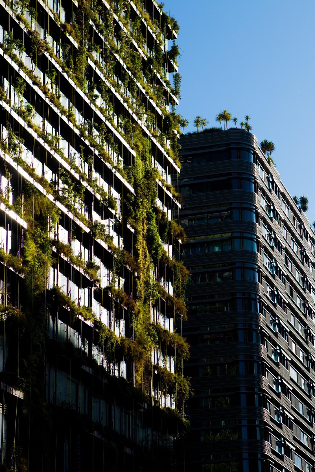
Vertical Urban Villages: Stacking Communities in High-Rise Districts
Vertical urban villages represent a revolutionary approach to high-density living by creating self-contained communities within towering structures. These three-dimensional neighborhoods stack residential, commercial, and public spaces to form complete ecosystems that reduce urban sprawl while maintaining human-scale interactions.
Multi-Level Public Spaces and Sky Gardens
Multi-level public spaces transform traditional high-rise design by incorporating community gathering areas at various building heights. You’ll find rooftop gardens, mid-level plazas, and elevated parks create social hubs that connect residents vertically throughout the structure. Sky gardens serve as neighborhood centers where children play while adults socialize, replicating ground-level community dynamics in three-dimensional space. These elevated green spaces also improve air quality and provide food production opportunities through urban farming initiatives.
Integrated Transportation Between Building Levels
Integrated transportation systems connect different floors and buildings through sky bridges, elevated walkways, and high-speed vertical transit. You can design express elevators that function like vertical subway systems, stopping at designated “station floors” that serve multiple residential levels. Moving walkways and escalators create seamless connections between buildings, allowing residents to travel horizontally without descending to street level. These systems reduce elevator congestion while enabling efficient movement throughout the vertical neighborhood complex.
Mixed-Income Housing in Vertical Neighborhoods
Mixed-income housing in vertical developments distributes affordable and market-rate units throughout different floors rather than segregating them by building or area. You can integrate various housing types from studio apartments to family units across multiple levels, creating economic diversity within the same structure. Community amenities like shared kitchens, childcare facilities, and co-working spaces serve all income levels equally. This vertical integration prevents the creation of isolated low-income floors while ensuring equitable access to building services and transportation connections.
Linear City Concepts: Building Along Transportation Corridors
Linear city designs maximize urban efficiency by organizing development along major transportation arteries. These concepts create continuous urban ribbons that prioritize connectivity while maintaining distinct community segments.
Transit-Oriented Development Along Rail Lines
Transit-oriented development along rail lines concentrates high-density mixed-use buildings within walking distance of stations. You’ll find residential towers, office complexes, and retail spaces clustered around transit hubs like those in Tokyo’s Yamanote Line corridor. These developments reduce car dependency by placing essential services within 400-800 meters of rail access points. Successful linear TOD projects feature pedestrian bridges connecting both sides of rail corridors, creating seamless community integration despite physical barriers.
Green Belts Separating Urban Segments
Green belts separating urban segments create natural boundaries between distinct neighborhoods along linear corridors. You’ll see these implemented as parks, urban forests, or agricultural zones that prevent continuous sprawl while providing recreational spaces. Cities like Copenhagen use green fingers extending from central corridors to maintain air quality and biodiversity. These buffer zones typically span 200-500 meters wide, offering cycling paths, stormwater management, and community gardens that enhance livability between dense development clusters.
Flexible Expansion Zones for Future Growth
Flexible expansion zones for future growth accommodate population increases without disrupting existing linear development patterns. You’ll design these areas as modular sections that can transform from low-density residential to mixed-use districts based on demographic needs. Smart zoning regulations allow building height increases and density bonuses when transit capacity expands. Pre-planned infrastructure corridors including utilities, roads, and green spaces enable rapid development while maintaining urban design consistency along the linear framework.
Hexagonal Cell Planning: Creating Efficient Geometric Urban Units
Hexagonal cell planning transforms urban layouts through geometric efficiency that maximizes connectivity while minimizing infrastructure redundancy. This cellular approach creates uniform districts that share boundaries optimally, reducing administrative overlap and resource waste.
Six-Sided Districts for Optimal Resource Distribution
Hexagonal districts maximize coverage while minimizing perimeter-to-area ratios, creating the most efficient service delivery zones possible. You’ll find that emergency services, utilities, and public transit can serve each cell with identical efficiency levels. Police stations positioned at hexagonal centers reach all district boundaries within equal response times. Fire departments benefit from uniform coverage patterns that eliminate service gaps between districts. Utility networks require 15% fewer distribution points compared to rectangular grid systems, reducing infrastructure costs significantly.
Interconnected Nodes for Seamless Movement
Six connection points per hexagon create natural transportation hubs that link directly to neighboring cells without redundant pathways. You can design transit systems that flow seamlessly between districts through these predetermined junction points. Bus routes follow hexagonal edges to serve maximum populations while maintaining consistent travel times. Pedestrian networks benefit from shorter walking distances to reach adjacent neighborhoods through shared boundary zones. Bicycle infrastructure connects all six neighboring cells through dedicated pathways that follow the geometric framework.
Modular Expansion Capabilities
Hexagonal cells expand outward in predictable patterns that maintain system integrity as cities grow organically. You can add new districts without disrupting existing infrastructure or service delivery networks. Growth patterns follow honeycomb principles where each new cell connects to three existing neighbors automatically. Infrastructure scaling becomes mathematically predictable as utilities and services expand proportionally with cell additions. Planning departments can model future expansion with precision since hexagonal growth follows consistent geometric rules that eliminate guesswork.
Polycentric Networks: Developing Multiple Urban Centers
Polycentric networks revolutionize traditional urban planning by creating interconnected centers that distribute economic activity across metropolitan regions. This approach transforms single-core cities into multi-nodal systems that enhance accessibility and reduce infrastructure strain.
Distributed Business Districts to Reduce Congestion
Distributed business districts scatter commercial hubs throughout metropolitan areas to prevent downtown bottlenecks that plague monocentric cities. You’ll create secondary business centers in suburban locations like Tysons Corner in Virginia or Century City in Los Angeles, each equipped with high-rise office buildings and mixed-use developments. These satellite districts reduce peak-hour traffic by 30-40% when properly connected through transit networks. Strategic placement near residential clusters ensures workers can access employment without traveling to congested downtown cores. Each district specializes in different industries—technology, finance, or healthcare—creating natural employment diversity that strengthens regional economic resilience.
Specialized Zones Connected by Rapid Transit
Specialized zones leverage rapid transit connections to create efficient networks where each center focuses on distinct economic functions. You’ll develop university districts, medical complexes, and innovation hubs that connect through high-frequency rail or bus rapid transit systems operating at 5-10 minute intervals. Cities like Copenhagen demonstrate this approach through their finger plan, where specialized centers extend along transit corridors like branches from a central trunk. Each zone maintains unique character—research parks feature low-density campuses while entertainment districts emphasize pedestrian-friendly streetscapes. Transit-oriented development within 800 meters of stations ensures seamless connectivity between specialized functions throughout the metropolitan network.
Balanced Development Across Metropolitan Areas
Balanced development distributes population density and economic opportunities equitably across metropolitan regions to prevent suburban sprawl and urban decay. You’ll establish development targets that maintain 15-20% employment-to-population ratios in each polycentric node, ensuring residents can live and work within the same district. Growth management strategies direct infrastructure investments toward designated centers rather than scattered development patterns. This approach requires coordinated regional planning that transcends municipal boundaries, as demonstrated in Portland’s urban growth boundary system. Balanced polycentrism creates self-sufficient communities that reduce cross-regional commuting while maintaining specialized economic functions that benefit from proximity to complementary districts.
Circular Economy Districts: Designing for Sustainable Resource Loops
Circular economy districts represent a paradigm shift in urban planning where waste becomes a valuable resource within closed-loop systems. These innovative neighborhoods create self-sustaining cycles that minimize environmental impact while maximizing resource efficiency.
Waste-to-Energy Integration in Neighborhood Planning
Waste-to-energy integration transforms neighborhood waste streams into localized power generation systems that fuel community infrastructure. Modern districts incorporate anaerobic digesters beneath residential blocks, converting organic waste into biogas that powers street lighting and heating systems. Districts like Copenhagen’s Amager Bakke demonstrate how waste incineration plants can double as recreational facilities, featuring ski slopes and climbing walls. These integrated systems reduce transportation costs by processing waste within 500 meters of generation points, creating energy independence while eliminating the need for distant landfills.
Local Food Production and Distribution Networks
Local food production networks embed agricultural systems directly into urban fabric through vertical farms, rooftop gardens, and community orchards that supply neighborhood markets. Districts incorporate hydroponic facilities within mixed-use buildings, producing fresh vegetables year-round while reducing transportation emissions by 85%. Urban farms connect through pedestrian corridors that double as food distribution pathways, linking production sites to local restaurants and grocery cooperatives. Food waste from these establishments cycles back to community composting facilities, creating nutrient-rich soil amendments that support continued agricultural production within the district.
Lower your hydroponic nutrient pH to the ideal range of 5.5-6.5 with General Hydroponics pH Down. This food-grade phosphoric acid formula promotes pH stability for optimal plant growth.

Water Recycling Systems Built Into Urban Design
Water recycling systems integrate naturally into district layouts through bioswales, constructed wetlands, and permeable surfaces that treat stormwater while creating recreational spaces. Greywater from residential buildings flows through terraced treatment gardens before returning to irrigation systems that maintain public landscaping. Districts incorporate rainwater harvesting infrastructure within architectural elements, using green roofs and decorative cisterns that collect and store precipitation for community use. These systems reduce municipal water demand by 40% while creating distinctive urban features that define neighborhood character and environmental identity.
Conclusion
These seven alternative urban planning map layouts offer you transformative approaches to creating more sustainable and livable cities. You’ll find that each concept addresses specific challenges in modern urban development while promoting environmental responsibility and community engagement.
By implementing these innovative designs you’re not just reshaping physical spaces – you’re creating opportunities for stronger neighborhoods and more efficient resource management. Whether you’re drawn to vertical villages or circular economy districts these layouts provide practical frameworks for future-ready urban development.
The key to successful implementation lies in adapting these concepts to your local context and community needs. You’ll discover that the most effective urban planning combines multiple approaches creating hybrid solutions that maximize both functionality and quality of life for residents.
Frequently Asked Questions
What are the main limitations of traditional urban planning maps?
Traditional urban planning maps are often outdated and fail to represent the complexities of modern cities effectively. They struggle with data visualization and stakeholder communication, making it difficult for community members to understand and engage with urban development projects. This leads to less inclusive planning discussions and reduced public support for development initiatives.
How do alternative map layouts improve urban planning?
Alternative map layouts enhance data visualization and make information more accessible and engaging for stakeholders. They improve communication between planners and communities, fostering better public engagement and support for urban development projects. These innovative approaches lead to more inclusive planning discussions and help communities better understand proposed changes.
What are radial city designs and how do they work?
Radial city designs create urban centers that spiral outward from a central point, establishing natural hierarchies of density and activity. This layout allows for organized development patterns where the highest density and most intense activities occur at the center, gradually decreasing as you move outward, creating efficient and logical urban growth patterns.
What is a hub-and-spoke transportation network?
A hub-and-spoke transportation network connects major transit terminals to suburban areas through efficient routing systems. Cities like Washington D.C. use this model to enhance transportation efficiency by centralizing major transit connections and distributing them outward to serve surrounding communities, reducing travel times and improving accessibility.
How does concentric zoning promote walkability?
Concentric zoning arranges mixed-use developments in rings around the urban core, placing residential, commercial, and office spaces within walking distance of each other. This design promotes walkability by reducing the need for long-distance travel and helps preserve neighborhood character while encouraging pedestrian-friendly development patterns.
What role do central green spaces play in urban design?
Central green spaces serve as community anchors and focal points that define a city’s identity. They guide development patterns around them and create natural gathering places for residents. Cities like Vienna demonstrate how these spaces impact surrounding districts by attracting quality development and enhancing neighborhood livability and property values.
What are grid-free organic layouts?
Grid-free organic layouts follow natural landscape contours instead of rigid geometric patterns. These designs harmonize with existing topography, working with hills, valleys, and natural features rather than against them. This approach creates more environmentally sensitive development that preserves natural beauty while accommodating urban growth needs.
How do curved street patterns enhance walkability?
Curved street patterns embrace elevation changes and natural topography, making walking more interesting and comfortable. Neighborhoods like San Francisco’s Russian Hill and Seattle’s Queen Anne demonstrate how curved streets can work with hills and slopes, creating more pleasant pedestrian experiences than straight streets that ignore natural terrain.
What are neighborhood clusters connected by pedestrian pathways?
Neighborhood clusters are distinct residential areas connected through dedicated walking and cycling paths rather than roads. This design emphasizes community interaction by creating safe, car-free connections between neighborhoods while preserving green corridors. It promotes walking and cycling while maintaining separate, identifiable community areas.
How do natural waterways enhance urban layouts?
Natural waterways serve as organizing elements in urban design, providing structure for development patterns while offering recreational opportunities and ecological benefits. Projects like Portland’s Tanner Springs Park show how integrating water features creates attractive focal points that enhance surrounding development and provide environmental benefits to urban areas.
What are vertical urban villages?
Vertical urban villages are high-density developments that stack residential, commercial, and public spaces within towering structures to create complete, self-contained communities. These developments reduce urban sprawl while maintaining human-scale interactions by incorporating all necessary amenities and services within a single vertical structure or complex of connected buildings.
What are multi-level public spaces in vertical developments?
Multi-level public spaces include rooftop gardens, elevated parks, and sky plazas that serve as social hubs within vertical urban villages. These spaces improve air quality, provide opportunities for urban farming, and create community gathering areas at different levels of high-rise developments, ensuring residents have access to outdoor spaces.
How do integrated transportation systems work in vertical neighborhoods?
Integrated transportation systems use sky bridges, express elevators, and internal transit networks to facilitate efficient movement throughout vertical neighborhoods. These systems connect different levels and buildings, allowing residents to access various amenities and services without leaving the development, creating seamless internal mobility.
What is mixed-income housing in vertical developments?
Mixed-income housing within vertical developments promotes economic diversity by including units for different income levels within the same structure or complex. This approach ensures equitable access to community amenities and prevents economic segregation, creating more socially inclusive communities with shared facilities and services.
What are linear city concepts?
Linear city concepts organize urban development along major transportation corridors, creating continuous urban ribbons that prioritize connectivity. This approach maintains distinct community segments while maximizing efficiency through organized development patterns that follow transportation infrastructure like highways, rail lines, or rapid transit systems.
What is transit-oriented development along rail lines?
Transit-oriented development concentrates high-density mixed-use buildings within walking distance of rail stations and transit stops. This approach reduces car dependency by ensuring residents can easily access public transportation for their daily needs, creating compact, walkable communities centered around transit infrastructure.
How do green belts separate urban segments?
Green belts are natural boundaries between different urban segments that enhance livability and biodiversity. They provide recreational space, preserve natural habitats, and create clear distinctions between different neighborhoods or districts while maintaining ecological corridors that support wildlife and environmental health.
What are flexible expansion zones in linear cities?
Flexible expansion zones are designated areas that can accommodate future growth without disrupting existing linear development patterns. These zones adapt to demographic needs and population increases, ensuring sustainable urban development while maintaining the integrity of the linear city’s organizational structure and transportation efficiency.
What is hexagonal cell planning?
Hexagonal cell planning uses geometric efficiency to create uniform urban districts that maximize connectivity while minimizing infrastructure redundancy. This approach organizes cities into hexagonal shapes that optimize resource distribution and allow emergency services and utilities to operate with identical efficiency levels across all districts.
How do interconnected nodes work in hexagonal planning?
Interconnected nodes within hexagonal districts create seamless movement and transportation networks. Bus routes and pedestrian pathways are designed to connect these nodes efficiently, enhancing accessibility throughout the hexagonal system and ensuring residents can easily move between different areas within and between hexagonal cells.
What is modular expansion in hexagonal cities?
Modular expansion allows hexagonal cities to grow organically by adding new hexagonal cells while maintaining system integrity. This approach enables predictable infrastructure scaling because each new hexagon follows the same geometric principles, making it easier to extend utilities, transportation, and services as the city expands.
What are polycentric networks in urban planning?
Polycentric networks create interconnected centers that distribute economic activity across metropolitan regions instead of concentrating everything in a single downtown core. This approach prevents congestion and creates multiple business districts throughout a metropolitan area, each serving different functions while remaining connected through transportation networks.
What are distributed business districts?
Distributed business districts scatter commercial hubs throughout metropolitan areas to reduce congestion in downtown cores. Examples like Tysons Corner in Virginia show how creating multiple business centers can distribute economic activity, reduce traffic to single locations, and provide employment opportunities closer to where people live.
How do specialized zones connected by rapid transit work?
Specialized zones focus on distinct economic functions like university districts, medical complexes, or technology centers, connected by rapid transit systems. This approach allows different areas to develop expertise in specific industries while maintaining connectivity, enabling workers and residents to easily access specialized services and employment throughout the region.
What is balanced development across metropolitan areas?
Balanced development ensures equitable distribution of population density and economic opportunities across metropolitan regions. This approach creates self-sufficient communities that reduce cross-regional commuting while maintaining specialized economic functions, preventing over-concentration in single areas and promoting regional economic stability.
What are circular economy districts?
Circular economy districts create self-sustaining cycles that minimize environmental impact while maximizing resource efficiency. These districts integrate waste-to-energy systems, local food production, and water recycling to create closed-loop systems where waste from one process becomes input for another, reducing environmental impact and resource consumption.
How does waste-to-energy integration work in urban districts?
Waste-to-energy integration transforms neighborhood waste streams into localized power generation systems. Copenhagen’s Amager Bakke exemplifies this concept by converting municipal waste into electricity and heating for surrounding neighborhoods, creating a closed-loop system that reduces landfill waste while providing clean energy.
What are local food production networks in urban areas?
Local food production networks embed agricultural systems into urban fabric through rooftop gardens, vertical farms, and community gardens. This reduces transportation emissions, creates fresh food access, and develops nutrient-rich soil through community composting, making neighborhoods more food-secure and environmentally sustainable.
How do water recycling systems integrate into district layouts?
Water recycling systems integrate into district layouts through gray water processing, rainwater harvesting, and local treatment facilities that significantly reduce municipal water demand. These systems enhance neighborhood character through water features while creating environmental identity and reducing strain on city-wide water infrastructure.