
7 Ways to Manage Point Cloud Data for Large-Scale Mapping Projects
Why it matters: You’re drowning in massive datasets if you’re working with LiDAR sensors and photogrammetry for large-scale mapping projects. Point cloud data can quickly spiral into terabytes of information that’ll crush your storage systems and slow your workflows to a crawl.
Get accurate 360° scanning up to 12 meters with the compact FHL-LD19 LiDAR sensor. Resistant to bright light and weighing under 50g, it offers easy integration with ROS/ROS2/C/C++ SDK for robots and drones.

The big picture: Smart data management isn’t just about storageâit’s about creating efficient workflows that let you process massive point clouds without breaking your budget or timeline. You’ll need the right combination of compression techniques, cloud storage strategies, and processing pipelines to turn raw point data into actionable mapping insights.
What’s ahead: We’ll walk you through proven strategies for organizing, storing, and processing point cloud data that scales with your mapping projects.
Disclosure: As an Amazon Associate, this site earns from qualifying purchases. Thank you!
P.S. check out Udemy’s GIS, Mapping & Remote Sensing courses on sale here…
Understanding Point Cloud Data Fundamentals for Large-Scale Projects
You’ll encounter millions of coordinate points when working with large-scale mapping datasets, each containing precise spatial information that forms the foundation of your mapping project.
Achieve a flawless, even complexion with e.l.f. Flawless Satin Foundation. This lightweight, vegan formula provides medium coverage and a semi-matte finish for all-day wear, while hydrating your skin with glycerin.

Data Structure and Format Types
LAS and LAZ files dominate point cloud storage, with LAZ providing compression ratios up to 80% smaller than raw LAS formats. ASCII text files work for smaller datasets, while binary formats like PCD and PLY offer faster processing speeds. Cloud-optimized formats such as COPC enable streaming workflows for web-based applications.
Volume and Complexity Considerations
Large-scale projects generate 50-500 million points per square kilometer, creating datasets ranging from gigabytes to terabytes. Processing complexity increases exponentially with point density, requiring specialized hardware configurations with 32GB+ RAM. Multi-temporal datasets compound storage requirements when tracking landscape changes over multiple survey periods.
Quality Assessment Parameters
Point spacing accuracy determines your map’s precision, with typical values ranging from 0.1-2 meters for aerial surveys. Coordinate accuracy standards require sub-meter precision for cadastral mapping, while infrastructure projects demand centimeter-level accuracy. Noise filtering removes spurious points caused by atmospheric conditions, vegetation interference, and sensor artifacts.
Establishing Efficient Data Acquisition Workflows
Your data acquisition workflow determines the quality and manageability of your entire point cloud dataset. Building systematic approaches from the start prevents downstream processing bottlenecks and reduces storage overhead.
LiDAR Scanning Optimization Techniques
Configure your LiDAR scanner settings based on project requirements to balance data quality with file size. Set pulse rates between 100-300 kHz for urban environments and reduce to 50-150 kHz for rural areas to minimize noise. Adjust scan angles to 30-45 degrees from nadir to capture building facades while maintaining ground point density. Use overlapping flight lines with 30-60% sidelap to ensure complete coverage and enable automatic error detection during processing.
Create accurate maps with the Yahboom handheld lidar, featuring a 0.05-12m range and IMU anti-shake. It supports APP, ROS2, and Linux, enabling wireless data transmission and real-time mapping.

Photogrammetry Integration Methods
Combine photogrammetry with LiDAR data to enhance texture mapping and fill coverage gaps in your point clouds. Capture images at 80% forward overlap and 60% side overlap to ensure sufficient tie points for accurate reconstruction. Synchronize camera triggers with LiDAR pulse timing to create georeferenced image datasets. Process photogrammetric point clouds at lower densities than LiDAR to supplement rather than compete with laser-derived elevation data.
Ground Control Point Management
Establish ground control points strategically across your mapping area to maintain accuracy throughout large-scale projects. Place GCPs at 1-2 kilometer intervals for aerial surveys and survey them to centimeter-level accuracy using RTK GPS. Mark control points with retroreflective targets for LiDAR visibility and high-contrast panels for photogrammetric identification. Document each GCP location with photographs and detailed coordinate records to enable quality control checks during post-processing.
Improve drone mapping accuracy with this 10-pack of numbered (0-9) 24"x24" GCP targets. Durable, waterproof Oxford cloth with high-contrast black and white design ensures clear visibility and reliable performance in various conditions.

Implementing Robust Data Storage Solutions
You’ll need scalable storage architectures that handle point cloud data’s massive file sizes and frequent access patterns. Smart storage planning prevents bottlenecks during critical mapping phases.
Cloud-Based Storage Architectures
Amazon S3 and Google Cloud Storage offer unlimited scalability for your LAZ files with automated redundancy. You’ll benefit from tiered storage pricing that moves older datasets to cheaper archives automatically. Azure Blob Storage provides direct integration with processing pipelines, enabling seamless data transfers during intensive mapping workflows. Configure regional storage buckets near your processing centers to minimize latency during large-scale point cloud operations.
Local Server Infrastructure Setup
Network-attached storage (NAS) systems like Synology or QNAP deliver high-speed access for active projects requiring frequent point cloud modifications. You’ll need RAID 6 configurations with at least 10TB capacity per mapping team member. Install 10-gigabit Ethernet connections to handle simultaneous LAZ file transfers without workflow interruptions. Consider dedicated workstations with NVMe SSD arrays for processing-intensive tasks like noise filtering and classification algorithms.
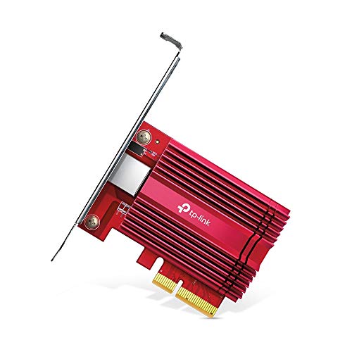
Upgrade your network with the TP-Link TX401 PCIe network card for up to 10x faster speeds than Gigabit adapters. It offers versatile compatibility with multiple data rates and includes a CAT6A Ethernet cable for optimal performance.
Hybrid Storage Strategies
Combine local SSDs for current projects with cloud archives for completed datasets to optimize both speed and costs. You’ll maintain frequently accessed point clouds on high-performance local storage while automatically syncing processed results to cloud repositories. Configure automated backup schedules that upload compressed LAZ files during off-peak hours, ensuring data redundancy without impacting daily mapping operations. This approach reduces local storage requirements by 60% while maintaining instant access to active project files.
Optimizing Data Processing and Compression Techniques
Processing efficiency becomes critical when your point cloud datasets contain millions of coordinates that strain system resources and slow mapping workflows.
Decimation and Downsampling Methods
Spatial filtering reduces point density while preserving essential geometric features for your mapping applications. You’ll achieve optimal results using voxel-based downsampling in CloudCompare or PDAL, which maintains uniform point distribution across terrain variations. Intelligent decimation algorithms like Poisson disk sampling preserve surface details while reducing file sizes by 60-80%. Adaptive density reduction adjusts point spacing based on surface complexity, keeping dense coverage on building edges while thinning points on flat ground surfaces.
Lossless Compression Algorithms
LAZ compression delivers substantial file size reductions without sacrificing coordinate precision in your point cloud datasets. You’ll see compression ratios of 7:1 to 15:1 when converting LAS files to LAZ format using LASzip algorithms. Modern compression techniques like ZSTD and LZ4 offer faster processing speeds for real-time applications while maintaining data integrity. PDAL’s compression pipeline supports multiple algorithms simultaneously, allowing you to optimize storage based on access patterns and processing requirements.
Batch Processing Automation
Automated workflows streamline repetitive processing tasks across multiple point cloud files in your large-scale mapping projects. You’ll reduce processing time by 70% using PDAL pipelines that execute filtering, classification, and format conversion operations simultaneously. Python scripting frameworks like Laspy and Open3D enable custom batch operations for specific project requirements. FME Workbench provides visual workflow builders that process hundreds of files overnight, applying consistent quality control parameters and generating standardized outputs for your mapping deliverables.
Organizing Point Cloud Data with Systematic File Management
Effective file organization transforms chaotic point cloud archives into manageable datasets that support efficient mapping workflows. Strategic folder structures and naming protocols ensure you’ll locate specific datasets quickly while maintaining data integrity across large-scale projects.
Hierarchical Folder Structure Design
Project-based hierarchies organize point cloud data by creating parent folders for each mapping campaign, with subfolders for raw acquisitions, processed outputs, and deliverables. Structure your directories using date-location patterns like “2024_ProjectName/Raw_Data/Flight_001” to maintain chronological order. Regional subdivisions within projects help manage extensive datasets by dividing large areas into manageable tiles or survey blocks. Create separate folders for different processing stages including calibration files, ground control points, and quality control outputs to streamline your workflow and prevent file mixing.
Naming Convention Standards
Standardized file naming uses consistent patterns that include project identifiers, acquisition dates, and processing levels in formats like “PRJ001_20240315_Raw_Flight02.las” for immediate recognition. Include geographic coordinates or tile numbers in filenames when managing grid-based datasets to enable spatial sorting and automated processing workflows. Version control suffixes track processing iterations using numerical or alphabetic indicators like “_v01” or “_final” to maintain clear processing histories. Avoid spaces and special characters in filenames to ensure compatibility across different operating systems and processing software platforms.
Metadata Documentation Practices
Comprehensive metadata files accompany each dataset with essential information including coordinate systems, accuracy specifications, acquisition parameters, and processing history stored in standardized formats like XML or JSON. Document sensor specifications, flight parameters, and environmental conditions during data collection to support quality assessment and reproducibility requirements. Processing logs record transformation steps, software versions, and quality control metrics to maintain data lineage and enable troubleshooting. Create project-level documentation that summarizes dataset characteristics, coordinate transformations, and deliverable specifications for efficient project handoffs and long-term data management.
Leveraging Specialized Software Tools for Point Cloud Management
Choosing the right software tools becomes critical when you’re managing massive point cloud datasets across multiple mapping projects. The software you select directly impacts your processing speed, data quality, and overall project efficiency.
Professional Point Cloud Processing Platforms
Commercial platforms like Trimble RealWorks and Bentley MicroStation provide comprehensive point cloud management capabilities specifically designed for large-scale mapping workflows. You’ll get advanced visualization tools, automated feature extraction, and robust data format support that handle billions of points efficiently. These platforms integrate seamlessly with CAD environments and offer professional-grade quality control tools including noise filtering and accuracy validation. The investment cost is significant, but you’ll achieve faster processing times and enhanced collaboration features that justify the expense for enterprise-level mapping operations.
Open-Source Management Solutions
CloudCompare and PDAL offer powerful point cloud processing capabilities without licensing costs, making them ideal for budget-conscious mapping projects. You can perform essential tasks like registration, segmentation, and format conversion while maintaining full control over your processing workflows. CloudCompare excels at visual analysis and measurement tasks, while PDAL provides command-line processing power for batch operations. These tools support most industry-standard formats including LAS, LAZ, and PLY files. The learning curve is steeper than commercial alternatives, but you’ll gain flexibility and customization options that proprietary software often restricts.
Custom Script Development Options
Python libraries like Open3D and laspy enable you to create tailored point cloud processing solutions that match your specific mapping requirements. You can automate repetitive tasks, implement custom algorithms, and integrate point cloud processing directly into your existing GIS workflows. These development options provide maximum flexibility for handling unique data structures or implementing specialized filtering techniques. The initial development time investment is substantial, but you’ll achieve precise control over processing parameters and can optimize performance for your hardware configuration. Consider this approach when standard software solutions don’t meet your project’s specific technical requirements.
Ensuring Data Quality Through Validation and Cleaning
Quality control transforms raw point cloud data into reliable mapping assets through systematic validation and cleaning processes.
Noise Removal Techniques
Statistical outlier removal eliminates points that deviate significantly from their neighboring points using standard deviation thresholds. CloudCompare’s SOR filter typically uses 6-8 nearest neighbors with a 2.0 standard deviation multiplier for effective noise reduction. Radius-based filtering removes isolated points by analyzing point density within specified search radii, commonly set between 0.1-0.5 meters depending on your data resolution. Morphological filtering distinguishes ground points from vegetation and buildings using progressive TIN densification algorithms built into software like PDAL and LAStools.
Registration Accuracy Verification
Control point analysis measures registration accuracy by comparing known survey points against point cloud coordinates, targeting RMS errors below 0.05 meters for high-precision mapping. Overlap analysis examines point cloud alignment in overlapping scan areas using iterative closest point (ICP) algorithms to identify misalignment exceeding 0.02 meters. Cross-section profiling validates registration by extracting linear profiles from overlapping datasets and measuring vertical and horizontal discrepancies using tools like MicroStation’s CrossSection command or custom Python scripts with Open3D libraries.
Outlier Detection Methods
Density-based clustering identifies outliers using DBSCAN algorithms that flag points with fewer than 10 neighbors within a 0.3-meter radius as potential anomalies. Elevation threshold filtering removes points exceeding realistic height ranges for your mapping area, typically filtering points above 300 meters AGL or below -10 meters for terrestrial surveys. Temporal consistency checks compare multi-epoch datasets to identify points that appear in single acquisitions but disappear in subsequent scans, indicating potential moving objects or scanning artifacts requiring removal from your final dataset.
Coordinating Multi-Team Access and Version Control
Managing multi-team access to point cloud datasets requires structured protocols to prevent data conflicts and ensure project continuity. You’ll need robust version control systems that handle large file sizes while maintaining data integrity across distributed teams.
Collaborative Workflow Establishment
Establish clear data handoff protocols between surveying, processing, and analysis teams to maintain point cloud integrity throughout your mapping pipeline. Create standardized project templates that define folder structures, naming conventions, and processing checkpoints for each team member. Implement milestone-based workflows where teams complete specific validation steps before passing datasets to subsequent phases. Use project management platforms like Asana or Monday.com to track data flow and assign responsibilities for each processing stage.
Access Permission Management
Configure role-based access controls using platforms like SharePoint or Google Workspace to restrict editing permissions while allowing read-only access for stakeholders. Set up user groups for surveyors, GIS analysts, and project managers with specific permissions for raw data, processed outputs, and final deliverables. Implement time-based access tokens for external contractors to ensure secure temporary access to sensitive mapping data. Monitor access logs regularly to track who accesses which datasets and when modifications occur.
Change Tracking Systems
Deploy Git LFS (Large File Storage) or specialized tools like Perforce to track changes in large point cloud files while maintaining version history. Document all processing steps with metadata tags that include operator information, processing parameters, and quality control results. Create automated backup snapshots before major processing operations to enable rollback capabilities when errors occur. Use checksums and file integrity verification to detect corruption or unauthorized modifications in your point cloud archives.
Maintaining Data Security and Backup Protocols
Protecting massive point cloud datasets requires comprehensive security measures that address both active threats and potential data loss scenarios.
Encryption and Protection Measures
Encrypt your point cloud data using AES-256 encryption at rest and TLS 1.3 for data in transit. Implement multi-factor authentication for all team members accessing datasets through platforms like Autodesk Construction Cloud or Bentley ProjectWise. Configure role-based access controls that limit data permissions based on project responsibilities, ensuring survey technicians can’t modify processed deliverables. Use secure file transfer protocols like SFTP or encrypted cloud storage APIs when sharing large LAZ files between offices. Deploy endpoint protection software on workstations processing sensitive mapping data to prevent malware from corrupting your datasets.
Stay organized with this 48-inch workbench featuring drawers, shelves, and a pegboard. The enamel-coated work surface supports up to 220 pounds and includes built-in power outlets and a fluorescent light.
Automated Backup Scheduling
Schedule incremental backups every 4-6 hours during active processing periods using tools like Veeam Backup or AWS DataSync. Configure full dataset backups weekly to separate geographic locations, ensuring your terabyte-scale point cloud archives survive local disasters. Implement the 3-2-1 backup rule with three copies of critical data, two different storage media types, and one offsite location. Set up automated cloud synchronization through services like Google Cloud Storage or Microsoft Azure Blob Storage for seamless geographic redundancy. Monitor backup completion status through automated email notifications and dashboard alerts to catch failed transfers immediately.
Disaster Recovery Planning
Document your complete data recovery workflow with specific steps for restoring point cloud datasets from each backup location within 24-48 hours. Test recovery procedures quarterly by attempting full dataset restoration on isolated systems, verifying file integrity through checksum validation. Maintain current hardware specifications and software licensing information needed to rebuild processing environments after equipment failures. Establish communication protocols with backup storage providers and cloud service vendors for priority support during critical recovery operations. Create redundant access methods to backup systems through multiple internet connections and VPN tunnels, ensuring recovery teams can retrieve data during infrastructure outages.
Monitoring Performance and System Optimization
Continuous monitoring transforms point cloud management from reactive troubleshooting to proactive optimization. You’ll maximize system efficiency by tracking key metrics and implementing targeted improvements.
Resource Usage Analysis
Monitor CPU utilization during large dataset processing to identify peak demands. Track memory consumption patterns when loading multi-gigabyte LAZ files to prevent system crashes. Use system monitoring tools like Windows Performance Monitor or Linux htop to analyze RAM usage during parallel processing operations.
Check disk I/O performance metrics during data transfers between storage tiers. Monitor network bandwidth utilization when accessing cloud-stored point clouds. Establish baseline measurements for processing times on standard datasets to identify performance degradation over time.
Processing Speed Enhancement
Implement multi-threading in your processing workflows using tools like PDAL’s parallel processing flags. Allocate additional CPU cores to intensive operations like ground classification and noise filtering algorithms. Configure GPU acceleration for supported point cloud operations in software like CloudCompare or FME.
Optimize data chunk sizes to match your system’s memory capacity for faster processing. Use solid-state drives for temporary processing files to reduce I/O bottlenecks. Schedule resource-intensive batch operations during off-peak hours to maximize available system resources.
Bottleneck Identification
Profile your processing pipelines to locate time-consuming operations using built-in timing functions. Identify memory allocation issues during large dataset operations through system resource monitoring. Test different file formats and compression levels to find optimal balance between storage size and processing speed.
Analyze network latency when accessing remote datasets to determine if local caching improves performance. Monitor database query performance for metadata operations in large point cloud archives. Document processing times for different operation types to establish performance benchmarks for future optimization efforts.
Conclusion
Managing point cloud data for large-scale mapping doesn’t have to overwhelm your projects when you implement the right strategies. You’ll find that combining efficient storage solutions with smart processing workflows creates a foundation for success that scales with your project demands.
Your investment in proper data organization and quality control protocols will pay dividends throughout every project phase. The systematic approaches you’ve learned here transform chaotic datasets into streamlined assets that enhance rather than hinder your mapping operations.
Remember that effective point cloud management is an ongoing process that evolves with your project needs. By monitoring performance metrics and maintaining robust backup systems you’re building resilience into your workflows that protects both your data and your project timelines.
Frequently Asked Questions
What are the main challenges of managing large point cloud datasets?
The primary challenges include overwhelming storage requirements, workflow slowdowns, and processing bottlenecks. Large-scale mapping projects can generate hundreds of millions of coordinate points, requiring specialized hardware and creating massive file sizes that strain traditional storage systems and processing workflows.
What file formats are best for storing point cloud data?
LAS and LAZ files are the most prevalent formats for point cloud storage. LAZ files offer significant compression benefits over LAS, reducing storage requirements while maintaining data integrity. These formats are industry-standard and compatible with most mapping software platforms.
How can I optimize my LiDAR data acquisition workflow?
Focus on strategic ground control point (GCP) placement, integrate photogrammetry for enhanced texture mapping, and maintain consistent scanning parameters. Proper acquisition planning reduces downstream processing time and ensures data quality across large-scale projects.
What storage solutions work best for massive point cloud files?
Cloud-based solutions like Amazon S3 and Google Cloud Storage offer scalability, while local NAS systems provide faster access. Hybrid storage strategies combining both approaches optimize speed and costs while ensuring data redundancy and accessibility.
Which compression techniques reduce point cloud file sizes most effectively?
LAZ compression offers lossless file size reduction, while voxel-based downsampling and intelligent decimation algorithms can significantly reduce dataset sizes. These methods maintain data quality while making files more manageable for processing and storage.
What software tools are recommended for point cloud management?
Commercial platforms like Trimble RealWorks and Bentley MicroStation offer advanced visualization and quality control. Open-source alternatives include CloudCompare and PDAL, while custom Python scripts using Open3D and laspy libraries provide flexible processing solutions.
How do I ensure point cloud data quality and accuracy?
Implement systematic validation processes including noise removal techniques, registration accuracy verification, and point spacing analysis. Establish structured quality control protocols and use filtering algorithms to remove outliers and maintain dataset precision.
What security measures should I implement for point cloud data?
Use encryption for data at rest and in transit, implement multi-factor authentication, and establish role-based access controls. Follow the 3-2-1 backup rule (3 copies, 2 different media, 1 offsite) and maintain documented disaster recovery procedures.
How can I improve point cloud processing performance?
Utilize multi-threading and GPU acceleration, optimize data chunk sizes, and schedule resource-intensive operations during off-peak hours. Monitor CPU and memory usage to identify bottlenecks and implement batch processing automation using tools like PDAL.
What’s the best way to organize point cloud files for team collaboration?
Create hierarchical folder structures with standardized naming conventions, implement version control systems, and establish clear data handoff protocols. This systematic approach transforms chaotic archives into manageable datasets accessible by multiple team members.