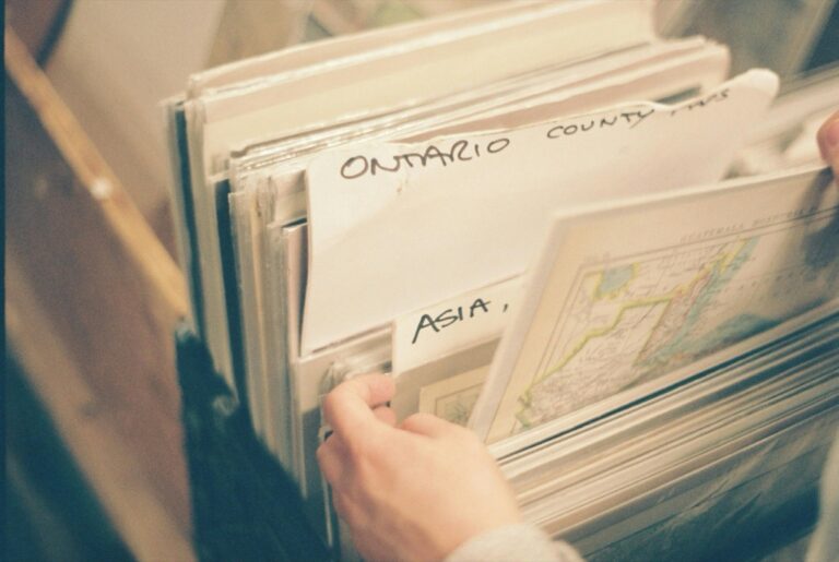
6 Best Map Archiving Solutions
Why it matters: Traditional map archives are reaching capacity limits while digital storage costs continue falling making alternative archiving solutions increasingly attractive for institutions and collectors.
The big picture: You’re no longer limited to dusty library basements or climate-controlled museum vaults when it comes to preserving historical cartographic materials.
What’s happening: Forward-thinking archivists are experimenting with everything from repurposed shipping containers to cloud-based virtual reality platforms to create accessible and cost-effective map storage solutions.
Disclosure: As an Amazon Associate, this site earns from qualifying purchases. Thank you!
P.S. check out Udemy’s GIS, Mapping & Remote Sensing courses on sale here…
Repurpose Community Centers as Neighborhood Map Repositories
Community centers offer ideal spaces for neighborhood map collections while serving their existing mission of local engagement and education.
Transform Meeting Rooms Into Interactive Map Displays
Mount historical neighborhood maps on lightweight foam boards that double as room dividers during events. Install LED strip lighting behind translucent map reproductions to create illuminated displays visible from multiple angles. Use rolling easels to showcase rotating collections of property surveys, zoning maps, and development plans. Create touch-friendly laminated overlays showing demographic changes over decades. Position QR codes next to each display linking to digital versions with zoom capabilities.
Lightweight yet rigid foam boards are perfect for crafts, displays, and school projects. The 3/16" thickness is easy to cut and handle.

Utilize Bulletin Boards for Historical Map Exhibitions
Share ideas and stay organized with this stylish 18" x 24" cork bulletin board. Its light birch wood frame complements any space, while the dense cork surface hides pin holes for lasting use.

Replace standard cork boards with magnetic whiteboard surfaces that accommodate map reproductions using heavy-duty magnets. Create themed monthly displays featuring insurance maps, transit route changes, or flood zone evolution. Install acrylic document holders below each map for explanatory text and source citations. Use colored pushpins to mark locations mentioned in community oral histories. Rotate displays quarterly to showcase different cartographic perspectives of neighborhood development patterns.
Create Map-Based Community Storytelling Events
Host monthly “Map Your Memory” sessions where residents mark significant locations on large-format neighborhood reproductions using removable stickers. Organize walking tours that begin with historical map review sessions in the center’s main room. Schedule intergenerational workshops pairing longtime residents with newcomers to annotate boundary changes on overlay sheets. Create collaborative timeline maps showing business openings, school construction, and transportation improvements across decades.
Get 525 removable labels for easy organization and updates. These 1/2" x 3/4" white labels stick securely to various surfaces and peel off cleanly, perfect for handwriting and relabeling.

Convert Abandoned Buildings Into Pop-Up Map Archives
Abandoned buildings offer unique opportunities for creating temporary map archive spaces that can reach new audiences. These unconventional venues transform forgotten structures into dynamic cartographic exhibition spaces.
Identify Suitable Vacant Structures for Temporary Installations
Scout warehouses, storefronts, and empty schools that provide adequate square footage for map displays. Look for buildings with sturdy walls, reliable electrical systems, and street-level accessibility for visitors. Industrial spaces with concrete floors work best since they can support heavy display cases and withstand foot traffic during exhibitions. Contact property management companies or city planning departments to identify available structures with short-term lease options. Check zoning regulations and obtain necessary permits before establishing temporary archive installations in vacant buildings.
Partner With Local Artists for Creative Map Presentations
Collaborate with muralists, photographers, and installation artists to transform historical maps into immersive visual experiences. Artists can create large-scale reproductions of rare maps using projection mapping techniques or hand-painted interpretations on building walls. Work with local art collectives to develop interactive map installations that encourage visitor participation through augmented reality apps or tactile exploration stations. Commission artists to design custom lighting systems that highlight specific cartographic features during evening events. These partnerships bring fresh perspectives to traditional map archiving while attracting diverse audiences to your temporary exhibitions.
Develop Mobile Archive Systems for Flexible Setups
Design modular storage units and portable display cases that can be quickly assembled in different abandoned building configurations. Use lightweight aluminum frames with secure locking mechanisms to protect valuable maps during transport between locations. Create wheeled cart systems that allow easy repositioning of archive materials based on available floor space and visitor flow patterns. Invest in portable climate control equipment to maintain proper temperature and humidity levels regardless of building conditions. Develop standardized setup procedures that enable your team to establish functional archive spaces within 24-48 hours of accessing a new vacant building.
Establish Map Collections in Coffee Shops and Cafes
Coffee shops naturally draw diverse crowds throughout the day, making them ideal venues for introducing map collections to unexpected audiences. You’ll find patrons spending extended periods in these spaces, creating perfect opportunities for casual map exploration.
Design Wall-Mounted Map Display Cases
Showcase your collectibles in this sleek, black BROTTAR display cabinet. It features 3-color LED lighting and a human body sensor for automatic illumination, plus four spacious shelves behind pop-up glass doors.

Wall-mounted display cases protect valuable maps while maintaining visibility in high-traffic areas. You should install lockable glass cases at eye level, using UV-filtering glass to prevent sun damage from windows. Position cases away from steam and heat sources, ensuring temperature stability. Create rotating displays by designing removable backing systems that allow you to swap maps monthly. Include small information cards explaining each map’s historical significance and geographic focus.
Showcase your items in this 71-inch display cabinet featuring four adjustable shelves and a locking tempered glass door. Built with a durable steel frame, it offers secure and stylish storage for your home or office.

Create Themed Map Corners for Different Geographic Regions
Themed corners transform unused cafe spaces into mini-geographic libraries that encourage exploration. You can designate specific seating areas for different regions – perhaps a “European Corner” featuring historical city plans or an “Adventure Zone” showcasing topographic hiking maps. Use lightweight, freestanding displays that won’t interfere with daily operations. Coordinate with cafe owners to match themes with their existing decor, creating cohesive environments that feel intentional rather than cluttered.
Explore the world's most breathtaking landscapes with this guide to 100 unforgettable scenic trails. Discover essential information for planning your next hiking adventure.

Integrate Digital Map Viewing Stations
Digital viewing stations expand your collection beyond physical space limitations while offering interactive experiences. You should set up tablet stations with high-resolution map scanning software, allowing patrons to zoom into fine details of historical cartographic works. Create simple interfaces with geographic search functions and timeline filters. Include charging stations and protective cases designed for public use. Partner with local GIS professionals to develop user-friendly navigation systems that don’t require technical mapping knowledge.
Transform Public Transportation Hubs Into Map Galleries
Public transportation hubs offer untapped potential for map archiving with their daily foot traffic of thousands of commuters. These high-visibility spaces can transform routine travel experiences into opportunities for cartographic discovery.
Install Map Archives in Subway Stations and Bus Terminals
Mount transit-appropriate display cases along platform walls using tamper-resistant materials and anti-glare glass. You’ll need weatherproof enclosures that withstand humidity fluctuations and heavy foot traffic. Position historical transportation maps at eye level near seating areas where commuters naturally gather while waiting. Rotate monthly collections featuring neighborhood development maps, vintage transit routes, and urban planning documents that connect directly to each station’s local history and geographic significance.
Develop Commuter-Friendly Map Browsing Experiences
Design quick-scan information panels with QR codes linking to detailed digital map collections accessible on mobile devices. You can create 5-minute discovery zones featuring large-format maps with highlighted points of interest relevant to commuters’ daily routes. Install interactive touchscreen kiosks that allow users to explore layered historical maps while waiting for trains. Provide multilingual signage and audio guides that accommodate diverse urban populations and enhance map accessibility during brief transit stops.
Create Transit-Themed Historical Map Collections
Curate transportation evolution displays showing how subway lines, bus routes, and street networks developed across different decades. You’ll want to feature vintage transit maps alongside modern route planning tools to demonstrate urban growth patterns. Showcase neighborhood transformation maps that highlight how public transportation shaped residential and commercial development. Include interactive timeline displays that connect specific transit milestones to broader city planning initiatives, helping commuters understand their role in ongoing urban geographic stories.
Utilize Parks and Outdoor Spaces for Map Preservation
Parks and recreational areas offer unique opportunities for creating accessible map archives that serve both preservation and education purposes. These natural settings provide ample space for innovative display systems while connecting historical cartography to the landscapes they represent.
Build Weather-Resistant Map Display Structures
Weather-resistant display cases transform parks into permanent map exhibition spaces using marine-grade aluminum frames and tempered glass panels. Install cedar or composite lumber kiosks with UV-resistant acrylic covers to protect historical maps from moisture and sun damage. Position structures along popular walking paths or near park entrances where visitors naturally gather. Include drainage systems beneath ground-mounted displays and use weatherproof LED lighting for evening visibility.
Establish Trail-Based Map Archive Networks
Trail networks create natural pathways for distributing map collections across multiple outdoor locations using interconnected display stations. Install waypoint markers every quarter-mile featuring regional historical maps relevant to specific trail segments or geographic features. Connect different parks through coordinated map themes like “Colonial Trade Routes” or “Native American Territories.” Design hiking apps that guide visitors between archive locations while providing GPS coordinates for each map installation point.
Create Geocaching-Style Map Discovery Programs
Geocaching techniques encourage active exploration of outdoor map archives through treasure-hunt style activities using GPS coordinates and hidden map replicas. Hide weatherproof containers containing laminated historical maps at specific coordinates throughout park systems. Create digital clues referencing cartographic features like elevation markers or historical landmarks shown on archived maps. Develop mobile apps that track participant progress and unlock additional map collections as users discover more locations.
Integrate Map Archives Into Retail and Commercial Spaces
Commercial environments offer unique opportunities for map preservation while creating unexpected discovery moments for shoppers. You’ll find that retail spaces naturally attract diverse audiences who might never visit traditional archives.
Partner With Bookstores for Map Collection Corners
Bookstores provide ideal partnerships for map archive integration due to their literary atmosphere and curious clientele. You can establish dedicated corner displays featuring regional historical maps alongside travel guides and atlases. Many independent bookstores welcome educational partnerships that enhance their community presence. Design rotating monthly exhibitions focusing on local geography, maritime charts, or historical boundary changes. Install wall-mounted viewing tables with magnifying equipment to accommodate detailed map examination. Consider hosting monthly “Maps & Coffee” events where collectors share stories about their favorite cartographic discoveries.
Establish Map Archives in Shopping Centers
Shopping centers offer high-traffic locations perfect for introducing map collections to mainstream audiences. You can negotiate display space near food courts or main corridors where families naturally gather and pause. Create interactive map stations with touchscreen capabilities allowing visitors to explore historical changes in their neighborhoods. Design child-friendly map activities featuring treasure hunts and geographic puzzles to engage younger audiences. Install climate-controlled display cases showcasing rare regional maps alongside modern satellite imagery comparisons. Partner with mall management to incorporate map-themed seasonal decorations and educational programming during school holidays.
Create Pop-Up Map Exhibitions in Market Spaces
Farmers markets and craft fairs provide dynamic venues for temporary map archive showcases reaching community-minded audiences. You can set up portable display systems featuring local agricultural history maps and land-use evolution charts. Design interactive booths where visitors trace family migration patterns or identify historical landmarks on vintage city plans. Create map-making workshops using market themes like “Plot Your Garden” or “Navigate Local Food Sources.” Establish partnerships with local historical societies to provide authentic regional maps and expert storytellers. Use weather-resistant display materials and secure transportation systems for easy setup across multiple market locations throughout your region.
Conclusion
Your map collection doesn’t have to remain locked away in traditional storage spaces. These six innovative archiving approaches open up exciting possibilities for making historical cartography more accessible to diverse audiences while addressing the growing storage crisis facing institutions worldwide.
Whether you’re transforming community centers into neighborhood repositories or creating weather-resistant outdoor displays, each strategy offers unique benefits for both preservers and discoverers of maps. The key lies in matching your specific collection needs with the right non-traditional space.
Start small by testing one approach that resonates with your community’s interests and resources. You’ll likely discover that these alternative archiving methods not only solve storage challenges but also breathe new life into historical maps by connecting them with people in unexpected and meaningful ways.
Frequently Asked Questions
What are the main challenges facing traditional map archives today?
Traditional map archives are facing critical capacity limits, with many institutions running out of space in conventional storage areas like library basements and museum vaults. These limitations have forced archivists to seek innovative alternatives for preserving historical cartographic materials while maintaining accessibility for researchers and the public.
How has digital storage technology impacted map preservation?
The decreasing costs of digital storage have revolutionized map preservation by making high-quality digitization more affordable and accessible. Institutions can now create digital backups of fragile historical maps, utilize cloud-based platforms, and even develop virtual reality experiences that allow people to explore maps without handling original documents.
What are some creative storage solutions for map archives?
Innovative archivists are exploring various creative alternatives including repurposed shipping containers for climate-controlled storage, cloud-based virtual reality platforms for digital access, and mobile archive systems that can be quickly assembled in different locations. These solutions offer cost-effective and flexible approaches to traditional storage challenges.
How can community centers be used for map preservation?
Community centers can be transformed into neighborhood map repositories by converting meeting rooms into interactive displays using lightweight foam boards and LED lighting. Bulletin boards can showcase historical map exhibitions with themed monthly displays, while community storytelling events like “Map Your Memory” sessions foster local engagement and preserve community history.
What role can abandoned buildings play in map archiving?
Abandoned buildings can be converted into pop-up map archives to reach new audiences and attract diverse visitors. Warehouses and storefronts can serve as temporary installations, partnering with local artists to create immersive map presentations. This approach brings fresh perspectives to traditional archiving while revitalizing unused urban spaces.
How can coffee shops and cafes contribute to map preservation?
Coffee shops and cafes can establish map collections by installing wall-mounted display cases that protect valuable maps while maintaining visibility. They can create themed geographic corners and integrate digital viewing stations with touchscreen interfaces, allowing patrons to casually explore high-resolution maps and detailed historical information during their visits.
What opportunities exist in public transportation hubs?
Transportation hubs like subway stations and bus terminals offer excellent opportunities due to high daily foot traffic. Weather-resistant display cases and interactive touchscreen kiosks can showcase transit-themed historical maps, helping commuters connect with their city’s geographic evolution through quick-scan information panels and QR codes.
How can outdoor spaces be utilized for map archives?
Parks and outdoor spaces can feature weather-resistant display structures made from marine-grade aluminum and tempered glass. Trail-based map archive networks with interconnected stations and waypoint markers can showcase regional historical maps, while geocaching-style discovery programs encourage active exploration through GPS-guided treasure hunts.
What retail opportunities exist for map preservation?
Retail spaces offer unique preservation opportunities through partnerships with bookstores for dedicated map collection corners, interactive stations in shopping centers, and child-friendly activities for families. Pop-up exhibitions at farmers markets and craft fairs can connect visitors with local history through portable displays and hands-on cartographic experiences.
How do mobile archive systems work?
Mobile archive systems feature flexible setups that allow for quick assembly and repositioning of display materials across various locations. These systems use lightweight, portable components that can be easily transported and configured in different spaces, making map collections more accessible to diverse audiences and communities.