6 Best Mapping Techniques for Urban Data
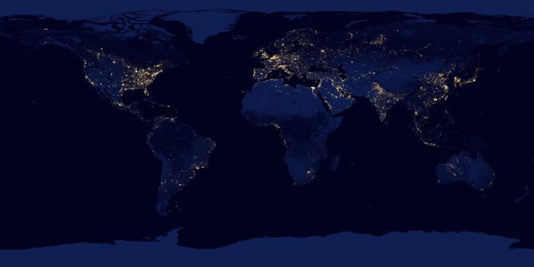
Cities pulse with invisible forces that shape your daily experience—from WiFi signals bouncing between buildings to air currents carrying pollution through neighborhoods. You walk through electromagnetic fields, sound waves, and data streams without seeing the complex layers of information surrounding you. The challenge: Making these hidden urban phenomena visible through innovative mapping techniques that reveal the true nature of modern city life.
Disclosure: As an Amazon Associate, this site earns from qualifying purchases. Thank you!
Mapping Air Quality and Pollution Patterns Through Sensor Networks
Air quality mapping transforms invisible atmospheric conditions into actionable urban data. You’ll need distributed sensor networks and strategic data collection methods to capture pollution patterns that traditional monitoring stations miss.
Installing Community-Based Air Monitoring Systems
Community-based monitoring networks expand your data coverage beyond government stations through citizen participation. Deploy low-cost sensors like PurpleAir or Clarity devices across neighborhoods to capture hyperlocal pollution variations. Position sensors at consistent heights (8-12 feet) on utility poles or building exteriors, ensuring adequate power sources and cellular connectivity. These networks generate granular data sets that reveal pollution disparities between different urban zones and community areas.
P.S. check out Udemy’s GIS, Mapping & Remote Sensing courses on sale here…
Protect your health with this smart indoor air quality monitor. It continuously tracks radon, PM2.5, CO2, VOCs, humidity, temperature, and air pressure, providing real-time data and notifications via the free Airthings app.

Using Mobile Sensor Platforms for Real-Time Data Collection
Mobile platforms create dynamic pollution maps by collecting continuous measurements along transit routes. Mount calibrated sensors on vehicles, bicycles, or public transportation to gather spatially distributed readings across your study area. GPS-enabled devices like the AirBeam or custom Arduino setups record coordinates with corresponding air quality measurements every few seconds. This approach captures pollution gradients around traffic corridors, industrial zones, and construction sites that stationary monitors can’t detect.
Track your valuables in real-time with this mini GPS tracker, using Apple's Find My network without monthly fees. Its compact, magnetic, and waterproof design easily attaches to vehicles and other assets.

Visualizing Pollution Hotspots and Temporal Variations
Pollution visualization requires interpolation techniques and temporal analysis to show concentration patterns over space and time. Use kriging or inverse distance weighting in GIS software to create continuous surfaces from point measurements, highlighting hotspots and clean air zones. Generate animated heat maps showing diurnal cycles, weekday patterns, and seasonal trends using tools like ArcGIS Pro or QGIS with time-enabled layers. Color-coded contour maps and 3D visualizations help stakeholders understand pollution distribution and identify areas needing intervention.
Tracking Digital Infrastructure and Connectivity Gaps
Digital connectivity forms the backbone of modern urban life, yet its distribution remains largely invisible to city planners and residents alike. Mapping these hidden networks reveals critical infrastructure gaps that impact economic opportunity and social equity.
Identifying Wi-Fi Dead Zones and Internet Access Disparities
Survey public Wi-Fi coverage using wardriving techniques with GPS-enabled devices to create comprehensive access maps. Deploy smartphone apps like WiFi Analyzer or NetSpot to systematically document signal strength across urban areas. Record access points including SSIDs, encryption status, and connection reliability to identify neighborhoods with limited free internet options. Document broadband availability through ISP service maps and speed test data from platforms like Ookla’s Speedtest Intelligence. Map household connectivity using census data combined with FCC broadband deployment reports to reveal areas where residents lack reliable internet access for work, education, and essential services.
Mapping Cell Tower Coverage and Signal Strength Variations
Collect cellular signal data using field strength meters or smartphone apps like Network Cell Info Lite to measure reception quality across different carriers. Document tower locations through FCC antenna structure registration databases and combine with field measurements to create coverage prediction models. Record signal variations by elevation, building density, and topographic features that create cellular shadows in urban canyons. Test data speeds at various locations using standardized protocols to map actual performance versus advertised coverage areas. Identify dead zones where emergency communications fail, particularly in basements, subway systems, and areas between tower coverage patterns that affect public safety response capabilities.
Experience vivid content on the Galaxy A16 5G's 6.7" display and capture stunning photos with its triple-lens camera. Enjoy peace of mind with a durable design, six years of updates, and Super Fast Charging.

Documenting Digital Divide Patterns Across Neighborhoods
Analyze demographic correlations between internet access rates and income, education, and age distribution using American Community Survey data layered with broadband availability maps. Map institutional access points including libraries, community centers, and schools that serve as digital equity anchors for underserved populations. Document device ownership patterns through survey data to identify areas where residents lack computers or smartphones necessary for digital participation. Track digital literacy resources including training programs and tech support services to understand capacity-building infrastructure. Visualize affordability barriers by comparing local internet pricing with median household income to reveal neighborhoods where connectivity costs exceed reasonable budget allocations for essential services.
This HP 14" laptop is designed for portability and productivity. It features an Intel Celeron N4020 processor, 4GB RAM, 64GB storage, and a micro-edge HD display for immersive visuals.

Documenting Sound Environments and Noise Pollution Distribution
Urban acoustic environments create invisible layers of stress and comfort that dramatically affect quality of life. Sound mapping reveals these hidden patterns through systematic measurement and visualization techniques.
Creating Acoustic Maps of Urban Soundscapes
Acoustic mapping transforms sound measurements into visual representations that reveal noise patterns across neighborhoods. You’ll need calibrated sound level meters positioned at strategic locations throughout your study area, collecting decibel readings at regular intervals. Deploy sensors during different time periods to capture rush hour traffic, evening activities, and weekend variations. GIS software like ArcGIS or QGIS processes your data using interpolation methods to create continuous noise contour maps. These visualizations identify areas exceeding WHO noise guidelines and help urban planners understand acoustic environments.
Measure noise levels accurately with the TestHelper SW-525A sound level meter. Features a large, red LCD display and alarm function for easy monitoring.

Measuring Traffic Noise Impact on Residential Areas
Traffic noise measurements require systematic data collection along residential streets and near major transportation corridors. Position sound meters at property lines facing roadways, collecting 15-minute samples during peak traffic hours. Record vehicle counts simultaneously to correlate noise levels with traffic density. Use specialized equipment like SVAN sound analyzers that capture frequency spectrum data, not just overall decibel levels. Map results using graduated colors showing noise exposure zones, typically ranging from 45-75 dB. This approach identifies homes experiencing chronic noise pollution above 55 dB during daytime hours.
The Nobsound AK2515 Pro provides accurate audio analysis with its high-resolution VFD display. Featuring versatile connectivity and advanced AGC, it captures nuanced sound and offers customizable display modes for optimal visual effects.

Identifying Quiet Spaces and Sound Sanctuaries
Quiet space mapping locates urban areas where ambient noise levels drop below 50 decibels during daytime hours. Survey parks, courtyards, and pedestrian zones using handheld sound meters during multiple visits across different weather conditions. Document natural sound masking from water features, vegetation, and architectural barriers that create acoustic refuges. Create maps highlighting these sanctuaries using green color schemes that contrast with high-noise areas. Include accessibility information and visiting hours to help residents locate peaceful spaces for recreation and mental health benefits within dense urban environments.
Visualizing Social Networks and Community Interaction Patterns
Social networks create invisible webs of connection throughout urban environments that traditional mapping often overlooks. You can reveal these hidden patterns through systematic data collection and innovative visualization techniques.
Mapping Pedestrian Flow and Gathering Spaces
Pedestrian flow analysis transforms foot traffic into visual patterns that reveal community social hubs. You’ll deploy time-lapse photography, GPS tracking apps, and manual counting stations to capture movement data across multiple time periods. Heat maps generated from this data identify natural congregation points like street corners, plazas, and transit stops where social interactions cluster. Mobile tracking through anonymized smartphone data provides large-scale movement patterns while preserving individual privacy.
Tracking Social Media Check-ins and Digital Footprints
Social media geolocation data creates real-time maps of community engagement and cultural activity. You can aggregate check-ins from platforms like Instagram, Twitter, and Foursquare to visualize where people actively share their urban experiences. API tools extract location tags and sentiment data to identify trending neighborhoods and event hotspots. Temporal analysis reveals daily rhythms of social activity, showing how digital footprints shift between business districts during work hours and entertainment zones during evenings.
Analyzing Public Space Usage and Social Connectivity
Public space utilization mapping connects physical infrastructure to social behavior patterns through observational data collection. You’ll document how different demographic groups use parks, benches, and community spaces throughout various seasons and times. Social network analysis software maps relationships between frequent users, revealing informal communities that form around specific locations. Activity mapping correlates usage intensity with design features, helping identify which spatial elements encourage or inhibit social interaction.
Measuring Heat Islands and Microclimate Variations
Temperature variations create invisible thermal landscapes that dramatically affect urban comfort and energy consumption. You’ll discover significant temperature differences across neighborhoods that traditional weather stations miss entirely.
Using Thermal Imaging to Identify Temperature Disparities
Thermal cameras reveal temperature differences of 10-15°F between adjacent city blocks during peak summer conditions. You can use handheld FLIR devices or drone-mounted thermal sensors to capture surface temperature data across different materials like asphalt, concrete, and vegetation. Professional-grade thermal imaging creates detailed heat maps showing how building materials, pavement types, and urban design choices create distinct thermal signatures that affect pedestrian comfort and energy costs.
Documenting Seasonal Climate Patterns in Different Zones
Microclimate monitoring stations placed throughout your study area capture seasonal temperature swings that vary dramatically between urban zones. You’ll find that dense commercial districts maintain higher nighttime temperatures year-round while residential areas with mature trees show greater seasonal fluctuation. Data loggers positioned at different elevations and surface types reveal how winter snow retention, summer heat absorption, and seasonal wind patterns create distinct climate fingerprints across neighborhoods.
Mapping Green Space Impact on Local Temperature Regulation
Parks and tree-lined streets reduce surrounding air temperatures by 2-8°F during summer months through evapotranspiration and shade effects. You can measure this cooling influence by positioning temperature sensors at varying distances from green infrastructure elements like community gardens, street trees, and pocket parks. Vegetation density correlates directly with cooling effectiveness, with mature tree canopies providing the strongest temperature regulation compared to grass lawns or newly planted landscaping.
Capturing Electromagnetic Fields and Radio Wave Distribution
Urban environments pulse with invisible electromagnetic energy from countless sources, creating complex interference patterns that affect everything from emergency communications to smart city infrastructure. Mapping these radio frequency landscapes reveals critical information about signal coverage gaps and electromagnetic pollution that city planners rarely consider.
Surveying Radio Frequency Emissions Across Urban Areas
Radio frequency surveys reveal the electromagnetic signatures of modern cities through systematic spectrum analysis. You’ll need a portable RF spectrum analyzer capable of scanning 10 MHz to 6 GHz to capture cellular, WiFi, and broadcast emissions across different neighborhoods. Document signal strength measurements at 100-meter intervals using GPS coordinates to create comprehensive RF heat maps. Industrial areas typically show 20-30 dB higher background RF levels compared to residential zones, while dense commercial districts exhibit complex multi-frequency interference patterns that can disrupt sensitive equipment.
Mapping Cellular and Broadcast Signal Coverage
Signal strength mapping transforms invisible cellular and broadcast coverage into actionable data for urban connectivity planning. Use drive-testing equipment or specialized smartphone apps to measure received signal strength indicator (RSSI) values across your target area. Record measurements every 50 meters along major corridors and document dead zones where signals drop below -85 dBm for cellular or -70 dBm for WiFi. Building materials and topography create signal shadows that extend 200-500 meters beyond tall structures, while underground areas often lose 15-25 dB of signal strength compared to street level.
Identifying Electromagnetic Interference Patterns
Interference pattern analysis uncovers how competing radio sources create electromagnetic dead zones and signal conflicts in urban environments. Deploy wideband EMI detectors to identify spurious emissions from LED lighting, industrial equipment, and transportation systems that disrupt legitimate communications. Map interference sources by triangulating signal peaks from multiple measurement points, focusing on frequencies between 2.4-5.8 GHz where WiFi and Bluetooth compete for spectrum space. Emergency services experience communication failures in areas where ambient EMI exceeds -95 dBm, particularly near hospital districts with multiple medical devices operating simultaneously.
Conclusion
These six mapping approaches transform your understanding of urban environments by revealing the hidden forces that shape daily city life. You’ll discover that invisible phenomena like air quality electromagnetic fields and social patterns create complex layers of information that traditional city planning often overlooks.
By implementing these mapping techniques you’re not just collecting data—you’re creating actionable insights that can improve public health digital equity and community well-being. Each method provides unique perspectives that help you make informed decisions about where to live work and spend time in urban spaces.
The power of visualizing invisible urban phenomena lies in its ability to democratize access to environmental and social information. You now have the tools to advocate for better air quality demand improved digital infrastructure and identify the quietest corners of your neighborhood for restoration and reflection.
Frequently Asked Questions
What are the invisible urban elements that affect daily city life?
Cities contain numerous unseen elements that significantly impact residents, including WiFi signals, air currents, electromagnetic fields, noise patterns, heat islands, and social interaction networks. These hidden phenomena shape everything from air quality and digital connectivity to community dynamics and thermal comfort, yet remain largely invisible to both city planners and residents.
How do air quality mapping systems work in urban environments?
Air quality mapping uses distributed sensor networks with low-cost monitors to capture hyperlocal pollution variations across neighborhoods. These community-based systems collect real-time data from multiple locations, expanding coverage beyond traditional government stations. Mobile sensor platforms and visualization techniques like kriging create comprehensive pollution maps showing concentration patterns over time and space.
What techniques are used to map digital connectivity in cities?
Digital connectivity mapping employs wardriving, smartphone apps, and systematic surveys to document WiFi coverage and cellular signal strength. These methods identify neighborhoods with limited internet access, cellular dead zones, and digital divides. The data reveals disparities in connectivity based on income, education, and geographic location, helping address digital equity issues.
How is urban noise pollution measured and visualized?
Sound mapping uses calibrated sound level meters and GIS software to create acoustic maps showing noise patterns across neighborhoods. Systematic data collection correlates noise levels with traffic density and identifies quiet spaces or sound sanctuaries. These visualizations help urban planners understand acoustic environments’ impact on quality of life and mental health.
What methods reveal social interaction patterns in cities?
Social network mapping combines pedestrian flow analysis, social media check-ins, and observational data collection. Time-lapse photography, GPS tracking apps, and manual counting stations create heat maps identifying congregation points and community hubs. Geolocation data from digital footprints reveals real-time community engagement and cultural activity patterns.
How do heat islands and microclimates vary across urban areas?
Thermal imaging reveals temperature differences of 10-15°F between adjacent city blocks, creating distinct microclimates. Monitoring stations document seasonal patterns and temperature variations between urban zones. Green spaces like parks and tree-lined streets can reduce surrounding temperatures by 2-8°F during summer months, significantly affecting urban comfort and energy consumption.
What role do electromagnetic fields play in urban environments?
Urban electromagnetic mapping uses portable RF spectrum analyzers to survey radio frequency emissions and create comprehensive heat maps. This reveals signal coverage gaps, electromagnetic pollution sources, and interference patterns that disrupt communications. Systematic analysis identifies dead zones and competing radio sources that create communication failures in modern cities.
Why is mapping invisible urban elements important for city planning?
Mapping invisible elements transforms hidden phenomena into actionable urban data, enabling evidence-based decision-making. These comprehensive maps help stakeholders identify areas requiring intervention, address environmental and social challenges, and improve quality of life. Understanding these complex layers of information is essential for creating more livable, equitable, and sustainable urban environments.