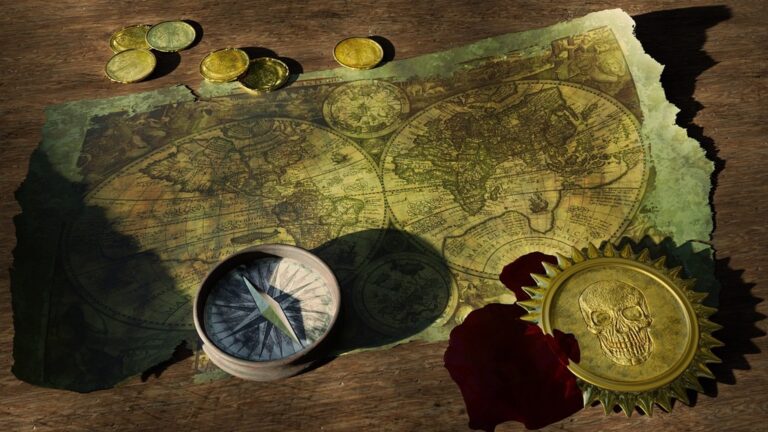
6 Stages in the Evolution of Cartographic Symbols Lost to Modern Maps
Maps haven’t always looked the way they do today. The symbols you see on modern maps — from highways to hospitals — evolved through six distinct stages that transformed how we navigate and understand our world.
This evolution spans thousands of years and reflects humanity’s changing relationship with geography and technology. Understanding these stages reveals why certain symbols became universal and how mapmakers solved the challenge of representing complex three-dimensional spaces on flat surfaces.
Disclosure: As an Amazon Associate, this site earns from qualifying purchases. Thank you!
Stage 1: Prehistoric Cave Paintings and Early Symbolic Representations
Your journey through cartographic evolution begins in prehistoric caves, where early humans first attempted to represent spatial relationships through symbolic marks. These primitive representations laid the foundation for modern mapping conventions you recognize today.
Simple Geometric Shapes for Landscape Features
Cave artists used basic geometric forms to depict essential landscape elements that guided their communities through territory. You’ll find circles representing water sources, wavy lines indicating rivers, and triangular shapes marking mountain peaks in sites like Lascaux and Altamira. These fundamental shapes became the building blocks for topographic symbols you still use today. Early mapmakers discovered that simplified geometric representations could convey complex terrain features more effectively than realistic drawings. Your modern mapping software continues this tradition by converting complex elevation data into standardized symbols that communicate landscape information at a glance.
Animal and Human Figures as Directional Markers
Prehistoric artists positioned animal and human figures strategically within cave paintings to indicate movement patterns and directional guidance. You can observe how these figures point toward water sources, hunting grounds, or safe passages through dangerous terrain. Cave paintings in places like Chauvet show animals oriented in specific directions that correspond to actual migration routes. Early humans understood that directional symbols needed to be immediately recognizable to community members navigating unfamiliar territory. Your contemporary wayfinding systems echo this approach by using intuitive figures and arrows that provide instant directional clarity without requiring extensive interpretation.
Stage 2: Ancient Civilizations and Hieroglyphic Map Symbols
Ancient civilizations transformed simple cave paintings into sophisticated symbolic systems that combined written language with geographical representation. You’ll discover how Egyptian hieroglyphs and Mesopotamian cuneiform created the foundation for standardized map symbols that conveyed complex spatial information across vast empires.
Egyptian Cartographic Hieroglyphs for Geographical Features
Egyptian mapmakers developed standardized hieroglyphic symbols that represented specific landscape features with remarkable precision. You’ll find wavy horizontal lines depicting the Nile River, mountain symbols showing elevated terrain, and house-shaped glyphs marking settlements along trade routes. These symbols appeared on papyrus maps dating to 1150 BCE, including the famous Turin Papyrus that detailed gold mining locations. The Egyptians combined pictographic elements with phonetic sounds, creating symbols that conveyed both visual and linguistic information about geographical features.
Mesopotamian Cuneiform Symbols on Clay Tablet Maps
Mesopotamian cartographers pressed cuneiform wedge-shaped marks into clay tablets to create detailed maps of cities, waterways, and agricultural regions. You’ll notice these symbols used triangular and linear patterns to represent mountains, rivers, and property boundaries with mathematical precision. The Babylonian World Map from 600 BCE demonstrates how cuneiform symbols depicted the Euphrates River and surrounding lands using standardized marks. These durable clay maps survived thousands of years, preserving evidence of systematic approaches to representing terrain, urban planning, and territorial boundaries across ancient Mesopotamia.
Stage 3: Classical Greek and Roman Standardized Cartographic Conventions
Greek and Roman cartographers revolutionized map-making by establishing systematic approaches to symbol standardization. Their innovations created the foundation for mathematical precision in geographical representation.
Development of Consistent Scale and Proportion Symbols
You’ll find that Greek cartographers like Eratosthenes pioneered proportional symbols that maintained consistent mathematical relationships across different map scales. They developed standardized mountain symbols using triangular shapes with specific height-to-base ratios, ensuring that terrain elevation could be accurately compared between regions. Roman mapmakers refined these concepts further by creating symbol libraries where each feature type—cities, roads, and military installations—followed strict proportional guidelines that remained consistent across the empire’s extensive mapping projects.
Introduction of Grid Systems and Coordinate Markings
You can trace modern coordinate systems back to Greek innovations, particularly Hipparchus’s development of latitude and longitude lines marked with precise numerical symbols. Roman cartographers expanded this system by creating detailed grid networks on their military and administrative maps, using standardized markers every 10 Roman miles. The famous Peutinger Table demonstrates this approach with its systematic use of distance symbols and junction markers that allowed travelers to navigate across vast territories using consistent mathematical references.
Stage 4: Medieval Manuscript Maps and Religious Symbolic Elements
Medieval cartographers transformed map-making by interweaving Christian religious symbolism with geographical representation. You’ll discover how monastery scribes created illuminated manuscripts that elevated cartographic symbols from functional tools to sacred artistic expressions.
Christian Iconography Integration in Cartographic Design
Christian symbols dominated medieval map design through standardized religious iconography that conveyed both geographical and spiritual information. You’ll find crosses marking Jerusalem and holy sites, angels positioned at cardinal directions, and Christ figures centered on T-O maps representing divine authority over earthly realms. Medieval mapmakers incorporated biblical creatures like dragons and sea monsters to represent unknown territories, while paradise gardens and the Tree of Life appeared in eastern map margins. These religious elements weren’t decorative additions but essential symbolic components that communicated theological worldviews alongside geographical knowledge.
Illuminated Manuscript Decorative Symbol Evolution
Illuminated manuscript maps elevated cartographic symbols through elaborate decorative frameworks that combined artistic flourishes with functional geographical markers. You’ll observe how monastery scribes developed intricate border designs featuring vine scrolls, geometric patterns, and heraldic emblems that complemented core mapping symbols. Gold leaf highlighting emphasized important cities and pilgrimage routes, while miniature architectural drawings replaced simple settlement dots. Celtic knot patterns and Byzantine-inspired motifs framed map contents, creating visual hierarchies that guided readers through complex geographical information while maintaining the manuscript’s devotional purpose.
Stage 5: Renaissance Scientific Revolution and Precise Technical Symbols
Renaissance cartographers transformed map-making by introducing mathematical precision and scientific methodology to symbol design. This period marked the shift from decorative medieval representations to technically accurate symbols based on empirical observation and measurement.
Mathematical Accuracy in Topographical Symbol Design
Renaissance mapmakers developed hachure systems that used precise line spacing and angles to represent elevation changes. Gerardus Mercator pioneered mathematical symbol ratios where mountain heights corresponded to specific hachure densities – closer lines indicated steeper slopes. Topographical symbols followed geometric principles with standardized proportions: rivers maintained consistent width-to-length ratios, and coastal features used mathematical curves based on actual survey measurements rather than artistic interpretation.
Standardization of Navigation and Maritime Symbols
Maritime cartographers established universal navigation symbols that sailors could recognize across different maps and nations. Compass roses featured standardized 32-point divisions with precise angular measurements, while depth soundings used consistent numerical notation systems. Lighthouse symbols adopted uniform triangular designs with specific height proportions, and hazard markers like rocks and shoals followed geometric standards. Portuguese and Dutch cartographers created symbol libraries that became international maritime conventions still used today.
Stage 6: Modern Digital Cartography and Universal Symbol Systems
You’re witnessing cartographic symbols reach their most sophisticated form through digital technology and international cooperation. Modern mapping systems combine computational precision with universal design principles that transcend cultural boundaries.
Computer-Generated Symbols and GIS Integration
Geographic Information Systems revolutionized symbol creation by generating precise, scalable representations through algorithmic processes. You can now access symbol libraries containing thousands of standardized icons that automatically adjust size, color, and complexity based on map scale and data density. ArcGIS Pro and QGIS feature dynamic symbology engines that render real-time data through proportional symbols, graduated colors, and animated displays. Machine learning algorithms optimize symbol placement to reduce visual clutter while maintaining data integrity across multiple zoom levels.
International Standardization and Global Symbol Recognition
You benefit from unprecedented symbol consistency through organizations like the International Cartographic Association and ISO technical committees that establish global mapping standards. Universal symbols for transportation, hazards, and infrastructure now appear identically across digital platforms from Google Maps to OpenStreetMap. The Unicode Consortium codified thousands of map symbols into standardized character sets, ensuring consistent display across devices and languages. International maritime and aviation authorities maintain synchronized symbol databases that update automatically across navigation systems worldwide, creating seamless global communication through cartographic language.
Conclusion
Understanding these six evolutionary stages reveals how cartographic symbols transformed from simple cave markings to sophisticated digital representations. You can see how each era built upon previous innovations while responding to new technological capabilities and cultural needs.
This evolution demonstrates humanity’s persistent drive to communicate spatial information effectively. Whether you’re examining ancient Egyptian hieroglyphs or modern GIS symbols you’ll find the same fundamental challenge: representing our complex three-dimensional world on flat surfaces.
Today’s digital mapping benefits directly from thousands of years of symbolic refinement. When you use GPS navigation or analyze geographic data you’re experiencing the culmination of this remarkable journey from prehistoric cave walls to interactive digital displays.
Navigate confidently with the Garmin Drive™ 53 GPS. This navigator features a bright, high-resolution touchscreen and provides helpful driver alerts for school zones, speed changes, and more.

Frequently Asked Questions
What are the six stages of map symbol evolution?
The six stages include: Stage 1 (Prehistoric cave paintings with basic geometric shapes), Stage 2 (Ancient civilizations using hieroglyphic and cuneiform symbols), Stage 3 (Classical Greek and Roman systematic standardization), Stage 4 (Medieval religious symbolism integration), Stage 5 (Renaissance mathematical precision), and Stage 6 (Modern digital cartography with GIS technology).
How did prehistoric humans create the first map symbols?
Early humans used simple geometric shapes in cave paintings to represent landscape features. Circles depicted water sources, wavy lines showed rivers, and animal figures indicated movement patterns. These basic forms were more effective than realistic drawings for conveying complex terrain and laid the foundation for modern mapping conventions.
What innovations did ancient civilizations bring to map-making?
Ancient Egyptians developed standardized hieroglyphic symbols for geographical features, appearing on papyrus maps from 1150 BCE. Mesopotamians used cuneiform symbols on clay tablets to map cities and agricultural regions. The Babylonian World Map from 600 BCE exemplifies these systematic approaches to terrain representation.
Get durable, tear-resistant posters made in the USA. Each 18" x 29" poster features high-quality 3 MIL lamination for lasting protection.

How did Greek and Roman cartographers advance map symbols?
Greeks like Eratosthenes pioneered proportional symbols with consistent mathematical relationships across scales and developed grid systems with latitude and longitude lines. Romans created symbol libraries for cities, roads, and military installations, refining these concepts with detailed grid networks exemplified by the Peutinger Table.
What role did religion play in medieval map symbols?
Medieval cartographers integrated Christian religious symbolism with geographical representation. Monastery scribes created illuminated manuscripts featuring crosses marking holy sites, angels at cardinal directions, and Christ figures centered on maps. Biblical creatures and paradise gardens appeared in margins, communicating theological worldviews alongside geographical knowledge.
How did Renaissance cartographers transform map-making?
Renaissance mapmakers introduced mathematical precision and scientific methodology, shifting from decorative medieval representations to technically accurate symbols. They developed hachure systems for elevation, with pioneers like Gerardus Mercator creating mathematical symbol ratios. Maritime cartographers established universal navigation symbols including standardized compass roses and depth soundings.
What makes modern digital cartography unique?
Modern digital cartography uses Geographic Information Systems (GIS) for precise, scalable symbol creation through algorithmic processes. Dynamic symbology engines render real-time data with proportional symbols and graduated colors. International organizations establish global mapping standards, ensuring consistent symbol recognition across digital platforms worldwide.
Why did simple geometric shapes work better than realistic drawings in early maps?
Simple geometric shapes were more effective because they could clearly convey essential information about terrain features without the visual complexity of realistic drawings. These basic forms were easier to recognize, reproduce, and understand across different cultures, making them ideal for communicating geographical information.