5 Best Community Engagement Strategies
You’ve probably seen countless community meetings where residents argue over zoning changes or development projects without really understanding what’s at stake. Mapping rights – the ability for communities to access participate in and influence how their neighborhoods are documented and planned – can transform these frustrating encounters into powerful collaborative efforts.
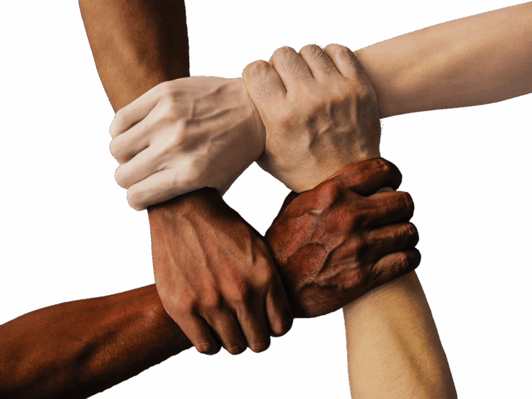
When you give people the tools to visualize and contribute to decisions about their own spaces you’re not just sharing information – you’re sharing power. Communities that embrace mapping as a democratic process see higher civic participation stronger advocacy outcomes and more inclusive decision-making that reflects diverse voices rather than just the loudest ones.
Disclosure: As an Amazon Associate, this site earns from qualifying purchases. Thank you!
Enable Participatory Mapping Through Community-Led Data Collection
You’ll transform mapping from a top-down process into a collaborative effort when residents become active data collectors in their own neighborhoods.
P.S. check out Udemy’s GIS, Mapping & Remote Sensing courses on sale here…
Organize Neighborhood Mapping Workshops
Organize hands-on workshops where residents learn basic mapping techniques using paper maps and GPS-enabled smartphones. Set up stations with different data collection focuses like infrastructure conditions, accessibility barriers, or community assets. Schedule multiple sessions to accommodate varying schedules and skill levels. Partner with local libraries or community centers to provide familiar, accessible venues. Recruit experienced volunteers to guide small groups through the mapping process and ensure quality data collection.
Experience vivid content on the Galaxy A16 5G's 6.7" display and capture stunning photos with its triple-lens camera. Enjoy peace of mind with a durable design, six years of updates, and Super Fast Charging.

Provide Digital Tools and Training for Residents
Provide user-friendly mobile apps like KoBoToolbox or Survey123 that work offline and sync data when connected to WiFi. Offer training sessions covering basic smartphone navigation, photo documentation, and GPS coordinate collection. Create simple instruction cards with visual guides for common mapping tasks. Establish a peer mentor system where tech-savvy residents support neighbors during data collection. Supply backup devices like tablets for residents without smartphones to ensure everyone can participate.
Create Accessible Data Collection Methods
Create multiple data collection options including paper forms, voice recordings, and photo documentation to accommodate different abilities and preferences. Design large-print maps and use high-contrast colors for residents with visual impairments. Offer bilingual materials and translators to engage non-English speaking community members. Establish collection points at senior centers, disability service organizations, and community gathering spaces. Use simple symbols and icons instead of complex terminology to make participation intuitive for all education levels.
Establish Transparent Data Sharing Protocols and Open Access Policies
Transparent data sharing protocols build trust between community members and mapping organizations. When residents can access the same information used in planning decisions, they’re more likely to participate actively in the mapping process.
Implement Community Data Ownership Guidelines
Create clear documentation stating that community-generated mapping data belongs to the residents who contributed it. Establish protocols that require explicit community consent before sharing sensitive neighborhood information with external organizations, including government agencies or developers. Draft agreements that specify how collected data can be used, ensuring communities retain control over information about their streets, housing conditions, and local resources.
Develop User-Friendly Public Data Portals
Build online platforms where residents can easily access mapping data without technical expertise. Design interfaces with simple search functions, downloadable maps in multiple formats, and mobile-responsive layouts that work on smartphones. Include features like address-based searches, neighborhood boundary tools, and real-time updates that show when new information becomes available through your community mapping initiatives.
Ensure Regular Updates and Community Feedback Loops
Schedule monthly data refresh cycles and notify community members when new mapping information becomes available. Create feedback mechanisms like online comment forms, community review periods, and public meetings where residents can verify mapping accuracy. Establish correction procedures that allow community members to report outdated information, suggest map improvements, and track the status of their submitted changes.
Build Collaborative Partnerships Between Local Organizations and Mapping Initiatives
Strong partnerships multiply your mapping project’s reach and effectiveness by connecting technical expertise with deep community knowledge.
Connect with Community-Based Organizations and Nonprofits
Partner with established nonprofits that already serve your target community to access existing trust networks and local expertise. Community organizations like neighborhood associations, advocacy groups, and service providers can identify priority mapping areas and recruit participants. Offer mapping services in exchange for their community connections – they’ll provide context about local issues while you supply technical skills. Schedule joint planning sessions to align mapping objectives with their ongoing community development goals.
Partner with Schools and Educational Institutions
Collaborate with local schools to integrate mapping projects into geography, social studies, and environmental science curricula. Students can collect field data, conduct surveys, and learn GIS basics while contributing to community mapping efforts. Work with university programs in urban planning, geography, or public policy to access student volunteers and research resources. Educational partnerships provide sustained engagement and fresh perspectives while building the next generation of community mappers.
Engage Local Government Departments and Planning Offices
Establish relationships with municipal planning departments to ensure your community mapping aligns with official planning processes and data standards. Planning offices often have existing GIS infrastructure and datasets you can leverage or contribute to. Connect with public works departments to identify infrastructure mapping needs and coordinate data collection efforts. Government partnerships legitimize community mapping initiatives and create pathways for resident input to influence official planning decisions.
Create Inclusive Representation Through Diverse Community Voices and Perspectives
Inclusive mapping requires intentional outreach to communities whose voices have historically been excluded from planning processes. You’ll need to design mapping initiatives that actively seek participation from residents who face the greatest barriers to civic engagement.
Prioritize Marginalized and Underrepresented Communities
Focus your mapping efforts on historically excluded neighborhoods by partnering with community advocates who already have established trust within these areas. You should prioritize outreach to low-income communities, communities of color, elderly residents, and individuals with disabilities who often lack representation in traditional planning processes. Schedule mapping sessions at convenient times and locations such as community centers, libraries, and religious institutions where residents already gather. Compensate participants for their time and expertise, recognizing that their local knowledge has real value for improving neighborhood conditions.
Offer Multilingual Resources and Cultural Sensitivity Training
Provide mapping materials in multiple languages that reflect your community’s linguistic diversity, including Spanish, Mandarin, Arabic, or other prevalent languages in your area. You’ll need to train mapping facilitators in cultural competency to ensure they can work effectively with diverse populations and understand different communication styles. Create visual mapping tools that don’t rely heavily on written language, using symbols, colors, and icons that are culturally appropriate and easily understood across different backgrounds. Partner with community cultural centers and immigrant service organizations to recruit bilingual volunteers who can serve as mapping ambassadors.
Address Digital Divide and Technology Access Barriers
Eliminate technology barriers by providing devices, internet access, and technical support during mapping sessions rather than assuming participants have smartphones or computers. You should offer both digital and analog mapping options, including paper maps, sticky notes, and drawing materials for residents who prefer hands-on approaches. Create simple, mobile-friendly mapping interfaces that work on older devices and don’t require high-speed internet connections. Establish mapping stations at public libraries, community centers, and mobile units that can reach residents in their neighborhoods with all necessary equipment provided.
This HP 14" laptop is designed for portability and productivity. It features an Intel Celeron N4020 processor, 4GB RAM, 64GB storage, and a micro-edge HD display for immersive visuals.

Develop Actionable Outcomes That Transform Mapping Data Into Community Solutions
Once you’ve collected comprehensive mapping data through community participation, the next critical step involves converting those insights into concrete solutions that address neighborhood challenges.
Translate Data Insights Into Policy Recommendations
Analyze mapping patterns to identify recurring community concerns and infrastructure gaps that require policy intervention. Transform your geographic data into evidence-based recommendations by documenting specific locations where residents reported issues like inadequate lighting, missing sidewalks, or transit accessibility problems. Present these findings to local government officials using clear visualizations that highlight priority areas and proposed solutions. Create policy briefs that connect mapping data directly to actionable municipal improvements, ensuring your community’s documented needs translate into legislative change.
Support Community-Driven Urban Planning Initiatives
Leverage mapping data to strengthen resident-led planning proposals and development advocacy efforts. Use your community-generated maps as supporting documentation for zoning variance requests, park improvements, or transportation modifications. Help neighborhoods present compelling cases to planning commissions by providing detailed geographic evidence of community assets and needs. Facilitate planning meetings where residents can reference specific mapping locations to support their development priorities, transforming abstract planning concepts into location-specific community visions.
Measure and Communication Impact to Stakeholders
Track policy implementation and infrastructure improvements that result from your mapping advocacy efforts. Document before-and-after conditions using updated community maps that show completed projects and ongoing challenges. Create progress reports that connect specific mapping data points to measurable community improvements like new crosswalks, improved street lighting, or enhanced public spaces. Share success stories with local media and community organizations, demonstrating how resident participation in mapping directly influences neighborhood improvements and encourages continued civic engagement.
Conclusion
Your commitment to mapping rights can fundamentally transform how your community approaches neighborhood planning and civic engagement. When you provide residents with the tools and training they need to document their own spaces you’re building more than just maps—you’re creating pathways for authentic democratic participation.
The success of these initiatives depends on your ability to maintain transparency build genuine partnerships and ensure every voice has the opportunity to contribute. By establishing clear data ownership protocols and fostering collaboration between residents organizations and local government you’ll create sustainable systems that continue generating positive change long after initial mapping sessions end.
Remember that effective community mapping isn’t just about collecting data—it’s about empowering your neighbors to become active participants in shaping their environment and holding decision-makers accountable to community needs.
Frequently Asked Questions
What are mapping rights and how do they benefit communities?
Mapping rights empower communities to actively participate in documenting and planning their neighborhoods. By providing tools for visualization and contribution, communities can transform contentious meetings into collaborative efforts. This democratic approach enhances civic participation, achieves better advocacy outcomes, and ensures decision-making reflects diverse voices rather than just the most vocal residents.
How can communities organize effective mapping workshops?
Communities can organize neighborhood mapping workshops by teaching residents basic mapping techniques through hands-on activities. Focus on infrastructure conditions and community assets while ensuring accessibility for different schedules and skill levels. Provide digital tools and training for all technological proficiency levels, and use diverse formats including bilingual materials to engage all community members effectively.
Why is transparent data sharing important in community mapping?
Transparent data sharing protocols and open access policies foster trust between community members and mapping organizations. When residents can access the same information used in planning decisions, they’re more likely to engage actively. Community data ownership guidelines ensure mapping data generated by residents remains under their control and requires explicit consent before external sharing.
How can mapping initiatives build effective partnerships?
Connect with community-based organizations and nonprofits to leverage existing trust networks and local expertise. Partner with schools to integrate mapping into curricula, allowing students to contribute while gaining skills. Engage local government departments to align community mapping with official planning processes, ensuring resident input influences decision-making and enhances project reach.
What strategies ensure inclusive representation in mapping projects?
Prioritize outreach to historically marginalized communities including low-income neighborhoods, communities of color, elderly residents, and individuals with disabilities. Schedule mapping sessions at convenient locations and times, compensate participants for contributions, and offer multilingual resources. Provide cultural sensitivity training to facilitators and establish mapping stations in public spaces to reach all residents.
How can communities turn mapping data into actionable solutions?
Analyze mapping patterns to identify recurring community concerns and infrastructure gaps requiring policy intervention. Document specific locations of reported issues to present evidence-based recommendations to local officials. Use community-generated maps to support resident-led planning proposals and track advocacy impact by documenting policy implementation and infrastructure improvements through progress reports.