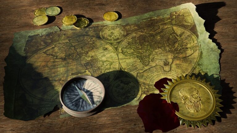
7 Best Mapping Techniques for Exploring Data
You’ve probably seen countless political maps and topographical charts, but the world of cartography extends far beyond these traditional formats. The big picture: Maps can tell stories about everything from global internet speeds to the distribution of your favorite coffee shops, revealing hidden patterns that reshape how you understand our world.
Get durable, tear-resistant posters made in the USA. Each 18" x 29" poster features high-quality 3 MIL lamination for lasting protection.

Why it matters: Unconventional mapping approaches help you discover insights that standard maps miss entirely. Whether you’re tracking cultural phenomena, environmental changes, or social trends, these creative cartographic techniques transform raw data into compelling visual narratives that make complex information instantly digestible.
Disclosure: As an Amazon Associate, this site earns from qualifying purchases. Thank you!
Fantasy Worlds Beyond Traditional Medieval Settings
Fantasy cartography extends far beyond castle-dotted kingdoms and dragon-infested mountains. You’ll discover that alternate history and speculative fiction offer rich mapping opportunities that challenge conventional fantasy boundaries.
P.S. check out Udemy’s GIS, Mapping & Remote Sensing courses on sale here…
Steampunk Alternate Histories
Victorian-era industrial landscapes provide compelling mapping subjects with their complex mechanical infrastructure. You can map steam-powered transportation networks, clockwork districts, and airship routing systems across brass-and-copper cityscapes. These maps showcase elevated railways, pneumatic tube networks, and coal distribution systems that define steampunk geography. Your cartographic work captures the intricate relationship between industrial advancement and urban planning in these alternate timelines.
Post-Apocalyptic Magical Realms
Wasteland fantasy settings combine environmental destruction with supernatural elements for unique mapping challenges. You’ll chart radiation zones alongside mystical ley lines, document mutated ecosystems where magic has twisted natural laws, and map survivor settlements protected by ancient ward stones. These maps illustrate how magical forces reshape devastated landscapes, creating oases of life amid desolation while tracking the spread of both contamination and magical renewal.
Urban Fantasy Modern Cities
Contemporary metropolitan areas layered with hidden supernatural elements offer sophisticated mapping opportunities. You can develop dual-layer maps showing mundane city infrastructure alongside vampire territories, werewolf pack boundaries, and fae court jurisdictions. These maps track magical hotspots in coffee shops, subway tunnels that serve as portal networks, and the invisible boundaries that separate the supernatural from ordinary urban life.
Science Fiction Maps With Unique Planetary Ecosystems
Science fiction cartography opens extraordinary possibilities for mapping alien worlds with distinct environmental systems. These planetary maps challenge traditional geographic conventions by incorporating extreme physics and speculative biology into coherent visual narratives.
Tidally Locked Worlds With Extreme Climate Zones
Tidally locked planets present fascinating mapping challenges where one hemisphere faces perpetual daylight while the other remains in eternal darkness. You’ll need to chart temperature gradients that create distinct biomes along the terminator line—the boundary between day and night sides. The scorching dayside might feature crystalline deserts and plasma storms while the nightside harbors frozen methane lakes and ice formations. Your maps should illustrate the narrow habitable zone where these extremes meet, creating unique ecosystems like thermal-gradient forests or twilight coral reefs that exist nowhere else in the universe.
Gas Giant Floating Cities and Atmospheric Layers
Gas giant atmospheres require three-dimensional mapping techniques to represent cities suspended at different altitudes within dense atmospheric layers. You’ll chart floating metropolises anchored to specific pressure zones where breathable atmosphere exists alongside unique weather patterns. Map the vertical stratification of these worlds—perhaps depicting diamond rain at lower altitudes, metallic hydrogen storms in mid-layers, and aurora-lit cloud cities in the upper atmosphere. Your cartographic work should show how inhabitants navigate between atmospheric levels using pressure-controlled transit systems and wind-pattern highways that connect floating settlements across vast gaseous landscapes.
Artificial Ring Worlds and Megastructures
Ring world cartography demands innovative approaches to represent curved living surfaces that span millions of miles around central stars. You’ll map the interior surface of these massive structures, showing how artificial gravity creates Earth-like conditions on the inner rim while depicting the engineering marvels that maintain structural integrity. Chart the day-night cycles created by shadow squares orbiting between the ring and its star, creating artificial seasons across different sections. Your maps should illustrate transportation networks that span continental distances, maintenance zones that keep the megastructure operational, and diverse biomes engineered to support different species across the ring’s vast circumference.
Historical Maps Reimagined Through Alternative Timelines
Historical cartography takes on new dimensions when you explore alternative timeline scenarios. These reimagined maps challenge traditional geographical understanding by visualizing how different historical outcomes could have reshaped our world’s political and cultural landscapes.
What-If Scenarios of Major Historical Events
You can create compelling alternative maps by reimagining pivotal moments in history. Map the Roman Empire’s continued expansion if it hadn’t fallen, showing extended borders across Northern Europe and into Asia. Visualize a world where the Library of Alexandria survived, depicting knowledge centers and trade routes that would have flourished. Consider mapping the Americas if European colonization had been delayed by centuries, showing evolved indigenous civilizations with their own continental trade networks and urban centers.
Parallel Evolution of Civilizations
Parallel civilization mapping explores how isolated societies might have developed simultaneously. You can map technological advancement timelines across different continents, showing how metallurgy or agriculture could have evolved independently. Visualize alternative Silk Road networks connecting civilizations that never actually met, or chart the development of writing systems across cultures. These maps reveal fascinating patterns of human innovation when geographical barriers create separate evolutionary paths for similar societal challenges.
Cultural Exchange Routes That Never Existed
You can design maps showing hypothetical cultural exchange networks that geography prevented. Chart trans-Saharan maritime routes if the desert had been an inland sea, connecting Mediterranean and sub-Saharan cultures directly. Map Arctic trade corridors if climate patterns had differed, linking Asian and American civilizations. Visualize mountain passes that could have connected isolated valleys, showing how different topography might have created entirely new cultural fusion zones and influenced language development patterns.
Psychological Landscapes That Map Emotional States
Psychological mapping transforms abstract mental states into visual territories, creating cartographic representations of human consciousness and emotional experiences.
Color-Coded Mood Territories
Design emotional maps using color psychology principles where warm reds indicate anger zones, cool blues represent calm areas, and gradient transitions show mood fluctuations throughout time periods. You’ll create geographic-style boundaries between different emotional states, with elevation changes representing intensity levels. Include symbolic landmarks like anxiety peaks, depression valleys, and joy plateaus. Map seasonal emotional patterns using temporal overlays that track how mood territories shift during different months or life events.
Memory Palace Architectural Layouts
Construct detailed floor plans of mental memory palaces using traditional architectural drawing conventions to represent cognitive storage systems. You’ll map room-to-room connections showing how memories link together, with different wings representing childhood, work experiences, and personal relationships. Include navigation markers like staircases for accessing deeper memories and windows symbolizing moments of clarity. Design storage areas using library classification systems where specific memory categories occupy designated spaces within your psychological architecture.
Dreamscape Navigation Systems
Navigate with ease using this 7-inch GPS navigator, featuring real-time voice guidance and pre-loaded 2025 maps. Customize routes based on your vehicle type to avoid restrictions and receive speed & red light warnings.

Create navigational charts for recurring dream environments using oceanic mapping techniques to represent the fluid nature of sleep consciousness. You’ll plot dream islands connected by subconscious currents, with depth soundings indicating memory layers and emotional undercurrents. Include hazard markers for nightmare regions, safe harbors representing peaceful dreams, and tidal patterns showing REM cycle influences. Map lucid dreaming zones as controlled airspace where conscious navigation becomes possible within the dream territory.
Microscopic Worlds Transformed Into Epic Adventures
You’ll discover that the smallest scales of existence offer the most expansive mapping opportunities. Microscopic cartography transforms invisible biological processes into navigable adventure realms.
Cellular Kingdoms and Organelle Cities
Cellular kingdoms transform living cells into sprawling metropolitan areas where each organelle becomes a distinct district. You can map mitochondria as power plants generating ATP energy, while the nucleus serves as your governmental capital controlling genetic information. Ribosomes function as manufacturing centers producing proteins, and the endoplasmic reticulum creates your transportation network moving materials throughout the cellular territory. These biological maps reveal complex urban planning principles operating at microscopic scales.
Molecular Battlefields and Atomic Structures
Molecular battlefields visualize chemical reactions as territorial conflicts where atoms clash and bond in strategic formations. You’ll map electron pathways as trade routes connecting atomic strongholds, while chemical bonds create alliances between molecular factions. Enzyme active sites become fortress gates controlling access to reaction chambers. These atomic adventure maps transform chemistry into tactical warfare scenarios where pH levels determine battlefield conditions and catalysts serve as powerful allies accelerating your molecular campaigns.
Bacterial Colonies as Thriving Civilizations
Bacterial colonies develop into sophisticated civilization maps where individual bacteria form communities with distinct social structures. You can chart biofilm formations as protective city walls, while quorum sensing creates communication networks between bacterial settlements. Plasmid exchanges function as diplomatic trade agreements sharing genetic resources across colony boundaries. These microbial societies demonstrate urban growth patterns, resource management systems, and territorial expansion strategies that mirror human civilizations at microscopic scales.
Abstract Concept Maps Made Tangible
You can transform intangible concepts into explorable cartographic territories that reveal hidden relationships and patterns. These visualization techniques bridge the gap between theoretical knowledge and spatial understanding.
Mathematical Equations as Physical Terrains
Mathematical functions become mountain ranges where elevation represents variable values and valleys show minimum points. You’ll map quadratic equations as parabolic ridges, exponential functions as steep cliff faces, and trigonometric patterns as rolling wave formations. Contour lines indicate solution sets while color gradients highlight positive and negative regions. Complex equations transform into multi-dimensional landscapes where hiking trails represent solution pathways and peaks mark critical points.
Music Theory Visualized as Geographical Features
Musical scales become mountain chains where each note represents a different elevation and key signatures define regional boundaries. You can map chord progressions as river systems flowing between harmonic territories, with major chords as broad valleys and minor chords as narrow canyons. Tempo changes appear as varying terrain difficulty while dynamic ranges create elevation profiles. Modulation bridges connect different musical regions and time signatures establish the geographical grid system.
Philosophical Ideas Represented Through Topography
Philosophical concepts transform into navigable landscapes where ethical frameworks become territorial boundaries and moral dilemmas appear as challenging mountain passes. You’ll represent opposing viewpoints as separated continents connected by bridges of compromise. Logical arguments flow like rivers through valleys of reasoning while paradoxes create impossible geographical features. Schools of thought establish distinct climate zones and philosophical evolution traces as geological formation layers.
Interactive Digital Maps With Dynamic Storytelling Elements
Digital cartography evolves beyond static representations when you integrate interactive elements that respond to user decisions and environmental changes. These dynamic mapping systems create immersive experiences where geography becomes a living narrative component.
Player Choice-Driven Terrain Changes
Choice-driven terrain modifications transform static landscapes into responsive environments that reflect user decisions. You’ll design mapping systems where major plot choices permanently alter geographical features, creating unique cartographic outcomes for each user experience.
Political alliances reshape territorial boundaries in real-time, while environmental decisions trigger visible changes in forest coverage, water levels, and urban development patterns. Your mapping framework must accommodate these dynamic transformations while maintaining geographical consistency and visual clarity across all possible narrative branches.
Real-Time Weather Systems Affecting Gameplay
Real-time weather integration requires sophisticated mapping layers that respond to both actual meteorological data and narrative requirements. You’ll implement dynamic weather overlays that influence accessibility, visibility, and strategic options across your mapped territories.
Seasonal changes affect river levels, mountain pass accessibility, and agricultural zones, while storm systems create temporary obstacles and opportunities. Your cartographic system must balance realistic weather patterns with gameplay mechanics, ensuring that meteorological events enhance rather than obstruct the storytelling experience.
Community-Built Collaborative World Expansion
Community-driven expansion systems enable users to contribute verified geographical content while maintaining cartographic standards and narrative coherence. You’ll establish collaborative frameworks where community members can propose new locations, trade routes, and landmark additions.
Moderation workflows ensure that user-generated content integrates seamlessly with existing geographical logic and artistic style. Your mapping platform must accommodate diverse creative contributions while preserving the overall world’s internal consistency and visual identity across all community-added elements.
Conclusion
These seven unconventional mapping approaches open up endless possibilities for your creative projects. Whether you’re designing fantasy worlds with complex magical systems or transforming abstract concepts into navigable territories you’ll discover that innovative cartography enhances storytelling and understanding.
Your maps don’t need to follow traditional rules to be effective. From microscopic cellular kingdoms to psychological landscapes that chart emotional territories every approach offers unique opportunities to engage your audience and communicate complex ideas visually.
The future of mapping lies in experimentation and creativity. By embracing these unconventional techniques you’ll develop skills that set your work apart while creating immersive experiences that resonate with viewers on multiple levels.
Frequently Asked Questions
What is unconventional cartography?
Unconventional cartography goes beyond traditional political and topographical maps to visualize diverse data sets like internet speeds, coffee shop distribution, and cultural trends. These creative mapping approaches transform complex information into easily understandable visual narratives, revealing hidden patterns and insights that enhance our understanding of various aspects of the world around us.
How does fantasy cartography extend beyond medieval settings?
Fantasy cartography explores diverse realms including steampunk alternate histories with Victorian industrial landscapes, post-apocalyptic magical worlds showing environmental destruction and supernatural elements, and urban fantasy maps depicting hidden supernatural infrastructure in modern cities. These approaches challenge conventional mapping boundaries and create rich, immersive world-building opportunities for storytelling and gaming.
What makes science fiction cartography unique?
Science fiction cartography tackles extraordinary challenges like mapping tidally locked planets with perpetual day/night hemispheres, three-dimensional gas giant atmospheres with floating cities, and artificial ring worlds with curved living surfaces. These maps require innovative techniques to represent temperature gradients, atmospheric layers, transportation networks, and engineered biomes that don’t exist in traditional Earth-based cartography.
How do alternative historical maps work?
Alternative historical maps visualize how different historical outcomes could have reshaped political and cultural landscapes. They explore what-if scenarios like continued Roman Empire expansion, parallel civilization development, and hypothetical cultural exchange routes. These maps challenge traditional geographical understanding by showing how alternative timelines could have created entirely different world configurations.
What are psychological landscape maps?
Psychological landscape maps transform abstract mental experiences into visual territories using color psychology for emotional zones, architectural memory palaces for cognitive storage systems, and oceanic techniques for dreamscape navigation. These innovative maps include safe harbors and nightmare regions, creating navigable representations of human consciousness and emotional experiences.
How does microscopic cartography work?
Microscopic cartography transforms invisible biological processes into navigable adventure realms. Cellular kingdoms feature organelles as districts (mitochondria as power plants, nucleus as government capital), molecular battlefields show chemical reactions as territorial conflicts, and bacterial colonies become thriving civilizations with biofilm city walls and quorum sensing communication networks.
What are abstract concept maps?
Abstract concept maps transform intangible ideas into explorable territories. Mathematical equations become physical terrains with elevation representing variable values, musical scales form mountain chains with chord progressions flowing like rivers, and philosophical ideas use topography where ethical frameworks become territorial boundaries and logical arguments flow like waterways.
How do interactive digital maps enhance storytelling?
Interactive digital maps incorporate dynamic elements where player choices drive terrain changes in real-time, weather systems influence accessibility and gameplay, and community collaboration allows users to contribute verified geographical content. These maps evolve beyond static representations, creating responsive environments that reflect user decisions while maintaining cartographic standards and narrative coherence.