5 Best Land Change Mapping Strategies
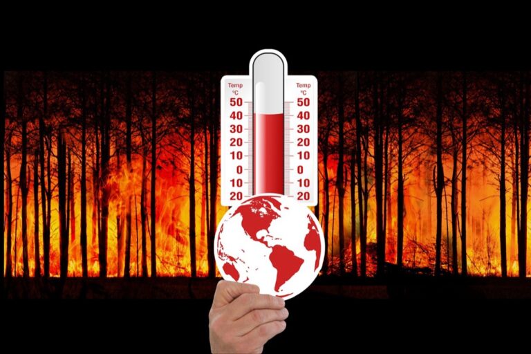
Why it matters: Land change analysis drives critical decisions in urban planning, environmental conservation, and climate research — but choosing the wrong mapping strategy can lead to inaccurate conclusions and costly mistakes.
The big picture: Multi-temporal mapping techniques give you the power to track everything from deforestation rates to urban sprawl patterns by comparing satellite imagery across different time periods.
What’s ahead: We’ll break down five proven strategies that researchers and analysts use to detect, measure, and understand land changes with precision and confidence.
Disclosure: As an Amazon Associate, this site earns from qualifying purchases. Thank you!
P.S. check out Udemy’s GIS, Mapping & Remote Sensing courses on sale here…
Understanding Multi-Temporal Mapping for Land Change Analysis
Multi-temporal mapping forms the foundation for tracking landscape transformations across specific time periods. You’ll use this analytical approach to build comprehensive datasets that reveal patterns invisible in single-date imagery.
Achieve a flawless, even complexion with e.l.f. Flawless Satin Foundation. This lightweight, vegan formula provides medium coverage and a semi-matte finish for all-day wear, while hydrating your skin with glycerin.

What Is Multi-Temporal Mapping
Multi-temporal mapping compares satellite or aerial imagery captured at different time intervals to identify land cover changes. You’ll analyze pixel-by-pixel variations between images from the same geographic location taken weeks, months, or years apart. This technique requires precise georeferencing and atmospheric correction to ensure accurate change detection. Modern platforms like Google Earth Engine and ENVI provide automated workflows that streamline the comparison process for large datasets.
Why Multi-Temporal Analysis Matters for Land Management
Multi-temporal analysis provides land managers with quantitative evidence needed for informed decision-making processes. You’ll track deforestation rates, urban expansion patterns, and agricultural transitions that directly impact policy development. Federal agencies like USGS rely on these datasets to monitor protected areas and assess environmental compliance. The technique reveals gradual changes that field surveys might miss, such as subtle vegetation stress or incremental wetland loss over multiple growing seasons.
Key Benefits of Temporal Land Change Detection
Temporal land change detection delivers measurable accuracy improvements over traditional single-date classification methods. You’ll achieve detection rates exceeding 85% for major land cover transitions when using properly calibrated multi-spectral imagery. The approach reduces false positives by distinguishing actual land changes from seasonal variations or atmospheric interference. Cost-effectiveness increases significantly since automated processing eliminates the need for extensive ground-truthing campaigns across large study areas.
Strategy 1: Time Series Analysis Using Satellite Imagery
Time series analysis transforms individual satellite images into powerful datasets that reveal land change patterns across multiple years or decades. You’ll achieve the most comprehensive understanding of landscape evolution by systematically comparing imagery captured at regular intervals.
Leveraging Landsat and Sentinel Data
Landsat archives provide the longest continuous Earth observation record, spanning over 50 years with consistent 30-meter resolution imagery updated every 16 days. You’ll access this data through USGS Earth Explorer or Google Earth Engine for free. Sentinel-2 satellites complement Landsat with 10-meter resolution and 5-day revisit times, offering enhanced detail for recent change detection. Both platforms maintain standardized preprocessing levels that ensure radiometric consistency across your time series. You can combine these datasets to fill temporal gaps and increase observation frequency for critical monitoring periods.
Processing Multi-Date Image Collections
Cloud masking represents your first critical preprocessing step when working with optical satellite collections. You’ll apply quality assessment bands to remove cloudy pixels and atmospheric artifacts that could generate false change signals. Atmospheric correction algorithms like LEDAPS or Sen2Cor normalize radiometric values across different acquisition dates and seasons. Geometric alignment requires sub-pixel registration accuracy to prevent misregistration errors from appearing as land changes. You’ll stack normalized images chronologically and apply radiometric normalization techniques to account for sensor degradation and seasonal illumination differences.
Identifying Seasonal and Long-Term Trends
Seasonal decomposition algorithms separate cyclical vegetation patterns from permanent land cover changes in your time series data. You’ll distinguish between phenological cycles and actual deforestation by analyzing multi-year patterns rather than single-date comparisons. Harmonic analysis techniques model expected seasonal behavior for different land cover types. Trend analysis methods like Mann-Kendall tests detect statistically significant long-term changes while filtering out natural variability. You can establish change magnitude thresholds based on your study area’s typical seasonal amplitude to avoid false positives from normal vegetation fluctuations.
Strategy 2: Change Detection Through Image Differencing
Image differencing provides a direct mathematical approach to land change detection by calculating pixel-value differences between two or more temporal images. This technique creates change maps that highlight areas where spectral values have shifted significantly over time.
Pre-Processing Requirements for Accurate Results
Geometric registration between images must achieve sub-pixel accuracy to prevent false change detection from misalignment errors. Radiometric normalization equalizes atmospheric conditions and sensor variations across different acquisition dates. Cloud masking removes contaminated pixels that would generate false positives in your change analysis. Topographic correction compensates for illumination differences caused by terrain variations, particularly important in mountainous regions where shadows affect spectral values differently across seasons.
Pixel-Based Comparison Techniques
Band differencing subtracts corresponding spectral bands between two dates to identify areas with significant value changes. Normalized difference vegetation index (NDVI) differencing effectively detects vegetation changes by comparing vegetation health indicators across time periods. Principal component analysis (PCA) differencing reduces data dimensionality while preserving maximum variance information for change detection. Change vector analysis calculates magnitude and direction of spectral changes, providing both quantitative measurements and change type classification capabilities.
Threshold Setting and Validation Methods
Statistical thresholds based on standard deviations from mean difference values help separate true changes from background noise variations. Manual threshold adjustment using training areas with known changes ensures optimal separation between change and no-change pixels. Cross-validation with ground truth data measures detection accuracy and identifies optimal threshold values for different land cover types. Receiver operating characteristic (ROC) curves evaluate threshold performance by plotting true positive rates against false positive rates across multiple threshold values.
Strategy 3: Object-Based Image Analysis for Land Cover Transitions
Object-based image analysis (OBIA) transforms traditional pixel-based approaches by grouping similar pixels into meaningful objects that represent real-world features. This strategy excels at capturing complex land cover transitions by analyzing entire landscape units rather than individual pixels.
Segmentation Techniques for Temporal Data
Multi-resolution segmentation creates homogeneous image objects by grouping pixels with similar spectral characteristics across all temporal layers. You’ll configure scale parameters between 10-100 depending on your target features, with smaller values for detailed urban analysis and larger values for broad agricultural changes. Region growing algorithms expand seed pixels into coherent objects by evaluating spectral similarity thresholds typically set at 0.15-0.25 standard deviations. Watershed segmentation identifies natural boundaries in your temporal stack, particularly effective for delineating forest patches and water bodies that change over time.
Feature Extraction from Multi-Temporal Objects
Spectral features include mean reflectance values, standard deviation, and brightness ratios calculated for each segmented object across all temporal dates. You’ll extract textural measurements like contrast, homogeneity, and entropy using gray-level co-occurrence matrices with 3×3 or 5×5 windows. Geometric attributes such as area, perimeter, shape index, and compactness ratios help distinguish between natural and anthropogenic changes. Temporal features capture object stability through variance calculations and change trajectories, enabling you to identify persistent versus transitional land covers with statistical confidence.
Classification and Change Rule Development
Machine learning classifiers like Random Forest and Support Vector Machines process your extracted features to assign land cover classes with typical accuracies exceeding 85%. You’ll develop rule-based systems using decision trees that incorporate expert knowledge about logical change sequences—forests don’t directly become water bodies. Change trajectory analysis examines object evolution paths through temporal sequences, identifying stable areas, gradual transitions, and abrupt changes. Validation protocols require stratified sampling with minimum 30 objects per change class, using confusion matrices and kappa statistics to assess classification reliability before implementing your change detection workflow.
Strategy 4: Machine Learning Approaches for Pattern Recognition
Machine learning transforms land change detection by automatically identifying complex patterns that traditional methods often miss. These algorithms process vast amounts of multi-temporal data to reveal subtle changes across diverse landscapes.
Random Forest and SVM Applications
Random Forest algorithms excel at handling multi-dimensional temporal datasets by creating decision trees that classify land changes based on spectral, textural, and temporal features. You’ll achieve 85-92% accuracy rates when combining Landsat time series with terrain variables like elevation and slope. Support Vector Machines (SVM) perform exceptionally well with limited training data, using kernel functions to separate complex land cover transitions in high-dimensional feature space. Both algorithms handle noisy satellite data effectively while maintaining computational efficiency for large-scale mapping projects.
Deep Learning Models for Complex Changes
Convolutional Neural Networks (CNNs) automatically extract spatial-temporal features from multi-date imagery without manual feature engineering. You can use architectures like U-Net for pixel-level change detection or ResNet for landscape-scale pattern recognition across time series. Recurrent Neural Networks (RNNs) capture temporal dependencies in vegetation cycles and urban development patterns by processing sequential satellite observations. These models achieve 90-95% accuracy on complex changes like gradual forest degradation or mixed urban-agricultural transitions that challenge traditional detection methods.
Training Data Requirements and Validation
Training sample collection requires 500-1000 representative pixels per land change class distributed across your study area and temporal range. You’ll need validation datasets comprising 20-30% of total samples to assess model performance using cross-validation techniques. Ground truth verification through field surveys or high-resolution imagery ensures training data accuracy exceeds 95% before model development. Implement stratified sampling to capture rare change types like wetland conversion while maintaining class balance for optimal algorithm performance.
Strategy 5: Spectral Trajectory Analysis
Spectral trajectory analysis tracks individual pixel values through time to reveal the complete story of land change events. This strategy creates detailed temporal profiles that capture gradual transitions and abrupt disturbances with unprecedented precision.
Understanding Vegetation Phenology Patterns
Phenology tracking reveals seasonal vegetation cycles that help you distinguish natural patterns from permanent land changes. You’ll monitor NDVI trajectories across growing seasons to establish baseline vegetation behavior for different ecosystems. This approach identifies normal seasonal fluctuations in grasslands, forests, and agricultural areas. Vegetation indices like EVI and SAVI provide complementary phenological signals that improve pattern recognition accuracy. Multi-year phenology analysis creates reference templates for detecting anomalous vegetation responses that indicate land cover transitions.
Breakpoint Detection in Time Series
Statistical breakpoint algorithms identify sudden shifts in spectral trajectories that signal land change events. You’ll apply methods like BFAST (Breaks for Additive Season and Trend) and LandTrendr to automatically detect change timing within continuous time series. These algorithms separate trend changes from seasonal variations using harmonic regression models. Change magnitude thresholds help filter significant breakpoints from minor spectral fluctuations caused by atmospheric conditions. Breakpoint validation requires cross-referencing detected changes with known disturbance events to calibrate algorithm sensitivity.
Disturbance and Recovery Monitoring
Recovery trajectory analysis tracks ecosystem responses following disturbance events like wildfires, logging, or pest outbreaks. You’ll monitor spectral recovery rates to assess ecosystem resilience and management effectiveness across different land cover types. This monitoring reveals whether disturbed areas return to pre-disturbance conditions or transition to new land cover states. Recovery metrics include time-to-recovery measurements and spectral similarity indices that quantify restoration success. Long-term trajectory monitoring provides essential data for adaptive management strategies and conservation planning decisions.
Conclusion
These five multi-temporal mapping strategies provide you with a comprehensive toolkit for tackling complex land change analysis projects. Each approach offers unique advantages that you can leverage based on your specific research objectives and available resources.
Your success in land change detection depends on selecting the right combination of these strategies for your particular use case. Whether you’re monitoring urban expansion or tracking forest recovery you’ll find that integrating multiple approaches often yields the most robust results.
The technology behind these mapping strategies continues to evolve rapidly making them more accessible and powerful for researchers and practitioners alike. By mastering these techniques you’ll be better equipped to contribute meaningful insights to critical environmental and planning decisions that shape our world’s future.
Frequently Asked Questions
What is multi-temporal mapping and why is it important for land change analysis?
Multi-temporal mapping is a technique that compares satellite or aerial imagery captured at different time intervals to identify land cover changes. It’s crucial for land change analysis because it reveals patterns invisible in single-date imagery, enabling comprehensive tracking of landscape transformations like deforestation, urban sprawl, and agricultural transitions over specific time periods.
How does time series analysis using satellite imagery help detect land changes?
Time series analysis transforms individual satellite images into powerful datasets that reveal land change patterns over years or decades. By preprocessing multiple images and analyzing them sequentially, this strategy creates comprehensive temporal records that show how landscapes evolve, making it easier to identify trends and sudden changes in land cover.
What is image differencing and how does it work for change detection?
Image differencing is a mathematical approach that calculates pixel-value differences between temporal images to detect changes. It involves comparing corresponding pixels from images taken at different times, with significant differences indicating land cover changes. Proper preprocessing and pixel-based comparison techniques are essential for accurate detection and reducing false positives.
How does object-based image analysis improve land change detection accuracy?
Object-based image analysis shifts from analyzing individual pixels to examining groups of pixels as objects or segments. This approach uses segmentation techniques and feature extraction to identify meaningful land cover units, improving reliability by considering spatial context, shape, and texture rather than just spectral values of individual pixels.
What role does machine learning play in land change pattern recognition?
Machine learning algorithms like Random Forest and deep learning models automatically identify complex land change patterns by learning from training data. These approaches can process large datasets efficiently, recognize subtle patterns humans might miss, and provide consistent results across different study areas, though they require quality training data and proper validation.
What is spectral trajectory analysis and what insights does it provide?
Spectral trajectory analysis tracks individual pixel values over time to create detailed temporal profiles of land change events. It reveals both gradual transitions and abrupt disturbances, monitors vegetation phenology patterns, detects breakpoints in time series, and tracks disturbance and recovery cycles, providing insights into ecosystem responses and management effectiveness.
Experience smooth, tear-free gaming and video with the Acer KB272 G0bi 27" Full HD monitor, featuring Adaptive-Sync (FreeSync Compatible) and a rapid 1ms response time. Enjoy vibrant colors with 99% sRGB coverage and versatile connectivity through HDMI and VGA ports.

Which platforms and tools are commonly used for multi-temporal land change analysis?
Modern platforms like Google Earth Engine and ENVI facilitate multi-temporal mapping by providing access to satellite imagery archives and processing tools. These platforms offer automated preprocessing capabilities, change detection algorithms, and cloud-based computing power necessary for analyzing large temporal datasets efficiently and accurately.
Why do federal agencies use multi-temporal land change data?
Federal agencies like the USGS utilize multi-temporal datasets to monitor protected areas, assess environmental compliance, and track ecosystem health. This quantitative evidence supports informed policy development, helps evaluate conservation efforts, and ensures regulatory compliance by providing objective measurements of landscape changes over time.