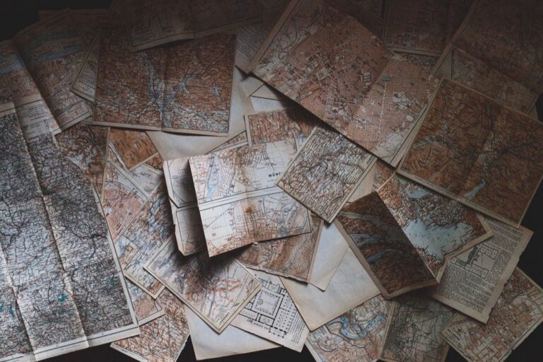
7 Best Map Design Ideas
You’re living in a golden age of cartography where traditional hand-drawn techniques meet cutting-edge digital tools. Modern mapmakers are discovering that combining analog sketching with digital precision creates more engaging and memorable maps than either method alone. Whether you’re designing for urban planning, storytelling, or artistic expression, blending these approaches unlocks creative possibilities that pure digital workflows simply can’t match.
Disclosure: As an Amazon Associate, this site earns from qualifying purchases. Thank you!
Layering Hand-Drawn Elements Over Digital Base Maps
This technique combines the precision of digital cartography with the visual appeal of hand-crafted elements. You’ll create maps that maintain geographic accuracy while adding personal touches that capture viewer attention.
Adding Custom Illustrations to Google Maps Screenshots
You can transform static Google Maps screenshots into engaging visual narratives by adding hand-drawn illustrations directly over the digital base. Export your Google Maps view at high resolution, then import the image into drawing software like Procreate or Adobe Fresco. Draw custom icons, building illustrations, or decorative elements on separate layers above the base map. This approach works particularly well for neighborhood guides, business directories, and event location maps where you need to highlight specific points of interest while maintaining the familiar Google Maps interface that viewers already understand.
P.S. check out Udemy’s GIS, Mapping & Remote Sensing courses on sale here…
Incorporating Sketched Landmarks on Digital Street Maps
You’ll enhance digital street maps by overlaying hand-sketched representations of notable landmarks and architectural features. Start with a clean digital street map from OpenStreetMap or similar sources, then add your sketched landmarks on transparent layers. Focus on distinctive buildings, monuments, or natural features that serve as navigation waypoints. Use consistent line weights and drawing styles across all sketched elements to maintain visual cohesion. This technique proves especially effective for tourist maps, walking tour guides, and urban planning presentations where you need to emphasize specific structures within their geographic context.
Overlaying Hand-Drawn Routes on GPS Navigation Maps
Navigate confidently with the Garmin Drive™ 53 GPS. This navigator features a bright, high-resolution touchscreen and provides helpful driver alerts for school zones, speed changes, and more.

You can personalize GPS navigation displays by drawing custom route overlays that highlight recommended paths, scenic detours, or historical significance. Export your GPS map data as a high-resolution image, then use digital drawing tools to trace routes with hand-drawn line styles. Add directional arrows, distance markers, or points of interest along the route using sketched elements. This approach works well for hiking guides, cycling maps, and heritage trails where the journey itself tells a story beyond simple point-to-point navigation.
Creating Hybrid Travel Journals With Digital and Analog Components
Capture your adventures in this compact travel journal. Features include 176 pages of premium, dotted paper, a ribbon bookmark, and an expandable inner pocket, all secured with an elastic closure.

You’ll transform your travel documentation by combining the precision of digital mapping with the personal touch of hand-drawn elements. This approach creates meaningful travel records that capture both accurate geographic data and emotional connections to places you’ve visited.
Printing Digital Maps for Hand Annotation
Print high-resolution digital base maps on quality paper to create annotation-ready templates for your travel journal. Export Google Earth Pro imagery at 300 DPI or download OpenStreetMap tiles through QGIS for crisp printing results. You’ll want to leave 30% white space around key areas for sketching notes about local discoveries, restaurant recommendations, or memorable encounters. Use waterproof pens like Sakura Pigma Micron for annotations that won’t smudge during field use.
Sketching Personal Experiences Alongside Digital Route Data
Layer your hand-drawn experiences directly over printed GPS track data from apps like Strava or AllTrails. Sketch small icons representing specific moments—a coffee cup where you stopped for espresso, a camera symbol at photo locations, or weather symbols showing conditions you encountered. This technique transforms sterile GPS breadcrumbs into rich visual narratives. You can also draw elevation profiles by hand alongside digital route data to show how terrain changes felt during your journey.
Combining Digital Photos With Hand-Drawn Map Memories
Integrate smartphone photos with hand-sketched map elements using apps like Procreate or Adobe Fresco on tablets. Import geotagged photos as reference layers, then trace simplified versions of landmarks, street layouts, or scenic viewpoints around them. Print these hybrid compositions on archival photo paper to preserve both digital accuracy and artistic interpretation. You’ll create unique travel documentation that combines photographic evidence with personal cartographic interpretation of memorable locations.
Experience vivid content on the Galaxy A16 5G's 6.7" display and capture stunning photos with its triple-lens camera. Enjoy peace of mind with a durable design, six years of updates, and Super Fast Charging.

Digitizing Hand-Drawn Maps for Interactive Online Experiences
Transforming your hand-drawn cartographic artwork into interactive digital formats opens new possibilities for engaging audiences online. You’ll bridge the gap between traditional sketching techniques and modern web technologies to create compelling digital experiences.
Scanning Artistic Maps for Web Integration
Scanning resolution determines your map’s digital quality and versatility. Use 600 DPI minimum for detailed artwork or 1200 DPI for maps requiring significant zoom functionality. Professional flatbed scanners like Epson Expression Photo HD XP-15000 handle large format drawings up to 13×19 inches effectively.
Get clear, detailed scans of photos and documents with the Epson Perfection V39 II. Its 4800 dpi resolution captures fine details, while one-touch buttons simplify scanning.

Clean your artwork before scanning and ensure proper lighting to capture subtle line weights. Save files as TIFF format for preservation and create PNG versions for web use. Post-processing in Adobe Photoshop allows you to adjust contrast and remove paper texture while preserving your original artistic character.
Converting Sketched Maps Into Clickable Digital Formats
Vector conversion transforms your sketches into scalable interactive elements. Adobe Illustrator‘s Image Trace function converts scanned artwork into editable paths while maintaining artistic qualities. Manual tracing provides better control over line weights and preserves intentional imperfections that give hand-drawn maps character.
Learn Adobe Illustrator with the 2025 release of this comprehensive guide. Master essential skills through hands-on lessons.

Create separate layers for different map elements like roads, landmarks, and annotations. Export as SVG format for web compatibility and use JavaScript libraries like Leaflet or D3.js to add interactivity. Define clickable areas using polygon coordinates that correspond to your sketched regions or points of interest.
Building Interactive Story Maps From Hand-Drawn Originals
Understand the structure of a one-hour TV drama pilot. This book provides a guide to story mapping for television.

Story mapping platforms integrate your artwork with multimedia content seamlessly. ArcGIS StoryMaps accepts custom imagery as basemaps, allowing you to upload high-resolution scans as foundational layers. CARTO and Mapbox support custom tile layers created from your hand-drawn originals.
Structure your narrative using waypoints that correspond to sketched locations on your map. Embed photos, videos, and text that complement your artistic interpretation. Test user navigation flows to ensure your hand-drawn elements enhance rather than complicate the digital storytelling experience.
Blending Digital Precision With Hand-Drawn Artistic Flair
You can achieve the perfect balance between technical accuracy and creative expression by strategically combining digital mapping foundations with hand-drawn artistic elements.
Using Digital Tools to Trace Hand-Drawn Map Outlines
Vector tracing transforms your sketched boundaries into scalable digital assets. Adobe Illustrator‘s Image Trace function converts hand-drawn coastlines and territorial boundaries into clean vector paths while preserving organic line quality. You’ll maintain the natural variation of pen strokes by adjusting the Path Fitting setting to 2-4 pixels. Import your 600 DPI scanned artwork and use the “Sketched Art” preset for optimal results. Clean up anchor points manually to ensure smooth curves while keeping the hand-drawn character intact.
Combining GPS Accuracy With Artistic Map Styling
GPS coordinate data provides the framework for stylized cartographic interpretation. Import precise waypoint coordinates into Illustrator or Inkscape, then overlay hand-drawn trail markers and terrain features. You can trace actual hiking paths from GPS tracks while adding artistic elements like illustrated trees, rock formations, and elevation changes. Use the GPS data as your base layer at 50% opacity, then draw artistic interpretations above. This technique ensures geographic accuracy while allowing creative freedom in visual representation and symbolic design choices.
Merging Satellite Imagery With Illustrated Map Elements
High-resolution satellite imagery serves as the foundation for selective artistic enhancement. Download georeferenced imagery from USGS Earth Explorer or Google Earth Pro, then overlay hand-drawn elements in specific areas. You’ll highlight key features like buildings, parks, or waterways with illustrated symbols while maintaining photographic accuracy for context. Use layer masks in Photoshop to blend satellite data with drawn elements seamlessly. Focus artistic additions on landmarks, points of interest, and navigational aids while preserving satellite imagery for spatial reference and terrain understanding.
Incorporating Hand-Drawn Icons Into Digital Mapping Platforms
Hand-drawn icons transform sterile digital maps into engaging visual experiences that connect with users on an emotional level. You can integrate your artistic elements directly into major mapping platforms while maintaining the technical precision that digital cartography demands.
Creating Custom Map Markers and Symbols
Custom markers replace generic digital pins with meaningful visual representations that enhance map readability. You’ll need to create icons in SVG format at 24×24 pixels for optimal web performance. Adobe Illustrator’s vectorization tools convert your hand-sketched symbols into scalable digital assets. Export markers with transparent backgrounds and test them across different zoom levels. Most mapping APIs including Google Maps and Mapbox accept custom marker uploads through their styling interfaces.
Adding Personal Artistic Elements to Digital Map Pins
Personal artistic touches differentiate your maps from standard digital templates while maintaining professional cartographic standards. Sketch unique pin designs that reflect your map’s theme or location characteristics. Use Procreate or similar digital drawing apps to refine hand-drawn elements before vectorization. Layer artistic details over functional pin shapes to preserve click functionality. Test artistic pins at various screen sizes and ensure sufficient contrast against different map backgrounds for accessibility compliance.
Designing Hand-Sketched Legends for Digital Maps
Hand-sketched legends provide clear symbol explanations while adding visual interest that pure text cannot achieve. Create legend entries that combine hand-drawn symbols with digital typography for optimal readability. Scan legend artwork at 300 DPI minimum and clean vector paths in Illustrator. Position legends strategically to avoid covering critical map features. Use consistent line weights and spacing between legend items to maintain professional appearance across different devices and screen resolutions.
Using Digital Tools to Enhance Hand-Drawn Map Projects
Professional cartographers increasingly leverage digital enhancement tools to refine hand-drawn maps while preserving their organic character. These workflows maintain artistic authenticity while adding precision and polish.
Adding Digital Color and Shading to Pencil Sketches
Adding digital color transforms pencil sketches into vibrant cartographic pieces without losing hand-drawn authenticity. Scan your pencil work at 600 DPI, then use Photoshop’s multiply blend mode to preserve line quality while layering colors underneath. Adobe Fresco offers realistic watercolor brushes that mimic traditional painting techniques on digital sketches. Procreate’s color-picking tools let you sample environmental colors from reference photos, ensuring accurate representation of terrain features and vegetation patterns in your enhanced maps.
Incorporating Digital Text and Labels on Hand-Drawn Maps
Incorporating digital typography elevates hand-drawn maps to professional cartographic standards while maintaining visual harmony. Use fonts like Optima or Gill Sans that complement organic line work rather than compete with it. Adobe Illustrator’s text-on-path tool follows curved geographical features naturally, while maintaining consistent spacing and alignment. Layer digital labels on separate files to preserve original artwork, and match text color to your hand-drawn ink tones for seamless integration across map elements.
Using Apps to Measure and Scale Hand-Drawn Map Elements
Using measurement apps ensures geographic accuracy in hand-drawn cartographic projects without sacrificing artistic expression. Google Earth Pro provides precise distance measurements you can transfer to sketched maps using proportional scaling techniques. Apps like Theodolite offer field measurement capabilities through smartphone cameras, letting you verify building heights and landmark proportions. Scale Master mobile apps calculate area measurements from photos, helping you maintain consistent proportions when sketching urban layouts or natural features from field observations.
Combining Historical Hand-Drawn Maps With Modern Digital Data
You’ll discover that layering modern data onto historical cartographic foundations creates compelling visualizations that bridge centuries of geographic knowledge. This approach reveals how landscapes have evolved while maintaining the artistic character that makes vintage maps so captivating.
Overlaying Contemporary Information on Vintage Map Reproductions
Overlay modern infrastructure data onto scanned historical maps using GIS software like ArcGIS or QGIS. You can digitally add current roads, buildings, and transit lines while preserving the original map’s decorative borders and hand-lettered place names. Use transparency settings between 60-80% for new layers to maintain visibility of underlying historical details. This technique works particularly well with 18th and 19th-century city maps, where you can show how urban development has transformed original settlement patterns.
Creating Timeline Maps With Historical and Current Elements
Create split-screen timeline visualizations that display multiple time periods on a single map canvas. You can use historical hand-drawn maps as base layers for specific decades while incorporating modern satellite imagery or digital street maps for current conditions. Adobe Illustrator’s artboard system allows you to align historical and contemporary elements precisely using common geographic reference points. Include timeline sliders or toggle buttons to let viewers switch between eras and observe changes in coastlines, urban expansion, or infrastructure development.
Blending Archival Maps With Real-Time Digital Information
Integrate live data feeds with historical map imagery to create dynamic hybrid visualizations. You can overlay real-time weather patterns, traffic conditions, or demographic data onto georeferenced historical maps using web mapping APIs. Tools like Leaflet.js enable you to combine scanned archival maps as custom tile layers with modern data streams. This approach proves especially effective for environmental monitoring projects where you want to show how current conditions relate to historical patterns documented in hand-drawn survey maps or nautical charts.
Conclusion
The fusion of hand-drawn artistry with digital precision opens endless possibilities for your mapping projects. Whether you’re creating travel journals that capture personal experiences or developing interactive story maps for your audience you’ll find that this hybrid approach delivers results that neither technique could achieve alone.
Your maps become more than navigation tools—they transform into engaging visual stories that connect with viewers on both practical and emotional levels. The techniques we’ve explored give you the flexibility to maintain geographic accuracy while adding the personal touch that makes your work memorable.
Start experimenting with just one or two methods that align with your current projects. You’ll quickly discover how this creative combination can elevate your cartographic work and set it apart in today’s digital landscape.
Frequently Asked Questions
What is hybrid cartography?
Hybrid cartography combines traditional hand-drawn mapping techniques with modern digital tools. This approach merges the precision of digital mapping technology with the artistic appeal and personal touch of hand-drawn elements, creating maps that are both accurate and visually engaging for various applications like urban planning and storytelling.
Why combine hand-drawn and digital mapping techniques?
The combination enhances map engagement and memorability beyond what purely digital methods can achieve. Hand-drawn elements add personality and artistic flair while digital tools provide geographic accuracy and interactive capabilities. This fusion creates more compelling visual narratives that resonate better with viewers.
What are the basic techniques for integrating hand-drawn elements into digital maps?
Key techniques include layering hand-drawn features over digital base maps, transforming static map screenshots with custom illustrations, incorporating sketched landmarks on street maps, and overlaying hand-drawn routes on GPS navigation maps. These methods maintain accuracy while adding personal touches.
How do you create hybrid travel journals?
Combine digital mapping precision with hand-drawn personal elements by printing high-resolution digital maps for annotation, using waterproof pens for field notes, sketching experiences alongside GPS data, and integrating smartphone photos with hand-sketched map elements to create unique travel documentation.
What scanning resolution is recommended for digitizing hand-drawn maps?
A minimum of 600 DPI is recommended for detailed artwork when digitizing hand-drawn maps. This resolution ensures sufficient detail preservation for conversion into interactive digital formats and maintains quality when creating scalable vector assets from the original sketches.
How can historical maps be combined with modern digital data?
Use GIS software to overlay contemporary information on historical map reproductions while preserving decorative elements. Create timeline maps showing historical and current elements side by side, and blend archival maps with real-time digital information for dynamic visualizations in environmental monitoring projects.
What tools are best for converting sketched maps into interactive formats?
Adobe Illustrator is excellent for vector conversion techniques, allowing sketched maps to become scalable interactive elements. Vector tracing preserves organic sketch qualities while creating digital assets. These tools enable building interactive story maps that integrate hand-drawn originals with multimedia content.
How do you balance technical accuracy with artistic expression in hybrid maps?
Use digital tools to trace hand-drawn outlines while maintaining artistic character, overlay hand-drawn features on precise GPS data, and merge satellite imagery with illustrated elements. This strategic combination achieves both geographic precision and creative visual appeal in the final product.