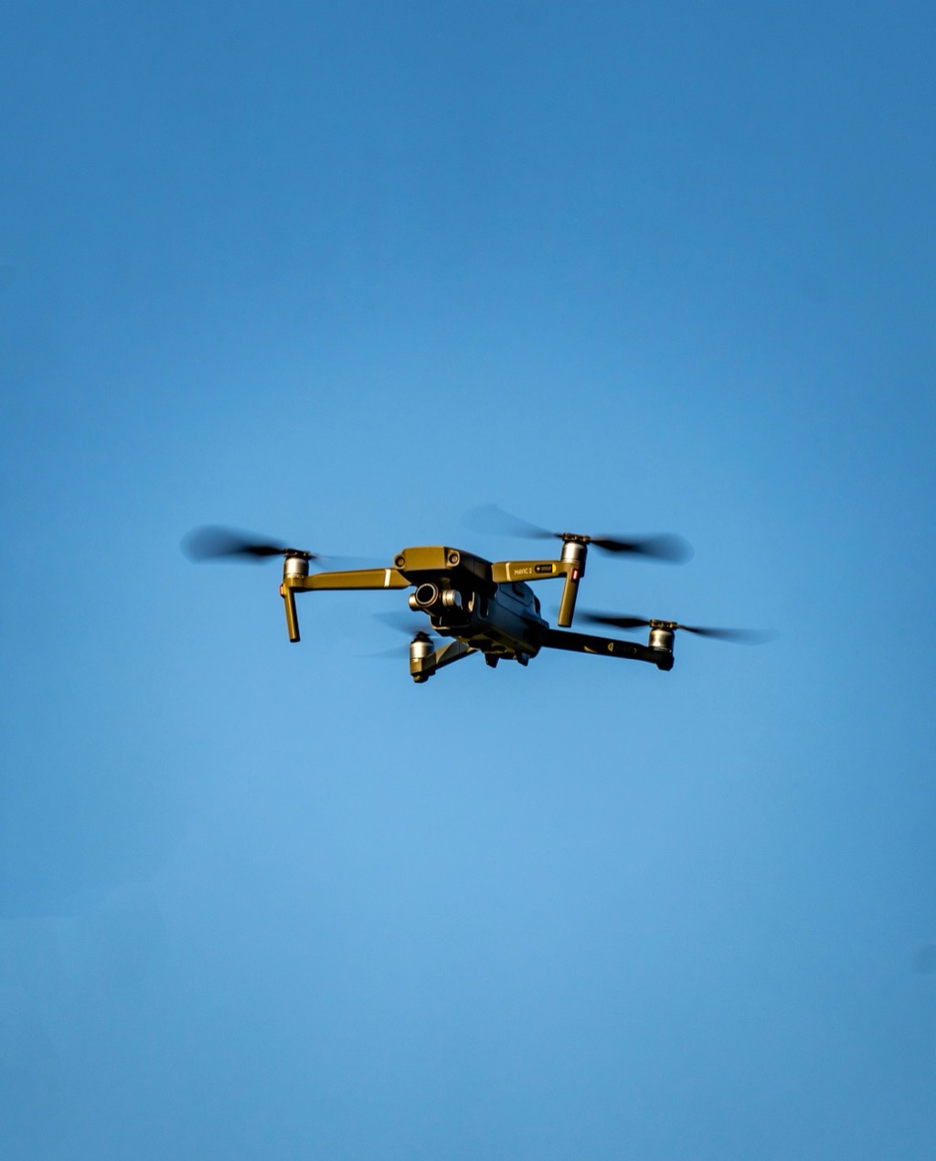
6 Best Drone Surveying Methods
You’re witnessing a revolution in how professionals map and measure our world. Traditional surveying methods that once took weeks now happen in hours thanks to cutting-edge drone technologies that deliver precision data from above.
From AI-powered terrain analysis to multi-spectral imaging capabilities these six innovative methodologies are reshaping industries like construction agriculture and environmental monitoring. Your next surveying project could benefit from techniques that combine speed accuracy and cost-effectiveness in ways previously impossible.
Disclosure: As an Amazon Associate, this site earns from qualifying purchases. Thank you!
LiDAR-Equipped Drone Surveying for High-Precision Topographic Mapping
Plan your next adventure with the 2025 National Geographic Road Atlas, covering the United States, Canada, and Mexico. Its durable, folded format (11 x 15 in) makes it ideal for hiking and camping trips.

LiDAR-equipped drones combine laser scanning technology with aerial mobility to capture millions of precise elevation points across vast terrains. You’ll achieve centimeter-level accuracy while dramatically reducing field time compared to traditional ground-based surveying methods.
P.S. check out Udemy’s GIS, Mapping & Remote Sensing courses on sale here…
Get accurate 360° scanning up to 12 meters with the compact FHL-LD19 LiDAR sensor. Resistant to bright light and weighing under 50g, it offers easy integration with ROS/ROS2/C/C++ SDK for robots and drones.

Advanced Point Cloud Data Collection Techniques
Pattern your flight paths systematically to maximize point density and minimize data gaps in complex terrain. You’ll capture optimal results using overlapping flight lines with 60-80% side overlap and maintaining consistent altitude throughout the survey mission.
Filter your raw point cloud data using classification algorithms that separate ground returns from vegetation and structures. Modern LiDAR systems like the Velodyne Puck or Riegl miniVUX generate up to 700,000 points per second with sub-5cm vertical accuracy.
Power your Velodyne VLP-16 Puck LiDAR Sensor with this T-Power charger. It's compatible with CUIINC SMIJ6-12-V-PS models and supports AC 100V-240V input.

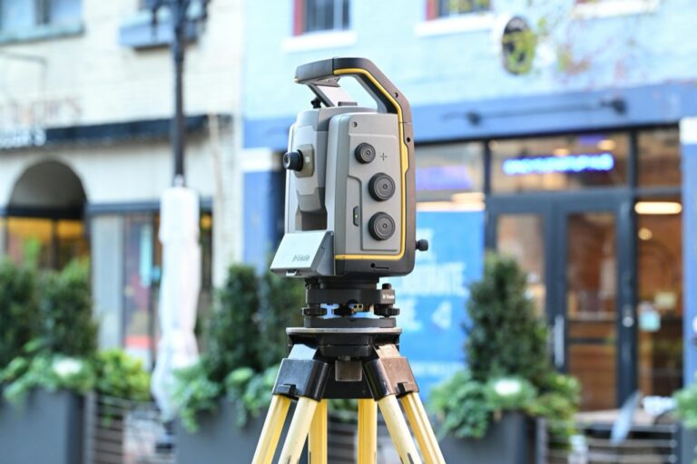
Integration with Traditional Surveying Equipment
Get accurate leveling with the KEZERS 32X Optical Level Kit. It features 32X magnification, a self-leveling system, and comes with a tripod and grade rod for easy setup.

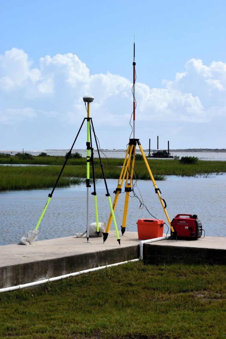
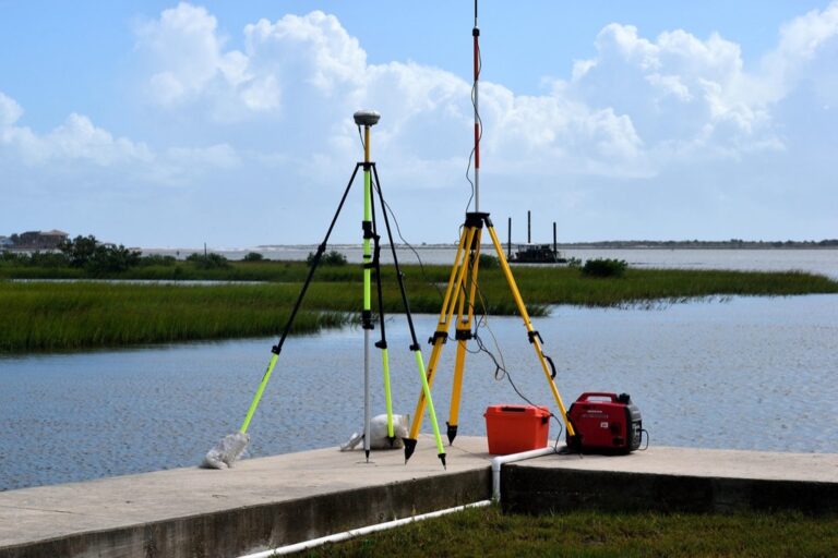
Establish ground control points using high-precision GPS equipment before deploying your LiDAR drone to ensure absolute positional accuracy. You’ll typically need 3-5 surveyed control points per square kilometer depending on terrain complexity and accuracy requirements.
Achieve centimeter-level precision with the E1 RTK GNSS system, featuring a 5km radio range and 60° tilt surveying. Enjoy 20+ hours of continuous operation and robust signal tracking in challenging environments.

Combine total station measurements with drone-collected LiDAR data to validate critical infrastructure features like building corners and utility locations. This hybrid approach reduces field verification time by 70% while maintaining surveying-grade precision standards.
Applications in Large-Scale Infrastructure Projects
Map linear infrastructure corridors including highways, pipelines, and transmission lines using LiDAR drones to identify encroachments and plan maintenance activities. You’ll complete 50-mile corridor surveys in single flight sessions that previously required weeks of ground-based measurements.
Monitor construction progress on major developments by comparing monthly LiDAR point clouds to detect earthwork volumes and structural changes. Mining operations use this methodology to calculate stockpile volumes with 98% accuracy for inventory management and regulatory compliance reporting.
Photogrammetry-Based 3D Modeling Using Multi-Spectral Imaging
Multi-spectral photogrammetry combines traditional 3D modeling with specialized imaging sensors to create detailed terrain models while capturing vegetation health, moisture content, and material composition data simultaneously.
RGB and Infrared Camera Combinations
You’ll achieve superior mapping results by mounting both RGB and near-infrared sensors on your drone platform. RGB cameras capture standard visual data while infrared sensors detect thermal signatures and vegetation stress patterns invisible to standard photography. This dual-sensor approach generates normalized difference vegetation index (NDVI) maps alongside your 3D models, providing vegetation health analytics for agricultural and environmental surveys. Most professional surveying drones accommodate payload weights of 2-4 pounds for dual-camera configurations.
Structure from Motion (SfM) Processing Methods
SfM algorithms reconstruct 3D geometry by analyzing overlapping images from multiple viewpoints during your flight mission. You’ll process thousands of tie points between sequential photos to generate dense point clouds with typical accuracies of 1-3 centimeters horizontally. Software like Pix4D and Agisoft Metashape automatically identify matching features across your image sets, creating photorealistic 3D models from standard camera data. Processing times range from 2-8 hours depending on image count and desired resolution levels.
Enhanced Accuracy Through Ground Control Points
Ground control points dramatically improve your photogrammetric accuracy from meter-level to centimeter-level precision across large survey areas. You’ll establish surveyed reference markers using RTK GPS equipment before flight operations, creating known coordinate positions throughout your mapping zone. These control points anchor your aerial imagery to real-world coordinates, reducing systematic errors and geometric distortions in final deliverables. Professional surveys typically require 3-5 ground control points per square kilometer for optimal results.
Real-Time Kinematic (RTK) GPS Integration for Centimeter-Level Accuracy
RTK GPS integration transforms drone surveying by delivering positional accuracy within 1-2 centimeters during flight operations. This methodology eliminates the guesswork associated with traditional GPS corrections by providing real-time positioning data directly to your drone’s navigation system.
Continuous Base Station Connectivity
Establishing a stable base station connection ensures your drone maintains centimeter-level accuracy throughout the entire survey mission. You’ll need to position your base station within 10-15 kilometers of your flight area and verify cellular or radio connectivity before takeoff. Modern RTK systems automatically correct for atmospheric delays and satellite orbit errors, delivering consistent positioning data every second. If connection drops occur, your drone switches to standard GPS mode temporarily while continuing to log correction data for post-processing recovery.
Reduced Post-Processing Time Requirements
RTK integration cuts post-processing workflows from hours down to minutes by applying corrections in real-time during data collection. Your survey data arrives pre-corrected, eliminating the need for extensive ground control point calculations and coordinate transformations. Processing software like Pix4D or DroneDeploy can generate final deliverables within 30 minutes of flight completion when using RTK-corrected imagery. You’ll still need basic quality checks and format conversions, but the computational-heavy correction algorithms run during flight rather than afterward.
Field Validation and Quality Control Protocols
Implementing systematic validation checks ensures your RTK corrections maintain survey-grade accuracy throughout each mission. You should establish at least three independent check points using traditional surveying equipment before drone deployment to verify base station calibration. Monitor your RTK fix solution status continuously during flight – anything below “fixed” integer ambiguity resolution indicates potential accuracy degradation. Post-flight validation involves comparing known control points with drone-captured coordinates, typically achieving residuals under 3 centimeters for horizontal positions and 5 centimeters vertically.
Thermal Imaging Drone Surveys for Infrastructure Inspection
Thermal imaging drone surveys detect temperature variations across infrastructure surfaces, revealing hidden defects and inefficiencies invisible to traditional visual inspections. You’ll capture thermal signatures that indicate structural problems, energy losses, and maintenance needs with unprecedented speed and accuracy.
Heat Signature Analysis for Building Diagnostics
Heat signature analysis identifies energy loss patterns and structural defects through thermal contrast detection. You’ll locate air leaks around windows and doors by observing temperature differentials of 3-5°F between interior and exterior surfaces. Moisture intrusion appears as cooler regions on thermal imagery, while electrical hotspots register temperatures 10-15°F above normal operating levels. Modern thermal sensors achieve temperature accuracy within ±0.1°C, enabling precise building envelope assessments across commercial and residential properties.
Pipeline and Utility Line Monitoring
Pipeline monitoring uses thermal imaging to detect leaks, blockages, and structural integrity issues along utility corridors. You’ll identify gas leaks through temperature anomalies caused by rapid expansion cooling, while water line breaks create distinct thermal signatures from temperature changes in surrounding soil. Underground utility mapping becomes possible through thermal detection of buried infrastructure, with depth penetration reaching 3-4 feet in optimal soil conditions. Regular thermal surveys reduce pipeline failure rates by 40% through early detection capabilities.
Solar Panel Efficiency Assessment Techniques
Solar panel efficiency assessment reveals underperforming modules and electrical faults through thermal pattern analysis. You’ll identify defective cells operating 15-20°C above normal temperatures, indicating reduced power output and potential fire hazards. Hot spots from micro-cracks, soiling, or shading patterns become immediately visible through thermal contrast, while bypass diode failures create characteristic rectangular heat signatures. Thermal surveys can assess entire solar installations in 30-45 minutes, identifying efficiency losses that reduce system output by 10-25% annually.
Artificial Intelligence-Powered Automated Flight Planning
AI-powered flight planning transforms drone surveying by automatically generating optimal routes and adapting to real-time conditions. These intelligent systems process vast datasets to create efficient survey patterns while maintaining safety protocols.
Machine Learning Route Optimization
Machine learning algorithms analyze terrain complexity, weather patterns, and battery life to create the most efficient flight paths for your survey missions. Advanced systems process historical flight data to predict optimal altitudes and speeds for different terrain types, reducing flight time by up to 40% compared to manual planning. These algorithms continuously learn from completed missions, improving route efficiency and adapting to site-specific challenges like wind patterns or restricted airspace zones.
Obstacle Detection and Avoidance Systems
Computer vision systems equipped with machine learning capabilities detect and classify obstacles in real-time, automatically adjusting flight paths to maintain safe distances from structures, vegetation, and moving objects. These systems use multiple sensors including cameras, LiDAR, and radar to create comprehensive 3D maps of the survey environment. Advanced algorithms predict obstacle movement patterns and pre-plan alternative routes, ensuring mission continuity even in complex environments with dynamic hazards like construction equipment or wildlife.
Predictive Maintenance Scheduling
AI algorithms monitor drone performance metrics including motor temperature, vibration patterns, and battery degradation to predict when maintenance will be needed before component failures occur. These systems analyze flight data trends to identify early warning signs of mechanical issues, scheduling maintenance windows that minimize survey downtime. Machine learning models track component wear patterns across different flight conditions, optimizing replacement schedules and reducing unexpected equipment failures by up to 75% during critical survey operations.
Swarm Drone Technology for Large-Area Simultaneous Surveying
Learn the science behind unmanned flight and UAV systems. This guide offers a step-by-step approach to understanding drone and UAV technology engineering.

Swarm drone technology multiplies your surveying capabilities by coordinating multiple aircraft to cover vast territories simultaneously. This approach reduces survey time exponentially while maintaining data consistency across the entire project area.
Coordinated Multi-Drone Operations
Coordinated flight systems deploy 3-12 drones simultaneously using centralized mission control software that manages each aircraft’s flight path, altitude, and data collection parameters. Your swarm operates through predetermined grid patterns with overlapping coverage zones to ensure complete area mapping without data gaps. Advanced collision avoidance algorithms maintain safe separation distances of 50-100 meters between aircraft while optimizing flight efficiency. Real-time communication protocols synchronize battery levels and weather adjustments across all units.
Data Synchronization and Processing Methods
Data synchronization occurs through cloud-based processing platforms that merge datasets from multiple drones using GPS timestamps and geographic coordinates. Your system automatically aligns overlapping imagery and sensor data to create seamless composite maps with consistent resolution and color balance. Machine learning algorithms identify and correct discrepancies between drone datasets, ensuring uniform data quality across the surveyed area. Processing time reduces by 60% compared to sequential single-drone surveys through parallel data handling workflows.
Cost-Effective Coverage of Extensive Territories
Cost-effective coverage emerges from reduced flight hours and operational efficiency gains when surveying areas exceeding 1,000 acres. Your swarm completes large-scale surveys in one-third the time of traditional single-drone operations, significantly lowering labor costs and equipment rental fees. Simultaneous data collection eliminates weather-related delays that often plague extended single-drone missions spanning multiple days. Energy efficiency improves through optimized flight paths that minimize battery consumption per drone while maximizing coverage area.
Conclusion
These cutting-edge drone surveying methodologies represent the future of geospatial data collection. By embracing technologies like AI-powered flight planning RTK GPS integration and swarm coordination systems you’ll position your surveying operations at the forefront of industry innovation.
The speed accuracy and cost benefits these methodologies deliver make them essential tools for competitive surveying practices. Whether you’re managing large infrastructure projects or conducting precision agricultural assessments these technologies will streamline your workflows while delivering superior results.
Your investment in these innovative approaches will pay dividends through reduced project timelines enhanced data quality and improved client satisfaction. The surveying industry continues evolving rapidly and adopting these methodologies ensures you’ll remain competitive in an increasingly demanding marketplace.
Frequently Asked Questions
How have drone technologies transformed professional surveying practices?
Drone technologies have revolutionized surveying by reducing project completion times from weeks to hours while significantly improving precision. These advancements utilize AI-powered terrain analysis, multi-spectral imaging, and LiDAR technology to deliver faster, more accurate, and cost-effective results across construction, agriculture, and environmental monitoring industries.
What is LiDAR-equipped drone surveying and how accurate is it?
LiDAR-equipped drones use laser scanning technology for high-precision topographic mapping, achieving centimeter-level accuracy. They collect point cloud data through systematic flight paths and use classification algorithms to filter raw data. This method significantly reduces field time compared to traditional surveying while maintaining exceptional precision for mapping projects.
How does photogrammetry-based 3D modeling work with multi-spectral imaging?
Photogrammetry combines traditional 3D modeling with specialized sensors to create detailed terrain models while capturing vegetation health and material composition data. Using RGB and near-infrared cameras, drones generate NDVI maps alongside 3D models. Structure from Motion (SfM) processing reconstructs 3D geometry from overlapping images with high accuracy.
What is RTK GPS technology and why is it important for drone surveying?
Real-Time Kinematic (RTK) GPS provides centimeter-level accuracy during drone surveying by delivering real-time positioning data. It requires a stable base station connection and automatically corrects for atmospheric delays and satellite orbit errors. RTK integration significantly reduces post-processing time by pre-correcting survey data during collection.
How do thermal imaging drone surveys benefit infrastructure inspection?
Thermal imaging drones detect temperature variations across surfaces to reveal hidden defects and inefficiencies invisible to traditional visual inspections. They’re used for building diagnostics, pipeline monitoring, and solar panel efficiency assessment. This technology enables early detection of structural issues, reducing failure rates and improving maintenance planning.
What advantages does AI-powered automated flight planning offer?
AI-powered flight planning generates optimal routes by analyzing terrain complexity, weather patterns, and battery life, reducing flight time by up to 40%. Machine learning algorithms adapt to real-time conditions, while obstacle detection systems maintain safe distances from hazards. Predictive maintenance scheduling reduces unexpected equipment failures by up to 75%.
How does swarm drone technology enhance surveying capabilities?
Swarm drone technology coordinates 3-12 drones simultaneously to cover large areas, significantly reducing survey time while ensuring data consistency. Centralized software manages flight paths and collision avoidance, while cloud-based platforms synchronize datasets from multiple drones. This approach completes extensive surveys in one-third the time of single-drone operations.
What role do ground control points play in drone surveying accuracy?
Ground control points anchor aerial imagery to real-world coordinates, significantly improving photogrammetric accuracy and reducing errors in final deliverables. They’re essential for both LiDAR and photogrammetry workflows, enhancing positional accuracy and reducing field verification time by up to 70% when properly integrated with drone survey data.