7 Comparative Map Layout Ideas That Transform Data Analysis
Why it matters: Comparative map layouts transform complex geographical data into clear visual stories that help your audience understand spatial relationships at a glance.
The challenge: Most designers struggle with cluttered compositions that overwhelm viewers instead of guiding them through meaningful comparisons between different regions or time periods.
What’s next: These seven proven layout strategies will help you create compelling side-by-side maps that highlight differences while maintaining visual harmony and readability.
Disclosure: As an Amazon Associate, this site earns from qualifying purchases. Thank you!
Split-Screen Comparative Layout Design
Split-screen layouts divide your map canvas into distinct vertical or horizontal sections, creating clear visual boundaries that prevent data overlap while maintaining spatial relationships between compared elements.
Side-by-Side Geographic Regions
Position different geographic areas using identical scales and projections to ensure accurate spatial comparisons. You’ll achieve the most effective results by aligning your coordinate systems and maintaining consistent symbology across both map panels. Select regions with similar geographic extents to maximize visual balance and prevent one area from dominating the composition.
Before and After Temporal Comparisons
Document temporal changes by placing chronologically different datasets in adjacent panels with synchronized zoom levels and center points. You should maintain identical classification schemes and color ramps to highlight genuine differences rather than cartographic inconsistencies. Establish clear temporal markers in your titles to eliminate confusion about time periods being compared.
Dual Data Layer Visualizations
Combine complementary datasets like elevation and land use by dedicating each panel to a single thematic layer while preserving identical geographic boundaries. You can enhance comprehension by using consistent base map elements and ensuring your data classifications align logically. Apply coordinated color schemes that don’t compete visually while still distinguishing between the different data themes effectively.
Overlay Transparency Map Design Technique
Overlay transparency design leverages semi-transparent layers to display multiple datasets simultaneously without sacrificing spatial relationships. This technique excels when you need to show correlations between overlapping geographic phenomena.
Semi-Transparent Layer Stacking
Stack multiple data layers using alpha transparency values between 30-70% for optimal visibility balance. You’ll achieve the best results by placing your most important dataset at full opacity as the base layer. Secondary layers should use 50% transparency while tertiary information works best at 30-40% opacity. This stacking approach prevents visual competition between datasets while maintaining clear geographic boundaries and spatial context throughout your comparative analysis.
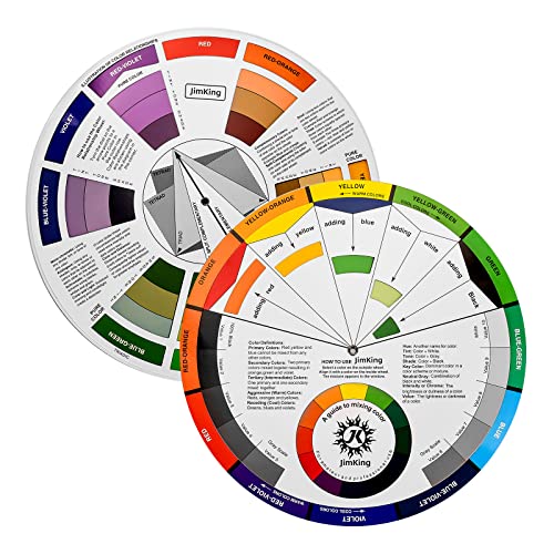
Color-Coded Overlay Systems
Implement complementary color schemes with distinct hues for each overlay to prevent visual confusion. Your primary layer should use warm colors like reds and oranges while secondary overlays work effectively with cool blues and greens. Avoid using similar color temperatures or adjacent hues on the color wheel. This systematic approach ensures viewers can distinguish between different data categories even when layers overlap at various transparency levels across your comparative map design.
Easily organize and understand color relationships with this rotating color wheel. Ideal for artists and designers, it features a durable, UV-coated design for lasting use and clear color identification.
Interactive Toggle Features
Create user-controlled visibility options allowing viewers to activate or deactivate specific overlay layers. You can implement checkbox controls layer switchers or slider bars to adjust transparency levels dynamically. Modern web mapping platforms like Leaflet and Mapbox GL JS support these interactive features natively. This functionality empowers users to explore data relationships at their own pace while maintaining the integrity of your comparative map layout design structure.
Multi-Panel Grid Layout Configuration
Multi-panel grid layouts transform complex comparative mapping challenges into organized visual narratives through systematic spatial arrangement. You’ll achieve maximum data clarity by structuring your comparative maps within defined grid systems that guide viewer attention across related geographic information.
Four-Quadrant Comparison Framework
Four-quadrant layouts divide your map canvas into equal sections that accommodate different time periods, variables, or geographic scales simultaneously. You’ll position your primary comparison in the upper quadrants while supporting data occupies lower panels. This framework works exceptionally well for demographic comparisons, environmental change analysis, and infrastructure development studies. Maintain consistent symbology across all four panels to prevent visual confusion while allowing subtle color variations to distinguish temporal or categorical differences.
Timeline Series Panel Arrangement
Timeline series arrangements display chronological data progression through sequential panel positioning from left to right or top to bottom. You’ll establish temporal rhythm by spacing panels evenly and maintaining identical geographic extents across the series. This configuration excels for tracking urban expansion, climate change impacts, or population migration patterns over multiple decades. Synchronize your classification breaks and color ramps across all timeline panels to ensure accurate visual comparison of data values throughout the temporal sequence.
Category-Based Grid Organization
Category-based grids organize thematic data into logical groupings that facilitate cross-variable analysis within structured layouts. You’ll cluster related datasets into distinct grid sections while maintaining visual hierarchy through consistent panel sizing and spacing. This approach proves invaluable for socioeconomic comparisons, land use classifications, or multi-criteria decision analysis. Apply coordinated color schemes within each category group while using neutral spacing elements to separate different thematic sections and prevent visual bleeding between unrelated datasets.
Swipe-Through Interactive Map Interface
Swipe-through interactive map interfaces revolutionize comparative mapping by allowing users to dynamically reveal underlying datasets through intuitive gesture controls. This approach transforms static comparative layouts into engaging experiences that maintain spatial context while enabling seamless transitions between different data layers.
Mobile-Optimized Slider Controls
Touch-responsive slider mechanisms provide precise control over data layer visibility on mobile devices. Position the slider control at the bottom of the screen to avoid finger obstruction while maintaining easy thumb access. Configure the slider to move smoothly between 0-100% opacity values, ensuring responsive feedback even on slower devices. Implement haptic feedback at key comparison points to enhance user engagement and provide tactile confirmation of important data thresholds during exploration.
Desktop Scroll-Based Navigation
Mouse wheel integration enables fluid navigation through comparative datasets without requiring additional interface elements. Map your scroll events to opacity changes or layer transitions, maintaining a 1:1 ratio between scroll distance and visual change for predictable user experience. Include keyboard arrow key support as an alternative navigation method, particularly beneficial for accessibility compliance. Position a discrete progress indicator along the map edge to show current position within the comparison sequence.
Animated Transition Effects
Smooth CSS transitions create professional-quality animations that guide user attention without overwhelming the interface. Set transition durations between 200-400 milliseconds to maintain responsiveness while providing visual continuity. Use easing functions like cubic-bezier curves to create natural motion that feels intuitive rather than mechanical. Implement loading states during data-heavy transitions to prevent jarring visual jumps when switching between complex comparative datasets.
Pop-Up Window Comparative Display
Pop-up windows transform static comparative maps into dynamic exploration tools that reveal detailed comparisons on demand. This interactive approach solves screen real estate limitations while maintaining clean base map aesthetics.
Click-to-Compare Functionality
Click-to-compare systems activate detailed comparison windows when you select specific map features or regions. You’ll implement clickable hotspots that trigger side-by-side data panels showing statistical differences, temporal changes, or categorical variations. JavaScript libraries like Leaflet or Mapbox GL JS provide built-in popup methods that support custom HTML content. Configure your click events to display coordinated datasets with synchronized zoom levels and identical classification schemes for accurate visual comparisons.
Hover-Activated Detail Windows
Hover-activated windows provide instant access to comparative data without requiring click interactions from your users. You’ll position these floating panels adjacent to cursor locations displaying real-time data comparisons between selected features. CSS positioning and JavaScript event listeners control window placement and content updates. Set hover delay timers between 200-300 milliseconds to prevent accidental triggers while ensuring responsive feedback. Include exit animations and proper z-index stacking to maintain visual hierarchy across multiple map layers.
Modal-Based Map Comparisons
Modal windows create focused comparison environments by overlaying full-screen or large-format displays over your base map interface. You’ll design these modals to showcase detailed side-by-side comparisons with enhanced data visualization capabilities including charts, graphs, and statistical summaries. Bootstrap or custom CSS frameworks provide responsive modal containers that adapt to different screen sizes. Implement escape key functionality and background click dismissal for intuitive user navigation while preserving the underlying map state for seamless return experiences.
Linked Map Synchronization System
Linked map synchronization systems create seamless user experiences by connecting multiple map panels through coordinated navigation and shared data properties. This approach eliminates the jarring disconnection often experienced when comparing separate map interfaces.
Coordinated Zoom and Pan Features
Coordinated zoom controls automatically mirror navigation actions across all connected map panels simultaneously. When you zoom into a specific area on one map, all synchronized panels adjust to the identical scale and center point. This ensures users maintain spatial context while comparing different datasets or time periods. Configure pan synchronization to follow cursor movement between panels, creating fluid transitions that preserve geographic relationships and prevent viewer disorientation during comparative analysis.
Shared Legend and Scale Integration
Shared legend systems unify symbology across all connected map panels to maintain consistent data interpretation. You’ll want to establish a master legend that governs color schemes, classification breaks, and symbol sizes for all synchronized views. Scale bar integration ensures identical measurement references appear across panels, preventing scale-related confusion. Position shared legends strategically between panels or in dedicated interface zones to maximize visibility while minimizing screen space consumption.
Real-Time Data Synchronization
Real-time synchronization updates all connected map panels instantly when underlying datasets change or refresh. Configure your system to broadcast data updates simultaneously across all views, maintaining temporal consistency for time-sensitive comparative analysis. Implement buffer management to handle varying data load times between panels, ensuring smooth user experiences even with large datasets. You can establish priority hierarchies that update critical panels first, followed by secondary comparative views to optimize performance.
Accordion-Style Expandable Map Layout
Accordion-style layouts transform comparative mapping challenges into organized, space-efficient solutions that reveal content progressively. This vertical stacking approach maximizes screen real estate while maintaining clear visual hierarchy across multiple datasets.
Collapsible Section Organization
Organize your map panels into collapsible sections that group related comparative datasets under distinct headers. Each accordion panel contains a specific map comparison—temporal changes, categorical differences, or multi-variable analyses—with clear labeling systems that identify the contained data. Design consistent header styling with intuitive expand/collapse indicators, ensuring users understand which sections contain active comparisons. Position the most critical comparative datasets in the first accordion panel to establish immediate context for your spatial analysis workflow.
Progressive Disclosure Design
Implement progressive disclosure principles that reveal comparative map complexity in manageable stages rather than overwhelming users with simultaneous data layers. Start with overview-level comparisons in collapsed states, then expand to detailed datasets as users engage with specific accordion sections. Structure your information hierarchy so basic comparisons appear first, followed by advanced analytical layers that build upon initial observations. This approach prevents cognitive overload while maintaining access to comprehensive comparative datasets for users requiring detailed spatial analysis.
Space-Efficient Vertical Stacking
Maximize vertical screen space through strategic accordion panel sizing that accommodates different map scales and comparative requirements. Configure dynamic panel heights that adjust based on content complexity—larger panels for detailed geographic comparisons, smaller panels for summary-level overviews. Implement smooth expansion animations that guide user attention while maintaining spatial context between comparative layers. Include scroll-lock features within expanded panels to prevent accidental navigation disruption during detailed map examination, ensuring consistent user experience across different screen sizes and device orientations.
Conclusion
These seven comparative map layout strategies give you the tools to transform cluttered geographic visualizations into clear compelling narratives. Whether you’re working with temporal data changes or complex multi-variable datasets each approach offers unique advantages for different storytelling needs.
The key to successful comparative mapping lies in choosing the right technique for your specific data and audience. Interactive solutions work best for exploratory analysis while static layouts excel at presenting focused conclusions.
Remember that effective comparative maps prioritize user experience over technical complexity. Start with your core message then select the layout design that best supports your geographic story while maintaining visual clarity and professional presentation standards.
Frequently Asked Questions
What are comparative map layouts and why are they important?
Comparative map layouts are visual design strategies that help present complex geographical data through clear, side-by-side comparisons. They’re crucial for preventing cluttered compositions that confuse viewers and instead facilitate meaningful data analysis. These layouts enable effective visual storytelling by emphasizing differences between datasets while maintaining visual harmony and readability across multiple geographic regions or time periods.
How does split-screen comparative layout design work?
Split-screen comparative layout design divides the map canvas into distinct sections to prevent data overlap while preserving spatial relationships. This technique requires identical scales and projections for accurate comparisons, along with aligned coordinate systems and consistent symbology. It’s particularly effective for before-and-after temporal comparisons, ensuring synchronized datasets and maintaining consistent classification schemes across adjacent panels.
What is overlay transparency map design?
Overlay transparency map design uses semi-transparent layers to display multiple datasets simultaneously without sacrificing spatial relationships. The technique involves stacking data layers with varying alpha transparency values, keeping the most important dataset at full opacity while making secondary layers more transparent. Complementary color-coded systems prevent visual confusion, and interactive toggle features allow users to control layer visibility.
How do multi-panel grid layout configurations work?
Multi-panel grid layouts organize complex comparative mapping into systematic spatial arrangements. The four-quadrant framework divides the canvas into equal sections for different time periods or variables, while timeline series arrangements display chronological data progression. Category-based grid organization clusters related datasets into logical groupings, using coordinated color schemes and neutral spacing to enhance clarity and prevent visual interference.
What are swipe-through interactive map interfaces?
Swipe-through interactive map interfaces allow users to dynamically reveal underlying datasets through intuitive gesture controls. They feature mobile-optimized slider controls for precise visibility control, scroll-based navigation for desktop users with keyboard accessibility support, and animated transition effects. These interfaces revolutionize comparative mapping by providing fluid, user-controlled transitions between datasets while maintaining smooth visual changes and enhanced user engagement.
How do pop-up window comparative displays enhance map functionality?
Pop-up window comparative displays transform static maps into dynamic exploration tools by addressing screen space limitations while maintaining clean aesthetics. They include click-to-compare functionality that activates detailed comparison windows, hover-activated detail windows for instant data access, and modal-based comparisons for focused side-by-side visualizations. These features enhance user navigation while preserving the underlying map state for seamless experiences.
What are linked map synchronization systems?
Linked map synchronization systems create seamless user experiences by connecting multiple map panels through coordinated navigation and shared data properties. They feature coordinated zoom and pan controls that adjust all connected panels simultaneously, shared legend and scale integration to unify symbology, and real-time data synchronization for instant updates across all views. This ensures spatial context maintenance and temporal consistency during comparative analysis.
How do accordion-style expandable map layouts optimize space?
Accordion-style expandable map layouts use vertical stacking to maximize screen real estate while maintaining clear visual hierarchy across multiple datasets. They feature collapsible section organization that groups related datasets under distinct headers, progressive disclosure design that reveals complexity in manageable stages, and dynamic panel heights with smooth expansion animations. This approach prevents cognitive overload while providing space-efficient comparative mapping solutions.