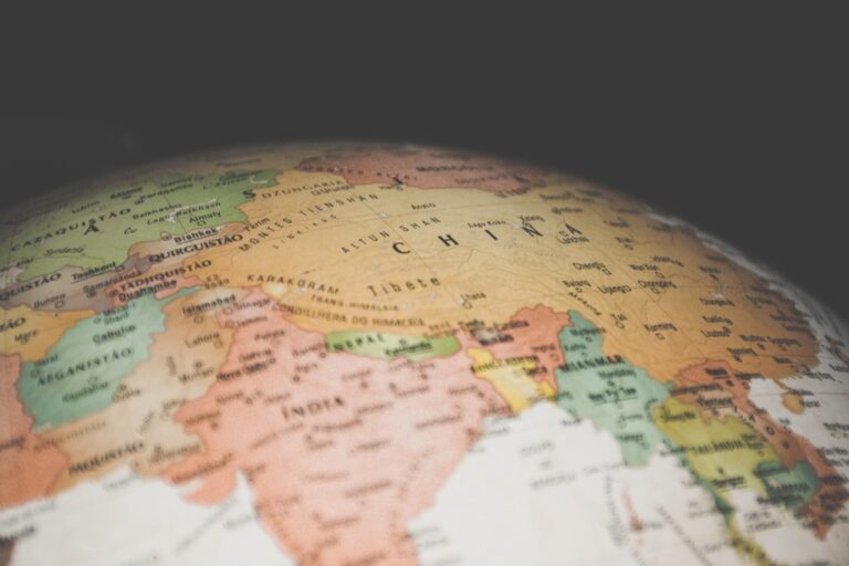
6 Map Projection Methods That Pro Cartographers Use
You’ve probably wondered why world maps look so different from each other – some make Greenland appear massive while others stretch Africa beyond recognition. The culprit? Map projections – mathematical methods that transform our round Earth onto flat surfaces, each with distinct strengths and weaknesses.
Understanding these six essential projection methods will help you choose the right map for navigation, data visualization, or geographic analysis. Whether you’re planning a polar expedition or creating infographics about global demographics, selecting the wrong projection can distort distances, areas, or shapes in ways that mislead your audience.
Why it matters: Different projections serve different purposes, and knowing when to use each one can make the difference between accurate representation and visual confusion.
Disclosure: As an Amazon Associate, this site earns from qualifying purchases. Thank you!
P.S. check out Udemy’s GIS, Mapping & Remote Sensing courses on sale here…
Understanding Map Projections: The Foundation of Cartographic Representation
Achieve a flawless, even complexion with e.l.f. Flawless Satin Foundation. This lightweight, vegan formula provides medium coverage and a semi-matte finish for all-day wear, while hydrating your skin with glycerin.

Map projections serve as mathematical formulas that transform Earth’s three-dimensional spherical surface onto a two-dimensional plane. You’ll encounter this fundamental challenge whenever you create any flat map since it’s geometrically impossible to flatten a sphere without introducing some form of distortion.
Projection systems preserve specific properties while sacrificing others based on your mapping objectives. Area-preserving projections maintain accurate size relationships between regions but distort shapes. Conformal projections preserve angles and shapes locally but alter area measurements. Distance-preserving projections maintain accurate measurements from specific reference points but compromise other spatial relationships.
Your projection choice directly impacts data interpretation and user understanding. Navigation applications require conformal properties to maintain bearing accuracy. Statistical mapping demands equal-area projections to prevent visual bias in choropleth displays. Thematic mapping often prioritizes aesthetic balance over strict geometric accuracy.
Three primary projection families organize the mathematical approaches you’ll use most frequently. Cylindrical projections wrap around Earth like a cylinder and work well for equatorial regions. Conic projections use cone-shaped surfaces and excel for mid-latitude mapping. Azimuthal projections project from a single point and serve specialized navigation or polar mapping needs.
Modern GIS software automates projection calculations but understanding the underlying mathematics helps you select appropriate coordinate systems. You’ll achieve better results by matching projection characteristics to your specific mapping purpose rather than defaulting to popular options like Web Mercator for all applications.
Mercator Projection: Navigating the Seas and Digital Maps
The Mercator projection dominates modern navigation and digital mapping despite its well-known distortions. You’ll find this cylindrical projection essential for marine navigation and ubiquitous in web mapping platforms.
Maritime Navigation Applications
Mercator projection preserves angles and shapes locally, making it invaluable for marine navigation since compass bearings appear as straight lines. You can plot direct courses between any two points using a ruler, which explains why nautical charts still rely heavily on this 16th-century innovation. Ship captains depend on Mercator’s conformal properties to maintain accurate headings across ocean passages, particularly in equatorial and mid-latitude regions where distortion remains minimal for navigation purposes.
Web Mapping and GPS Systems
Navigate with ease using this 7-inch GPS navigator, featuring real-time voice guidance and pre-loaded 2025 maps. Customize routes based on your vehicle type to avoid restrictions and receive speed & red light warnings.

Web Mercator (EPSG:3857) powers virtually every online mapping platform you use, from Google Maps to OpenStreetMap. You’ll recognize its familiar appearance from countless digital interfaces, where it renders quickly and allows seamless zooming across multiple scales. GPS navigation systems utilize Mercator-based projections because they maintain local angle relationships, ensuring your turn-by-turn directions remain geometrically accurate. However, you should note that Web Mercator sacrifices geodetic accuracy for visual consistency and computational efficiency.
Navigate confidently with the Garmin Drive™ 53 GPS. This navigator features a bright, high-resolution touchscreen and provides helpful driver alerts for school zones, speed changes, and more.

Limitations in Polar Regions
Mercator projection becomes unusable near the poles, where distortion approaches infinity and Greenland appears larger than Africa. You can’t map polar regions effectively using standard Mercator because landmasses become grotesquely enlarged and navigation becomes unreliable above 70° latitude. Polar stereographic projections replace Mercator for Arctic and Antarctic mapping, while Universal Polar Stereographic (UPS) coordinates handle GPS positioning in these extreme latitudes where UTM zones converge.
Equal-Area Projections: Preserving Accurate Size Relationships
Equal-area projections maintain accurate proportional relationships between geographic features, making them essential when size comparisons matter more than shape fidelity. You’ll sacrifice angular accuracy and local shape preservation to ensure that one square kilometer in Greenland appears identical in size to one square kilometer in Brazil.
Statistical Analysis and Data Visualization
Statistical mapping requires equal-area projections to prevent visual bias in choropleth maps and density visualizations. You’ll avoid misleading interpretations when displaying population density, economic indicators, or disease prevalence across different latitudes. The Albers Equal-Area Conic projection works exceptionally well for continental-scale statistical analysis, while the Mollweide projection handles global datasets effectively. Your audience won’t be deceived by inflated polar regions that could skew their understanding of data distributions.
Environmental and Climate Studies
Environmental research demands accurate area measurements for habitat analysis, deforestation monitoring, and climate change impact assessment. You’ll use equal-area projections like the Lambert Azimuthal Equal-Area for regional biodiversity studies or the Goode Homolosine for global vegetation mapping. These projections ensure that forest cover calculations, wetland assessments, and conservation priority areas maintain their true proportional relationships. Your environmental impact studies will reflect actual ecosystem sizes rather than projection-distorted measurements.
Population and Resource Distribution Maps
Population density maps and resource distribution analyses require equal-area projections to accurately represent human settlement patterns and natural resource availability. You’ll prevent urban areas from appearing disproportionately large while ensuring rural regions maintain their correct relative sizes. The Eckert IV projection excels for global population studies, while regional analyses benefit from conic equal-area variants. Your demographic visualizations will show true population concentrations without the area distortions that plague conformal projections.
Azimuthal Projections: Centering on Specific Points of Interest
Azimuthal projections excel when you need to focus mapping analysis around a central point of interest. These projections position your chosen location at the center with minimal distortion radiating outward.
Aviation and Flight Path Planning
Aviation applications rely heavily on azimuthal projections for accurate great circle route calculations. You’ll find these projections essential when plotting intercontinental flight paths because they display true directions and distances from your departure airport. The Lambert Azimuthal Equal-Area projection works particularly well for flight planning software since it maintains accurate area measurements for fuel consumption calculations. Airlines use these projections to optimize routing efficiency and calculate precise navigation bearings for long-distance flights.
Polar Region Mapping
Polar region mapping requires azimuthal projections to minimize the extreme distortions that plague cylindrical projections near the poles. You’ll achieve the most accurate results using polar stereographic projections centered on either the North or South Pole. These projections preserve angles and shapes in polar regions making them standard for Arctic and Antarctic research applications. Climate scientists rely on polar azimuthal projections for ice sheet monitoring and oceanographic studies where accurate measurements are critical for understanding environmental changes.
Radio and Telecommunications Coverage
Radio and telecommunications planning depends on azimuthal projections to model signal coverage patterns from transmission points. You can accurately calculate broadcast ranges and interference zones using azimuthal equidistant projections centered on your transmitter locations. These projections show true distances in all directions from the center point making them perfect for cellular tower placement and satellite footprint analysis. Emergency communication systems use azimuthal projections to determine optimal antenna positioning for maximum geographic coverage during disaster response operations.
Conic Projections: Balancing Accuracy for Mid-Latitude Regions
Conic projections offer an optimal balance between distortion and accuracy for regions between 30° and 60° latitude. You’ll find these projections particularly effective when your mapping focus centers on continental landmasses where both area and shape preservation matter.
National and Regional Mapping
National mapping agencies rely heavily on conic projections for their topographic and administrative map series. The Lambert Conformal Conic projection serves as the foundation for USGS topographic maps and the State Plane Coordinate System across most US states. You’ll achieve minimal distortion when mapping entire countries like the United States, Canada, or European nations that span significant east-west distances. The Albers Equal-Area Conic projection works exceptionally well for census maps and demographic analysis, maintaining accurate area relationships crucial for population density calculations and electoral district mapping.
Weather Forecasting Systems
Weather prediction models depend on conic projections to maintain geometric accuracy across continental weather systems. The Lambert Conformal Conic projection preserves angles and shapes essential for tracking storm fronts, pressure systems, and precipitation patterns. You’ll find this projection standard in meteorological applications because it minimizes distortion of wind direction calculations and atmospheric modeling. The National Weather Service uses conic projections for radar composites and forecast grids, ensuring that storm tracking algorithms maintain spatial accuracy across multiple climate zones and geographic regions.
Agricultural and Land Use Planning
Agricultural planning systems utilize conic projections to maintain accurate area measurements for crop yield calculations and land management decisions. You’ll preserve critical area relationships when analyzing farmland distribution, irrigation coverage, and soil classification maps using Albers Equal-Area Conic projections. The USDA relies on conic projections for the Cropland Data Layer and agricultural census mapping, ensuring that acreage calculations remain consistent across state boundaries. These projections support precision agriculture applications where GPS coordinates must translate accurately to field management zones and variable-rate application maps.
Cylindrical Projections: Maintaining Straight-Line Relationships
Cylindrical projections wrap around the Earth like a paper cylinder, creating maps where meridians and parallels intersect at perfect right angles. You’ll find these projections fundamental to coordinate systems and global mapping frameworks.
Global Reference Systems
Universal Transverse Mercator (UTM) coordinates form the backbone of modern surveying and GIS applications worldwide. You’ll encounter UTM zones spanning 6 degrees of longitude each, providing accurate measurements for local and regional projects. State Plane Coordinate Systems rely on cylindrical projections for consistent reference frameworks across administrative boundaries. Web Mercator remains the standard for online mapping platforms, ensuring seamless tile rendering across zoom levels despite its area distortions.
Time Zone and Coordinate Mapping
Cylindrical projections excel at time zone visualization because meridians appear as straight vertical lines at regular intervals. You can easily identify longitude-based time boundaries on these maps without angular distortion. Military and aviation applications depend on cylindrical coordinate grids for consistent navigation references across large areas. GPS coordinate display systems typically use cylindrical frameworks to maintain straight-line relationships between waypoints and flight paths.
Educational and General Purpose Maps
World atlases commonly feature cylindrical projections for their familiar rectangular appearance and ease of comparison between regions. You’ll find these projections ideal for showing global patterns like climate zones, ocean currents, and trade routes as straight lines. Classroom wall maps traditionally use cylindrical formats because students can easily locate coordinates using the grid system. Reference maps benefit from the consistent scale along meridians, making distance measurements straightforward for educational exercises.
Explore our world with the updated Thirty-First Edition of the Atlas of the World, featuring detailed maps and current geographic information. Discover political boundaries, population densities, and more in this comprehensive resource.

Robinson Projection: Creating Visually Appealing World Maps
Explore the world with this 36"x24" physical wall map featuring current geographic details and Earth elevation profiles. Printed on rolled paper in the U.S.A. using the Robinson Projection.

Robinson projection balances visual appeal with acceptable distortion levels, making it ideal for general-purpose world maps. You’ll find this pseudo-cylindrical projection minimizes extreme distortions while maintaining recognizable continental shapes.
Educational Textbooks and Atlases
Educational publishers rely on Robinson projection for world maps because it presents continents in familiar proportions without shocking distortions. You’ll see textbook maps using Robinson projection to teach global geography, climate patterns, and cultural distributions. Students recognize countries easily since the projection maintains reasonable shape accuracy across most populated regions. Publishers choose Robinson projection for reference atlases where visual clarity trumps mathematical precision, creating maps that support learning rather than navigation.
Media and Publication Graphics
News organizations and magazines select Robinson projection for infographics displaying global data like population statistics, economic indicators, and environmental trends. You’ll notice editorial maps using Robinson projection because it creates clean, professional-looking world maps that fit standard publication layouts. The projection’s balanced appearance works well for print media where extreme polar distortions would appear jarring to readers. Graphic designers appreciate Robinson projection’s aesthetic qualities for wall maps and poster displays in offices and classrooms.
General Reference Applications
Reference maps for libraries, offices, and public spaces typically use Robinson projection because it provides an accurate general impression of world geography. You’ll find Robinson projection in decorative world maps where visual appeal matters more than precise measurements. The projection works effectively for displaying global phenomena like climate zones, biomes, and cultural regions where relative positions matter more than exact distances. Government agencies often choose Robinson projection for public information displays because it presents world geography in an accessible, non-threatening format.
Conclusion
Understanding these six projection methods empowers you to make informed mapping decisions that serve your specific needs. Whether you’re planning maritime routes with Mercator or analyzing population data with equal-area projections each method offers distinct advantages for different applications.
Your choice of projection directly impacts how audiences interpret geographic information. Using the wrong projection can distort critical relationships between regions or mislead viewers about actual distances and sizes.
Modern mapping tools provide access to hundreds of projections but knowing when and why to use these fundamental six gives you the foundation for effective cartographic communication. Take time to evaluate your mapping objectives before selecting a projection—your data accuracy and audience understanding depend on it.
Frequently Asked Questions
What are map projections and why do they matter?
Map projections are mathematical techniques used to transform the Earth’s round surface onto flat maps. They matter because different projections preserve different properties (area, shape, distance, or angles) while distorting others. Choosing the wrong projection can mislead viewers by distorting distances, areas, or shapes, making it crucial to select the appropriate projection for your specific mapping purpose.
Why do world maps look different from each other?
World maps look different because they use various map projections, each designed for specific purposes. Since Earth is round and maps are flat, every projection must sacrifice some accuracy. Some projections preserve area relationships, others maintain shapes, and some focus on accurate navigation. This results in maps that can look dramatically different from one another.
What is the Mercator projection and when should it be used?
The Mercator projection is a cylindrical projection that preserves angles and shapes locally, making it essential for marine navigation and GPS systems. It’s ideal for plotting accurate courses and turn-by-turn directions. However, it severely distorts areas, especially near the poles, so it shouldn’t be used for size comparisons or statistical mapping where accurate area representation matters.
When should I use equal-area projections?
Use equal-area projections when accurate size relationships between geographic features are crucial. They’re essential for statistical mapping, choropleth maps, population density visualizations, environmental studies, climate research, and resource distribution maps. These projections prevent visual bias by maintaining accurate area measurements, ensuring data like population or economic indicators are represented proportionally.
What are azimuthal projections best suited for?
Azimuthal projections excel when focusing analysis around a central point of interest. They’re ideal for aviation route planning, polar region mapping, radio signal coverage modeling, and telecommunications planning. These projections minimize distortion radiating outward from a central point, making them perfect for applications where distance and direction from a specific location are most important.
What makes the Robinson projection popular for world maps?
The Robinson projection balances visual appeal with acceptable distortion levels, making it ideal for general-purpose world maps. Educational publishers favor it for textbooks and atlases because it presents continents in familiar proportions without shocking distortions. Media organizations also prefer it for clean, professional-looking infographics that fit standard publication layouts while providing an accurate general impression of world geography.
How do I choose the right map projection for my needs?
Choose based on your mapping purpose: use conformal projections (like Mercator) for navigation, equal-area projections for statistical mapping and size comparisons, azimuthal projections for analysis around a central point, and compromise projections (like Robinson) for general reference maps. Consider what properties matter most for your application—accurate areas, shapes, distances, or visual appeal.