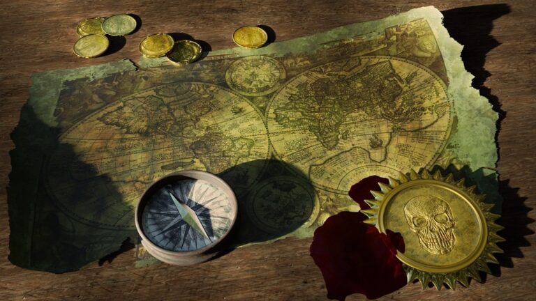
5 Best Augmented Reality Tools for Map Storytelling
The big picture: You’re standing at the intersection of mapping technology and immersive storytelling where augmented reality transforms static maps into dynamic narrative experiences.
Why it matters: Traditional cartographic storytelling relies on flat visualizations that limit how you engage with geographic data and historical events.
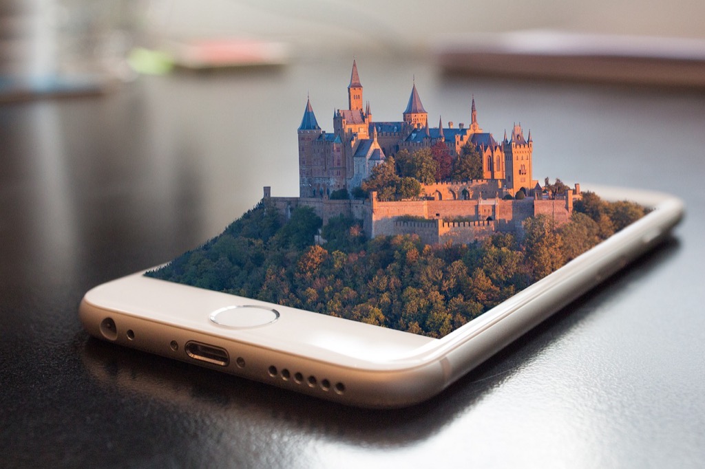
What’s next: AR-powered maps let you overlay digital content onto real-world locations creating compelling stories that blend physical geography with interactive elements you can explore in real-time.
Disclosure: As an Amazon Associate, this site earns from qualifying purchases. Thank you!
P.S. check out Udemy’s GIS, Mapping & Remote Sensing courses on sale here…
Interactive Historical Timeline Overlays
You’ll transform static maps into dynamic storytelling platforms by layering temporal data that reveals how locations evolved over time.
Visualizing Past Events on Present-Day Maps
You can overlay historical events directly onto current geographic locations using AR frameworks like ARCore or ARKit. Position battle formations from the Civil War on modern Gettysburg fields, or display the 1906 San Francisco earthquake’s impact zones on today’s city streets. These overlays require precise georeferencing of historical data to ensure accurate spatial alignment. You’ll need to convert historical coordinates using datum transformations and account for urban development changes that may have altered the original landscape’s reference points.
Creating Temporal Layers for Educational Content
You’ll build educational experiences by structuring historical data into chronological layers within your AR mapping application. Create separate data layers for different time periods—colonial settlements, industrial development, and modern urbanization—each containing relevant geographic features, demographic information, and contextual imagery. Use temporal databases like PostGIS with time-enabled queries to manage these datasets efficiently. You can implement layer switching mechanisms that allow users to toggle between different historical periods while maintaining consistent cartographic symbology and scale relationships.
Implementing User-Controlled Time Navigation
You can develop intuitive time navigation controls using slider interfaces or gesture-based interactions that let users scrub through historical timelines. Implement smooth temporal transitions using interpolation algorithms that gradually morph geographic features between time periods. Your AR application should preload adjacent temporal layers to ensure responsive navigation without loading delays. Consider using WebGL-based rendering engines like Cesium or Three.js for smooth animations, and implement level-of-detail systems that adjust data complexity based on the user’s temporal zoom level and viewing distance.
Real-Time Environmental Data Visualization
You can transform static environmental maps into dynamic AR experiences that reveal Earth’s changing conditions as they happen. Real-time data visualization through AR cartography creates powerful storytelling opportunities for environmental scientists and educators.
Displaying Climate Change Impact Through AR Maps
You’ll create compelling climate narratives by overlaying real-time temperature data onto AR maps using APIs from NOAA and NASA. Temperature gradients appear as color-coded heat maps on your mobile device, while sea level rise projections display as 3D water overlays on coastal areas. You can implement time-lapse animations showing glacial retreat or forest loss using satellite imagery from Landsat and MODIS sensors, allowing users to witness decades of environmental change in minutes.
Integrating Live Weather and Pollution Data
Your AR maps become environmental monitoring tools by connecting to weather stations and air quality sensors through APIs like OpenWeatherMap and AirNow. You’ll display real-time wind patterns as animated arrows, precipitation levels as particle effects, and air quality indices as color-coded overlays on specific neighborhoods. Pollution data from EPA monitoring stations creates heat maps showing PM2.5 concentrations, while weather radar integration displays storm systems moving across your mapped region.
Get real-time weather data with the Ambient Weather WS-2902. This WiFi-enabled station measures wind, temperature, humidity, rainfall, UV, and solar radiation, plus it connects to smart home devices and the Ambient Weather Network.

Showcasing Biodiversity and Conservation Efforts
You can highlight endangered species habitats using AR visualization techniques that overlay wildlife tracking data from GPS collars and camera traps. Conservation areas appear as protected boundaries with real-time animal movement patterns, while species population data displays as interactive 3D charts above their territories. You’ll integrate citizen science data from eBird and iNaturalist to show recent wildlife sightings, creating dynamic biodiversity maps that update based on field observations and research station monitoring.
Keep your dog safe with the Halo Collar 4, a GPS wireless fence and tracker. It uses dual-frequency GPS for accurate location and features customizable boundaries, activity tracking, and extended battery life.

Immersive Cultural Heritage Experiences
AR technology transforms historical sites into living museums where you can witness civilizations unfold across time. These applications preserve cultural narratives through interactive digital overlays.
Reconstructing Ancient Civilizations on Modern Terrain
Ancient structures rise from ruins when you overlay 3D archaeological reconstructions onto present-day landscapes. You’ll visualize complete Roman forums over scattered foundations using photogrammetric models and historical blueprints. AR frameworks like Unity’s AR Foundation enable precise alignment of virtual architecture with GPS coordinates. Archaeological teams now create detailed mesh reconstructions that you can explore room by room, revealing daily life patterns through artifact placement and architectural details.
Achieve a flawless, even complexion with e.l.f. Flawless Satin Foundation. This lightweight, vegan formula provides medium coverage and a semi-matte finish for all-day wear, while hydrating your skin with glycerin.

Highlighting Cultural Landmarks and Traditions
Cultural significance emerges through layered storytelling that connects monuments to their historical contexts. You can trigger narrative overlays by pointing your device at landmarks, revealing ceremonial purposes and architectural evolution. Location-based AR triggers activate when you approach sacred sites, displaying traditional ceremonies and cultural practices. Museums integrate these experiences with QR code activation systems, allowing you to access multilingual content and audio narrations from community elders and cultural historians.
Preserving Indigenous Knowledge Through Digital Mapping
Traditional ecological knowledge becomes accessible through AR-enhanced territory maps that display seasonal migration patterns and resource management practices. You’ll discover medicinal plant locations and harvest cycles by overlaying indigenous classification systems onto botanical surveys. Collaborative mapping platforms now enable tribal communities to control their cultural data while sharing appropriate knowledge with researchers. These digital archives preserve oral histories through geolocated audio recordings and traditional place names that maintain cultural continuity.
Personalized Journey Documentation
AR cartographic storytelling transforms personal exploration into collaborative mapping experiences. You can now create dynamic narratives that capture your unique perspectives while connecting with broader community stories.
Enabling User-Generated Story Mapping
Creating your own story maps becomes effortless with AR-enabled mobile applications like Mapbox Studio and ESRI Story Maps. You’ll upload georeferenced photos, record audio narratives, and attach contextual information directly to specific coordinates. Modern GPS accuracy within 3-5 meters ensures your stories align precisely with physical locations. Real-time data validation checks prevent coordinate drift and maintain mapping accuracy throughout your documentation process.
Understand the structure of a one-hour TV drama pilot. This book provides a guide to story mapping for television.

Creating Collaborative Travel Narratives
Sharing travel experiences through collaborative AR platforms allows multiple users to contribute to unified story maps. You can invite travel companions to add their perspectives using shared project workspaces in applications like Google Earth Studio or ArcGIS Online. Time-stamped contributions create chronological narratives that preserve the sequence of events. Version control systems track individual contributions while maintaining data integrity across collaborative mapping sessions.
Building Community-Driven Location Stories
Developing community narratives requires structured data collection frameworks that accommodate diverse storytelling approaches. You’ll establish consistent metadata standards for user submissions including location accuracy, content categories, and verification protocols. Moderation tools filter inappropriate content while preserving authentic local perspectives. Integration with social mapping platforms like OpenStreetMap enables community contributions to enhance broader cartographic databases with crowd-sourced cultural knowledge.
Enhanced Geographic Education Tools
AR cartographic storytelling revolutionizes traditional classroom learning by transforming static maps into immersive educational experiences. You can now engage students with dynamic spatial narratives that bring geographic concepts to life.
Transforming Traditional Classroom Learning
Traditional textbook maps become interactive learning environments when enhanced with AR overlays that display population density changes, climate patterns, and economic data visualization. You’ll create engaging classroom experiences by importing geographic datasets into platforms like Unity with AR Foundation, allowing students to manipulate 3D terrain models while exploring topographic relationships. AR-enhanced lessons enable real-time data visualization where students can observe volcanic activity, track hurricane paths, and examine tectonic plate movements through immersive digital overlays on physical maps.
Developing Interactive Geography Lessons
Interactive lesson development requires structured AR frameworks that support educational objectives while maintaining cartographic accuracy and spatial precision. You can build comprehensive learning modules using ARCore geospatial APIs to anchor virtual content to specific coordinates, creating location-based educational triggers that activate when students approach designated areas. Educational AR applications integrate seamlessly with existing curricula through platforms like Mapbox Education APIs, enabling teachers to customize interactive experiences that align with specific learning standards and geographic competencies.
Improving Spatial Understanding Through Visualization
Spatial visualization techniques enhance student comprehension by displaying complex geographic relationships through layered AR overlays that demonstrate elevation profiles, watershed boundaries, and urban development patterns. You’ll improve learning outcomes by implementing 3D cartographic models that allow students to examine cross-sectional views of landforms, analyze demographic distributions, and explore temporal changes in land use patterns. AR visualization tools support differentiated learning approaches through customizable interface options that accommodate various learning styles while maintaining consistent geographic data accuracy and projection standards.
Conclusion
These five AR cartographic storytelling approaches represent just the beginning of what’s possible when you combine cutting-edge technology with traditional mapping methods. You’re witnessing a fundamental shift in how geographic information gets shared and experienced.
The potential for creating meaningful connections between people and places has never been greater. Whether you’re an educator looking to engage students or a cultural organization preserving heritage stories you now have powerful tools at your disposal.
As AR technology continues evolving you’ll see even more sophisticated applications emerge. The key is starting with clear storytelling objectives and building from there. Your maps can become living documents that grow and adapt with your community’s needs.
The future of cartographic storytelling lies in your hands. Start experimenting with these techniques today and discover how AR can transform your geographic narratives into unforgettable experiences.
Frequently Asked Questions
What is AR cartographic storytelling?
AR cartographic storytelling combines augmented reality technology with traditional mapping to create immersive, interactive experiences. It allows users to overlay digital content, historical data, and real-time information onto physical locations, transforming static maps into dynamic storytelling platforms that merge geographic data with compelling narratives.
How does AR enhance traditional mapping methods?
AR enhances traditional maps by adding interactive layers of information that users can access in real-time. Instead of viewing static geographic data, users can visualize historical timelines, environmental changes, cultural heritage sites, and personal stories directly overlaid onto real-world locations, creating more engaging and educational experiences.
What are the educational benefits of AR maps in classrooms?
AR maps revolutionize classroom learning by transforming textbook maps into interactive 3D experiences. Students can manipulate terrain models, observe real-time data visualizations of natural phenomena, and explore complex geographic relationships through layered overlays. This enhances comprehension and accommodates different learning styles while maintaining cartographic accuracy.
How can AR maps display environmental data?
AR maps can overlay real-time environmental information including temperature data, sea level projections, weather patterns, and air quality indices. By integrating APIs from organizations like NOAA and NASA, these maps become dynamic monitoring tools that visualize climate change impacts and environmental conditions in real-time.
What role does AR play in cultural heritage preservation?
AR transforms historical sites into living museums by overlaying digital reconstructions of ancient civilizations onto modern landscapes. It preserves cultural narratives through interactive storytelling, displays traditional ecological knowledge, and connects landmarks to their historical contexts, ensuring cultural continuity through immersive digital experiences.
Can users create their own AR story maps?
Yes, users can create personalized AR story maps using platforms like Mapbox Studio and ESRI Story Maps. They can upload georeferenced photos, record audio narratives, and attach contextual information to specific coordinates, creating collaborative mapping experiences that capture unique perspectives and community stories.
What technologies are needed for AR mapping applications?
AR mapping applications typically use frameworks like ARCore, ARKit, or Unity with AR Foundation. These platforms enable precise georeferencing of digital content, support 3D model overlays, and provide geospatial APIs for anchoring virtual content to specific coordinates while maintaining cartographic accuracy.
How do interactive historical timelines work in AR maps?
Interactive historical timelines in AR maps allow users to visualize past events on present-day locations through chronological data layers. Users can toggle between different time periods using slider interfaces or gesture-based controls, with consistent cartographic symbology maintaining clarity while transitioning between historical eras.