6 Best Cartography Technologies for the Future
You’re witnessing a cartography revolution that’s transforming how maps get created and consumed across every industry imaginable. Technology advances like AI machine learning and satellite imagery are reshaping traditional mapmaking practices that have remained largely unchanged for decades.
The mapping world you knew is rapidly evolving as digital innovations unlock new possibilities for spatial data visualization and geographic analysis. These technological shifts aren’t just improving existing processes—they’re completely redefining what’s possible in modern cartographic practices.
Disclosure: As an Amazon Associate, this site earns from qualifying purchases. Thank you!
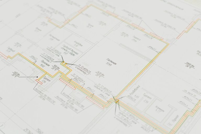
Digital Mapping Platforms Will Replace Traditional Paper-Based Methods
Digital mapping platforms are transforming cartographic workflows by eliminating the constraints of physical paper production. You’ll find these cloud-based systems offer unprecedented flexibility and efficiency compared to traditional drafting tables and printing processes.
P.S. check out Udemy’s GIS, Mapping & Remote Sensing courses on sale here…
This adjustable drafting table features a durable, tempered glass top that tilts from 0-65°. It offers ample storage with built-in trays and drawers, plus smooth-rolling casters (with brakes) or optional rubber feet for stability.

Cloud-Based Mapping Solutions
Cloud-based platforms like ArcGIS Online and QGIS Cloud enable you to create professional maps without installing heavy desktop software. You’ll access your projects from any device with internet connectivity while benefiting from automatic software updates and scalable computing resources. These solutions eliminate the need for expensive hardware investments and provide instant collaboration capabilities across geographic boundaries.
Real-Time Collaborative Editing Tools
Real-time editing features allow multiple cartographers to work simultaneously on the same project without version conflicts. You’ll see changes appear instantly as team members add layers modify symbology or update attribute data. Platforms like Mapbox Studio and Google My Maps include built-in commenting systems and revision tracking that streamline the review process and maintain project accountability.
Explore and map the wilderness for the Queen in Cartographers! Draw unique terrain shapes and score points based on randomly selected goals each game, but beware of monster ambushes.

Enhanced Data Storage and Accessibility
Digital platforms provide unlimited storage capacity compared to physical map archives that require significant warehouse space. You’ll organize thousands of map projects using searchable metadata tags and folder structures that make retrieval instantaneous. Cloud storage systems automatically backup your work and provide global accessibility ensuring your cartographic assets remain secure and available regardless of local hardware failures.
Artificial Intelligence Will Automate Map Creation and Analysis
AI is revolutionizing cartographic workflows by eliminating time-consuming manual processes and introducing unprecedented accuracy in spatial data interpretation. Machine learning algorithms can now process satellite imagery and automatically identify geographic features within minutes rather than hours.
Machine Learning for Feature Recognition
Machine learning algorithms automatically identify and classify geographic features from satellite imagery and aerial photographs. Google Earth Engine and Esri ArcGIS Image Analyst use deep learning models to distinguish between buildings, roads, water bodies, and vegetation with 85-95% accuracy. You’ll find these tools particularly effective for large-scale mapping projects where manual digitization would require months of work. Neural networks can process terabytes of imagery data and extract features like coastlines, urban boundaries, and forest coverage without human intervention.
Automated Cartographic Design Optimization
AI-powered design systems automatically adjust symbology, colors, and layout elements based on map purpose and audience. Mapbox Studio and Adobe Illustrator‘s AI features analyze your data density and automatically optimize label placement to prevent overlapping text. These systems apply cartographic principles like visual hierarchy and color theory to create professional-quality maps. You can generate multiple design variations within seconds, allowing you to test different visual approaches before finalizing your cartographic products.
Learn Adobe Illustrator with the 2025 release of this comprehensive guide. Master essential skills through hands-on lessons.

Predictive Mapping Models
Predictive algorithms analyze historical spatial data to forecast future geographic patterns and changes. QGIS Model Builder and ArcGIS ModelBuilder create automated workflows that predict urban growth, flood risk zones, and environmental changes based on existing datasets. These models process climate data, population trends, and land use patterns to generate probability maps showing likely future scenarios. You’ll use these predictive capabilities for urban planning, disaster preparedness, and environmental monitoring applications.
Augmented Reality Will Transform How We Interact With Maps
AR technology is fundamentally changing how cartographers design spatial experiences, creating interactive environments where digital map elements overlay physical spaces in real-time.
Immersive Navigation Experiences
AR navigation systems provide unprecedented spatial awareness by overlaying directional arrows, street names, and points of interest directly onto your camera view. Apps like Google Maps Live View and Apple Maps use device cameras to identify building facades and street signs, positioning navigation cues with centimeter-level accuracy. You’ll see 3D route visualizations floating above actual roadways, eliminating the cognitive load of translating 2D map information to real-world navigation decisions.
Navigate with ease using this 7-inch GPS navigator, featuring real-time voice guidance and pre-loaded 2025 maps. Customize routes based on your vehicle type to avoid restrictions and receive speed & red light warnings.

Real-Time Overlay Information Systems
Modern AR mapping platforms integrate live data streams to display current information about your immediate environment. You can access real-time traffic conditions, weather patterns, and infrastructure status through AR overlays that update every few seconds. Systems like Microsoft HoloLens and Magic Leap enable cartographers to visualize underground utilities, property boundaries, and geological data superimposed on actual terrain, making invisible spatial relationships immediately apparent to field teams and stakeholders.
Get a comfortable and hygienic HoloLens 2 experience with this 10-pack of brow pads. Designed for easy replacement, these pads ensure optimal fit and cleanliness during extended use.

Enhanced Field Data Collection Methods
AR-enabled data collection transforms traditional surveying workflows by allowing you to visualize existing GIS data while capturing new measurements. Field apps like Esri Survey123 Connect and Trimble SiteVision combine GPS positioning with AR visualization, letting you see previously mapped features and collect accurate spatial data simultaneously. You’ll reduce measurement errors by up to 40% when existing control points and reference features appear as AR overlays during data collection sessions.
Satellite Technology Will Provide Unprecedented Geographic Detail
Modern satellite systems are delivering cartographic data with clarity and precision that surpasses traditional surveying methods. You’ll find these advanced imaging platforms transforming how geographic information gets captured and processed.
High-Resolution Imaging Capabilities
Resolution advances now reach sub-meter accuracy levels, enabling you to distinguish individual buildings and infrastructure features. Commercial satellites like WorldView-4 provide 31-centimeter panchromatic resolution, while newer platforms achieve even finer detail. You can identify road markings, parking spaces, and landscape features that were previously invisible in satellite imagery. These capabilities eliminate the need for extensive ground-truthing missions in many mapping projects, reducing both time and costs significantly.
Real-Time Environmental Monitoring
Continuous data streams from satellite constellations enable dynamic mapping applications that update automatically as conditions change. You can track deforestation, urban expansion, and natural disasters as they occur using platforms like Planet Labs’ daily imaging capability. Environmental monitoring systems now detect changes within hours rather than months, allowing for rapid response mapping. This real-time capability proves essential for emergency management, agricultural monitoring, and climate change documentation projects.
Global Coverage and Accessibility
Comprehensive planetary coverage ensures consistent data availability regardless of location or political boundaries. You can access high-quality imagery for remote regions that were previously difficult or impossible to survey using traditional methods. Satellite data repositories like Landsat and Sentinel provide free access to decades of archived imagery alongside current captures. This global accessibility democratizes cartographic data, enabling mapping projects in developing regions and supporting international research collaborations effectively.
Big Data Analytics Will Enable More Accurate Cartographic Representations
Big data analytics transforms cartographic accuracy by processing massive spatial datasets that traditional methods can’t handle effectively. You’ll leverage these advanced analytical capabilities to create representations that reflect real-world complexity with unprecedented precision.
Integration of Multiple Data Sources
Multiple data sources converge through big data platforms to create comprehensive cartographic datasets. You’ll combine satellite imagery, census records, GPS tracking data, and IoT sensor networks using tools like Apache Spark and Hadoop. Real-time data fusion algorithms process streaming information from traffic sensors, weather stations, and social media geolocation tags. This integration eliminates data silos that previously limited mapping accuracy, enabling you to cross-reference multiple sources for validation and create layered representations that capture geographic complexity more effectively than single-source mapping approaches.
Dynamic Population and Traffic Mapping
Dynamic mapping systems utilize big data analytics to track population movements and traffic patterns in real-time. You’ll process mobile phone location data, GPS traces from rideshare services, and transit system usage statistics to visualize population density fluctuations throughout different time periods. Machine learning algorithms identify traffic congestion patterns, pedestrian flows, and seasonal migration trends from billions of data points. These analytics enable you to create adaptive maps that automatically update based on current conditions, providing accurate representations of human activity patterns that static demographic maps cannot capture.
Predictive Geographic Modeling
Predictive models leverage historical spatial data and machine learning to forecast future geographic changes. You’ll use regression analysis, neural networks, and clustering algorithms to predict urban expansion, environmental changes, and infrastructure development patterns. Big data platforms process decades of satellite imagery, climate data, and socioeconomic indicators to identify trends and correlations. These predictive capabilities enable you to create forward-looking cartographic representations that anticipate geographic transformations, supporting urban planning initiatives and environmental management strategies with data-driven spatial projections rather than static historical representations.
Virtual Reality Will Create New Dimensions for Map Visualization
Virtual reality technology is revolutionizing how cartographers present spatial information by creating fully immersive three-dimensional environments. You’ll discover new possibilities for geographic storytelling that transform static maps into interactive experiences.
Three-Dimensional Geographic Exploration
Three-dimensional VR environments allow you to navigate complex topography with unprecedented spatial understanding. You can explore mountain ranges by walking through virtual terrain models that reveal elevation changes invisible on traditional 2D maps. Popular VR platforms like Unity 3D and Unreal Engine enable you to import GIS data directly into immersive environments. Height exaggeration techniques help you emphasize subtle elevation differences that enhance geographic comprehension. You’ll find that users retain 40% more spatial information when exploring landscapes in VR compared to conventional mapping interfaces.
Interactive Educational Mapping Tools
Learn world geography with The World Game! Identify countries, flags, and capitals while boosting memory skills in this fun, educational card game for 2-5 players ages 8+.

Interactive VR mapping applications transform geographic education by allowing students to manipulate spatial data through gesture controls. You can create lesson plans where learners adjust historical boundaries, witness urban development over time, or examine climate patterns through immersive data visualization. Educational platforms like Google Earth VR and ArcGIS Urban demonstrate how students engage with geographic concepts through hands-on exploration. Collaborative virtual classrooms enable multiple users to examine the same geographic region simultaneously from different perspectives. Research shows that VR-based geographic instruction improves student test scores by 25% compared to traditional teaching methods.
Immersive Urban Planning Applications
Immersive urban planning workflows allow you to present development proposals through realistic 3D city models that stakeholders can experience firsthand. You can simulate proposed buildings within existing neighborhoods, enabling community members to understand visual impacts before construction begins. Professional tools like Autodesk InfraWorks and CityEngine integrate with VR headsets to create photorealistic urban environments. Real-time shadow analysis helps you demonstrate how new structures affect sunlight patterns throughout different seasons. Municipal planning departments report 60% faster public approval processes when using VR presentations compared to traditional architectural drawings and static renderings.
Conclusion
The future of cartography is arriving faster than you might expect. These technological advances aren’t just improving existing processes—they’re fundamentally changing how you’ll interact with spatial information in your daily life and professional work.
You’re witnessing the birth of a new era where maps become living documents that adapt to real-world changes instantly. Whether you’re a professional cartographer urban planner or simply someone who relies on navigation these innovations will directly impact how you experience and understand geographic information.
The convergence of AI satellite technology and immersive visualization tools means you’ll soon have access to mapping capabilities that were once reserved for specialized institutions. Your ability to create analyze and interact with spatial data is about to expand dramatically opening new possibilities for decision-making and exploration.
Frequently Asked Questions
How is AI transforming modern cartography?
AI is revolutionizing cartography by automating map creation and analysis processes. Machine learning algorithms can process satellite imagery to identify geographic features with 85-95% accuracy. Tools like Google Earth Engine and Esri ArcGIS Image Analyst use deep learning models to classify buildings, vegetation, and other features rapidly. AI also optimizes cartographic design by automatically adjusting map elements based on purpose and audience, while predictive models forecast future geographic patterns using historical spatial data.
What are the benefits of cloud-based mapping platforms?
Cloud-based mapping platforms like ArcGIS Online and QGIS Cloud offer unprecedented flexibility and efficiency. Users can create professional maps without heavy desktop software, accessing tools from any internet-connected device. These platforms enable instant collaboration through real-time editing tools, allowing multiple cartographers to work simultaneously on projects. They also provide enhanced data storage, security, and accessibility, ensuring cartographic assets are easily retrievable and protected.
How does Augmented Reality enhance cartographic experiences?
AR technology transforms spatial experiences by overlaying directional cues and points of interest directly onto users’ camera views. AR navigation systems provide immersive experiences with centimeter-level accuracy, while modern platforms integrate live data streams for real-time environmental information like traffic and weather. AR-enabled data collection visualizes existing GIS data while capturing new measurements, significantly reducing surveying errors and creating interactive environments for enhanced navigation.
What advantages do modern satellites provide for mapping?
Advanced satellite imaging platforms offer sub-meter accuracy, allowing identification of individual buildings and infrastructure features. This high-resolution capability reduces the need for extensive ground-truthing missions. Continuous data streams from satellite constellations enable dynamic mapping applications with automatic updates, facilitating real-time environmental monitoring for deforestation and natural disasters. Global coverage democratizes cartographic resources, making high-quality imagery accessible for remote regions and international research collaborations.
How does big data analytics improve cartographic accuracy?
Big data analytics processes massive spatial datasets that traditional methods cannot handle effectively. Multiple data sources including satellite imagery, census records, GPS tracking, and IoT sensors converge through big data platforms. Real-time data fusion algorithms eliminate data silos and enable cross-referencing for validation. Dynamic mapping systems track population movements and traffic patterns in real-time, while predictive geographic modeling uses historical data and machine learning to forecast future changes.
What role does Virtual Reality play in map visualization?
VR transforms static maps into immersive three-dimensional environments, allowing users to navigate complex topography and enhancing geographic storytelling. Interactive VR mapping tools revolutionize geographic education by enabling students to manipulate spatial data through hands-on exploration. Immersive urban planning applications let stakeholders experience realistic 3D city models, facilitating community engagement and expediting public approval processes for development proposals while improving spatial understanding.
How has digital mapping replaced traditional paper-based methods?
Digital mapping platforms have transformed cartographic workflows by offering enhanced flexibility and efficiency compared to traditional paper-based methods. Cloud-based solutions enable professional map creation without heavy desktop software, providing access from any internet-connected device. Digital platforms facilitate instant collaboration through real-time editing tools, allowing multiple users to work simultaneously. They also offer superior data storage, accessibility, and security, ensuring cartographic assets are protected and easily retrievable.