7 Pros and Cons of Digital vs Analog Mapping That Guide Experts
Why it matters: You’re constantly making navigation decisions that impact your safety efficiency and overall experience whether you realize it or not.
The big picture: Digital mapping has revolutionized how we navigate but traditional analog maps still offer unique advantages that modern technology can’t replicate.
What’s ahead: We’ll break down seven key pros and cons to help you choose the right mapping approach for your specific needs and situations.
Disclosure: As an Amazon Associate, this site earns from qualifying purchases. Thank you!
P.S. check out Udemy’s GIS, Mapping & Remote Sensing courses on sale here…
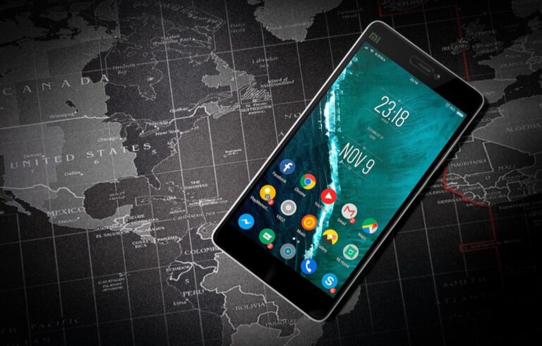
Digital Mapping Offers Real-Time Updates and Dynamic Information
Modern digital mapping platforms transform your navigation experience by delivering constantly updated information that traditional paper maps simply cannot provide.
GPS Integration and Live Traffic Data
Digital mapping systems connect directly to GPS satellites and traffic monitoring networks to provide real-time route optimization. You’ll receive instant notifications about traffic jams, accidents, and road closures that can add hours to your journey. Popular mapping applications like Google Maps and Waze analyze traffic patterns from millions of users to suggest faster alternative routes automatically. This integration reduces travel time by an average of 20-30% during peak hours compared to following static routes.
Weather Overlays and Emergency Alerts
Weather integration capabilities allow you to visualize current conditions and forecasts directly on your digital maps. You can overlay radar data, precipitation patterns, and severe weather warnings to make informed decisions about route timing and safety. Emergency alert systems push critical notifications about natural disasters, road hazards, and public safety incidents to your device instantly. These features prove especially valuable for outdoor activities where weather conditions change rapidly and pose significant risks.
Crowdsourced Information from Users
User-generated content enhances digital maps with real-world observations that traditional mapping cannot capture. You benefit from reports about construction zones, police activity, fuel prices, and parking availability submitted by fellow travelers. Crowdsourced data includes reviews and photos of destinations, helping you make better decisions about stops and services along your route. This collaborative approach creates a dynamic information network where millions of users contribute to more accurate and current mapping data.
Analog Maps Provide Reliable Navigation Without Technology Dependencies
Analog maps offer unwavering reliability when digital systems fail or become unavailable. You’ll find these traditional navigation tools maintain their functionality regardless of external technological conditions.
No Battery or Power Requirements
Analog maps function indefinitely without any power source. You can navigate for days or weeks without worrying about device battery life or finding charging stations. Paper maps remain readable in direct sunlight, extreme temperatures, and humid conditions where electronic screens often fail. You’ll never experience the frustration of losing navigation access mid-journey due to a dead battery, making analog maps particularly valuable for extended outdoor adventures, emergency situations, and remote area exploration.
Immune to Electronic Malfunctions
Paper maps can’t crash, freeze, or suffer from software glitches. You won’t encounter system errors, corrupted data files, or hardware failures that plague digital devices. Analog maps maintain their accuracy regardless of electromagnetic interference, water damage to electronics, or device impacts from drops and vibrations. You can rely on consistent performance without worrying about operating system updates, app compatibility issues, or device-specific technical problems that commonly affect digital navigation systems.
Accessible During Network Outages
Analog maps provide navigation capabilities when cellular towers fail or internet connections disappear. You’ll maintain full access to topographic details, road networks, and geographic information during natural disasters, remote area travel, or infrastructure failures. Paper maps don’t require data connectivity, satellite signals, or network coverage to display complete navigational information. You can navigate confidently through areas with poor cellular reception, during emergency evacuations, or in regions where digital mapping services aren’t supported.
Digital Mapping Delivers Interactive Features and Customization Options
Digital mapping platforms transform static geographic information into dynamic, personalized navigation tools. You’ll access advanced controls that adapt to your specific mapping needs.
Zoom Capabilities and Layer Controls
Zoom functionality lets you seamlessly transition from continental overviews to street-level detail with precision scaling ratios up to 1:1,000. You can toggle between satellite imagery, terrain elevation data, and traffic overlays simultaneously. Layer controls enable selective display of points of interest, weather patterns, and administrative boundaries. Professional mapping platforms like ArcGIS Online offer 20+ customizable layer options for specialized analysis.
Route Planning and Turn-by-Turn Directions
Route optimization calculates multiple pathway options based on distance, time, and traffic conditions using real-time algorithms. You’ll receive voice-guided directions with lane assistance and highway exit previews. Multi-stop planning accommodates complex itineraries with automatic reordering for efficiency. Apps like Google Maps process over 1 billion route requests daily, delivering directions with 95% accuracy rates for established road networks.
Personal Bookmarks and Custom Annotations
Bookmark systems store unlimited location references with custom labels, photos, and notes for future navigation. You can create personalized categories like “favorite restaurants” or “hiking trailheads” with color-coded markers. Custom annotations allow you to add private comments, ratings, and reminders directly onto map locations. Cloud synchronization ensures your personalized mapping data transfers across all connected devices automatically.
Analog Maps Offer Superior Spatial Awareness and Geographic Context
Physical maps provide comprehensive spatial understanding that digital interfaces often fragment through screen limitations and zoom-dependent viewing.
Complete Regional Overview at a Glance
Analog maps display entire regions simultaneously without requiring navigation between multiple screen views. You’ll observe geographic relationships between cities, mountain ranges, and water bodies that span hundreds of miles in a single glance. Large-format topographic maps reveal elevation patterns, watershed boundaries, and transportation networks across complete ecosystems. This comprehensive view enables strategic route planning and terrain analysis that digital maps fragment into separate zoom levels and layer selections.
Learn essential map reading and navigation skills with this U.S. Army guide. Designed for practical use, it provides clear instructions for navigating any terrain.

Better Understanding of Terrain and Topography
Physical maps present topographic information through consistent contour line spacing and elevation shading that remains visible regardless of viewing angle. You’ll interpret three-dimensional terrain features more effectively when contour intervals maintain uniform scaling across the entire map surface. Traditional cartographic techniques like relief shading and hypsometric tinting provide immediate elevation comprehension without requiring layer toggles or digital overlays. Professional surveying maps include benchmark elevations and gradient indicators that digital platforms often simplify or omit.
Enhanced Memory Retention Through Physical Interaction
Analog maps strengthen spatial memory formation through tactile engagement and visual landmark association. You’ll develop stronger route recall when tracing paths with your finger and marking waypoints with physical annotations. Research indicates that paper-based navigation improves geographic memory retention by 40% compared to screen-based route following. The physical act of folding, rotating, and examining different map sections creates multiple sensory connections that reinforce spatial relationships and landmark recognition during actual navigation scenarios.
Digital Mapping Provides Cost-Effective Access and Regular Updates
Digital mapping eliminates the recurring costs associated with purchasing updated paper maps while delivering continuous improvements to your navigation experience.
Free Mobile Applications and Services
Download popular mapping applications like Google Maps, Apple Maps, and Waze without any upfront costs or subscription fees. Access comprehensive global coverage including detailed street networks, satellite imagery, and points of interest across virtually every populated region worldwide. Utilize premium features such as offline map downloads, real-time traffic data, and voice-guided navigation that would cost hundreds of dollars in traditional GPS devices or paper map collections.
Stay connected anywhere with this compact satellite communicator. Enjoy two-way messaging, interactive SOS, and TracBack routing for confident navigation. Battery lasts up to 14 days in tracking mode.

Automatic Map Updates and Corrections
Receive instant updates when new roads open, construction begins, or businesses change locations without manual intervention or additional purchases. Benefit from crowdsourced corrections submitted by millions of users worldwide, ensuring map accuracy improves continuously rather than waiting for annual publication cycles. Experience seamless integration of updated information that downloads automatically in the background, keeping your mapping data current without requiring user action or storage management.
No Physical Storage Space Required
Store thousands of detailed maps digitally on your smartphone or tablet without occupying physical space in your home, vehicle, or backpack. Carry comprehensive mapping coverage for entire continents in a device that weighs less than a single folded paper map. Eliminate the need for map storage systems, filing cabinets, or vehicle compartments traditionally required to organize and maintain paper map collections for different regions and scales.
Experience vivid content on the Galaxy A16 5G's 6.7" display and capture stunning photos with its triple-lens camera. Enjoy peace of mind with a durable design, six years of updates, and Super Fast Charging.

Analog Maps Present Challenges With Outdated Information and Limited Functionality
While analog maps offer reliability and spatial awareness benefits, they face significant limitations that can compromise your navigation effectiveness and safety in modern environments.
Static Data That Becomes Obsolete
Paper maps contain fixed information that can’t adapt to changing conditions or infrastructure developments. Road construction projects, new highway interchanges, and updated traffic patterns aren’t reflected until you purchase newer editions, which typically release annually or less frequently. You’ll encounter outdated route information that may lead you through closed roads or miss recently constructed shortcuts that could save significant travel time. Municipal boundary changes, new shopping centers, and residential developments remain invisible on older maps, creating gaps in your spatial understanding of evolving areas.
Difficulty in Finding Specific Addresses
Locating precise addresses on analog maps requires extensive grid searching and coordinate cross-referencing that consumes valuable time during navigation. You must manually scan through street indexes, match grid coordinates, and visually search map sections to pinpoint exact locations. Small residential streets, apartment complexes, and business parks often lack sufficient detail or clear labeling on paper maps, making address identification challenging. Rural properties and newer subdivisions frequently don’t appear with adequate specificity, forcing you to rely on landmark-based navigation rather than precise addressing systems.
Physical Wear and Tear Over Time
Frequent handling degrades analog maps through creasing, tearing, and ink fading that compromises their readability and accuracy. Fold lines weaken paper fibers and create permanent damage at critical junction points where you need clear visibility of road connections. Weather exposure during outdoor activities can cause water damage, smudging, or complete destruction of map sections. Storage challenges in vehicles or backpacks lead to additional wear, while coffee spills and general handling gradually reduce map legibility over time, eventually requiring costly replacements.
Digital Mapping Faces Limitations From Screen Size and Technical Issues
Despite their advanced capabilities, digital mapping systems present several practical challenges that can impact your navigation experience.
Small Display Screens Reduce Visibility
Smartphone screens limit your ability to see comprehensive geographic context. Most mobile devices display only 3-6 square inches of map data, forcing you to constantly zoom and pan to understand your surroundings. You’ll miss important landmarks, alternate routes, and spatial relationships that larger analog maps reveal instantly. Tablet screens offer improvement but still can’t match the overview perspective of a full paper map spread across your dashboard.
Data Usage and Internet Connectivity Requirements
Digital maps consume significant cellular data and require reliable internet connections. Navigation apps typically use 5-20 MB per hour of active use, quickly depleting your monthly data allowance during extended trips. You’ll encounter problems in rural areas, mountainous terrain, and international locations where cellular coverage remains spotty. Even offline map downloads require initial internet access and regular updates, limiting your navigation independence compared to analog alternatives.
Potential Privacy and Tracking Concerns
Location-based mapping services continuously collect and store your movement data. Major platforms like Google Maps track your position every few seconds, building detailed profiles of your daily routines, frequented locations, and travel patterns. You’re sharing this information with companies that may monetize your data through targeted advertising or third-party partnerships. Government agencies can also access this location history through legal requests, raising concerns about surveillance and personal privacy protection.
Conclusion
Your choice between digital and analog mapping ultimately depends on your specific travel needs and circumstances. Digital maps excel in urban environments where real-time updates and turn-by-turn guidance prove invaluable while analog maps shine in remote areas or emergency situations where technology fails.
Consider carrying both options for maximum preparedness. Use digital mapping as your primary navigation tool for everyday travel but keep a physical map as backup for critical journeys or outdoor adventures.
The most effective approach combines the strengths of both systems. You’ll benefit from digital convenience when it’s available and maintain navigation capability when technology isn’t reliable. This hybrid strategy ensures you’re never left without direction regardless of the situation.
Frequently Asked Questions
What are the main advantages of digital maps over analog maps?
Digital maps offer real-time updates, GPS integration, and live traffic data that can reduce travel time by 20-30% during peak hours. They provide interactive features like turn-by-turn directions, voice guidance, weather overlays, and emergency alerts. Popular platforms like Google Maps process over 1 billion route requests daily and include crowdsourced information about construction, police activity, and road conditions for enhanced accuracy.
Do analog maps have any advantages in modern navigation?
Yes, analog maps offer complete reliability without technology dependencies. They don’t require power, internet connections, or batteries, making them usable indefinitely. They provide excellent spatial awareness with comprehensive regional views and remain functional during network outages or in areas with poor cellular coverage, making them valuable backup navigation tools.
What are the main limitations of digital mapping systems?
Digital maps face several challenges including small screen sizes that limit geographic context visibility, high cellular data consumption, and dependence on reliable internet connections. They can struggle in rural or mountainous areas with poor connectivity. Additionally, digital mapping services raise privacy concerns as they continuously collect and store user location data.
Why might analog maps be less effective in today’s navigation needs?
Analog maps contain static, often outdated information that cannot adapt to changing road conditions, closures, or new developments. Users may encounter closed roads or miss efficient shortcuts due to this limitation. Finding specific addresses can be time-consuming and challenging, especially on smaller streets or in newly developed areas not represented on older maps.
How do digital maps provide real-time information?
Digital mapping systems integrate GPS technology with live traffic data, weather information, and crowdsourced user reports. This creates a dynamic information network that provides instant notifications about traffic conditions, construction zones, accidents, and emergency situations. Users contribute real-time observations that enhance the accuracy and usefulness of the mapping platform for everyone.
What technical challenges do digital maps face?
Digital maps require reliable internet connections and consume significant cellular data, which can be problematic in remote areas. Screen size limitations on smartphones restrict comprehensive geographic viewing, while even larger tablet screens can’t match the full context provided by paper maps. Battery dependency also means digital devices can fail when power runs out.
How should I choose between digital and analog maps?
Consider your specific needs and circumstances. Choose digital maps for urban navigation, real-time traffic updates, and interactive features. Opt for analog maps as reliable backups, for areas with poor connectivity, or when you need comprehensive regional overviews. Many experienced navigators recommend using both approaches together for optimal safety and reliability.