7 Best Mobile Map Features for Navigation
Your smartphone‘s map app knows more about your daily habits than most people in your life. It tracks where you go for coffee each morning and remembers that shortcut you take to avoid traffic during rush hour.
The big picture: Mobile map personalization has evolved beyond simple location tracking into sophisticated systems that adapt to your unique preferences and behaviors. These techniques transform generic navigation tools into intelligent assistants that anticipate your needs and streamline your journeys.
Why it matters: Mastering these personalization features can save you significant time and reduce daily stress while making your mobile mapping experience more intuitive and efficient.
Disclosure: As an Amazon Associate, this site earns from qualifying purchases. Thank you!
P.S. check out Udemy’s GIS, Mapping & Remote Sensing courses on sale here…
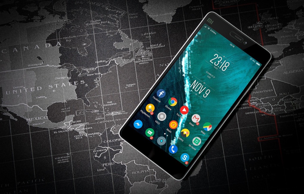
Customize Your Color Scheme and Visual Themes
Visual customization transforms your mobile mapping experience from generic to personally optimized. You’ll enhance readability and reduce eye strain through strategic color choices that match your navigation patterns.
Choose Dark Mode for Night Navigation
Dark mode reduces glare and preserves night vision during evening drives or late-night navigation sessions. You’ll experience less eye fatigue when switching between your phone screen and dark road conditions. Modern map apps like Google Maps and Apple Maps automatically adjust interface brightness in dark mode, maintaining readable text while dimming background elements. This feature becomes essential for rideshare drivers, delivery professionals, and anyone navigating frequently after sunset.
Select High-Contrast Colors for Better Visibility
High-contrast color schemes improve map readability in bright sunlight and challenging lighting conditions. You can adjust road colors, text brightness, and landmark visibility to create sharper visual separation between map elements. Apps typically offer contrast settings that make highways appear bolder, street names more prominent, and points of interest stand out distinctly. These adjustments prove particularly valuable for users with visual impairments or those operating in high-glare environments.
Apply Branded Colors for Business Applications
Branded color themes align your maps with corporate identity when using navigation for business purposes. You can implement company colors into route displays, location markers, and interface elements to maintain brand consistency across all business tools. Fleet management applications and corporate travel platforms often support custom color schemes that match organizational branding guidelines. This personalization reinforces professional appearance while maintaining functional navigation capabilities.
Set Up Custom Points of Interest and Landmarks
Custom points of interest transform your mobile map from a generic navigation tool into a personalized wayfinding system that reflects your unique travel patterns and priorities.
Add Personal Favorite Locations
Label your most-visited destinations with memorable names that make sense to you. Replace “123 Main Street” with “Mom’s House” or “Favorite Coffee Shop” to speed up navigation searches. Most mapping apps let you star locations and add custom names through the location details menu. Save multiple addresses for contacts like work locations, friends’ homes, and regular meeting spots. This personalization technique reduces typing time and eliminates address confusion when you’re navigating to familiar places.
Create Custom Categories for Different Activity Types
Organize your saved locations into themed categories that match your lifestyle and activities. Create categories like “Restaurants,” “Gas Stations,” “Client Locations,” or “Hiking Trailheads” to group similar destinations together. Most mobile map apps support custom tags and folder systems through their favorites or saved places features. Color-code different activity types using available icon options – red for urgent locations, blue for leisure spots, and green for work-related destinations. This visual organization system helps you quickly identify location types during navigation.
Import Business-Specific Locations and Waypoints
Upload business location databases directly into your mapping app using CSV files or contact imports. Many professional mapping platforms support bulk location imports through their business accounts or API connections. Sync CRM data with mapping systems to automatically populate client addresses, delivery stops, and service locations. This integration eliminates manual data entry and ensures your mobile map stays current with business operations. Create route-specific waypoint collections for delivery drivers, sales territories, or maintenance schedules that can be shared across team devices.
Configure Layer Visibility and Map Elements
Customizing your map’s visual layers transforms a generic navigation tool into a specialized interface that displays only the information you need.
Toggle Traffic Information Display
Real-time traffic overlays help you avoid congestion during your daily commute. Most mapping apps let you toggle traffic layers on or off through the main menu or settings panel. You’ll see color-coded roads indicating traffic speed – green for normal flow, yellow for moderate delays, and red for heavy congestion. Enable traffic alerts to receive automatic notifications about accidents, construction zones, and road closures along your planned route. This feature proves especially valuable during peak hours when alternate routes can save significant travel time.
Control Satellite vs Street View Options
Satellite imagery provides aerial perspective while street view offers ground-level detail for navigation decisions. Switch between these viewing modes based on your specific needs – use satellite view for hiking trails, rural areas, or understanding terrain features. Street view works better for urban navigation where building details and street signs matter most. Many apps offer hybrid modes that combine satellite imagery with street labels and route overlays. Toggle between these options using the layer button typically located in the bottom-right corner of your map interface.
Adjust Label Density and Text Size
Label density controls determine how much text information appears on your map display. Reduce label density in crowded urban areas to minimize visual clutter and focus on navigation essentials. Increase text size for better readability while driving or when using your phone in bright sunlight conditions. Most apps offer three density levels – minimal, standard, and detailed – along with font size adjustments ranging from small to extra-large. These settings sync across devices when you’re logged into your mapping account, maintaining consistent visibility preferences.
Personalize Navigation Voice and Audio Settings
Voice and audio personalization transforms your mobile mapping experience into a tailored guidance system that matches your communication preferences and accessibility requirements.
Select Preferred Voice Assistant Language
Choose your navigation language to match your native tongue or professional environment. Most mapping apps offer 40+ language options including regional dialects like UK English versus US English. You’ll find language settings typically located in the app’s main preferences menu under “Voice & Audio” or “Navigation Settings.”
Switch between languages instantly when traveling internationally or working with multilingual teams. Popular options include Spanish, French, German, and Mandarin with natural-sounding pronunciation algorithms. This feature proves especially valuable for delivery drivers and rideshare operators serving diverse communities.
Customize Turn-by-Turn Instruction Volume
Adjust navigation volume independently from your phone’s media and ringtone levels for optimal clarity during different driving conditions. Most apps provide volume sliders ranging from whisper-quiet to maximum amplification, allowing precise control over instruction loudness.
Set automatic volume adjustment based on ambient noise detection through your device’s microphone. This smart feature increases volume during highway driving and lowers it in quiet residential areas. You can also configure volume to duck music playback during turn announcements, ensuring you never miss critical navigation cues.
Capture crystal-clear audio anywhere with the Mini Mic Pro. This wireless lavalier microphone offers seamless plug-and-play connectivity for iPhones, Androids, and laptops, and includes wind protection for optimal recording.

Enable Audio Cues for Accessibility Needs
Activate detailed voice descriptions for enhanced navigation assistance including street names, landmark callouts, and hazard warnings. These expanded audio cues benefit users with visual impairments and provide additional context during complex intersections or highway merges.
Configure haptic feedback patterns to complement voice instructions with vibration alerts for turn warnings and destination arrivals. You can adjust vibration intensity and enable different patterns for left turns, right turns, and straight-ahead navigation to create a multi-sensory guidance system that works even with audio muted.
Create and Manage Custom Route Preferences
Configure your mobile map app’s routing engine to match your specific travel patterns and constraints. Custom route preferences eliminate the need to manually adjust settings for each navigation session.
Set Default Transportation Mode
Choose your primary transportation method to optimize route calculations for your daily commute. Most mapping apps offer walking, driving, cycling, and public transit options that adjust estimated travel times and route suggestions accordingly.
Select driving mode for car-based navigation with traffic-aware routing, or choose cycling mode for bike-friendly paths that avoid major highways. Walking mode prioritizes pedestrian pathways and sidewalks, while public transit mode integrates bus and train schedules for multi-modal journey planning.
Avoid Tolls, Highways, or Ferries
Enable toll avoidance settings to automatically exclude paid routes from your navigation options. This feature proves particularly valuable for delivery drivers and frequent commuters who want to minimize operational costs.
Configure highway avoidance for scenic routes or when driving vehicles with speed restrictions. Ferry avoidance settings help users in coastal areas maintain land-based routing, while bridge avoidance options accommodate drivers with height restrictions or phobias.
Save Frequently Used Route Options
Create custom routing profiles for different scenarios like “Work Commute” or “Weekend Errands” with specific preference combinations. These saved configurations switch instantly between different routing priorities without manual adjustment.
Store multiple route variations for the same destination to account for different traffic conditions or time constraints. Label each saved route with descriptive names like “Fast Route” or “Scenic Route” for quick selection during navigation setup.
Build Personal Location Collections and Lists
Transform your mobile map into a comprehensive location management system by creating organized, shareable collections that adapt to your workflow patterns.
Organize Saved Places by Categories
Create themed location groups using your map app’s folder system to streamline navigation setup. Most apps allow 15-20 categories with customizable names like “Morning Meetings,” “Lunch Spots,” or “Client Sites.” Label each category with clear, searchable terms that match your daily vocabulary. Color-code different categories using distinct markers – blue for business locations, green for dining, red for emergency contacts. Sort locations alphabetically within each category to reduce search time during navigation.
Share Custom Lists with Team Members
Export location collections through your map app’s sharing features to distribute standardized waypoints across your organization. Google Maps and Apple Maps support team sharing for up to 50 locations per list. Generate shareable links that teammates can import directly into their mapping apps without manual data entry. Update shared collections in real-time so team members receive automatic notifications when new locations are added. Assign editing permissions to specific users while maintaining view-only access for broader team distribution.
Sync Collections Across Multiple Devices
Enable cloud synchronization in your map app settings to maintain consistent location data across smartphones, tablets, and desktop browsers. Most major mapping platforms support automatic syncing within 5-10 minutes of updates. Backup your location collections monthly using your device’s cloud storage or the map app’s export function. Test sync functionality regularly by adding locations on one device and verifying they appear on others. Troubleshoot sync issues by checking internet connectivity and clearing the app’s cache when locations don’t update properly.
Implement Geofencing and Location-Based Alerts
Transform your mobile mapping experience into a proactive navigation assistant by setting up intelligent location triggers. Geofencing technology creates virtual boundaries around specific areas, automatically generating notifications when you enter or exit designated zones.
Set Up Arrival and Departure Notifications
Configure your map app to send automatic alerts when you reach important destinations or leave familiar areas. Most modern mapping platforms like Google Maps and Apple Maps allow you to set arrival notifications for saved locations including your home, office, or client sites. Enable departure alerts to receive notifications when leaving specific zones, which proves especially valuable for delivery professionals tracking time spent at each stop. These notifications can include estimated travel time to your next destination and real-time traffic updates for optimal route planning.
Create Custom Alerts for Specific Areas
Design location-based triggers for specialized zones that match your unique navigation needs. Set up speed limit alerts for school zones, construction areas, or residential neighborhoods where reduced speeds are required. Configure parking reminder notifications for downtown districts or airport zones where time restrictions apply. Business users can create client proximity alerts that trigger when approaching important meeting locations, automatically displaying contact information and appointment details. You’ll also benefit from custom boundary alerts for restricted areas, toll zones, or regions with specific driving regulations.
Configure Time-Based Location Reminders
Establish smart reminders that combine location data with time-sensitive scheduling for enhanced productivity. Program your mapping app to send departure alerts based on real-time traffic conditions, ensuring you leave with enough time to reach appointments punctually. Set recurring location reminders for weekly meetings, grocery store visits, or maintenance appointments that trigger only during specific time windows. Configure morning commute alerts that activate 15-30 minutes before your usual departure time, including current traffic conditions and alternative route suggestions for optimal travel planning.
Conclusion
You now have the tools to transform your mobile mapping experience from basic navigation to a fully personalized system. These seven techniques work together to create a mapping environment that adapts to your specific needs and preferences.
Your customized map setup will become more valuable over time as you fine-tune settings and build comprehensive location collections. The combination of visual personalization audio preferences and intelligent routing creates a navigation experience that truly understands your travel patterns.
Start implementing these features gradually to avoid overwhelming yourself. Focus on the techniques that address your most frequent navigation challenges first then expand your customization as you become more comfortable with the advanced features.
Frequently Asked Questions
How do smartphone map apps track my daily habits?
Experience vivid content on the Galaxy A16 5G's 6.7" display and capture stunning photos with its triple-lens camera. Enjoy peace of mind with a durable design, six years of updates, and Super Fast Charging.

Modern map apps use advanced algorithms to analyze your movement patterns, frequent destinations, and timing preferences. They learn from your coffee stops, preferred routes, and traffic shortcuts to anticipate your needs. This data helps create personalized suggestions and optimized routing based on your established travel behaviors.
What are the benefits of using dark mode in map apps?
Dark mode reduces glare and eye strain, especially during nighttime navigation. It helps preserve night vision for drivers and is particularly beneficial for rideshare drivers and delivery professionals working evening shifts. Dark mode also saves battery life on devices with OLED screens.
Create stunning visuals with this 80" LED digital signage display. Featuring a foldable design, flight case, and GOB technology for durability, it offers seamless splicing for large video walls and easy content updates via a cloud platform.

How can I customize my map’s visual appearance?
You can adjust color schemes, switch between light and dark themes, and modify contrast levels for better visibility. High-contrast colors improve readability in bright sunlight, while custom branded colors help maintain corporate identity for business users. These options enhance accessibility and reduce visual fatigue.
What are custom points of interest and how do I set them up?
Custom POIs are personalized location markers you create for frequently visited places. You can label them with memorable names, organize them into categories like “Restaurants” or “Client Locations,” and color-code them for quick identification. This reduces typing time and confusion during navigation.
How do I configure traffic information displays?
Most map apps allow you to toggle traffic overlays on or off. Real-time traffic data shows color-coded speed indicators on roads, helping you avoid congestion. You can customize the display intensity and choose whether to see traffic information constantly or only when planning routes.
Can I change the navigation voice and language?
Yes, most map apps offer over 40 language options, including regional dialects. You can customize turn-by-turn instruction volume, enable automatic volume adjustment based on ambient noise, and select different voice profiles. Some apps also offer detailed voice descriptions for enhanced accessibility.
How do I set up route preferences for different travel modes?
Access your app’s routing settings to select default transportation modes (driving, walking, cycling, transit). You can enable avoidance settings for tolls, highways, and ferries. Create custom routing profiles for different scenarios, such as work commutes versus leisure trips.
What are location collections and how do I manage them?
Location collections are organized groups of saved places, similar to folders. You can create themed collections, share them with team members, and sync across devices. Use clear labeling, color-coding, and regular updates to maintain an efficient location management system.
How do geofencing and location alerts work?
Geofencing creates virtual boundaries around specific locations. You can set up arrival/departure notifications, custom alerts for areas like school zones, and time-based reminders. These features transform your map into a proactive assistant that helps manage your schedule and location-based tasks.
How can I reduce visual clutter on my map?
Adjust label density settings to show fewer street names and POI markers. Customize text size for better readability, toggle unnecessary map elements off, and use simplified view modes. You can also switch between satellite and street views based on your navigation needs.