7 Best Remote Sensing Applications for Environmental Storytelling
The big picture: Remote sensing technology is revolutionizing how journalists and storytellers capture and present environmental stories by providing unprecedented access to data from satellites, drones, and sensors worldwide.
Why it matters: You can now tell compelling stories about climate change, urban development, and natural disasters using real-time data that was previously impossible to obtain, making your reporting more accurate and visually stunning.
What’s next: These seven innovative approaches will transform how you approach data-driven storytelling and help you create more engaging content that resonates with your audience while standing out in today’s competitive media landscape.
Disclosure: As an Amazon Associate, this site earns from qualifying purchases. Thank you!
P.S. check out Udemy’s GIS, Mapping & Remote Sensing courses on sale here…
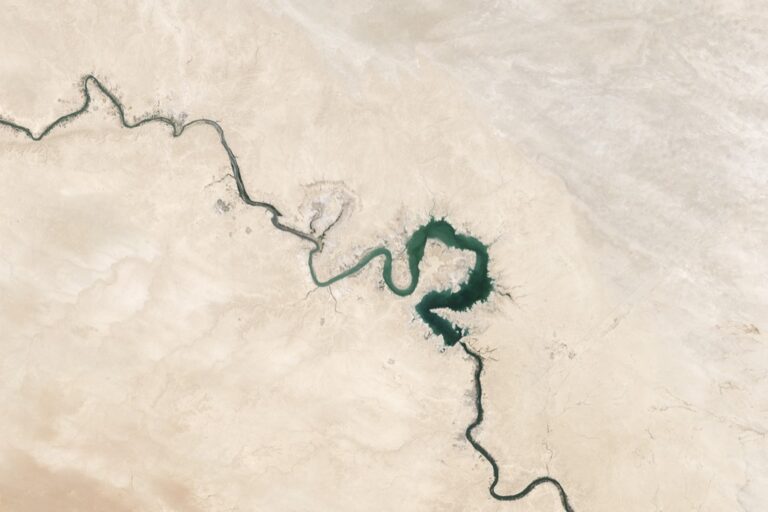
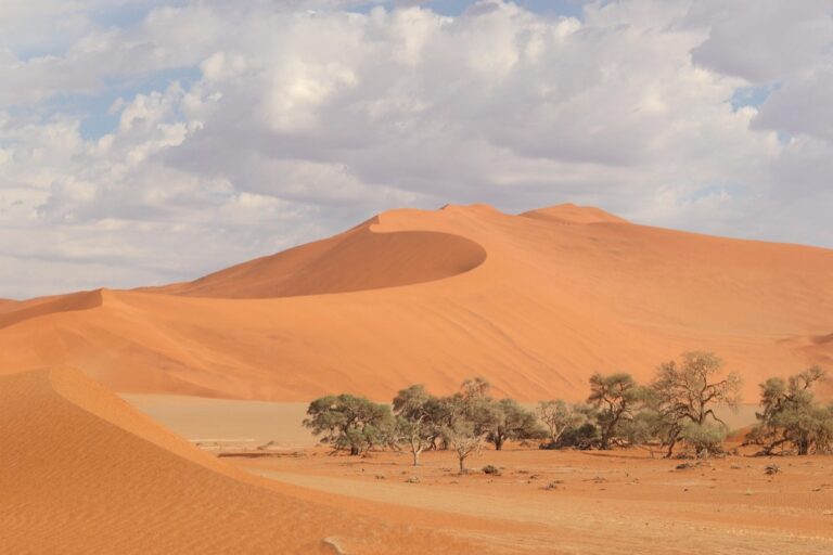
Satellite Imagery Time-Lapse Narratives Reveal Environmental Changes
Time-lapse sequences from satellite imagery transform static environmental data into compelling visual narratives that capture decades of change in minutes.
Creating Visual Stories of Deforestation and Urban Growth
Document rapid landscape transformation by combining Landsat and Sentinel-2 imagery spanning 30-40 years. You’ll capture Amazon deforestation rates, urban sprawl patterns, and infrastructure development with stunning clarity. Tools like Google Earth Engine and Planet Labs provide high-resolution datasets for creating seamless transitions. Frame your narrative around specific locations like São Paulo’s expansion or Jakarta’s coastal development to maximize audience engagement and understanding.
Documenting Climate Impact Through Multi-Decade Comparisons
Reveal climate change effects through comparative satellite analysis showing glacier retreat, sea ice loss, and drought progression. NASA’s Climate Change and Global Warming portal offers curated datasets from 1972-present. You’ll find dramatic examples like Greenland ice sheet changes and Aral Sea shrinkage that demonstrate measurable climate impacts. Combine thermal imagery with visible spectrum data to show temperature variations alongside physical changes for comprehensive storytelling.
Showcasing Seasonal Transformations and Natural Cycles
Capture nature’s rhythms by documenting agricultural cycles, migration patterns, and seasonal vegetation changes through high-frequency satellite monitoring. MODIS and Sentinel imagery provide weekly coverage perfect for showing crop rotations, wildfire seasons, and phenological shifts. Focus on specific phenomena like cherry blossom progression across Japan or Arctic sea ice formation cycles. These natural patterns create engaging narratives that connect audiences to Earth’s dynamic systems.
LiDAR Archaeological Discoveries Uncover Hidden Historical Tales
LiDAR technology revolutionizes archaeological storytelling by penetrating dense vegetation to reveal ancient structures invisible to traditional methods. This remote sensing technique creates compelling narratives about forgotten civilizations and their historical significance.
Revealing Lost Civilizations Beneath Forest Canopies
You’ll discover massive archaeological complexes hidden beneath rainforest canopies using airborne LiDAR systems. Maya cities like El Mirador in Guatemala emerged from decades of jungle concealment when LiDAR revealed pyramid complexes spanning 650 square miles. The technology penetrates triple-canopy forests to expose ancient plazas, causeways, and residential areas that traditional excavation methods couldn’t locate. These discoveries rewrite population estimates and urban planning understanding of pre-Columbian civilizations.
Mapping Ancient Trade Routes and Settlement Patterns
You can trace extensive trade networks by analyzing LiDAR-detected pathways connecting archaeological sites across vast landscapes. Roman roads in Britain become visible through subtle elevation changes that LiDAR captures with centimeter-level precision. The technology reveals settlement hierarchies by identifying fortified positions, storage facilities, and transportation corridors spanning hundreds of miles. These patterns illuminate economic relationships and political structures that shaped ancient societies across Europe, Asia, and the Americas.
Reconstructing Historical Landscapes and Cultural Heritage
You’ll reconstruct vanished landscapes by combining LiDAR data with historical records to create immersive archaeological narratives. Ancient field systems, irrigation networks, and terraced agriculture emerge from seemingly empty hillsides when LiDAR removes modern vegetation layers. The technology documents cultural heritage sites threatened by development or climate change, preserving three-dimensional records for future generations. These reconstructions help communities understand their ancestral connections to transformed landscapes and support heritage tourism initiatives.
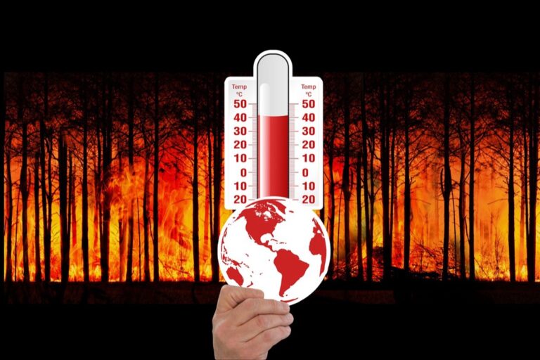
Thermal Imaging Exposes Urban Heat Island Stories
Thermal imaging from satellites reveals the invisible temperature patterns that define urban inequality and environmental justice. You can transform infrared data into compelling narratives that expose how heat affects different communities.
Visualizing Social Inequality Through Temperature Mapping
You’ll discover stark temperature differences between wealthy and low-income neighborhoods using thermal satellite data from Landsat 8’s TIRS sensor. Affluent areas with tree cover typically register 5-10°F cooler than concrete-heavy districts. Plot temperature overlays on demographic maps to reveal how heat burden correlates with income levels, creating powerful visual stories about environmental racism. Document these disparities across cities like Phoenix, Atlanta, and Los Angeles to show systemic patterns of unequal heat exposure affecting vulnerable populations.
Tracking Energy Efficiency Across Different Neighborhoods
You can identify energy waste patterns by analyzing thermal signatures from commercial and residential buildings using FLIR thermal cameras or satellite thermal bands. Buildings with poor insulation appear as bright heat sources in infrared imagery, while energy-efficient structures show cooler signatures. Map these thermal patterns across neighborhoods to reveal correlation between building age, income levels, and energy consumption. Document seasonal variations to show how different areas respond to heating and cooling demands throughout the year.
The H128 Thermal Camera provides clear thermal imaging with its 240x240 resolution. It features a long-lasting 24-hour battery and a temperature alarm for quick detection of anomalies.

Illustrating Public Health Impacts of Heat Distribution
You’ll connect thermal mapping data with health statistics to reveal how temperature variations affect community wellness outcomes. Areas with temperatures exceeding 95°F show increased emergency room visits and heat-related illnesses during summer months. Use thermal imagery combined with CDC health data to map heat-vulnerable populations including elderly residents and those with chronic conditions. Document cooling center locations against thermal hotspots to identify underserved areas needing additional resources for heat relief programs.
Hyperspectral Data Creates Precision Agriculture Narratives
Hyperspectral sensors capture hundreds of narrow spectral bands that reveal invisible agricultural stories across vast farming landscapes. You’ll discover how this advanced remote sensing technology transforms agricultural journalism by exposing crop health patterns and farming practices that traditional photography can’t detect.
Following Crop Health Journeys Throughout Growing Seasons
Track individual field performance across entire growing cycles using hyperspectral band combinations that detect stress before visual symptoms appear. You’ll identify nitrogen deficiency patterns in corn fields weeks earlier than conventional methods by analyzing chlorophyll absorption signatures at 550-700 nanometers. Monitor disease progression in wheat crops through subtle spectral changes that reveal fungal infections at 760-900 nanometer ranges, creating compelling visual narratives of agricultural resilience and vulnerability.
Demonstrating Sustainable Farming Success Stories
Document regenerative agriculture practices by comparing spectral signatures between conventional and organic farming operations over multiple seasons. You’ll showcase cover crop benefits through enhanced soil organic matter detection using 1,400-2,500 nanometer wavelengths that reveal carbon sequestration success. Create before-and-after stories of degraded farmland restoration by tracking vegetation health indices and soil composition changes that demonstrate sustainable farming transformation across entire watersheds.
Revealing Food Security Challenges in Different Regions
Expose regional agricultural disparities by analyzing crop yield predictions through hyperspectral vegetation indices across different climate zones and economic conditions. You’ll map drought stress patterns in smallholder farming communities using water stress indicators at 970 and 1,240 nanometers that reveal food vulnerability months before harvest failures. Compare agricultural productivity between developed and developing regions through spectral analysis of crop vigor, irrigation efficiency, and soil health indicators that tell powerful stories about global food inequality.
Radar Interferometry Tells Ground Movement Stories
Radar interferometry transforms millimeter-scale ground movements into compelling narratives about Earth’s dynamic surface. This technique compares satellite radar images taken at different times to detect vertical and horizontal displacement patterns invisible to traditional observation methods.
Documenting Earthquake Impact and Recovery Processes
Earthquakes create dramatic displacement patterns that radar interferometry captures with precision measurements down to centimeters. You’ll discover how major seismic events like the 2011 Tōhoku earthquake shifted entire coastlines by several meters through detailed interferometric analysis. Recovery storytelling becomes powerful when you track infrastructure rebuilding efforts and land subsidence patterns over months following major tremors. Post-earthquake monitoring reveals how communities adapt to permanently altered landscapes through coordinated reconstruction efforts.
Tracking Subsidence in Mining and Urban Areas
Mining operations create measurable ground subsidence that interferometry documents across entire regions over decades of extraction activities. You’ll expose how cities like Jakarta sink at rates exceeding 25 centimeters annually due to groundwater pumping and urban development pressures. Industrial subsidence stories emerge when you combine radar data with economic impact assessments showing infrastructure damage costs. Urban planning narratives strengthen when interferometric evidence supports policy changes regarding water management and construction regulations in vulnerable areas.
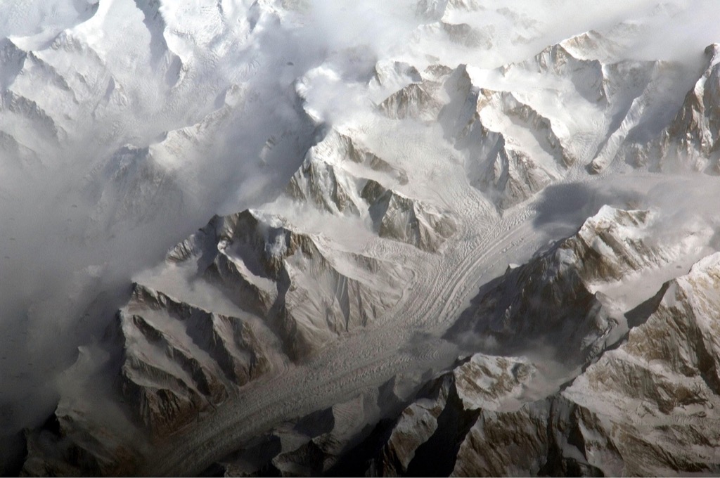
Monitoring Glacier Movement and Ice Sheet Changes
Glacial flow patterns become visible through interferometric analysis that tracks ice movement velocities across vast polar regions. You’ll document how climate change accelerates glacier retreat by measuring flow speed increases in outlets like Greenland’s Jakobshavn Glacier. Ice sheet instability stories develop when radar data reveals sudden acceleration events and calving processes affecting global sea level projections. Antarctic monitoring provides compelling evidence of ice shelf collapse through interferometric measurements showing dramatic velocity changes preceding major breakup events.
Drone-Based Remote Sensing Captures Community-Level Stories
Drones revolutionize hyperlocal storytelling by capturing intimate community narratives that satellites can’t reveal. You’ll access real-time data streams that document human experiences at scales where individual lives intersect with broader environmental changes.
Documenting Disaster Response and Recovery Efforts
Document disaster response through sequential drone flights that capture community resilience in action. You’ll track evacuation routes during floods, map damaged infrastructure after hurricanes, and follow reconstruction progress over months. Thermal sensors reveal heat signatures from trapped victims during search operations, while multispectral cameras assess structural damage invisible to standard photography. Follow emergency responders as they navigate debris fields, creating visual timelines that showcase human determination against natural disasters.
Quickly identify hidden issues with the FLIR C5 thermal camera. It features MSX technology and 160x120 thermal imaging to create detailed images, and easily uploads to the FLIR Ignite cloud for documentation and sharing.

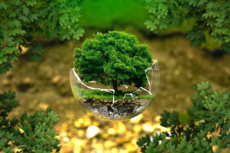
Showcasing Conservation Success Stories at Local Scale
Showcase conservation victories through before-and-after drone imagery that captures ecosystem recovery at community watersheds. You’ll document wetland restoration projects, track native species returning to rehabilitated habitats, and measure reforestation success in local parks. High-resolution sensors reveal vegetation health improvements, while time-lapse sequences show rapid ecosystem changes over growing seasons. Monitor community garden initiatives, urban pollinator corridors, and neighborhood tree-planting campaigns that demonstrate grassroots environmental stewardship.
Following Wildlife Migration Patterns and Habitat Changes
Follow wildlife movements through seasonal drone surveys that reveal migration corridors within urban landscapes. You’ll track bird populations using coastal flyways, monitor deer movement patterns across suburban developments, and document butterfly migration through community gardens. Thermal imaging captures nocturnal animal behavior, while AI-powered species recognition algorithms count populations automatically. Map habitat fragmentation caused by new construction, identify wildlife crossing points on local roads, and document seasonal changes in feeding areas.
Multi-Sensor Data Fusion Creates Comprehensive Environmental Chronicles
Multi-sensor data fusion transforms isolated remote sensing datasets into rich environmental narratives that reveal the complete story behind ecological changes.
Combining Different Technologies for Complete Picture Stories
Layering multiple remote sensing technologies creates deeper environmental narratives than single-sensor approaches. You’ll combine optical satellite imagery with radar data to penetrate cloud cover during Amazon deforestation monitoring. Thermal sensors reveal temperature patterns while LiDAR exposes forest structure changes. NASA’s MODIS fire data paired with Sentinel-1 radar tracking shows wildfire progression through smoke-obscured landscapes. Hyperspectral vegetation indices merged with soil moisture radar create comprehensive drought impact stories across agricultural regions.
Integrating Ground Truth with Satellite Observations
Connecting satellite observations with field measurements validates your remote sensing narratives and adds human context to environmental data. You’ll pair citizen science water quality reports with Landsat imagery to document pollution events in real-time. Weather station data combined with thermal satellite readings reveals urban heat island variations throughout neighborhoods. Stream gauge measurements merged with flood mapping from synthetic aperture radar creates accurate disaster response stories. Ground-based phenology observations paired with satellite vegetation indices track climate change impacts on local ecosystems.
Get real-time weather data with the Ambient Weather WS-2902. This WiFi-enabled station measures wind, temperature, humidity, rainfall, UV, and solar radiation, plus it connects to smart home devices and the Ambient Weather Network.

Building Interactive Multimedia Storytelling Platforms
Creating interactive platforms transforms static remote sensing data into engaging environmental chronicles that audiences can explore. You’ll build web applications using Leaflet.js and MapBox to layer time-series satellite imagery with interactive timelines. Google Earth Engine Apps enable readers to toggle between different sensor datasets and time periods. Story maps combine satellite animations with ground-level photography and community interviews. Interactive dashboards using Plotly and D3.js visualize sensor data correlations while embedded videos show field validation of remote sensing findings.
Understand the structure of a one-hour TV drama pilot. This book provides a guide to story mapping for television.

Conclusion
Remote sensing technology offers you unprecedented opportunities to transform your storytelling approach and create compelling narratives that resonate with modern audiences. These seven innovative techniques provide the foundation for developing data-driven content that stands out in today’s competitive media landscape.
Achieve a flawless, even complexion with e.l.f. Flawless Satin Foundation. This lightweight, vegan formula provides medium coverage and a semi-matte finish for all-day wear, while hydrating your skin with glycerin.

You’ll find that integrating satellite imagery time-lapse sequences LiDAR archaeological discoveries and thermal mapping into your stories creates powerful visual narratives that traditional reporting methods simply can’t match. The combination of hyperspectral analysis radar interferometry and drone footage allows you to uncover hidden stories and present complex environmental issues in accessible engaging formats.
Your investment in learning these remote sensing storytelling techniques will pay dividends as audiences increasingly demand immersive multimedia experiences. By mastering multi-sensor data fusion and interactive storytelling platforms you’ll position yourself at the forefront of journalism’s digital evolution while making meaningful environmental and social issues more compelling for your readers.
Frequently Asked Questions
What is remote sensing technology in journalism?
Remote sensing technology in journalism involves using satellites, drones, and sensors to gather data for storytelling. It enables journalists to create more accurate and visually compelling narratives about environmental issues, climate change, urban development, and natural disasters by providing access to real-time and historical data that would otherwise be impossible to obtain through traditional reporting methods.
How do time-lapse satellite sequences enhance storytelling?
Time-lapse satellite sequences transform static environmental data into dynamic visual stories by showing decades of change in minutes. By combining Landsat and Sentinel-2 imagery, journalists can document rapid transformations like Amazon deforestation, urban growth in cities like São Paulo, glacier retreat, and drought progression, making complex environmental changes more engaging and understandable for audiences.
What role does LiDAR technology play in archaeological journalism?
LiDAR technology revolutionizes archaeological storytelling by penetrating dense vegetation to uncover hidden historical narratives. It reveals massive archaeological complexes like Maya cities in Guatemala, maps ancient trade routes and settlement patterns, and helps reconstruct vanished landscapes. This technology preserves cultural heritage sites and enhances community connections to their ancestral histories.
How does thermal imaging expose urban inequality?
Thermal imaging reveals invisible temperature patterns that highlight urban heat islands and environmental justice issues. Thermal satellite data shows stark temperature differences between affluent and low-income neighborhoods, demonstrating correlations between heat exposure and income levels. It also identifies energy waste patterns in buildings and connects temperature variations with public health statistics.
What is hyperspectral data and how is it used in agriculture reporting?
Hyperspectral data uses specialized sensors to track crop health patterns invisible to traditional photography. It allows journalists to follow crop health throughout growing seasons, identifying issues like nitrogen deficiency and disease before visual symptoms appear. This technology documents sustainable farming practices, compares organic versus conventional methods, and analyzes food security challenges across different regions.
How does radar interferometry measure ground movement?
Radar interferometry captures millimeter-scale ground movements to create compelling narratives about Earth’s dynamic surface. It measures displacement patterns from earthquakes, documents ground subsidence from mining and urban development, and monitors glacier movement. This technique provides precise data on how major events like the 2011 Tōhoku earthquake shift coastlines and affect recovery processes.
Experience smooth, tear-free gaming and video with the Acer KB272 G0bi 27" Full HD monitor, featuring Adaptive-Sync (FreeSync Compatible) and a rapid 1ms response time. Enjoy vibrant colors with 99% sRGB coverage and versatile connectivity through HDMI and VGA ports.

What advantages do drones offer for local storytelling?
Drones revolutionize hyperlocal storytelling by capturing intimate community narratives that satellites cannot reveal. They document disaster response through sequential flights, track evacuation routes during floods, map infrastructure damage after hurricanes, and showcase conservation success stories. Drones also follow wildlife migration patterns and reveal how urban development impacts local ecosystems and animal behavior.
What is multi-sensor data fusion in environmental journalism?
Multi-sensor data fusion combines various remote sensing technologies to create comprehensive environmental narratives. It layers optical satellite imagery with radar data for more effective monitoring, integrates ground truth data with satellite observations for validation, and incorporates citizen science reports with satellite imagery. This approach creates interactive multimedia platforms that enhance audience engagement with environmental stories.