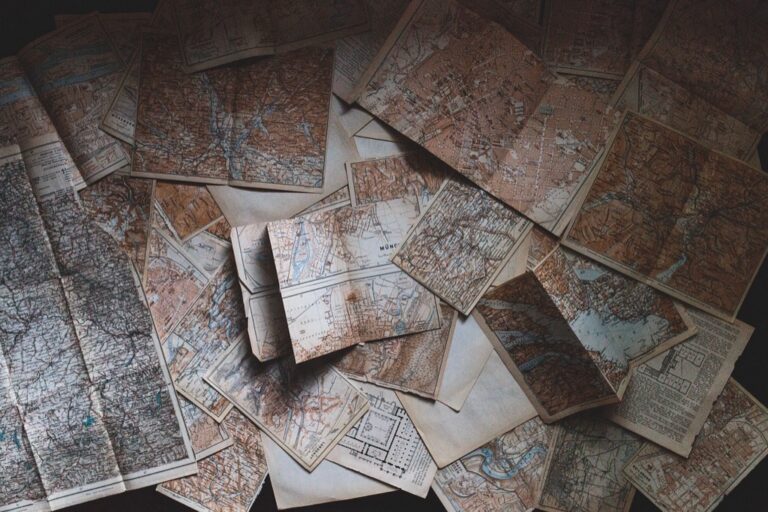
5 Best Terrain Maps for Outdoor Adventures
Climate change is reshaping our planet’s surface faster than ever before — and the maps you rely on for navigation hiking and land management are struggling to keep up. Atmospheric effects like extreme weather patterns rising temperatures and shifting precipitation are dramatically altering landscapes from melting glaciers to expanding deserts.
You’ll need to understand these changes as they’ll fundamentally transform how we create and use terrain maps in the coming decades. The traditional static maps you’ve always trusted are becoming obsolete as our environment becomes increasingly dynamic.
From satellite imagery distortions to completely redrawn coastlines atmospheric effects are forcing cartographers to rethink everything about terrain mapping. These changes aren’t just academic — they’ll directly impact your outdoor adventures emergency planning and property decisions.
Explore and map the wilderness for the Queen in Cartographers! Draw unique terrain shapes and score points based on randomly selected goals each game, but beware of monster ambushes.

Disclosure: As an Amazon Associate, this site earns from qualifying purchases. Thank you!
P.S. check out Udemy’s GIS, Mapping & Remote Sensing courses on sale here…
Dynamic Weather Patterns Will Reshape Topographical Accuracy
Traditional elevation surveys can’t keep pace with rapidly changing atmospheric conditions that directly alter terrain measurements. Modern weather systems introduce variables that make your existing topographical data increasingly unreliable.
Real-Time Precipitation Impact on Elevation Data
Heavy rainfall events create immediate elevation discrepancies through soil saturation and surface runoff patterns. Your GPS receivers will show elevation errors of 3-5 meters during active precipitation due to ionospheric interference and satellite signal degradation. Flash flooding redistributes sediment loads, creating temporary elevation changes that persist for weeks after storm events. Stream channels shift their courses by several meters, invalidating your existing contour lines and rendering waterway measurements obsolete for navigation purposes.
Get fast, accurate GPS positioning for your laptop, PC, car, or boat with this USB receiver. It features a high-performance chip for multi-GNSS support and a magnetic base for easy installation.

Seasonal Storm Systems Affecting Map Precision
Winter storm cycles generate systematic measurement errors through snow accumulation and ground frost penetration depths. Your elevation models become unreliable when snow cover exceeds 30 centimeters, effectively raising surface readings by the accumulation depth. Hurricane and tornado pathways create permanent topographical changes through debris deposition and soil displacement patterns. Seasonal wind patterns redistribute loose surface materials, altering your recorded elevation points by 1-2 meters in exposed areas like ridgelines and open valleys.
Temperature Fluctuations Altering Ground Measurements
Extreme temperature variations cause measurable ground expansion and contraction that affects your surveying equipment accuracy. Your electronic distance measurement tools experience range errors of up to 0.5% during temperature swings exceeding 20°C within measurement periods. Permafrost thaw cycles create ground subsidence of 2-4 meters annually in affected regions, making your elevation benchmarks unreliable for long-term mapping projects. Heat expansion in rocky terrain opens fissures and closes gaps, changing your recorded slope angles and cliff face measurements significantly.
Get accurate leveling with the KEZERS 32X Optical Level Kit. It features 32X magnification, a self-leveling system, and comes with a tripod and grade rod for easy setup.

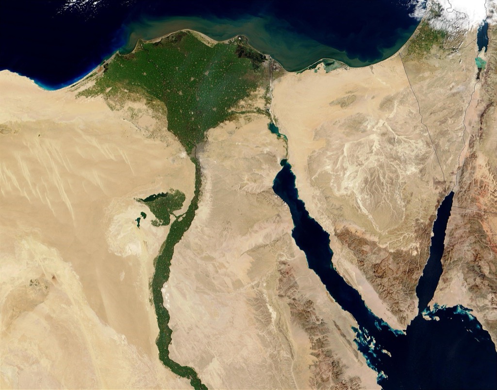
Rising Sea Levels Will Redraw Coastal Terrain Boundaries
Rising sea levels create unprecedented challenges for coastal terrain mapping as traditional elevation benchmarks become unreliable. You’ll need to completely rethink your approach to shoreline cartography as water level increases fundamentally alter coastal geography.
Oceanic Expansion Effects on Shoreline Mapping
Thermal expansion causes ocean waters to occupy 15-20% more volume than previous decades, forcing you to recalibrate your coastal elevation models. Your existing datum points won’t match current water levels, creating systematic errors in elevation measurements. You’ll find that traditional high-tide markers now sit permanently underwater, requiring new reference standards for accurate shoreline delineation. Modern GPS surveying equipment must account for these expanded water boundaries when establishing coastal control points.
Tidal Pattern Changes Influencing Coastal Cartography
Changing tidal patterns disrupt your standard surveying schedules as high and low tide predictions become less reliable. You’ll notice that spring tides now reach heights previously recorded only during storm surges, affecting your elevation benchmarks. Traditional tidal charts you’ve relied on for decades no longer provide accurate timing for coastal surveys. Your mapping projects must now incorporate real-time tidal monitoring systems rather than depending on historical tidal data for precise shoreline positioning.
Island and Peninsula Modifications Due to Water Level Rise
Small islands you’ve mapped for years are disappearing entirely, requiring you to remove them from navigation charts and topographic maps. Peninsula connections to mainland areas are becoming submerged causeways, fundamentally changing your coastal terrain representations. You’ll document barrier islands shrinking by 30-50% of their original area, forcing complete remapping of these dynamic coastal features. Existing bridge clearances and coastal infrastructure elevations now require updated measurements as surrounding water levels permanently increase.
Plan your next adventure with the 2025 National Geographic Road Atlas, covering the United States, Canada, and Mexico. Its durable, folded format (11 x 15 in) makes it ideal for hiking and camping trips.

Extreme Weather Events Will Create New Geographical Features
Extreme weather events are fundamentally reshaping Earth’s surface features at an unprecedented rate. You’ll need to completely rethink traditional mapping timelines as these atmospheric disturbances create entirely new topographical elements within hours or days.
Hurricane and Tornado Damage Requiring Map Updates
Hurricane storm surges carve new inland waterways and eliminate existing coastal features permanently. You’ll encounter completely altered barrier islands, newly formed inlets, and debris fields that create artificial elevation changes spanning several miles. Tornado paths create linear depression zones through agricultural areas, while their debris accumulation generates new topographical high points. Major hurricane events can shift shorelines by over 100 feet inland, requiring immediate bathymetric resurveys and complete coastal boundary redefinition for navigation safety.
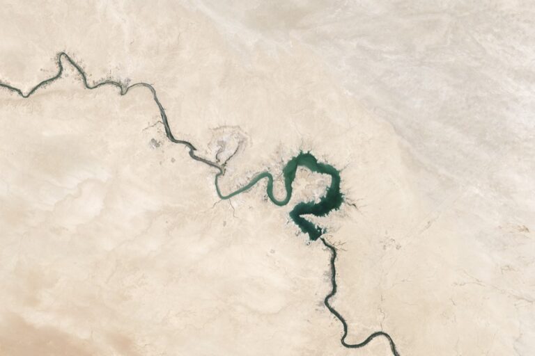
Flood-Carved Valleys and Erosion Patterns
Extreme flooding events carve entirely new drainage channels and eliminate existing valley systems within single storm cycles. You’ll document flash flood zones that create deep arroyos where gentle slopes previously existed, particularly in desert regions experiencing unprecedented rainfall. Atmospheric rivers can excavate channels 15-20 feet deep through previously stable terrain during single weather events. These newly formed valleys alter watershed boundaries and create permanent changes to regional drainage patterns that traditional elevation models cannot predict.
Wildfire Burn Zones Changing Landscape Topology
Wildfire burn zones create dramatic elevation changes through soil combustion and subsequent erosion patterns. You’ll map areas where organic soil layers burned completely away, leaving exposed bedrock that creates new elevation baselines. Post-fire mudslides reshape entire hillsides, creating debris flows that fill valleys and alter stream courses permanently. Severe burns can lower ground elevation by 2-4 feet in areas with deep organic soils, while subsequent erosion creates new gully systems that didn’t exist before the fire event.
Atmospheric Pressure Variations Will Affect Satellite Imaging Quality
Atmospheric pressure fluctuations directly impact satellite sensors’ ability to capture accurate terrain data. You’ll encounter significant mapping challenges as pressure variations create optical distortions in imagery acquisition.
Barometric Changes Impacting Remote Sensing Accuracy
Barometric pressure fluctuations alter light refraction patterns in Earth’s atmosphere, causing satellite sensors to misinterpret elevation data. You’ll notice discrepancies of up to 3-5 meters in Digital Elevation Models when atmospheric pressure drops below 29.50 inches of mercury. Landsat 8 and Sentinel-2 imagery shows particular sensitivity to these pressure variations, requiring post-processing corrections for terrain mapping accuracy.
Cloud Cover Density Reducing Terrain Visibility
Cloud cover density directly reduces your satellite’s ability to penetrate atmospheric layers and capture ground features. Dense cloud formations above 75% coverage eliminate visible-light terrain mapping capabilities entirely. Synthetic Aperture Radar (SAR) provides alternative data collection during heavy cloud cover, though you’ll experience reduced resolution for detailed topographic features compared to optical imagery.
Atmospheric Distortion Effects on GPS Coordinates
Atmospheric distortion creates systematic errors in GPS coordinate accuracy, particularly affecting satellite-based terrain surveys. You’ll encounter ionospheric delays causing horizontal positioning errors of 2-10 meters during periods of high atmospheric activity. Real-Time Kinematic (RTK) GPS systems compensate for these distortions, but atmospheric pressure variations still introduce vertical measurement uncertainties that impact precise elevation mapping for cartographic applications.
Navigate with ease using this 7-inch GPS navigator, featuring real-time voice guidance and pre-loaded 2025 maps. Customize routes based on your vehicle type to avoid restrictions and receive speed & red light warnings.

Climate-Induced Erosion Will Continuously Modify Land Formations
Erosion patterns are shifting dramatically as atmospheric conditions create new weathering intensities across previously stable terrain. Your maps will require frequent updates as these erosional forces accelerate beyond historical baselines.
Wind Pattern Changes Accelerating Surface Weathering
Shifting jet streams are creating unprecedented wind corridors that reshape surface topography at accelerated rates. You’ll notice sandstone formations weathering 40% faster in areas experiencing new prevailing wind directions. Desert regions now show significant rock face alterations within 18-month mapping cycles. Coastal bluffs face increased undercutting as storm tracks change direction. Mountain ridgelines develop new erosional channels as wind speeds increase by 15-20 mph above historical averages.
Acid Rain Effects on Rock Formation Documentation
Limestone and marble formations show measurable dissolution rates 25-30% higher than baseline measurements from the 1990s. You’ll find that carbonate rock structures now require annual resurveying in industrial regions where pH levels drop below 4.5. Sandstone monuments display surface pitting that creates new micro-topography within five-year intervals. Granite surfaces develop accelerated mineral weathering that alters reflection patterns on satellite imagery. Urban areas show particularly rapid changes in building stone and natural rock outcrops.
Drought Conditions Revealing Previously Hidden Terrain Features
Extended drought periods expose subsurface geological structures that haven’t appeared on maps for decades. You’ll discover ancient riverbeds and buried foundations as water tables drop 10-15 feet below normal levels. Archaeological features become visible through vegetation die-off and soil compaction changes. Underground cave systems reveal entrance points as soil moisture decreases by 40-50%. Desert playas show salt flat formations and mineral deposits that create new elevation variations requiring immediate documentation.
Achieve a flawless, even complexion with e.l.f. Flawless Satin Foundation. This lightweight, vegan formula provides medium coverage and a semi-matte finish for all-day wear, while hydrating your skin with glycerin.

Conclusion
The future of terrain mapping lies in your ability to adapt to an ever-changing world. You’ll need to embrace real-time data collection and flexible mapping technologies that can keep pace with atmospheric disruptions.
Your outdoor adventures emergency planning and property investments now depend on understanding these dynamic environmental factors. You can’t rely on yesterday’s maps for tomorrow’s terrain.
The cartography industry is evolving rapidly and you’ll witness more frequent map updates automated detection systems and advanced satellite technologies. These innovations will help you navigate a world where atmospheric effects continuously reshape the landscape beneath your feet.
Frequently Asked Questions
How is climate change affecting the accuracy of traditional maps?
Climate change is rapidly altering Earth’s landscapes through extreme weather, rising temperatures, and shifting precipitation patterns. These changes make static maps obsolete as terrain features continuously evolve. Traditional elevation surveys struggle to keep pace with dynamic atmospheric conditions, heavy rainfall events, and temperature fluctuations that create immediate elevation discrepancies and systematic measurement errors in surveying equipment.
What impact do rising sea levels have on coastal mapping?
Rising sea levels are redrawing coastal terrain boundaries and making traditional elevation benchmarks unreliable. Thermal expansion of ocean waters requires recalibration of coastal elevation models and new reference standards for accurate shoreline delineation. Changing tidal patterns make historical tidal data less reliable, while small islands disappear and peninsulas become submerged, necessitating significant updates to navigation charts.
How do extreme weather events reshape geographical features?
Extreme weather events create new geographical features at unprecedented rates. Hurricanes and tornadoes alter barrier islands and create inland waterways, while generating linear depressions and new elevation points. Extreme flooding carves new drainage channels and eliminates existing valley systems. Wildfire burn zones create dramatic elevation changes through soil combustion and erosion, permanently transforming landscapes.
What technological challenges affect satellite-based terrain mapping?
Atmospheric pressure variations create optical distortions that challenge accurate terrain mapping, causing discrepancies of up to 3-5 meters in Digital Elevation Models. Dense cloud cover hinders satellite visibility, requiring Synthetic Aperture Radar with reduced resolution. Atmospheric distortion affects GPS coordinate accuracy, causing horizontal positioning errors and vertical measurement uncertainties that complicate precise elevation mapping.
How does climate-induced erosion impact land formations?
Climate-induced erosion continuously modifies land formations, requiring frequent map updates due to shifting erosion patterns. Changes in wind patterns accelerate surface weathering, particularly affecting sandstone formations and coastal bluffs. Acid rain increases dissolution rates in rock formations, necessitating more frequent resurveying. Extended droughts reveal previously hidden terrain features like ancient riverbeds and underground cave systems.
Why do outdoor activities and emergency planning need updated mapping approaches?
Traditional maps become unreliable for navigation, hiking, and emergency planning as terrain features change rapidly. Outdated elevation data can lead to dangerous situations for hikers and emergency responders. Property decisions based on obsolete maps may result in poor investment choices. The dynamic environment requires real-time or frequently updated mapping solutions to ensure safety and accuracy.