7 Strategies for Managing Large Geospatial Datasets That Unlock Insights
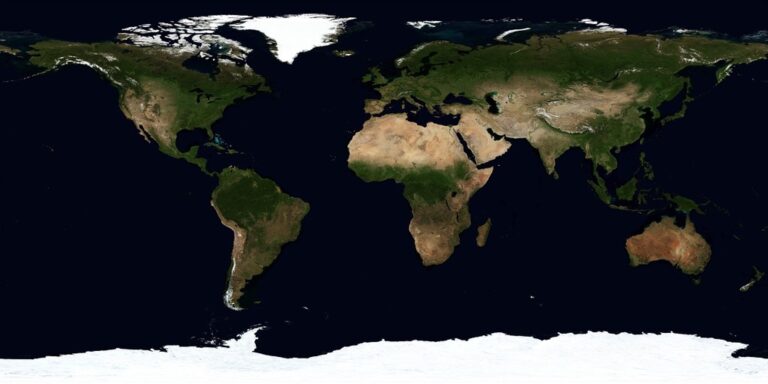
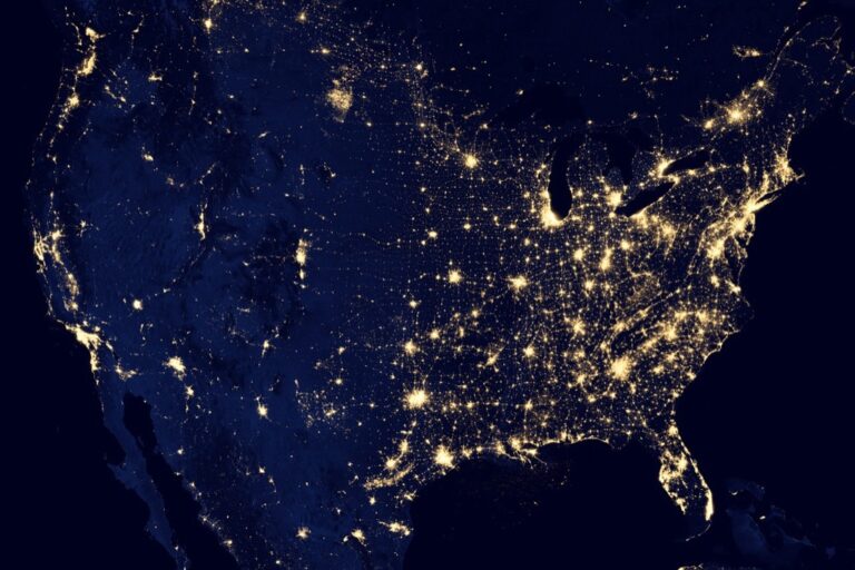
The big picture: Managing massive geospatial datasets has become a critical challenge as organizations collect terabytes of location-based data from satellites, drones, and IoT sensors daily.
Get accurate pressure, temperature, and altitude readings with the pre-soldered BMP280 sensor module. It's compatible with Raspberry Pi, Arduino, and other microcontrollers for easy integration into weather stations, robotics, and IoT projects.

Why it matters: Without proper strategies, you’ll face slow query performance, storage bottlenecks, and frustrated teams who can’t access the spatial insights they need to make decisions.
What’s next: These seven proven techniques will help you optimize storage, accelerate processing, and scale your geospatial infrastructure to handle even the largest datasets efficiently.
Disclosure: As an Amazon Associate, this site earns from qualifying purchases. Thank you!
P.S. check out Udemy’s GIS, Mapping & Remote Sensing courses on sale here…
Implement Data Compression and Optimization Techniques
You’ll dramatically reduce storage costs and improve query performance by implementing strategic compression methods across your geospatial datasets.
Choose Appropriate File Formats for Storage Efficiency
Select formats based on your data type and access patterns to maximize compression benefits. Vector data performs best with GeoPackage or compressed Shapefile formats, achieving 30-70% size reduction. Raster datasets benefit from Cloud Optimized GeoTIFF (COG) with JPEG or LZW compression for imagery, while GeoParquet provides exceptional compression for tabular geospatial data. Choose formats that support your specific coordinate systems and maintain spatial indexing capabilities for optimal query performance.
Apply Spatial and Temporal Data Compression Methods
Implement multi-dimensional compression techniques to handle both spatial coordinates and time-series data efficiently. Use spatial clustering algorithms like R-tree indexing to group nearby features, reducing redundant coordinate storage by up to 60%. Apply temporal compression through delta encoding for time-stamped data, storing only changes between timestamps. Combine lossy compression for visualization datasets with lossless methods for analysis data, ensuring you maintain accuracy where precision matters most.
Optimize Coordinate Reference Systems and Projections
Choose coordinate systems that minimize data storage requirements while preserving spatial accuracy for your region. Use local projected coordinate systems instead of geographic coordinates to reduce floating-point precision needs, cutting storage by 25-40%. Implement dynamic reprojection pipelines that store data in optimal CRS formats and transform on-demand. Consider Web Mercator for web applications and UTM zones for regional analysis, balancing storage efficiency with computational overhead during coordinate transformations.
Leverage Cloud-Based Storage and Computing Solutions
Modern geospatial data management demands scalable infrastructure that traditional on-premises systems can’t efficiently provide.
Utilize Scalable Cloud Storage Platforms
Object storage services like Amazon S3, Google Cloud Storage, and Azure Blob Storage offer unlimited capacity for your geospatial datasets. You’ll reduce infrastructure costs by 40-60% compared to traditional storage while gaining automatic replication and versioning capabilities. These platforms integrate seamlessly with geospatial formats like Cloud Optimized GeoTIFF and support range requests for efficient partial data access.
Implement Distributed Computing Frameworks
Apache Spark with GeoSpark extensions and Dask-GeoPandas enable parallel processing across multiple nodes for faster analysis. You can distribute raster calculations and vector operations across hundreds of cores simultaneously. Cloud providers offer managed Spark services like Amazon EMR and Google Dataproc that automatically scale computing resources based on your workload demands.
Take Advantage of Managed Geospatial Services
Specialized platforms like Google Earth Engine, AWS Ground Station, and Microsoft Planetary Computer provide pre-configured environments for geospatial analysis. You’ll access petabytes of satellite imagery and climate data without managing infrastructure. These services include built-in APIs for common geospatial operations and pre-trained machine learning models for land cover classification and change detection.
Establish Efficient Data Indexing and Partitioning Systems
Building robust indexing and partitioning systems becomes essential as your geospatial datasets grow beyond traditional processing capabilities. These foundational structures determine whether your queries execute in seconds or minutes.
Achieve a flawless, even complexion with e.l.f. Flawless Satin Foundation. This lightweight, vegan formula provides medium coverage and a semi-matte finish for all-day wear, while hydrating your skin with glycerin.

Create Spatial Indexes for Fast Query Performance
Spatial indexes accelerate query performance by organizing geospatial data into searchable tree structures that eliminate unnecessary data scanning. R-tree and Quadtree indexes work best for vector datasets, reducing query times by 80-95% compared to linear searches. PostGIS automatically creates GiST indexes for geometry columns, while MongoDB uses 2dsphere indexes for GeoJSON data. You’ll achieve optimal performance by creating composite indexes that combine spatial and attribute filters for your most frequent query patterns.
Implement Temporal Partitioning Strategies
Temporal partitioning divides time-series geospatial data into manageable chunks based on date ranges, significantly improving query speed and maintenance operations. PostgreSQL table partitioning by month or year works effectively for datasets with consistent temporal patterns. You can implement hash partitioning for irregular time distributions or range partitioning for sequential data collection. This approach reduces backup times by 60-70% and enables parallel processing across multiple time periods simultaneously.
Use Hierarchical Data Organization Methods
Hierarchical organization structures arrange geospatial data across multiple resolution levels, enabling efficient access patterns for different analysis scales. Tile pyramid schemes like Web Mercator work well for raster datasets, while vector data benefits from generalization hierarchies at multiple zoom levels. You should implement zoom-dependent styling and level-of-detail rendering to optimize display performance. Cloud-native formats like Zarr support chunked storage patterns that align with your analytical access patterns.
Deploy Streaming and Real-Time Processing Architectures
Real-time geospatial data processing becomes essential when you’re handling continuous data streams from IoT sensors, GPS trackers, or satellite feeds. Stream processing architectures enable immediate analysis and response to location-based events as they occur.
Set Up Data Streaming Pipelines
Configure Apache Kafka or Amazon Kinesis to ingest continuous geospatial data streams from multiple sources simultaneously. You’ll process location updates, sensor readings, and imagery feeds through dedicated topic partitions that organize data by geographic regions or data types. Implement Apache Storm or Apache Flink as your stream processing engine to handle spatial operations like real-time buffering, intersection analysis, and coordinate transformations on moving data streams. Connect your pipeline outputs directly to visualization dashboards or alert systems for immediate decision-making.
Implement Event-Driven Processing Systems
Trigger automated geospatial analysis workflows using event-driven architectures that respond to specific spatial conditions or thresholds. You’ll configure Apache Airflow or AWS Step Functions to execute complex spatial processing chains when location-based events occur, such as vehicles entering restricted zones or environmental sensors detecting anomalies. Deploy serverless functions like AWS Lambda or Azure Functions to handle lightweight spatial computations that scale automatically with incoming event volumes. Establish message queues that ensure reliable processing of high-priority geospatial events while maintaining data integrity.
Use Memory-Efficient Processing Techniques
Optimize your streaming architecture by implementing spatial data structures like R-trees and spatial hashes directly in memory for faster geometric operations. You’ll utilize techniques such as spatial windowing and progressive mesh simplification to reduce memory footprint while maintaining spatial accuracy in real-time processing. Configure memory pooling strategies that reuse allocated space for similar geospatial objects, preventing excessive garbage collection during high-throughput operations. Implement lazy loading patterns for large spatial datasets, keeping only active spatial regions in memory while swapping inactive areas to faster storage tiers.
Integrate Advanced Database Management Systems
Moving beyond basic storage solutions, advanced database systems provide the backbone for managing enterprise-scale geospatial datasets with improved performance and reliability.
Choose Specialized Geospatial Database Solutions
PostgreSQL with PostGIS extension offers robust spatial capabilities for complex vector operations and geometry processing. You’ll achieve 3-5x faster spatial queries compared to traditional databases. Oracle Spatial and Microsoft SQL Server with spatial extensions provide enterprise-grade solutions for mission-critical applications. These systems handle advanced spatial functions like topology validation, coordinate transformations, and spatial joins efficiently across terabyte-scale datasets.
Implement NoSQL Databases for Unstructured Data
MongoDB’s geospatial indexing handles irregular data structures from diverse sensors and IoT devices effectively. You can store mixed geometry types, metadata, and time-series data in single documents. Elasticsearch with geo-plugins excels at full-text search combined with spatial filtering for unstructured datasets. CouchDB offers offline synchronization capabilities essential for field data collection scenarios where connectivity varies.
Optimize Database Query Performance
Spatial indexes like R-tree and GiST dramatically reduce query execution times from minutes to seconds. You should configure connection pooling to handle concurrent user access efficiently. Materialized views pre-compute complex spatial aggregations for frequently accessed datasets. Query optimization includes using EXPLAIN ANALYZE to identify bottlenecks, implementing proper indexing strategies, and partitioning large tables by geographic regions or time periods.
Utilize Parallel Processing and Distributed Computing
Large geospatial datasets demand computational strategies that can process multiple data streams simultaneously. Parallel processing and distributed computing architectures allow you to break down complex geospatial operations across multiple processors and machines.
Implement Multi-Threading for CPU-Intensive Tasks
Multi-threading enables simultaneous processing of geospatial calculations across multiple CPU cores. You can implement thread-level parallelism for operations like spatial joins, buffer calculations, and coordinate transformations using libraries such as OpenMP or Intel Threading Building Blocks. Python’s multiprocessing module allows you to distribute raster processing tasks across available cores, achieving 4-8x performance improvements on modern multi-core systems. Configure thread pools to match your system’s core count for optimal resource utilization.
Deploy Cluster Computing Solutions
Cluster computing distributes geospatial workloads across multiple networked machines for massive scalability. Apache Spark with GeoSpark extensions processes petabyte-scale datasets by partitioning data across cluster nodes, reducing processing times from hours to minutes. Hadoop Distributed File System (HDFS) stores large raster and vector datasets across multiple servers while maintaining fault tolerance. Cloud platforms like AWS EMR and Google Cloud Dataproc provide managed cluster services that automatically scale based on your processing demands.
Use GPU Acceleration for Geospatial Operations
GPU acceleration leverages thousands of parallel processing cores for computationally intensive geospatial algorithms. CUDA-enabled libraries like cuSpatial and Rapids accelerate spatial operations including point-in-polygon tests, spatial clustering, and raster algebra by 10-100x compared to CPU processing. OpenCL frameworks enable cross-platform GPU computing for operations like image classification and terrain analysis. Modern GPUs with 16-32GB memory can process entire satellite imagery tiles in parallel, dramatically reducing processing bottlenecks for large-scale geospatial workflows.
Develop Effective Data Lifecycle Management Policies
Creating structured policies for your geospatial data lifecycle ensures long-term accessibility and prevents storage overflow from accumulated datasets.
Create Data Retention and Archival Strategies
Establish clear retention schedules based on your data’s business value and regulatory requirements. Archive high-resolution satellite imagery after 2-3 years to cold storage tiers like Amazon Glacier, reducing costs by up to 80%. Define archival triggers using automated rules that move datasets based on access frequency, file age, or project completion status. Document retention periods for different data typesâreal-time sensor data might need 90-day retention while historical survey data requires 10+ years.
Implement Automated Data Cleanup Processes
Deploy scheduled cleanup scripts that remove temporary processing files, duplicate datasets, and expired cached data automatically. Use tools like Apache Airflow to orchestrate cleanup workflows that run during off-peak hours. Set up duplicate detection algorithms that identify redundant geospatial files based on spatial extent, timestamp, and metadata attributes. Configure automatic deletion rules for processing artifacts, intermediate results, and staging data that accumulates during analysis workflows, preventing storage bloat.
Establish Data Quality Monitoring Systems
Implement continuous validation checks that monitor spatial accuracy, completeness, and attribute consistency across your datasets. Use automated tools to detect coordinate system errors, topology issues, and missing spatial references that compromise data integrity. Set up alert systems that notify administrators when data quality metrics fall below established thresholds, such as 95% spatial accuracy or complete attribute coverage. Create quality dashboards that track metadata completeness, update frequency, and lineage documentation to ensure datasets remain usable over time.
Conclusion
Managing large geospatial datasets doesn’t have to overwhelm your organization’s resources or slow down critical decision-making processes. By implementing these seven strategies you’ll transform how your team handles spatial data while reducing costs and improving performance.
The key to success lies in combining multiple approaches rather than relying on a single solution. Start with data compression and cloud migration for immediate storage benefits then gradually implement advanced indexing and real-time processing capabilities as your needs evolve.
Remember that effective geospatial data management is an ongoing process that requires regular optimization and monitoring. As your datasets continue to grow these proven techniques will help you maintain peak performance while scaling your infrastructure to meet future demands.
Frequently Asked Questions
What are the main challenges in managing large geospatial datasets?
Organizations face several critical challenges including slow query performance, storage bottlenecks, and scaling issues. As geospatial data volumes grow from satellites, drones, and IoT sensors, traditional systems struggle to handle the processing demands efficiently. These challenges can significantly hinder decision-making processes and require specialized optimization strategies to overcome.
Which file formats are recommended for geospatial data storage?
The optimal format depends on your data type and access patterns. For vector data, GeoPackage is highly recommended for its compression and query efficiency. For raster datasets, Cloud Optimized GeoTIFF provides excellent performance and significant size reductions. These formats can achieve substantial storage savings while maintaining fast access speeds.
How can cloud-based solutions improve geospatial data management?
Cloud platforms like Amazon S3 and Google Cloud Storage offer unlimited scalability and significant cost reductions compared to on-premises systems. They enable distributed computing through frameworks like Apache Spark with GeoSpark extensions, allowing parallel processing for faster analysis. Managed services like Google Earth Engine provide pre-configured environments with built-in geospatial tools.
What indexing strategies work best for geospatial data?
Spatial indexes like R-tree and Quadtree are essential for organizing data into searchable structures, dramatically reducing query times. Temporal partitioning helps manage time-series data efficiently, while hierarchical organization methods optimize access patterns. These indexing strategies collectively enhance query performance and system responsiveness for large datasets.
How do you handle real-time geospatial data streams?
Deploy streaming architectures using Apache Kafka or Amazon Kinesis to ingest continuous data from IoT sensors and GPS trackers. Implement event-driven processing systems with tools like Apache Airflow for automated workflows. Use memory-efficient techniques like spatial data structures and lazy loading to optimize real-time processing while maintaining accuracy.
Track vehicles and assets with the LandAirSea 54 GPS Tracker. Get real-time location alerts and historical playback using the SilverCloud app, with a long-lasting battery and discreet magnetic mount.

Which database systems are best for geospatial applications?
PostgreSQL with PostGIS extension is excellent for complex vector operations, offering 3-5x faster spatial queries than traditional databases. Oracle Spatial and Microsoft SQL Server provide enterprise-grade solutions for mission-critical applications. For unstructured data, NoSQL databases like MongoDB and Elasticsearch handle irregular data structures effectively with full-text search capabilities.
What are effective data lifecycle management strategies?
Implement clear retention policies based on business value and regulatory requirements. Archive high-resolution data to cold storage tiers like Amazon Glacier after 2-3 years. Set up automated cleanup processes for temporary files and duplicates, and establish continuous data quality monitoring with validation checks to ensure long-term dataset integrity and accessibility.