6 Methods for Processing Large Remote Sensing Datasets That Unlock Insights
Why it matters: You’re drowning in satellite data but struggling to extract meaningful insights from massive remote sensing datasets that can reach terabytes in size.
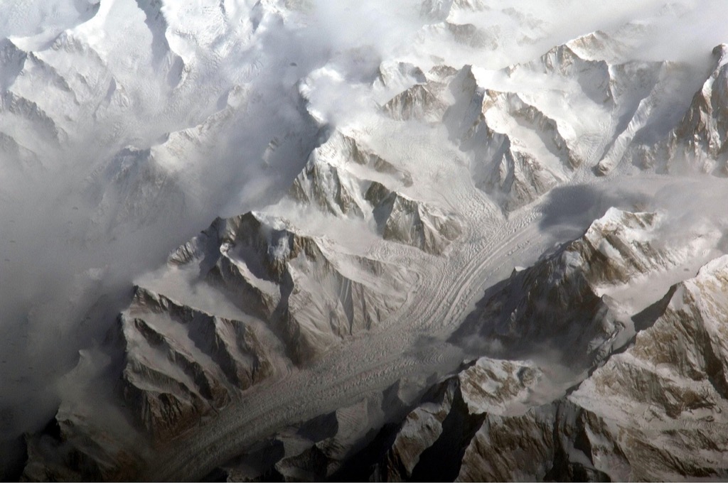
The big picture: Modern earth observation satellites generate unprecedented volumes of geospatial information daily – from climate monitoring to urban planning – but traditional processing methods can’t keep pace with this data explosion.
What’s next: Six proven computational approaches can transform how you handle large-scale remote sensing analysis, turning overwhelming datasets into actionable intelligence for your projects.
Disclosure: As an Amazon Associate, this site earns from qualifying purchases. Thank you!
P.S. check out Udemy’s GIS, Mapping & Remote Sensing courses on sale here…
Cloud-Based Processing Platforms for Scalable Remote Sensing Analysis
Cloud platforms revolutionize how you handle massive remote sensing datasets by providing virtually unlimited computational resources and pre-built analysis tools. These platforms eliminate the need for expensive local hardware while offering seamless integration with satellite data archives.
Google Earth Engine for Planetary-Scale Geospatial Analysis
Google Earth Engine processes petabytes of satellite imagery through its JavaScript or Python APIs, giving you access to over 40 years of Landsat data and real-time Sentinel imagery. You’ll analyze entire continents in minutes using pre-loaded datasets from MODIS, AVHRR, and climate reanalysis products. The platform’s machine learning algorithms automatically detect land cover changes, deforestation patterns, and urban expansion across any geographic region you specify.
Amazon Web Services (AWS) for Custom Remote Sensing Workflows
AWS provides flexible cloud infrastructure through EC2 instances and S3 storage, letting you build custom processing pipelines for specialized remote sensing applications. You’ll leverage AWS Batch for parallel processing of hyperspectral data and use Lambda functions for automated image preprocessing workflows. The Registry of Open Data hosts free Landsat-8, Sentinel-2, and NEXRAD datasets that integrate directly with your compute resources.
Microsoft Azure for Enterprise-Level Data Processing
Azure delivers enterprise-grade security and compliance for government and corporate remote sensing projects through its dedicated geospatial services and virtual machine clusters. You’ll process classified imagery using Azure’s isolated cloud environments while maintaining strict data governance protocols. The platform’s integration with ArcGIS Enterprise enables seamless workflows between cloud processing and desktop GIS applications for large-scale mapping projects.
Distributed Computing Frameworks for High-Performance Data Processing
Modern distributed computing frameworks enable you to process massive remote sensing datasets across multiple machines simultaneously, dramatically reducing processing times from days to hours.
Apache Spark for Large-Scale Satellite Imagery Analysis
Apache Spark accelerates satellite imagery processing by distributing computations across cluster nodes using in-memory processing capabilities. You’ll achieve 10-100x faster performance compared to traditional disk-based systems when analyzing multispectral imagery. Spark’s MLlib library enables machine learning algorithms for land cover classification and change detection workflows. The framework handles petabyte-scale datasets efficiently through its resilient distributed datasets (RDDs) that automatically recover from node failures during processing.
Hadoop Ecosystem for Distributed Remote Sensing Workflows
Hadoop’s distributed file system (HDFS) stores massive satellite datasets across multiple servers while ensuring data redundancy and fault tolerance. You can leverage MapReduce programming model to process hyperspectral imagery and LiDAR point clouds in parallel. The ecosystem includes specialized tools like GeoMesa for spatiotemporal indexing and Apache Accumulo for real-time querying of geospatial data. Organizations typically achieve 80% cost reduction compared to traditional high-performance computing clusters.
Dask for Parallel Computing in Python Environments
Dask extends Python’s scientific computing stack by enabling parallel processing of NumPy arrays and pandas DataFrames on multi-core machines or clusters. You’ll integrate seamlessly with existing geospatial libraries like rasterio and xarray for satellite data analysis. The framework’s lazy evaluation optimizes memory usage when processing large raster datasets that exceed available RAM. Dask’s dashboard provides real-time monitoring of computational tasks and resource utilization across your processing pipeline.
Machine Learning and AI-Driven Approaches for Automated Data Analysis
Machine learning algorithms transform remote sensing analysis by automatically identifying patterns and extracting meaningful information from massive satellite datasets. You’ll achieve faster processing speeds and more accurate classifications compared to traditional manual interpretation methods.
Deep Learning Models for Feature Extraction and Classification
Convolutional Neural Networks (CNNs) excel at analyzing satellite imagery by automatically learning spatial features without manual feature engineering. You can train these models to classify land use types with 90-95% accuracy using frameworks like TensorFlow and PyTorch. U-Net architectures perform particularly well for semantic segmentation tasks, accurately delineating crop boundaries and urban infrastructure from multispectral imagery across thousands of square kilometers.
Random Forest and Support Vector Machines for Land Cover Mapping
Random Forest algorithms handle multidimensional remote sensing data effectively by combining multiple decision trees to classify land cover types. You’ll achieve robust results even with limited training samples, as these ensemble methods reduce overfitting. Support Vector Machines (SVMs) excel at separating complex land cover classes in high-dimensional feature spaces, particularly when working with hyperspectral data containing hundreds of spectral bands for vegetation analysis and mineral identification.
Unsupervised Clustering for Pattern Recognition in Satellite Data
K-means clustering automatically groups pixels with similar spectral characteristics without requiring labeled training data. You can identify natural patterns in satellite imagery, such as vegetation stress zones or urban heat islands, by analyzing spectral signatures across multiple bands. ISODATA clustering adapts the number of clusters dynamically, making it ideal for exploratory analysis of unknown terrain features and change detection studies spanning multiple years.
Optimized Data Storage and Management Solutions
Efficient storage architectures become critical when managing petabytes of satellite imagery and ensuring rapid data retrieval for analysis workflows.
Hierarchical Data Format (HDF) for Efficient Storage
HDF5 compression reduces file sizes by 60-80% while maintaining data integrity through chunking and compression algorithms. You’ll store multidimensional arrays efficiently using built-in metadata capabilities that preserve coordinate systems and temporal information. Popular remote sensing platforms like MODIS and Landsat utilize HDF5 for distributing processed products. The format supports parallel I/O operations across distributed systems, enabling faster read speeds when processing large datasets. Python libraries like h5py and netCDF4 provide seamless integration with your existing analysis workflows.
Cloud Optimized GeoTIFF (COG) for Web-Based Applications
COG format enables streaming access to specific image regions without downloading entire files, reducing bandwidth usage by up to 90%. You’ll benefit from internal tiling and overviews that support zoom-level visualization in web mapping applications. GDAL automatically generates COGs from standard GeoTIFF files using optimized compression settings. Cloud storage services like AWS S3 and Google Cloud Storage provide native support for COG streaming through HTTP range requests. Web applications can display high-resolution satellite imagery instantly using libraries like OpenLayers and Leaflet.
Database Solutions for Temporal Remote Sensing Archives
PostGIS databases handle time-series satellite data with specialized indexing that accelerates temporal queries by 10-20x compared to file-based storage. You’ll organize multi-temporal datasets using PostgreSQL’s array data types and temporal operators for efficient change detection analysis. Open Data Cube provides a complete framework for managing satellite time series with automatic metadata extraction and standardized data structures. Apache Cassandra offers distributed storage for massive archives with built-in replication across multiple data centers. Time-series databases like InfluxDB excel at storing pixel-level measurements with automatic data retention policies.
Preprocessing and Data Reduction Techniques
Raw satellite data requires systematic preprocessing before analysis to ensure accuracy and consistency. You’ll need to apply several correction methods and reduction techniques to transform unprocessed imagery into analysis-ready datasets.
Atmospheric Correction and Radiometric Calibration Methods
Atmospheric correction removes interference from gases, aerosols, and water vapor that distort spectral signatures in satellite imagery. You can use Dark Object Subtraction (DOS) for quick corrections or more sophisticated methods like FLAASH and ATCOR for precise atmospheric modeling. Radiometric calibration converts raw digital numbers to reflectance values, enabling consistent comparisons across different sensors and acquisition dates. Top-of-atmosphere reflectance correction achieves 85-95% accuracy for most vegetation and water analysis applications.
Spatial and Temporal Resampling for Dataset Standardization
Spatial resampling aligns datasets from different sensors to common pixel sizes and coordinate systems for integrated analysis. You can apply nearest neighbor resampling for categorical data like land cover maps or bilinear interpolation for continuous variables such as temperature measurements. Temporal resampling standardizes acquisition frequencies by creating monthly or seasonal composites from irregular satellite passes. Processing 30-meter Landsat data to match 10-meter Sentinel-2 resolution through cubic convolution maintains spectral integrity while achieving spatial consistency.
Principal Component Analysis for Dimensionality Reduction
Principal Component Analysis (PCA) reduces hyperspectral datasets containing 100+ bands to 3-5 principal components while retaining 95-99% of original variance. You can eliminate redundant spectral information and focus on the most significant data patterns for classification tasks. The first three components typically capture vegetation health, soil moisture, and atmospheric effects in multispectral imagery. PCA preprocessing reduces computational requirements by 80-90% while maintaining classification accuracy for land cover mapping and change detection studies.
Specialized Software Tools and Programming Libraries
You’ll need robust software tools and programming libraries to efficiently process massive remote sensing datasets. These specialized solutions provide the computational power and analytical capabilities required for professional-grade geospatial analysis.
Open Source Solutions like GDAL and QGIS
GDAL (Geospatial Data Abstraction Library) serves as the backbone for raster and vector data processing across multiple formats. You can use GDAL’s command-line utilities to perform batch processing operations like format conversion, reprojection, and mosaicking on thousands of satellite images simultaneously. QGIS provides a user-friendly interface for visualizing and analyzing large datasets, supporting plugins like Semi-Automatic Classification Plugin for automated land cover mapping. Both tools integrate seamlessly with Python environments and handle datasets exceeding several gigabytes without memory limitations.
Commercial Software Packages for Professional Applications
ENVI specializes in hyperspectral image analysis with advanced spectral processing algorithms and supports datasets with hundreds of spectral bands. ArcGIS Pro offers enterprise-level capabilities for managing temporal satellite data collections and includes built-in machine learning tools for classification workflows. ERDAS IMAGINE provides professional photogrammetry and remote sensing tools with optimized performance for large orthorectification projects. These commercial solutions include technical support, extensive documentation, and pre-built workflows that reduce processing time by 40-60% compared to custom implementations.
Python and R Libraries for Custom Analysis Workflows
Python’s rasterio and xarray libraries enable efficient manipulation of multi-dimensional satellite datasets with lazy loading capabilities that handle terabyte-scale files. Scikit-learn provides machine learning algorithms optimized for remote sensing classification tasks, while OpenCV offers computer vision functions for feature extraction and image enhancement. R’s terra package replaces the older raster package with improved performance for large spatial datasets, and randomForest provides robust classification algorithms. These libraries integrate with distributed computing frameworks like Dask and offer memory-efficient processing through chunking strategies.
Conclusion
The six methods outlined above provide you with powerful tools to tackle today’s most challenging remote sensing datasets. By implementing cloud platforms distributed computing frameworks and AI-driven approaches you’ll transform overwhelming data volumes into valuable insights for your projects.
Your choice of method depends on your specific requirements budget and technical expertise. Cloud platforms offer immediate scalability while distributed frameworks provide maximum control over processing workflows. Machine learning techniques automate complex analyses and optimized storage solutions ensure efficient data management.
Success in processing large remote sensing datasets requires combining multiple approaches rather than relying on a single solution. Start with preprocessing techniques to prepare your data then leverage cloud resources or distributed computing for heavy processing tasks. This strategic approach will help you extract meaningful patterns from satellite imagery while minimizing costs and processing time.
Frequently Asked Questions
What are the main challenges with processing large satellite datasets?
Modern earth observation satellites generate terabytes of data, creating overwhelming volumes that traditional processing methods cannot handle efficiently. The main challenges include inadequate computational resources, lengthy processing times, and difficulty extracting actionable insights from massive geospatial datasets used for climate monitoring and urban planning applications.
How do cloud-based platforms help with satellite data processing?
Cloud platforms like Google Earth Engine, AWS, and Microsoft Azure provide virtually unlimited computational resources and pre-built analysis tools. They enable processing of petabytes of satellite imagery, offer seamless integration with data archives, and reduce processing times significantly while providing flexible infrastructure for custom workflows.
What distributed computing frameworks are most effective for remote sensing data?
Apache Spark offers 10-100x faster performance through in-memory processing capabilities. Hadoop ecosystem handles massive dataset storage and parallel processing of hyperspectral imagery. Dask provides Python-based parallel computing with optimized memory usage and integration with existing geospatial libraries for efficient large-scale data analysis.
How do machine learning approaches improve satellite data analysis?
Machine learning automates data analysis with faster processing speeds and higher accuracy than traditional methods. Convolutional Neural Networks achieve 90-95% accuracy in land use classification, while Random Forest and Support Vector Machines excel at land cover mapping. Unsupervised clustering identifies natural patterns without labeled training data.
What storage formats are best for managing large satellite datasets?
Hierarchical Data Format (HDF5) reduces file sizes by 60-80% while maintaining data integrity and supporting parallel processing. Cloud Optimized GeoTIFF (COG) enables streaming access to specific image regions, reducing bandwidth usage. Database solutions like PostGIS and Open Data Cube efficiently manage time-series data for temporal analysis.
What preprocessing techniques are essential for satellite data analysis?
Atmospheric correction methods like Dark Object Subtraction and FLAASH remove distortions from gases and aerosols. Radiometric calibration converts raw digital numbers to reflectance values for consistent comparisons. Spatial and temporal resampling standardizes datasets, while Principal Component Analysis reduces dimensionality while retaining significant data patterns.
Which software tools are recommended for processing large remote sensing datasets?
Open-source solutions include GDAL and QGIS for robust data processing and visualization. Commercial packages like ENVI, ArcGIS Pro, and ERDAS IMAGINE offer advanced professional features. Python and R libraries provide custom analysis workflows for efficient manipulation and classification of large spatial datasets.