6 Best Map Tracking Tools for Pattern Discovery
Why it matters: You need reliable ways to monitor geographic changes whether you’re tracking urban development real estate shifts or environmental transformations.
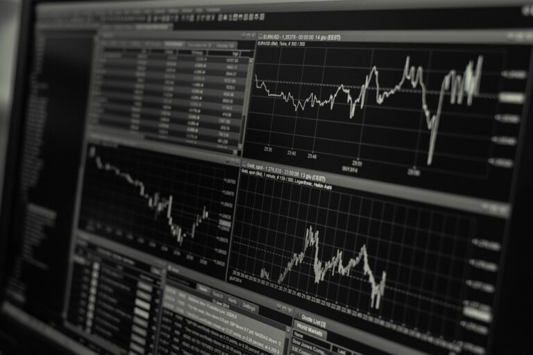
The big picture: Map change detection technology has evolved from basic satellite comparisons to sophisticated AI-powered systems that can identify alterations in real-time across vast geographic areas.
What’s next: Six proven methods can help you track these changes effectively from free government tools to premium commercial platforms each offering unique advantages for different monitoring needs.
Disclosure: As an Amazon Associate, this site earns from qualifying purchases. Thank you!
P.S. check out Udemy’s GIS, Mapping & Remote Sensing courses on sale here…
Version Control Systems for Geographic Data Management
Version control systems provide systematic tracking of geographic data modifications, enabling cartographers to maintain comprehensive change histories. These platforms offer collaborative workflows essential for complex mapping projects involving multiple contributors.
Git-Based Solutions for Mapping Projects
Git repositories excel at tracking vector data formats like GeoJSON and KML files through distributed version control. You’ll find GitHub and GitLab particularly effective for managing collaborative mapping workflows with detailed commit histories. Popular tools include QGIS integration plugins, ArcGIS Pro Git support, and specialized platforms like Felt for web-based mapping collaboration. These solutions maintain complete change logs while supporting branch-based development for experimental cartographic approaches.
Subversion and Mercurial Alternatives
Subversion (SVN) offers centralized control ideal for organizations requiring strict access permissions on sensitive geographic datasets. You can implement folder-based project organization with atomic commits ensuring data integrity during large-scale updates. Mercurial provides distributed capabilities similar to Git but with simpler command structures for teams transitioning from traditional file management. Both systems support binary geographic file formats better than Git, making them suitable for raster datasets and proprietary mapping formats.
Geographic Information System Built-In Change Detection
Professional GIS platforms include integrated change detection capabilities that streamline your mapping workflow without requiring external analysis tools.
ArcGIS Temporal Analysis Tools
Change Analysis Raster Function automatically compares multitemporal imagery within ArcGIS Pro’s interface. You’ll access pixel-level difference calculations through the Image Analyst extension, enabling direct comparison of satellite data across time periods. The Detect Change Using Change Analysis Raster tool quantifies vegetation loss, urban expansion, and land cover transitions with configurable threshold settings. Time-enabled layers let you visualize temporal datasets through animated displays, making pattern identification more intuitive for large-scale monitoring projects.
QGIS History and Version Tracking Features
Temporal Controller in QGIS 3.14+ manages time-based vector and raster datasets through built-in animation controls. You’ll configure temporal properties for each layer, enabling automatic filtering and visualization of changes across specified time ranges. The Processing Toolbox includes change detection algorithms like r.series.interp for raster analysis and v.overlay for vector comparison operations. Plugin integration with Temporal/Spectral Profile Tool extends your change detection capabilities, providing statistical analysis and graphical outputs for comprehensive temporal data assessment.
Specialized Map Monitoring Software Solutions
Dedicated map monitoring platforms offer advanced capabilities beyond standard GIS tools, providing automated workflows specifically designed for change detection across large geographic areas.
Remote Sensing Change Detection Platforms
ENVI’s change detection suite processes multispectral imagery using pixel-based algorithms to identify alterations in land cover, vegetation health, and urban development. You’ll find advanced statistical methods like Principal Component Analysis and Change Vector Analysis that quantify modifications with high precision. eCognition’s object-based approach segments imagery into meaningful features before comparing temporal datasets, reducing noise from seasonal variations while maintaining accuracy for infrastructure monitoring and environmental assessment projects.
Automated Satellite Imagery Comparison Tools
Google Earth Engine’s cloud platform enables you to process petabytes of satellite data using JavaScript or Python APIs for large-scale change analysis. The platform automatically handles atmospheric corrections and geometric registration across Landsat, Sentinel, and MODAS datasets. Planet Labs’ Analytics API delivers daily satellite imagery comparisons with machine learning algorithms that flag potential changes, sending automated alerts when modifications exceed your specified thresholds for construction activity, deforestation, or coastal erosion monitoring.
Database-Driven Change Tracking Methods
Database-driven approaches provide the most robust foundation for systematic map change tracking. These methods leverage structured data storage and temporal querying capabilities to maintain comprehensive audit trails of geographic modifications.
Achieve a flawless, even complexion with e.l.f. Flawless Satin Foundation. This lightweight, vegan formula provides medium coverage and a semi-matte finish for all-day wear, while hydrating your skin with glycerin.

PostGIS Temporal Extensions
PostGIS temporal extensions enable you to track geometry changes through time-aware database operations. The temporal_tables extension automatically maintains version history for spatial features when you modify coordinates or attributes. You’ll configure temporal columns using SYSTEM_TIME periods that record valid time ranges for each feature state. ST_SnapshotAggregation functions let you query historical geometries at specific timestamps, while ST_TimeSplit operations partition features across temporal boundaries. These extensions integrate seamlessly with QGIS temporal controllers and support complex queries like “show all parcels that changed between January and March 2024.”
Spatial Database Audit Trails
Spatial database audit trails capture detailed modification logs for every geographic feature change in your system. You’ll implement trigger-based logging using PostgreSQL’s pgAudit extension combined with custom spatial functions that record geometry transformations. The audit tables store old and new coordinate values alongside user information and modification timestamps. Oracle Spatial’s Flashback technology provides automatic versioning without custom triggers, maintaining up to 90 days of change history. These audit systems support forensic analysis of data modifications and enable you to reconstruct the complete evolution of geographic features across multiple editing sessions.
Cloud-Based Mapping Platform Features
Cloud-based mapping platforms offer scalable infrastructure for monitoring geographic changes across extensive areas. These platforms combine powerful processing capabilities with accessible interfaces for comprehensive change detection workflows.
Google Earth Engine Change Monitoring
Google Earth Engine provides petabyte-scale satellite imagery processing for detecting land cover changes across decades of historical data. You’ll access pre-processed datasets from Landsat, Sentinel, and MODIS satellites through JavaScript or Python APIs. The platform’s cloud computing infrastructure handles complex temporal analysis algorithms including NDVI trend detection, urban expansion mapping, and deforestation monitoring. You can create custom change detection workflows using built-in functions like image differencing and classification algorithms that automatically identify significant landscape modifications.
Mapbox and OpenStreetMap Version History
Mapbox’s dataset management system tracks vector data modifications through comprehensive version control and rollback capabilities for collaborative mapping projects. You’ll monitor feature-level changes using their API to identify additions, deletions, and attribute modifications across different time periods. OpenStreetMap maintains complete edit history through changeset tracking, allowing you to analyze contributor patterns and geographic feature evolution. Both platforms provide RESTful APIs for programmatic access to version data, enabling automated change detection workflows for road networks, building footprints, and administrative boundaries.
Custom Scripting and API Integration Approaches
Developing custom solutions offers the most flexibility for specific monitoring requirements that standard tools can’t address. You’ll create tailored workflows that integrate multiple data sources and automate complex change detection processes.
Python-Based Automated Monitoring Scripts
Python libraries like GDAL and Rasterio enable sophisticated change detection workflows. You’ll process satellite imagery automatically by comparing pixel values across different time periods. Libraries such as OpenCV provide advanced image processing capabilities for detecting subtle changes in urban development or vegetation patterns. Automated scripts can run scheduled comparisons and generate alerts when changes exceed predetermined thresholds, eliminating manual monitoring tasks.
REST API Integration for Real-Time Updates
REST APIs from mapping services provide instant access to change notifications and updated datasets. You’ll connect to platforms like Mapbox or Google Maps APIs to receive real-time updates about road closures, new construction, or infrastructure changes. These integrations allow automatic synchronization of your monitoring systems with authoritative data sources. Custom webhooks can trigger immediate responses when significant changes occur in your areas of interest.
Conclusion
You now have six proven methods to track map changes that fit different budgets and technical requirements. Whether you’re monitoring urban development or environmental shifts these tools provide the accuracy and efficiency you need.
Your choice depends on your specific needs: free government tools for basic monitoring commercial platforms for advanced analysis or custom solutions for specialized workflows. Each approach offers unique advantages that can transform how you detect and respond to geographic changes.
The key is matching your monitoring requirements with the right technology. Start with the method that best fits your current needs and scale up as your projects grow more complex.
Frequently Asked Questions
What is map change detection technology?
Map change detection technology uses satellite imagery and AI-powered systems to identify geographic changes in real-time. It has evolved from simple satellite comparisons to advanced automated systems that can monitor urban development, environmental transformations, and land use changes across large areas efficiently.
What are the main methods for tracking geographic changes?
There are six primary methods: government satellite tools, commercial mapping platforms, GIS software with built-in detection, specialized monitoring software, database-driven tracking systems, and cloud-based platforms. Each method offers different advantages depending on your monitoring needs and budget requirements.
How do version control systems help with geographic data management?
Version control systems like Git systematically track modifications in geographic datasets, enabling collaborative workflows and change history management. They’re particularly effective for vector data formats and include tools like QGIS integration plugins and ArcGIS Pro Git support for seamless workflow integration.
What are the key features of professional GIS change detection tools?
Professional GIS tools like ArcGIS and QGIS offer temporal analysis capabilities, pixel-level imagery comparisons, and automated change quantification. They include temporal controllers, change detection algorithms, and visualization tools that enhance mapping workflows for large-scale monitoring projects.
How do specialized map monitoring software solutions differ from standard GIS tools?
Specialized software like ENVI and eCognition provide automated workflows specifically designed for change detection. They offer advanced capabilities such as multispectral imagery processing, object-based analysis, and machine learning algorithms that reduce noise while maintaining high accuracy for large-scale monitoring.
What advantages do cloud-based mapping platforms offer?
Cloud-based platforms like Google Earth Engine and Mapbox provide scalable infrastructure, extensive satellite imagery processing, and real-time monitoring capabilities. They offer APIs for custom workflows, automated change detection, and collaborative features that enhance team-based mapping projects without requiring local infrastructure.
How can custom scripting enhance map change detection?
Custom Python scripts using libraries like GDAL and Rasterio enable sophisticated, automated monitoring workflows. They allow scheduled satellite imagery comparisons, automated alert generation, and integration with REST APIs for real-time updates, providing tailored solutions for specific monitoring requirements.
What role do database-driven methods play in change tracking?
Database-driven methods using PostGIS temporal extensions provide robust systematic tracking through structured data storage and temporal querying. They maintain detailed version histories, support complex spatial queries, and offer audit trails for forensic analysis of geographic feature evolution.