6 Best Mapping Techniques for Accuracy
Why it matters: You’re living in a mapping revolution where ancient cartographic wisdom meets cutting-edge digital technology. Traditional techniques like hand-drawn sketches and field observations still hold immense value when combined with GPS satellites and geographic information systems. Smart mapmakers are discovering that blending old-school methods with modern tools creates more accurate comprehensive and user-friendly maps than either approach alone.
Disclosure: As an Amazon Associate, this site earns from qualifying purchases. Thank you!
Combine Hand-Drawn Sketches With Digital GIS Platforms
Hand-drawn sketches provide the spatial intuition and field observations that digital systems often miss, while GIS platforms offer precision and analytical power that traditional methods can’t match.
Create Base Maps Using Traditional Sketching Methods
Start with field sketches to capture terrain features, landmark relationships, and spatial patterns that GPS coordinates alone can’t convey. Use grid paper or coordinate templates to maintain proportional accuracy while sketching. Focus on recording elevation changes, vegetation boundaries, and human-made features with descriptive annotations. Traditional sketching helps you understand the landscape’s character before digital processing begins. Your hand-drawn base maps should emphasize critical decision points, sight lines, and accessibility routes that automated mapping tools typically overlook.
P.S. check out Udemy’s GIS, Mapping & Remote Sensing courses on sale here…
Get precise with this 2-pack of 8.5" x 11" graph paper pads. Each pad features 30 sheets of 4x4 grid paper with easy-tear perforations and a sturdy cardboard backing for convenient use.

Import Hand-Drawn Elements Into Geographic Information Systems
Scan your sketches at 300 DPI resolution and georeference them using known control points within your GIS software. ArcGIS Pro and QGIS both support raster georeferencing tools that align sketched features with coordinate systems. Digitize important sketch elements as vector layers, converting hand-drawn boundaries into polygons and route notes into line features. This process transforms your field observations into analyzable data layers. Use the sketch transparency settings to overlay your drawings with satellite imagery for comparison and accuracy verification.
Enhance Accuracy With GPS Coordinates and Digital Overlays
Integrate GPS waypoints collected during your field sketching sessions to anchor hand-drawn features to precise coordinates. Modern GPS units achieve sub-meter accuracy, providing the spatial framework your sketches need for professional applications. Layer your georeferenced sketches with digital elevation models, aerial photography, and cadastral data to identify discrepancies and validate observations. This hybrid approach combines the contextual richness of field sketching with the measurement precision of digital systems. Your final maps benefit from both human spatial intelligence and technological accuracy standards.
Integrate Historical Maps With Contemporary Satellite Imagery
Explore history's most significant maps with *Great Maps*. This book delves into cartographic masterpieces and their historical context.

Combining historical cartographic documents with modern satellite data reveals territorial evolution and landscape changes that neither source captures alone.
Layer Vintage Cartographic Documents Over Modern Aerial Views
Georeferencing historical maps onto contemporary satellite imagery creates powerful analytical overlays in GIS platforms like ArcGIS Pro or QGIS. You’ll need to identify common control points between your vintage map and current aerial photography, then apply polynomial transformations to align coordinate systems. This process reveals infrastructure development, urban expansion, and environmental changes across decades or centuries. The overlay technique works best with maps from 1850 onward when surveying accuracy improved significantly.
Compare Territorial Changes Using Time-Lapse Mapping Techniques
Temporal mapping workflows showcase landscape evolution through sequential map layers spanning multiple time periods. Create animated visualizations by stacking georeferenced maps from different eras, then use fade transitions to demonstrate changes in coastlines, river courses, or settlement patterns. Tools like ArcGIS Pro’s Time Slider or custom web applications enable interactive time-lapse exploration. Document your temporal accuracy by noting survey dates and potential cartographic biases from each historical period.
Preserve Cultural Heritage Through Digital Map Archives
Digital preservation workflows protect fragile historical maps while making them accessible for modern analysis. Scan original documents at 600 DPI minimum using calibrated color profiles, then store master files in uncompressed TIFF format. Create metadata records following Dublin Core standards, including cartographer information, publication dates, and scale details. Web-based map viewers like Leaflet or OpenLayers display your archived collections with zoom functionality that preserves fine cartographic details from original documents.
Merge Field Survey Data With Crowdsourced Mapping Applications
Combining professional field survey data with crowdsourced platforms creates powerful mapping solutions that leverage both accuracy and community engagement. This approach validates community contributions while expanding your survey coverage through collaborative efforts.
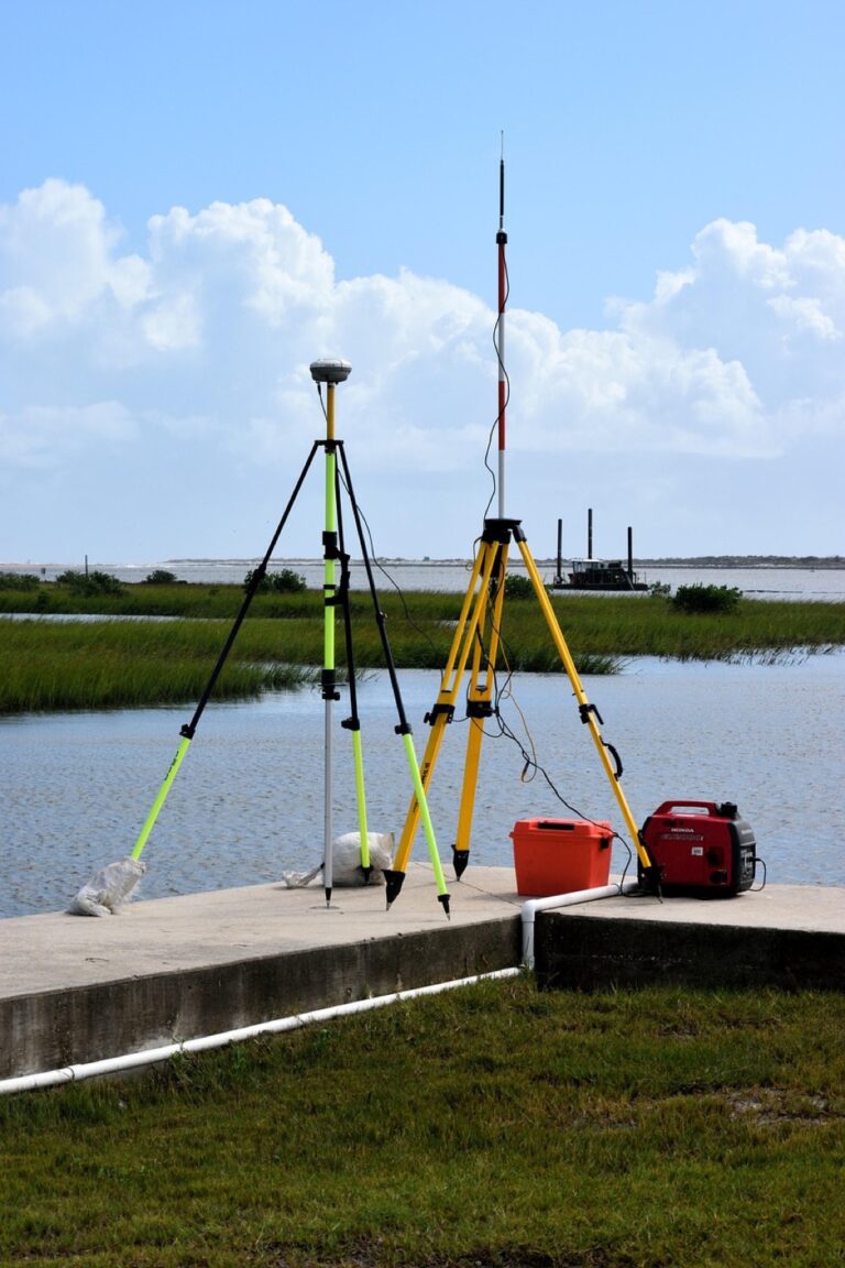
Conduct On-Ground Measurements Using Traditional Survey Tools
Collect precise measurements using theodolites, total stations, and GPS units to establish accurate baseline data for your mapping project. Record elevation points, boundary markers, and infrastructure locations with centimeter-level accuracy. Document your measurements in standardized formats that’ll integrate seamlessly with digital platforms. Take detailed field notes about terrain conditions, accessibility constraints, and notable features that automated tools might miss. This professional-grade data becomes your validation standard for community-generated content.

Upload Field Data to Collaborative Platforms Like OpenStreetMap
Transfer your survey data to OpenStreetMap using JOSM editor or iD editor for direct integration with the global mapping community. Convert your field measurements into GPX files or CSV formats that these platforms readily accept. Add detailed tags for infrastructure types, surface materials, and accessibility features based on your ground observations. Share your expertise by contributing to areas where professional survey data is scarce. Your contributions enhance the platform’s accuracy while benefiting from ongoing community updates and corrections.
Validate Community-Generated Content With Professional Survey Results
Compare crowdsourced mapping data against your field survey measurements to identify discrepancies and verify accuracy levels. Use your professional GPS coordinates to confirm the spatial accuracy of community-contributed features like roads, buildings, and landmarks. Cross-reference elevation data from your total station measurements with crowdsourced topographic information. Flag inconsistencies for community review while acknowledging accurate contributions from local mappers. This validation process improves overall map quality and builds trust between professional surveyors and volunteer contributors.
Blend Compass Navigation With GPS Technology for Outdoor Adventures
Combining traditional compass navigation with modern GPS technology creates a robust navigation system that performs reliably across diverse outdoor conditions and terrain challenges.
Use Magnetic Compass as Primary Navigation Tool
Master basic compass techniques including bearing calculations, triangulation, and declination adjustments before integrating digital systems. Practice taking accurate bearings to visible landmarks and converting magnetic readings to true bearings using local declination values. Develop proficiency with back-bearings and cross-bearings for position confirmation. Carry a quality baseplate compass with adjustable declination since magnetic compasses function independently of batteries and satellite signals. Regular compass drills in familiar terrain build the spatial awareness and confidence needed for challenging backcountry navigation scenarios.
Employ GPS Devices as Backup and Verification Systems
Stay connected anywhere with this compact satellite communicator. Enjoy two-way messaging, interactive SOS, and TracBack routing for confident navigation. Battery lasts up to 14 days in tracking mode.

Configure GPS units to display magnetic bearings matching your compass readings and enable coordinate systems appropriate for your mapping requirements. Use GPS waypoints to mark critical navigation points including trail junctions, water sources, and emergency exits. Cross-reference GPS positions with compass bearings to verify accuracy and identify potential errors from satellite interference or device malfunction. Program backup routes and download offline maps before departing since GPS devices may lose signal in dense forest canopy or steep canyon environments where compass navigation remains reliable.
Teach Navigation Skills Through Hybrid Training Programs
Structure training sessions that progress from basic compass work to GPS integration over multiple field exercises in varying terrain conditions. Design practical scenarios requiring participants to navigate using compass bearings when GPS signals are unavailable or unreliable. Incorporate map-and-compass techniques with GPS coordinate plotting to reinforce spatial reasoning and build redundant navigation skills. Conduct night navigation exercises and adverse weather training since challenging conditions expose the limitations of single-method navigation approaches and demonstrate the value of maintaining proficiency with both traditional and modern techniques.
Fuse Paper Map Reading With Mobile Mapping Applications
Traditional topographic maps and mobile applications complement each other perfectly when you understand their unique strengths. This hybrid approach maximizes navigation accuracy while building essential spatial reasoning skills that digital-only navigation can’t develop.
Practice Topographic Map Interpretation Skills
Start with USGS topographic quadrangles to master contour line interpretation and terrain visualization before relying on digital displays. Focus on identifying ridgelines, valleys, and slope gradients using elevation markers and contour spacing patterns. Practice estimating distances using map scales and recognizing vegetation patterns through standard topographic symbols. These foundational skills translate directly to understanding digital elevation models and terrain visualization in mobile applications, creating stronger spatial awareness for fieldwork.
Cross-Reference Paper Maps With Real-Time Digital Navigation
Use your smartphone‘s GPS positioning to verify your location on paper maps during field navigation exercises. Open apps like Gaia GPS or AllTrails alongside your topographic map to compare route planning and terrain features in real-time. Record waypoints on both formats to identify discrepancies between paper contours and digital elevation data. This cross-referencing technique helps you catch GPS errors while building confidence in traditional map reading skills when technology fails.
Develop Spatial Awareness Through Multi-Format Map Usage
Rotate between paper maps and mobile apps during the same navigation session to strengthen your spatial reasoning abilities. Start route planning on paper to visualize the complete terrain context, then use mobile apps for precise positioning and progress tracking. Switch back to paper maps when signal drops or battery concerns arise. This alternating practice develops mental mapping skills and terrain memory that purely digital navigation cannot provide, creating more confident and capable outdoor navigators.
Incorporate Indigenous Mapping Knowledge With Modern Cartographic Tools
Indigenous mapping traditions offer spatial knowledge systems that span thousands of years, providing unique perspectives on landscape relationships that complement modern digital cartography.
Document Traditional Wayfinding Techniques and Oral Histories
Record traditional navigation methods through structured interviews with indigenous knowledge holders, capturing verbal descriptions of landmark relationships and seasonal route variations. Use digital audio recording equipment and GPS units to document specific locations mentioned in oral histories. Create detailed field notes that translate verbal directions into geographic coordinates, preserving both the cultural context and spatial accuracy of traditional wayfinding systems.
Translate Cultural Spatial Knowledge Into Digital Map Formats
Convert indigenous place names and territorial boundaries into GIS data layers using culturally appropriate symbology and metadata standards. Work with community elders to verify the accuracy of digital representations, ensuring traditional knowledge maintains its cultural integrity within modern mapping frameworks. Export these cultural layers into standard formats like KML or shapefile for integration with contemporary basemaps and analysis tools.
Collaborate With Native Communities on Participatory Mapping Projects
Partner with tribal councils and indigenous organizations to develop community-controlled mapping initiatives that respect data sovereignty and cultural protocols. Provide GIS training to community members while learning traditional spatial concepts that enhance your own cartographic understanding. Establish data-sharing agreements that give communities ownership over their geographic information while enabling collaborative research projects that benefit both traditional knowledge systems and modern cartographic science.
Conclusion
Your mapping skills will reach new heights when you embrace both traditional and modern techniques. This hybrid approach gives you the spatial awareness of hand-drawn methods combined with the precision of digital technology.
The six integration strategies we’ve explored create more reliable and comprehensive mapping solutions than any single approach could provide. You’ll find that combining these methods builds confidence in your navigation abilities while preserving valuable traditional knowledge.
Whether you’re documenting cultural heritage or planning your next outdoor adventure these blended techniques will serve you well. Start implementing one or two approaches that resonate with your needs and gradually expand your toolkit as you gain experience.
Frequently Asked Questions
What is the mapping revolution mentioned in the article?
The mapping revolution refers to the integration of traditional cartographic techniques with modern digital technology. This approach combines hand-drawn sketches, field observations, and compass navigation with GPS satellites, GIS systems, and mobile mapping applications. The result is more accurate, comprehensive, and user-friendly maps that leverage both human spatial intelligence and technological precision.
How do hand-drawn sketches enhance digital mapping?
Hand-drawn sketches provide spatial intuition and context that digital systems often lack. They capture terrain relationships and landscape elements that GPS alone cannot convey. When combined with GIS platforms, these sketches offer the contextual richness of traditional mapping while benefiting from the precision and analytical capabilities of modern technology.
What is the process for integrating hand-drawn maps into GIS?
The integration process involves scanning hand-drawn sketches, georeferencing them to real-world coordinates, and digitizing important features into data layers. GPS coordinates enhance accuracy, transforming field observations into analyzable digital data. This creates a hybrid approach that combines human spatial intelligence with technological precision for more effective mapping solutions.
How can historical maps be integrated with modern satellite imagery?
Historical maps can be georeferenced onto modern aerial views using GIS platforms to create analytical overlays. This process reveals territorial evolution and landscape changes over time, highlighting infrastructure development and environmental changes. Time-lapse mapping techniques can showcase landscape evolution through sequential map layers and interactive visualizations.
What are the benefits of combining professional survey data with crowdsourced mapping?
This combination provides both accuracy and community engagement. Professional field surveys using theodolites and GPS establish baseline data, while crowdsourced platforms like OpenStreetMap benefit from enhanced accuracy. The validation of crowdsourced data against professional results fosters trust between surveyors and volunteer contributors, improving overall map quality.
Why should compass navigation be combined with GPS technology?
Combining compass navigation with GPS creates a robust navigation system suitable for diverse outdoor conditions. Traditional compass skills like bearing calculations and triangulation provide fundamental spatial reasoning, while GPS serves as backup verification. This hybrid approach ensures navigation accuracy even when technology fails or signals are unavailable.
How do traditional topographic maps complement mobile mapping apps?
Learn essential map reading and navigation skills with this U.S. Army guide. Designed for practical use, it provides clear instructions for navigating any terrain.

Traditional topographic maps enhance spatial reasoning and terrain visualization skills that mobile apps alone cannot develop. Cross-referencing paper maps with real-time digital navigation helps verify locations and catch GPS errors. Alternating between both methods during navigation builds mental mapping skills and terrain memory for more capable outdoor navigation.
What role does Indigenous mapping knowledge play in modern cartography?
Indigenous mapping knowledge contributes thousands of years of traditional spatial knowledge systems to modern cartography. This includes documenting wayfinding techniques, oral histories, and landmark relationships. Translating cultural spatial knowledge into digital formats while maintaining accuracy and cultural integrity enhances both traditional knowledge preservation and modern mapping practices through respectful collaboration.