5 Best Social Media Map Tools
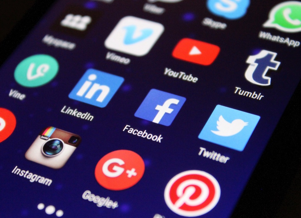
Why it matters: Social media platforms are revolutionizing how you discover share and interact with maps â transforming everything from disaster response to urban planning. Traditional mapping methods can’t keep pace with the real-time collaborative potential that platforms like Instagram TikTok and Twitter offer for geographic information sharing. You’re witnessing a fundamental shift where crowdsourced mapping data and social engagement are creating more dynamic accessible and personalized map experiences than ever before.
Disclosure: As an Amazon Associate, this site earns from qualifying purchases. Thank you!
Social Media Platforms Will Democratize Map Creation and Sharing
Social media platforms are breaking down traditional barriers that once restricted map creation to professional cartographers and large organizations. You’ll now find powerful mapping tools integrated directly into popular platforms, enabling anyone to create and share geographic content instantly.
User-Generated Mapping Content
You can now create interactive maps using built-in tools on platforms like Instagram Stories and TikTok. These platforms allow you to add location tags, custom markers, and visual overlays without specialized GIS software. Users are contributing millions of geotagged posts daily, creating real-time visual maps of events, businesses, and cultural phenomena. This democratization means you’re no longer dependent on official mapping agencies for current geographic information.
P.S. check out Udemy’s GIS, Mapping & Remote Sensing courses on sale here…
Crowdsourced Geographic Data Collection
You’ll benefit from massive crowdsourced datasets emerging from social media check-ins and location sharing. Platforms like Foursquare and Facebook generate millions of venue verifications monthly through user contributions. Social media users are reporting road closures, construction updates, and hazard locations faster than traditional mapping services. This real-time data collection creates more accurate and current geographic information than centralized mapping systems can provide.
Reduced Barriers to Map Publishing
You can now publish maps instantly without technical expertise or expensive software licenses. Social media platforms provide drag-and-drop map creation tools that generate shareable content in minutes. Publishing costs have dropped to zero for basic mapping projects, compared to thousands of dollars for traditional cartographic production. These platforms handle hosting, distribution, and analytics automatically, eliminating the technical infrastructure previously required for map dissemination.
Real-Time Collaborative Mapping Will Transform Geographic Information Updates
Social media platforms now enable instant geographic information updates through collaborative mapping tools that connect users worldwide. You’ll witness unprecedented speed in map accuracy as millions of contributors share real-time observations.
Live Event Mapping and Documentation
You can track events as they unfold through platforms like Twitter and Instagram that aggregate geotagged posts into interactive maps. During natural disasters or major incidents, users document conditions through photos and location data faster than traditional surveying methods. These crowdsourced updates create detailed visual records that emergency responders and researchers access immediately, transforming how you monitor and respond to developing situations across geographic regions.
Community-Driven Map Corrections
You’ll see map errors corrected within hours rather than months through social media reporting systems integrated with mapping platforms. Users identify incorrect business locations, missing roads, or outdated landmarks through simple photo uploads and location tags. Major mapping services like Google Maps and OpenStreetMap now process these community submissions automatically, ensuring you access more accurate geographic data that reflects real-world changes as they occur.
Instant Geographic Data Verification
You can verify map information through cross-referencing multiple social media sources that provide real-time ground truth data. Platforms aggregate user-generated content to confirm business hours, accessibility features, and current site conditions faster than traditional verification methods. This crowdsourced validation system helps you make informed decisions based on recently confirmed information, eliminating the delays associated with formal surveying and official data collection processes.
Interactive Map Storytelling Will Enhance Geographic Narratives
Social media platforms are revolutionizing how geographic stories unfold through interactive mapping features. These dynamic storytelling tools transform static maps into engaging narrative experiences that capture spatial relationships in compelling ways.
Multimedia Map Integration
Layered media elements create immersive geographic narratives by combining video clips, photographs, and audio recordings directly onto map interfaces. You’ll find platforms like Instagram and Snapchat enabling users to embed location-specific content that plays automatically when viewers explore different map areas. These multimedia layers provide contextual depth that traditional maps can’t achieve, allowing storytellers to document cultural events, environmental changes, or historical narratives through multiple sensory channels simultaneously.
Location-Based Social Stories
Sequential storytelling through geotagged social posts creates compelling geographic narratives that unfold across time and space. You can now follow journey-based stories where each location reveals new chapters through connected social media posts, creating immersive travel documentaries or cultural explorations. Platforms automatically link related posts from the same geographic areas, enabling users to discover interconnected stories from multiple perspectives and building comprehensive location-based narratives that traditional mapping couldn’t support.
Enhanced User Engagement Through Interactivity
Interactive map features boost audience participation through clickable hotspots, embedded polls, and user-generated content layers that encourage exploration. You’ll experience higher engagement rates when maps include interactive elements like 360-degree photo viewers, embedded social feeds, or collaborative annotation tools that let users add their own stories. These participatory features transform passive map viewing into active exploration experiences, increasing time spent with geographic content and creating stronger emotional connections to places.
Personalized Map Recommendations Will Drive Targeted Geographic Content
Social media algorithms are transforming how you discover and interact with geographic content. These platforms now analyze your location data, interests, and social connections to deliver customized mapping experiences that match your specific needs and preferences.
Algorithm-Based Map Suggestions
Machine learning systems analyze your location history, search patterns, and engagement data to recommend relevant maps and geographic content. Instagram’s location-based algorithm suggests nearby places based on your previous check-ins and stories you’ve viewed. Facebook’s recommendation engine identifies maps and location-based posts from your network activity, while TikTok’s algorithm surfaces location-tagged videos matching your geographic interests. LinkedIn uses professional networking data to recommend business-focused mapping content and industry-specific geographic insights.
Social Network Influence on Map Discovery
Your social connections directly influence which maps and geographic content appear in your feeds. When friends share location-based posts or check into specific places, algorithms prioritize similar geographic content for your timeline. Twitter’s trending topics surface location-based maps during breaking news events, while Pinterest’s social discovery features highlight travel maps and location guides from users with similar interests. Snapchat’s Map feature showcases content from your friend network, creating personalized geographic narratives based on social proximity.
Customized Geographic Information Delivery
Platforms customize geographic information delivery based on your demographic data, location patterns, and content preferences. YouTube recommends travel vlogs and mapping tutorials aligned with your viewing history and geographic searches. Reddit’s location-based subreddits surface community-driven maps and local geographic discussions tailored to your subscribed communities. WhatsApp’s location sharing features adapt to your communication patterns, while Google Maps integrates social data to provide personalized route suggestions and place recommendations based on your social media activity.
Mobile-First Map Distribution Will Prioritize Accessibility and Convenience
Social media platforms will continue reshaping map distribution by prioritizing mobile accessibility and seamless user experiences. This evolution transforms how geographic content reaches and serves diverse audiences across different devices and contexts.
Smartphone-Optimized Map Formats
Experience vivid content on the Galaxy A16 5G's 6.7" display and capture stunning photos with its triple-lens camera. Enjoy peace of mind with a durable design, six years of updates, and Super Fast Charging.

You’ll see maps designed specifically for smaller screens with simplified visual elements and touch-friendly interfaces. Social media platforms like Instagram and TikTok already optimize geographic content for vertical viewing formats, using bold typography and high-contrast color schemes that remain legible on mobile devices. These optimized formats reduce data usage through compressed imagery while maintaining essential geographic information, making maps accessible even with limited bandwidth connections.
Location-Aware Map Sharing
You can share maps that automatically adapt to your current location and context through GPS integration and device sensors. Platforms like Snapchat’s Snap Map and Facebook’s location services demonstrate how maps respond to your proximity to featured locations, highlighting nearby points of interest while filtering distant content. This intelligent sharing creates personalized geographic experiences that prioritize relevant local information based on your real-time position and movement patterns.
Cross-Platform Geographic Content Integration
You’ll experience seamless map sharing across multiple social media platforms through standardized geographic data formats and API connections. Maps created on one platform automatically format for others, maintaining visual consistency while adapting to each platform’s unique display requirements. Integration tools like Google Maps embedding and Apple’s MapKit allow geographic content to flow between Instagram Stories, Twitter posts, and TikTok videos without losing essential spatial information or visual quality.
Conclusion
The transformation of map dissemination through social media represents a fundamental shift in how you access and interact with geographic information. You’re witnessing the democratization of cartography where anyone can contribute to and benefit from collaborative mapping efforts.
Your relationship with maps is becoming increasingly personal and immediate. Social platforms now deliver customized geographic content that adapts to your location interests and social connections in real-time.
The mobile-first approach ensures you’ll continue to experience seamless map sharing across platforms while multimedia storytelling transforms static geographic data into engaging narratives. This evolution positions you at the center of a more connected and responsive mapping ecosystem.
Frequently Asked Questions
How are social media platforms changing traditional mapping methods?
Social media platforms are revolutionizing mapping by enabling real-time collaboration and crowdsourced data collection. Platforms like Instagram, TikTok, and Twitter allow users to contribute millions of geotagged posts daily, creating dynamic and personalized mapping experiences. This shift democratizes map creation, breaking down barriers that previously restricted mapping to professional cartographers and large organizations.
What makes social media maps more accessible than traditional maps?
Social media maps are more accessible because they’re created using built-in platform tools that require no technical expertise or expensive software. Users can easily create interactive maps, share geographic content instantly, and contribute real-time updates. The mobile-first approach with smartphone-optimized formats and touch-friendly interfaces makes these maps convenient for everyday use.
How do social media platforms improve map accuracy?
Social media platforms enhance map accuracy through collaborative mapping tools that leverage contributions from millions of users. Community-driven corrections allow users to quickly report inaccuracies, leading to faster updates on major mapping services. Cross-referencing multiple social media sources enables real-time verification of geographic information, improving overall data reliability.
What role does crowdsourced data play in modern mapping?
Crowdsourced data from platforms like Foursquare and Facebook enables users to report updates, hazards, and changes faster than traditional mapping services. This real-time data collection creates more current and comprehensive maps, particularly valuable for disaster response and urban planning. Users contribute geographic information through check-ins, posts, and location-based updates.
How do social media maps help during emergencies?
During emergencies, social media platforms aggregate geotagged posts to create live event maps that document unfolding situations. These maps provide emergency responders with immediate access to detailed visual records of natural disasters, accidents, or other events. Real-time updates from affected areas help coordinate response efforts more effectively than traditional reporting methods.
What is geographic storytelling on social media?
Geographic storytelling transforms static maps into engaging narratives through interactive mapping features. Users can create location-based stories using multimedia integration like video clips and audio recordings. Sequential geotagged posts create immersive narratives that unfold over time and space, allowing others to explore interconnected stories and experiences.
How do algorithms personalize map recommendations?
Social media algorithms analyze users’ location data, interests, and social connections to deliver customized mapping experiences. Machine learning systems on platforms like Instagram, Facebook, and TikTok suggest relevant maps and geographic content based on engagement history and location patterns. Friends’ check-ins and location-based posts also influence the geographic content users discover.
What makes mobile mapping on social media effective?
Mobile mapping on social media is effective due to smartphone-optimized formats with simplified visuals and touch-friendly interfaces. GPS integration enables location-aware map sharing that adapts to users’ current locations. Cross-platform integration allows maps to maintain visual consistency across multiple social media platforms, creating seamless user experiences.