5 Best Digital Map Technologies
The digital maps on your phone already feel magical but they’re about to get a massive upgrade. Real-time data streams are transforming cartography from static representations into living breathing documents that update by the second. You’re witnessing the biggest revolution in mapmaking since GPS technology first emerged decades ago.
This isn’t just about faster traffic updates or more accurate restaurant hours. Real-time data integration is fundamentally changing how maps capture and display our world creating new possibilities for everything from disaster response to urban planning. The shift means maps will soon predict rather than just reflect making them essential tools for decision-making across industries.
Your future interactions with maps will be more dynamic personalized and contextually aware than ever before. These five emerging trends show exactly how real-time data will reshape cartography in ways that’ll impact your daily life.
Disclosure: As an Amazon Associate, this site earns from qualifying purchases. Thank you!
P.S. check out Udemy’s GIS, Mapping & Remote Sensing courses on sale here…
Real-Time Traffic and Transportation Mapping
Transportation networks pulse with constant activity, creating dynamic patterns that traditional static maps can’t capture. Real-time data transforms these networks into living systems where every vehicle movement, delay, and route change feeds into comprehensive transportation intelligence.
Dynamic Route Optimization
You’ll see navigation systems evolve beyond basic shortest-path calculations to incorporate live traffic density, weather conditions, and predictive congestion modeling. Machine learning algorithms now process millions of GPS pings per second to identify optimal routes before traffic patterns fully develop. Modern mapping platforms like HERE and Mapbox integrate construction data, event schedules, and historical traffic patterns to suggest routes that adapt continuously throughout your journey, reducing travel times by up to 30% compared to static routing methods.
Live Public Transit Updates
Your transit experience transforms when real-time vehicle tracking connects directly to mapping interfaces, showing exact bus and train positions rather than scheduled estimates. Transit agencies worldwide now broadcast live departure times, capacity levels, and service disruptions through standardized GTFS-Realtime feeds. You can visualize subway delays, bus bunching patterns, and alternative route options instantly, while accessibility features highlight elevator outages and platform changes that affect mobility-impaired passengers navigating complex transit systems.
Emergency Response Coordination
Emergency dispatchers rely on real-time mapping to coordinate response efforts across multiple agencies, tracking ambulance locations, hospital capacity, and traffic conditions simultaneously. You’ll find that modern emergency mapping systems integrate 911 call data, traffic camera feeds, and weather sensors to create comprehensive situational awareness dashboards. These platforms enable dynamic resource allocation, automatically suggesting fastest response routes while accounting for road closures, and providing real-time updates to field personnel through mobile mapping applications designed for high-stress emergency environments.
Get comprehensive weather data with this wireless station. It features a 7-in-1 outdoor sensor for accurate temperature, humidity, wind, and rain readings, displayed on a clear, adjustable 7.5" LCD screen.

Environmental Monitoring and Climate Visualization
Real-time environmental data transforms maps from static references into dynamic monitoring systems. You’ll witness how instantaneous climate information creates unprecedented opportunities for environmental awareness and response.
Weather Pattern Tracking
Weather pattern tracking delivers live atmospheric data directly to your maps through automated meteorological stations and satellite feeds. You can visualize temperature gradients, precipitation patterns, and wind vectors as they develop across regions. Storm systems appear as animated overlays showing movement trajectories and intensity changes. Modern weather APIs like NOAA’s real-time feeds integrate seamlessly with mapping platforms, enabling you to create responsive weather visualizations that update every 15 minutes with current conditions.
Natural Disaster Mapping
Natural disaster mapping leverages seismic sensors, flood gauges, and wildfire detection systems to provide immediate hazard visualization. You can track earthquake epicenters within minutes of occurrence using USGS real-time data streams. Flood monitoring systems display water levels and inundation zones as conditions change, while satellite-based fire detection shows wildfire perimeters and spread rates. Emergency managers rely on these live disaster maps to coordinate evacuations and deploy resources effectively during critical events.
Pollution Level Monitoring
Pollution level monitoring integrates air quality sensors and water quality stations to display contamination data in real-time. You can visualize particulate matter concentrations, ozone levels, and toxic gas measurements through color-coded overlays that update hourly. Industrial monitoring networks provide immediate alerts when pollution exceeds safe thresholds. Water quality sensors track chemical runoff and bacterial contamination in rivers and lakes, creating dynamic pollution maps that help communities make informed health decisions.
Understand your indoor air quality with the Amazon Smart Air Quality Monitor. It tracks five key factors and provides an easy-to-understand air quality score in the Alexa app, plus notifications when air is poor.

Urban Planning and Smart City Development
Real-time data transforms urban planning from reactive guesswork into predictive science. Smart cities leverage continuous data streams to optimize everything from traffic flow to utility distribution.
Population Density Analysis
Population density mapping reveals how people actually use urban spaces throughout the day. GPS tracking data from mobile devices shows you where crowds gather during peak hours, helping planners identify bottlenecks before they become problems. Transit ridership sensors and pedestrian counters create heat maps that highlight underutilized areas needing development or overloaded zones requiring infrastructure expansion.
Track vehicles and assets with the LandAirSea 54 GPS Tracker. Get real-time location alerts and historical playback using the SilverCloud app, with a long-lasting battery and discreet magnetic mount.

Infrastructure Usage Patterns
Infrastructure monitoring systems track how citizens interact with city services in real-time. Water pressure sensors reveal consumption patterns across neighborhoods, while smart parking meters show occupancy rates that guide pricing strategies. Traffic signal data captures vehicle flow at intersections, enabling dynamic timing adjustments. These patterns help you identify which infrastructure investments deliver the greatest impact.
Easily monitor your home's water pressure with this durable gauge. It features a 2-1/2" dial, measures 0-200 PSI via a 3/4" hose thread, and provides accurate readings for system maintenance.

Resource Allocation Optimization
Resource allocation becomes data-driven when you integrate real-time usage metrics with predictive models. Emergency services use call volume patterns and response time data to position vehicles strategically. Waste management routes adapt based on bin sensor data showing fill levels. Public transit schedules adjust automatically using passenger load information, reducing wait times while maximizing efficiency across the entire network.
Precision Agriculture and Land Management
Real-time data integration transforms agricultural mapping from seasonal snapshots into continuous field monitoring systems. You’ll find that precision agriculture benefits dramatically from live sensor networks that track crop conditions, soil parameters, and irrigation needs across vast farmlands.
Crop Health Monitoring
Crop health monitoring uses multispectral sensors and drone-mounted cameras to deliver real-time vegetation analysis directly to your farm management maps. You can visualize NDVI (Normalized Difference Vegetation Index) values that update hourly, revealing stressed crop areas before visible symptoms appear. Satellite feeds combined with IoT field sensors create dynamic heat maps showing chlorophyll levels, pest infestations, and nutrient deficiencies across individual field zones.
Explore multispectral image sensors using metasurfaces. This book delves into advancements in optical science and photonics.

Soil Condition Mapping
Soil condition mapping integrates wireless sensor networks that continuously monitor moisture levels, pH balance, and nutrient concentrations throughout your fields. You’ll receive live updates on soil temperature variations, compaction levels, and organic matter distribution through color-coded mapping interfaces. Ground-based sensors transmit data every 15 minutes, allowing you to track soil health changes and optimize fertilizer application timing based on real-time conditions.
Irrigation System Management
Irrigation system management leverages real-time soil moisture sensors and weather station data to create dynamic water distribution maps for your agricultural operations. You can monitor sprinkler system performance, detect leaks, and adjust water flow rates automatically based on live field conditions. Smart irrigation controllers integrate with mapping platforms to display water usage patterns, soil saturation levels, and crop water stress indicators across different field zones.
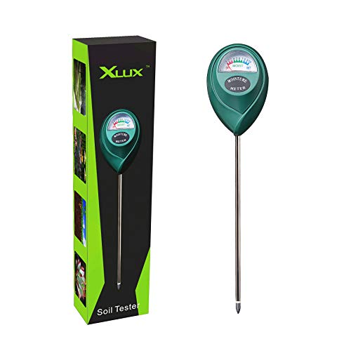
Know when to water with the XLUX Soil Moisture Meter. This easy-to-read meter instantly displays soil moisture levels, preventing over or under watering of your indoor and outdoor plants.
Interactive Social and Economic Mapping
Real-time data transforms social and economic mapping from static demographic snapshots into dynamic visualization systems. You’ll discover how live population movements and economic indicators create maps that respond to changing social patterns.
Real-Time Demographics
Population density shifts become visible through GPS tracking data from mobile devices and transit systems. You can monitor crowd formations at events sporting venues concerts and public gatherings using aggregated location services. Migration patterns emerge through cell tower handoffs and social check-ins revealing seasonal movements between urban and rural areas. Age demographics appear through app usage patterns and device registration data helping you identify generational clusters in real-time across neighborhoods.
Economic Activity Tracking
Commercial activity monitoring reveals business district vitality through payment processing data and foot traffic sensors. You’ll track retail performance using credit card transactions mobile payments and point-of-sale systems that update economic heat maps hourly. Employment patterns become visible through commuter flows parking occupancy rates and office building access data. Market demand indicators emerge from delivery requests ride-sharing pickups and service appointment scheduling creating dynamic economic activity layers.
Social Media Geolocation Data
Event detection capabilities identify gatherings protests festivals and emergencies through geotagged posts and hashtag clustering. You can monitor social sentiment across geographic areas using location-tagged tweets Instagram posts and Facebook check-ins that reveal community mood patterns. Cultural mapping emerges through restaurant reviews entertainment venue ratings and local business mentions creating real-time cultural activity zones. Tourism flow analysis tracks visitor movements through social media sharing patterns helping you visualize popular destinations and travel routes.
Conclusion
Real-time data integration represents the most significant leap forward in cartography since digital mapping began. You’re witnessing the birth of intelligent maps that don’t just show where things are—they predict where they’re going and help you make better decisions every step of the way.
These five transformative applications will reshape how you interact with geographic information daily. From avoiding traffic jams before they form to monitoring crop health in real-time your maps will become proactive partners rather than passive reference tools.
The future of cartography isn’t just about better accuracy—it’s about maps that understand context anticipate needs and respond to the world as it changes. You’ll soon experience navigation that feels less like following directions and more like having a knowledgeable local guide who knows exactly what’s happening right now.
Frequently Asked Questions
What makes real-time data integration in digital maps different from current GPS technology?
Real-time data integration goes beyond basic GPS navigation by creating predictive mapping systems. While GPS shows your location and basic traffic, real-time maps will analyze multiple data streams to predict events, optimize complex routing decisions, and provide dynamic environmental monitoring. This transforms maps from reactive tools into proactive decision-making platforms for everything from disaster response to urban planning.
How will real-time mapping improve transportation and navigation?
Real-time mapping transforms transportation by creating dynamic route optimization using live traffic data, weather conditions, and predictive congestion modeling. Users will receive instant updates on public transit positions, service disruptions, and alternative routes. This integration significantly reduces travel times by analyzing vehicle movements, delays, and real-time conditions to suggest the most efficient pathways.
What role does real-time mapping play in emergency response?
Real-time mapping enhances emergency response by providing dispatchers with live tracking of resources, personnel, and changing conditions. Emergency managers can visualize natural disasters as they unfold using seismic sensors and flood gauges, coordinate evacuations more effectively, and deploy resources based on dynamic situational awareness rather than static information.
How does environmental monitoring benefit from real-time mapping?
Real-time environmental mapping creates dynamic monitoring systems that track weather patterns, pollution levels, and natural disasters as they happen. Users can visualize temperature gradients, precipitation patterns, storm systems, and air quality data in real-time. This enables better environmental awareness, faster emergency response to natural disasters, and informed decision-making about health risks.
What impact will real-time data have on urban planning and smart cities?
Real-time data transforms urban planning from reactive guesswork into predictive science. Planners can analyze live population density patterns, monitor infrastructure usage through sensors, and optimize resource allocation dynamically. This includes tracking crowd formations, identifying bottlenecks, monitoring utility consumption trends, and adapting emergency services and public transit based on real-time metrics.
How does real-time mapping revolutionize agriculture and land management?
Real-time agricultural mapping provides continuous field monitoring through live sensor networks that track crop conditions, soil parameters, and irrigation needs. Farmers receive dynamic vegetation analysis, heat maps revealing stressed crops, soil moisture monitoring, and optimized water distribution maps. This transforms agriculture from seasonal snapshots into precision farming with immediate insights.
What changes will occur in social and economic mapping with real-time data?
Real-time social and economic mapping moves beyond static demographic snapshots to create dynamic visualization systems. These maps track live population movements, economic indicators, business district vitality through payment data, and social media geolocation for event detection. This provides responsive insights into changing social patterns and community sentiment in real-time.