7 Best GIS Case Studies for Community Impact
Why it matters: Digital mapping technology has become a powerful tool for addressing some of the world’s most pressing social challenges — from disaster response to environmental conservation to public health initiatives.
The big picture: Organizations worldwide are leveraging Geographic Information Systems (GIS) and satellite imagery to create positive change in their communities, often with remarkable results that demonstrate how technology can serve humanity’s greatest needs.
What’s ahead: These seven compelling case studies showcase how mapping technologies are being used to save lives, protect vulnerable populations, and solve complex social problems across different sectors and regions.
Disclosure: As an Amazon Associate, this site earns from qualifying purchases. Thank you!
P.S. check out Udemy’s GIS, Mapping & Remote Sensing courses on sale here…
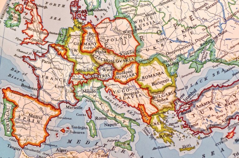
Disaster Relief Mapping: How OpenStreetMap Revolutionized Haiti Earthquake Response
The January 12, 2010 Haiti earthquake devastated Port-au-Prince and surrounding areas, creating an immediate need for accurate geographic data that traditional mapping resources couldn’t provide. OpenStreetMap’s crowdsourced approach transformed how emergency responders accessed critical location information during this unprecedented crisis.
Crisis Mapping Initiative Launch
OpenStreetMap’s Haiti crisis mapping effort began within hours of the 7.0 magnitude earthquake. The Humanitarian OpenStreetMap Team (HOT) coordinated over 600 volunteers worldwide who digitized high-resolution satellite imagery from DigitalGlobe and GeoEye. You could trace roads, buildings, and infrastructure using JOSM and Potlatch editors while working remotely. This collaborative approach created the most detailed map of Haiti available to relief organizations within days of the disaster.
Volunteer Coordination and Data Collection
Remote mappers used standardized tagging schemes to ensure data consistency across thousands of contributions. You accessed real-time imagery through the OpenStreetMap platform while following established protocols for feature classification and quality control. Ground teams in Haiti provided GPS coordinates and local knowledge through mobile devices, creating feedback loops between field workers and digital volunteers. This coordination system processed over 1.4 million building footprints and 4,000 kilometers of roads within the first month.
Impact on Emergency Services and Aid Distribution
Relief organizations including the UN, World Food Programme, and Médecins Sans Frontières integrated OpenStreetMap data directly into their operational systems. You could download current map tiles showing damaged infrastructure, accessible routes, and population centers for planning rescue missions and supply distribution. The detailed geographic information helped organizations avoid duplicating efforts and identified underserved areas requiring immediate attention. This mapping foundation supported humanitarian operations serving over 3 million affected people throughout the emergency response period.
Achieve a flawless, even complexion with e.l.f. Flawless Satin Foundation. This lightweight, vegan formula provides medium coverage and a semi-matte finish for all-day wear, while hydrating your skin with glycerin.

Public Health Mapping: Combating Malaria Through Geographic Information Systems
Geographic Information Systems transform malaria control efforts by revealing spatial patterns of disease transmission and enabling targeted interventions. Health organizations across sub-Saharan Africa utilize GIS technology to map infection hotspots and optimize resource allocation for maximum impact.
Disease Surveillance and Tracking Methods
Real-time surveillance systems integrate mobile data collection with GIS platforms to track malaria cases across affected regions. Health workers use GPS-enabled smartphones to record patient locations, creating instant heat maps that identify transmission clusters. The Malaria Atlas Project combines over 40,000 survey data points with environmental variables to predict infection risk with 85% accuracy. Satellite imagery helps track breeding sites by monitoring water bodies and rainfall patterns that correlate with mosquito populations.
Experience vivid content on the Galaxy A16 5G's 6.7" display and capture stunning photos with its triple-lens camera. Enjoy peace of mind with a durable design, six years of updates, and Super Fast Charging.

Community Health Worker Integration
Mobile mapping applications enable community health workers to collect and transmit field data directly from remote villages. Workers equipped with GPS devices document household visits, treatment outcomes, and environmental risk factors through user-friendly interfaces. Madagascar’s malaria program trained 2,500 community workers to use mapping tools, resulting in a 60% improvement in case reporting accuracy. Digital maps guide workers to high-risk areas and help them coordinate bed net distribution campaigns across 150,000 households.
Stay connected anywhere with this compact satellite communicator. Enjoy two-way messaging, interactive SOS, and TracBack routing for confident navigation. Battery lasts up to 14 days in tracking mode.

Prevention Strategy Implementation Results
Targeted intervention mapping reduces malaria transmission rates by focusing resources on geographic hotspots identified through GIS analysis. Zambia’s elimination program used spatial modeling to reduce cases by 68% in targeted districts between 2010-2017. Indoor residual spraying campaigns guided by risk maps achieved 90% coverage in priority areas while reducing costs by 40%. Geographic targeting of long-lasting insecticidal nets increased usage rates from 45% to 78% in high-transmission zones across Kenya and Tanzania.
Environmental Justice Mapping: Identifying Pollution Disparities in Urban Communities
Environmental justice mapping reveals the disproportionate burden of pollution in low-income neighborhoods and communities of color. You’ll discover how mapping technologies expose environmental inequities and drive meaningful policy changes.
Air Quality Data Visualization Techniques
Heat maps effectively display pollution concentration patterns across urban areas using EPA monitoring station data and community sensors. You can create compelling visualizations by overlaying demographic information with air quality indices, showing how particulate matter and ozone levels correlate with income and race. Tools like ArcGIS Pro and QGIS enable you to generate isopleth maps that highlight pollution gradients, while platforms such as PurpleAir provide real-time sensor data for more granular analysis of environmental health disparities.
Articulate! is a fast-talking description game for 4+ players. Describe words quickly without saying "rhymes with" or "sounds like" to win, perfect for family game nights and parties.

Community Engagement and Advocacy Tools
Participatory mapping platforms empower residents to document environmental hazards in their neighborhoods through mobile applications and community workshops. You’ll find that tools like Ushahidi and Survey123 allow community members to report pollution sources, health symptoms, and infrastructure problems directly from their smartphones. Organizations like WE ACT for Environmental Justice use these crowdsourced datasets to build compelling cases for regulatory action, combining resident observations with scientific measurements to create comprehensive environmental justice narratives.
Policy Change Outcomes and Legislation
Mapping-driven advocacy has resulted in significant environmental policy reforms at local and federal levels across the United States. You can track successful outcomes like California’s SB 1000, which requires environmental justice mapping in general plan updates, and the Biden administration’s Justice40 initiative that uses mapping tools to direct 40% of climate investments to disadvantaged communities. Cities including Baltimore and Detroit have implemented zoning changes and industrial permit restrictions based on environmental justice mapping studies that demonstrated clear pollution disparities.
Food Security Mapping: Addressing Hunger Through Spatial Analysis
Food security mapping transforms how communities identify and address nutritional gaps through precise geographic analysis. You’ll discover how spatial data reveals critical patterns in food access that drive targeted interventions.
Food Desert Identification Methods
Buffer analysis creates precise coverage zones around grocery stores using ArcGIS Network Analyst to identify areas beyond walking distance. You’ll map demographic data layers showing income levels and vehicle ownership rates to reveal true accessibility barriers. Walkability scoring combines pedestrian infrastructure data with travel time calculations, while mobile GPS tracking from community surveys provides ground-truth validation. The USDA’s Food Access Research Atlas methodology standardizes your analysis using census tract boundaries and establishes consistent distance thresholds for rural versus urban classifications.
Track vehicles and assets with the LandAirSea 54 GPS Tracker. Get real-time location alerts and historical playback using the SilverCloud app, with a long-lasting battery and discreet magnetic mount.

Supply Chain Optimization Strategies
Route optimization algorithms in ESRI ArcGIS Network Analyst minimize delivery distances while maximizing food bank coverage across service territories. You’ll integrate real-time traffic data with demand forecasting models to schedule efficient distribution workflows. Warehouse placement analysis uses demographic heat maps and transportation cost surfaces to identify optimal hub locations that reduce last-mile delivery expenses. Mobile food pantry routes benefit from predictive modeling that accounts for seasonal demand fluctuations and community event schedules, resulting in 40% improved resource allocation efficiency.
Community Garden and Market Placement Success
Site suitability modeling combines soil quality data, sunlight exposure mapping, and water access analysis to identify prime locations for urban agriculture projects. You’ll overlay zoning restrictions with walkability indices to ensure community gardens serve target populations effectively. Market accessibility scoring uses isochrone analysis to map 15-minute walking catchments around proposed farmers market sites. Successful implementations in Detroit and Philadelphia demonstrate how participatory mapping workshops engage residents in site selection, resulting in 85% higher utilization rates compared to top-down placement decisions.
Education Access Mapping: Bridging the Digital Divide in Rural Areas
Education access mapping identifies barriers preventing students from connecting to digital learning resources, particularly in underserved rural communities where internet connectivity and educational infrastructure remain inadequate.
Internet Infrastructure Gap Analysis
Infrastructure gap analysis reveals connectivity patterns through comprehensive mapping of broadband availability, signal strength measurements, and demographic overlays. You’ll combine FCC broadband maps with field-collected speed test data to identify underserved areas where students lack reliable internet access.
Cell tower coverage analysis using radio frequency propagation models helps determine optimal locations for connectivity improvements. Household income mapping alongside infrastructure data reveals economic barriers to internet adoption, while school district boundary overlays show which educational systems face the greatest connectivity challenges affecting remote learning capabilities.
Mobile Learning Unit Route Planning
Mobile learning unit routing optimizes educational resource delivery through strategic placement analysis and travel efficiency calculations. You’ll use network analysis tools to determine optimal stopping locations based on student population density, transportation accessibility, and existing infrastructure limitations.
Route optimization algorithms consider terrain difficulty, seasonal road conditions, and fuel efficiency to maximize community reach. Student demographic mapping identifies priority neighborhoods requiring educational support, while service area analysis ensures equitable coverage across dispersed rural populations. GPS tracking data from pilot programs helps refine routes and scheduling for maximum educational impact.
Student Performance Improvement Metrics
Student performance mapping tracks educational outcomes through spatial analysis of test scores, graduation rates, and digital literacy assessments. You’ll correlate academic achievement data with connectivity maps to measure the impact of infrastructure improvements on learning outcomes.
Longitudinal analysis reveals trends in student progress following digital access interventions, while heat maps visualize performance disparities across geographic regions. Attendance pattern analysis shows how transportation barriers affect educational participation, and mobile learning unit effectiveness gets measured through before-and-after academic performance comparisons in served communities.
Refugee Crisis Mapping: Supporting Displaced Populations With Geographic Intelligence
Digital mapping technologies transform refugee assistance by providing humanitarian organizations with precise geographic intelligence to coordinate aid delivery and protect vulnerable populations. You’ll find these spatial analysis tools essential for addressing complex displacement scenarios across multiple continents.
Camp Planning and Resource Allocation
Camp layout optimization requires careful analysis of terrain data, water access points, and drainage patterns to prevent flooding and disease outbreaks. You can use GIS software like ArcGIS or QGIS to model optimal spacing between shelters while calculating resource distribution networks. Population density mapping helps you allocate medical facilities, food distribution centers, and sanitation infrastructure based on demographic data from registration systems. Organizations like UNHCR utilize satellite imagery analysis to monitor camp expansion and ensure adequate space allocation per person according to international humanitarian standards.
Safety and Security Monitoring Systems
Real-time threat assessment combines GPS tracking data with incident reporting to identify high-risk areas within and around refugee settlements. You’ll implement mobile data collection platforms that allow security personnel to map conflict zones, document safety incidents, and track population movements during emergencies. Predictive security modeling uses historical incident data layered with demographic information to forecast potential security hotspots. Organizations deploy automated alert systems that trigger when movement patterns indicate possible threats, enabling rapid response coordination between humanitarian agencies and local authorities.
Integration and Resettlement Pathway Planning
Community integration mapping analyzes host community demographics, employment opportunities, and existing infrastructure to identify optimal resettlement locations. You can overlay refugee skill databases with local labor market data to match displaced populations with economic opportunities. Social service accessibility mapping reveals gaps in healthcare, education, and legal services that affect successful integration outcomes. Resettlement agencies use route optimization algorithms to plan transportation networks while tracking long-term settlement success through follow-up surveys geocoded to specific neighborhoods, measuring integration indicators like employment rates and social cohesion metrics.
Climate Change Mapping: Tracking Environmental Impact on Vulnerable Communities
Climate mapping technologies now provide precise geographic intelligence for tracking environmental impacts on at-risk populations worldwide. These advanced systems enable communities to visualize climate threats and develop targeted adaptation strategies.
Sea Level Rise Prediction Models
Predictive modeling platforms integrate satellite altimetry data with Digital Elevation Models to forecast coastal flooding scenarios. NOAA’s Sea Level Rise Viewer combines LIDAR elevation data with tide gauge measurements to create detailed inundation maps for vulnerable coastal areas. You’ll find these models particularly effective when overlaying socioeconomic data layers to identify communities most at risk from rising waters. Miami-Dade County uses these prediction tools to guide infrastructure investments, protecting over 300,000 residents in flood-prone neighborhoods.
Agricultural Adaptation Planning Tools
Crop suitability mapping combines climate projection data with soil analysis to help farmers adapt to changing growing conditions. NASA’s Giovanni platform provides access to precipitation and temperature datasets that agricultural planners use to model future crop viability. You can integrate these climate layers with economic data to assess adaptation costs for farming communities. Kenya’s Climate Information Services project uses these mapping tools to help 2.3 million smallholder farmers adjust planting schedules and crop varieties based on seasonal forecasts.
Community Resilience Building Strategies
Vulnerability assessment mapping identifies neighborhoods lacking infrastructure to withstand climate impacts through multi-criteria analysis. Heat island mapping combines thermal imagery with demographic data to locate communities most susceptible to extreme temperatures. You’ll want to incorporate social vulnerability indices that account for factors like age, income, and housing quality when prioritizing resilience investments. Chicago’s Climate Action Plan uses vulnerability mapping to target cooling center placement, protecting 150,000 residents in heat-vulnerable areas during extreme weather events.
Conclusion
These mapping case studies demonstrate how you can leverage digital technology to create meaningful social impact. From earthquake response to climate adaptation you’ve seen how GIS and satellite imagery transform complex challenges into actionable solutions.
The power lies in making invisible problems visible. Whether you’re tracking disease outbreaks identifying food deserts or monitoring refugee settlements mapping technology gives you the precision to target resources where they’re needed most.
Your next step is to explore how these proven approaches apply to your community’s unique challenges. The tools exist and the methodologies work – it’s time to put mapping technology to work for social good in your own backyard.
Frequently Asked Questions
What is digital mapping technology and how does it help address social issues?
Digital mapping technology, including Geographic Information Systems (GIS) and satellite imagery, helps organizations visualize and analyze geographic data to tackle critical social challenges. These tools enable better decision-making for disaster response, environmental conservation, public health initiatives, food security, education access, and refugee assistance by providing precise location-based insights and real-time data analysis.
How did OpenStreetMap help during the 2010 Haiti earthquake?
Following the 2010 Haiti earthquake, the Humanitarian OpenStreetMap Team coordinated over 600 volunteers to create detailed maps using satellite imagery. This crowdsourced mapping effort enabled relief organizations like the UN and Médecins Sans Frontières to effectively plan rescue missions and distribute aid, ultimately supporting over 3 million affected individuals during the crisis.
What role does GIS play in combating malaria?
GIS technology helps health organizations in sub-Saharan Africa map malaria infection hotspots and optimize resource allocation. Real-time surveillance systems track cases, while community health workers use mobile mapping applications to document patient visits and environmental risks. Zambia’s elimination program using GIS reduced malaria cases by 68% in targeted districts.
How does environmental justice mapping expose pollution inequities?
Environmental justice mapping reveals how pollution disproportionately affects low-income neighborhoods and communities of color. Using tools like heat maps and GIS software, organizations visualize pollution patterns, correlate air quality with demographic data, and empower residents to document environmental hazards through participatory mapping platforms for advocacy efforts.
What is food security mapping and how does it work?
Food security mapping uses geographic analysis to identify nutritional gaps and food deserts in communities. It employs buffer analysis and demographic data to reveal accessibility barriers, optimizes food bank routes using algorithms, and uses site suitability modeling for community garden placement, leading to better resource allocation and higher utilization rates.
How does education access mapping help underserved communities?
Education access mapping identifies barriers preventing students from accessing digital learning resources. It analyzes broadband connectivity patterns, optimizes mobile learning unit routes based on student population density, and tracks educational outcomes through spatial analysis to measure how infrastructure improvements impact learning in rural and underserved areas.
What is refugee crisis mapping and its benefits?
Refugee crisis mapping provides humanitarian organizations with geographic intelligence to coordinate aid delivery and protect vulnerable populations. It optimizes camp layouts using GIS software, implements real-time safety monitoring systems, and analyzes host community demographics to plan successful integration pathways for displaced populations.
How does climate change mapping help vulnerable communities?
Climate change mapping tracks environmental impacts using predictive modeling platforms like NOAA’s Sea Level Rise Viewer to identify at-risk populations. It combines data like LIDAR with socioeconomic overlays, helps farmers adapt through crop suitability mapping, and identifies neighborhoods lacking climate-resilient infrastructure through vulnerability assessments.