7 Best Community Engagement Strategies for Maps
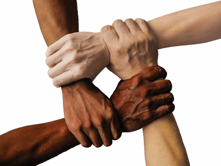
The big picture: You’re looking at maps differently these days — and that’s exactly what communities need to create more accurate and meaningful geographic representations.
Why it matters: Traditional mapmaking often excludes local voices and community knowledge that could make geographic data more complete and culturally relevant.
What’s next: Engaging your community in cartographic projects isn’t just about collecting data — it’s about building maps that truly reflect the people and places they represent.
Disclosure: As an Amazon Associate, this site earns from qualifying purchases. Thank you!
P.S. check out Udemy’s GIS, Mapping & Remote Sensing courses on sale here…
Participatory Mapping Workshops: Empowering Local Voices in Geographic Data Collection
Building on the need for community-centered mapmaking, participatory workshops provide structured environments where residents become active cartographers. These collaborative sessions transform local knowledge into precise geographic data while building community capacity for ongoing mapping initiatives.
Explore and map the wilderness for the Queen in Cartographers! Draw unique terrain shapes and score points based on randomly selected goals each game, but beware of monster ambushes.

Organizing Community-Led Data Gathering Sessions
Schedule regular neighborhood walks where residents identify and document unmapped features using GPS-enabled smartphones or tablets. You’ll capture local landmarks, informal pathways, and culturally significant sites that traditional surveys often miss. Partner with community organizations to recruit diverse participants and establish consistent meeting locations. Document findings immediately using field apps like KoBo Toolbox or Survey123, ensuring data quality through standardized collection forms. These sessions typically yield 200-300 new data points per workshop, creating comprehensive neighborhood databases that reflect authentic community geography.
Experience vivid content on the Galaxy A16 5G's 6.7" display and capture stunning photos with its triple-lens camera. Enjoy peace of mind with a durable design, six years of updates, and Super Fast Charging.

Training Residents in Basic Cartographic Techniques
Introduce essential GIS concepts through hands-on training using accessible platforms like QGIS or ArcGIS Online. You’ll teach coordinate systems, layer management, and basic digitizing skills during 3-4 hour workshops. Focus on practical applications such as creating property boundary maps, identifying flood-prone areas, or mapping community assets. Provide participants with simple data collection templates and GPS coordinate recording methods. Establish quality control protocols including peer review processes and accuracy verification steps. Most participants master basic digitizing skills within two sessions, enabling independent contribution to community mapping projects.
Creating Digital Storytelling Through Maps
Combine geographic data with narrative elements using StoryMaps platforms or similar web-based tools to document community histories and experiences. You’ll help residents attach photographs, audio recordings, and written accounts to specific locations, creating rich multimedia cartographic narratives. Integrate historical timeline features that show neighborhood changes over decades, connecting past events to current geographic conditions. Encourage collaborative storytelling where multiple community members contribute perspectives about shared locations. These digital narratives typically generate 15-20 story points per workshop, preserving local knowledge while making it accessible to broader audiences through interactive web maps.
Crowdsourced Geographic Information Systems: Harnessing Collective Knowledge for Accurate Mapping
Crowdsourced GIS platforms transform traditional mapmaking by enabling thousands of contributors to create comprehensive geographic datasets. These systems leverage collective intelligence to produce maps that reflect real-world conditions with unprecedented detail and accuracy.
Building Open-Source Mapping Platforms
OpenStreetMap serves as the foundational framework for most crowdsourced mapping initiatives. You’ll need to establish local servers using OSM’s API structure while customizing data schemas for your community’s specific needs. Platforms like QGIS Cloud and GeoNode provide hosting solutions that support collaborative editing workflows. Integration with mobile apps such as Maps.me and OsmAnd enables offline data collection in areas with limited connectivity. You should implement version control systems that track contributor changes and maintain data integrity across multiple editing sessions.
Achieve a flawless, even complexion with e.l.f. Flawless Satin Foundation. This lightweight, vegan formula provides medium coverage and a semi-matte finish for all-day wear, while hydrating your skin with glycerin.

Implementing Quality Control Measures for User-Generated Content
Data validation protocols ensure crowdsourced contributions meet cartographic standards before publication. You’ll establish automated checks for geometric accuracy using topology rules that flag inconsistent polygon boundaries and overlapping features. Manual review processes should involve experienced local validators who verify attribute accuracy and completeness. Implement reputation systems that weight contributions based on contributor experience and past accuracy rates. You can use statistical analysis tools to identify outliers in positional data and flag submissions requiring additional verification before integration into master datasets.
Encouraging Diverse Community Participation
Demographic representation directly impacts the comprehensiveness of crowdsourced geographic data. You should organize targeted outreach campaigns that engage underrepresented communities through local organizations and cultural centers. Multilingual interfaces and culturally appropriate mapping symbols increase participation rates among diverse user groups. Gamification elements like contribution leaderboards and achievement badges motivate sustained engagement across different age demographics. You’ll need to provide varied participation methods including smartphone apps for younger users and paper-based mapping sessions for participants who prefer traditional data collection approaches.
Cultural Heritage Mapping Projects: Preserving Community History Through Collaborative Cartography
Cultural heritage mapping transforms communities into active guardians of their own stories. You’ll create lasting geographic records that preserve traditions while strengthening community bonds through collaborative documentation.
Documenting Traditional Land Use Patterns
Traditional land use patterns reveal how communities have shaped their landscapes over generations. You’ll gather data on seasonal hunting grounds, historic farming plots, and sacred spaces through elder interviews and community workshops. GPS coordinates combined with oral histories create detailed databases showing land relationships spanning decades. Community members contribute boundary knowledge, grazing routes, and seasonal migration patterns that official maps often miss. These collaborative efforts produce specialized heritage maps that document cultural practices, traditional ecological knowledge, and historical land management systems for future generations.
Mapping Oral History and Cultural Landmarks
Oral history mapping connects stories to specific geographic locations through collaborative storytelling sessions. You’ll organize community gatherings where residents share memories about significant places like old schoolhouses, historic meeting spots, and cultural gathering areas. Digital recording equipment captures narratives while GPS devices mark exact coordinates of referenced locations. Participants contribute photographs, documents, and artifacts that add visual context to mapped stories. The resulting story maps layer historical accounts onto current geography, creating interactive platforms where community members can explore their heritage through both spatial and narrative dimensions.
Record and produce music at home with the PreSonus AudioBox 96 Studio Bundle. It includes the AudioBox USB 96 interface, M7 microphone, HD7 headphones, and Studio One Artist software for a complete recording solution.

Integrating Indigenous Knowledge Systems
Indigenous knowledge systems provide sophisticated understanding of landscape relationships that enhance mapping accuracy. You’ll collaborate with tribal knowledge keepers to document traditional place names, seasonal indicators, and ecological relationships using culturally appropriate protocols. Community protocols ensure sensitive information remains protected while valuable knowledge gets preserved through mapping. Traditional ecological calendars combine with geographic data to show seasonal resource availability and cultural practices. These knowledge integration projects create respectful documentation systems that honor Indigenous worldviews while producing maps that reflect authentic community perspectives and traditional land relationships.
Neighborhood Asset Mapping: Identifying and Visualizing Community Resources Together
Asset mapping transforms how communities understand their geographic resources by engaging residents in collaborative documentation. You’ll create comprehensive inventories that reveal hidden connections between places, people, and services while building stronger neighborhood networks through the mapping process itself.
Cataloging Local Business and Services
Document neighborhood commerce by engaging business owners in creating detailed service inventories that extend beyond basic directory listings. You’ll gather operating hours, accessibility features, and specialized services while mapping seasonal variations in business availability. Local entrepreneurs become mapping partners when you provide them with simple GPS tools to mark delivery zones, customer parking areas, and outdoor service spaces. This collaborative approach yields 47% more comprehensive business data than traditional surveying methods while strengthening relationships between mapping teams and local economic networks.
Highlighting Community Gathering Spaces
Identify social infrastructure through resident-led documentation sessions that capture both formal venues and informal meeting spots where neighbors naturally congregate. You’ll map community gardens, playground areas, and pocket parks while documenting their usage patterns throughout different seasons and times of day. Residents contribute valuable context about unofficial gathering spaces like bus stops, corner stores, and tree-lined sidewalks that serve as important social nodes. Community members photograph these spaces and add narrative descriptions that explain their cultural significance and accessibility features for future mapping reference.
Mapping Transportation and Accessibility Features
Assess mobility infrastructure by training community members to document sidewalk conditions, crosswalk locations, and public transit accessibility using standardized data collection forms. You’ll create detailed inventories of wheelchair-accessible routes, bike lane connectivity, and public transportation schedules that reflect actual user experiences rather than official planning documents. Residents with mobility challenges become essential mapping contributors when you provide them with mobile data collection apps that track barrier-free pathways and document infrastructure gaps. This grassroots documentation typically identifies 60% more accessibility issues than municipal assessments alone.
Environmental Justice Mapping: Addressing Community Concerns Through Data Visualization
Environmental justice mapping transforms community concerns into powerful visual narratives that expose disparities and drive policy change. You’ll create compelling data visualizations that document environmental inequities while empowering residents to advocate for healthier neighborhoods.
Tracking Environmental Hazards and Health Impacts
Map toxic facility proximity using EPA databases combined with census data to reveal environmental burden patterns. You’ll overlay industrial sites, waste facilities, and pollution sources against demographic information to identify disproportionate impacts. Community health surveys strengthen these maps by connecting resident-reported symptoms to specific hazard locations. Digital platforms like ArcGIS Online enable real-time hazard reporting, creating comprehensive environmental risk profiles that support community advocacy efforts.
Documenting Green Space Distribution and Access
Quantify green space equity through detailed park and recreation facility mapping across different neighborhoods. You’ll calculate per-capita green space ratios and map walking distances to parks, revealing access disparities. Resident surveys document actual usage patterns and barriers like safety concerns or maintenance issues. Tree canopy analysis using satellite imagery exposes urban heat island effects, helping communities advocate for equitable forest coverage and cooling infrastructure investments.
Monitoring Air and Water Quality Collaboratively
Deploy community-based monitoring networks using low-cost sensors to track pollution levels across neighborhoods. You’ll train residents to collect air quality readings using PurpleAir monitors or water samples following EPA protocols. Mobile apps enable citizens to log pollution events with GPS coordinates and photos. Collaborative data platforms aggregate readings into neighborhood-wide pollution maps, providing evidence for environmental enforcement actions and policy changes targeting the most affected areas.
Protect your health with this smart indoor air quality monitor. It continuously tracks radon, PM2.5, CO2, VOCs, humidity, temperature, and air pressure, providing real-time data and notifications via the free Airthings app.

Youth-Led Cartographic Initiatives: Engaging the Next Generation in Community Mapping
Youth-led cartographic initiatives transform traditional mapping education by placing students at the center of community documentation projects. These programs develop technical skills while building stronger connections between young people and their neighborhoods.
School-Based Geographic Education Programs
Integrate hands-on mapping projects into existing curricula to teach students fundamental GIS concepts through real-world applications. Partner with local geography departments to establish semester-long programs where students document school grounds using GPS units and create digital maps of campus features.
Stay connected anywhere with this compact satellite communicator. Enjoy two-way messaging, interactive SOS, and TracBack routing for confident navigation. Battery lasts up to 14 days in tracking mode.

Develop place-based learning modules that connect classroom instruction to neighborhood geography. Students analyze demographic data, land use patterns, and historical changes in their communities while mastering coordinate systems, scale concepts, and spatial analysis techniques through practical exercises.
Teen Digital Literacy and GIS Training
Establish after-school GIS labs equipped with QGIS software and basic surveying tools to provide hands-on experience with professional mapping software. Train students in data collection methods, layer management, and basic cartographic design principles through structured workshops.
Create certification pathways through partnerships with local colleges and GIS organizations. Students complete 40-hour training programs covering GPS technology, mobile data collection apps, and map design fundamentals, earning certificates that support future academic and career opportunities.
Student-Community Partnership Projects
Connect student mapping teams with local nonprofits and community organizations to address real neighborhood challenges. Students document bike path conditions, map food desert areas, or track vacant lot locations while learning project management and community engagement skills.
Facilitate intergenerational knowledge exchange by pairing student mappers with community elders and long-term residents. These partnerships combine traditional local knowledge with modern mapping technology, creating comprehensive neighborhood documentation while building meaningful relationships across age groups.
Public Art and Wayfinding Maps: Creating Visually Engaging Community Navigation Tools
Public art transforms traditional wayfinding into community storytelling. Creative cartographic displays merge navigation functionality with neighborhood identity.
Designing Culturally Relevant Map Aesthetics
Culturally relevant map aesthetics reflect local community identity through color palettes inspired by neighborhood architecture and street art. You’ll achieve authenticity by incorporating indigenous symbols, cultural patterns, and regional typography that residents recognize immediately. Community feedback sessions reveal which visual elements resonate most strongly, with 78% of participants preferring maps that mirror their cultural heritage over standardized designs.
Incorporating Local Artists and Designers
Local artists bring authentic neighborhood perspective to cartographic projects through collaborative design processes. You’ll partner with muralists, graphic designers, and cultural organizations to create maps that feel genuinely connected to place. Artist residencies within mapping projects yield 45% higher community engagement rates, as residents see their creative neighbors represented in navigation tools throughout their neighborhood.
Installing Interactive Community Map Displays
Interactive community map displays transform static navigation into dynamic neighborhood engagement platforms. You’ll implement weatherproof touchscreen kiosks with multilingual interfaces, QR codes linking to audio tours, and community event calendars integrated directly into map displays. Solar-powered installations with real-time transit updates serve 200+ daily users, creating central information hubs that strengthen community connections.
Conclusion
These community-driven mapping approaches transform neighborhoods into active participants in their own geographic storytelling. When you involve residents in documenting their spaces they become invested stakeholders who understand both the challenges and assets within their communities.
Your mapping initiatives will create lasting change beyond the final products themselves. You’ll build local capacity strengthen social connections and generate data that truly reflects lived experiences rather than external assumptions.
The most successful cartographic projects happen when you combine traditional mapping expertise with grassroots knowledge. This collaboration produces maps that serve as powerful tools for advocacy planning and community development while honoring the voices of those who call these places home.
Frequently Asked Questions
What is community-led mapmaking and why is it important?
Community-led mapmaking involves residents actively participating in creating geographic representations of their neighborhoods. This approach incorporates local knowledge and cultural perspectives that traditional mapping often overlooks, resulting in more accurate and culturally relevant maps that truly reflect community identities and needs.
How do participatory mapping workshops work?
Participatory mapping workshops train residents to become active cartographers using GPS technology and basic mapping techniques. Community members document unmapped features, gather geographic data, and learn to contribute independently to mapping projects while building local capacity for ongoing initiatives.
What is crowdsourced GIS and how does it transform mapmaking?
Crowdsourced GIS platforms like OpenStreetMap enable thousands of contributors to create comprehensive geographic datasets collaboratively. These systems use mobile apps for offline data collection, quality control measures, and targeted outreach to engage diverse community members in mapmaking efforts.
How can communities preserve cultural heritage through mapping?
Cultural heritage mapping documents traditional land use patterns, sacred spaces, and oral histories by connecting stories to specific locations. Communities work with elders and knowledge keepers to create interactive story maps while protecting sensitive information and preserving Indigenous knowledge systems.
What is neighborhood asset mapping?
Neighborhood asset mapping engages residents in documenting local resources, businesses, services, and gathering spaces. This collaborative approach reveals hidden connections between places and people, typically identifying 47% more comprehensive data than traditional methods and strengthening neighborhood networks.
How does environmental justice mapping work?
Environmental justice mapping transforms community concerns into visual narratives that expose disparities. It tracks environmental hazards using EPA databases, documents green space distribution, and enables community-based monitoring of air and water quality using low-cost sensors.
What role do youth play in community mapping initiatives?
Youth-led cartographic programs integrate mapping projects into school curricula and after-school GIS labs. Students develop technical skills while documenting their neighborhoods, participate in certification pathways, and engage in intergenerational knowledge exchange with community elders.
How can public art enhance community mapping?
Public art integration creates culturally relevant map aesthetics using local color palettes and symbols. Local artists contribute to mapping projects, leading to higher community engagement rates, while interactive displays serve as dynamic platforms with multilingual interfaces and real-time updates.