5 Best Map Projections for Understanding Reality
Why it matters: Map projections shape how you understand the world — and they’re quietly influencing every geographic decision you make. From GPS navigation to climate data visualization these mathematical translations of our 3D planet onto flat surfaces distort reality in ways that can mislead or inform.
Navigate confidently with the Garmin Drive™ 53 GPS. This navigator features a bright, high-resolution touchscreen and provides helpful driver alerts for school zones, speed changes, and more.

The big picture: Every map you’ve ever seen lies to you in some way because it’s physically impossible to flatten a sphere without compromising accuracy. These distortions affect everything from your perception of country sizes to how scientists communicate global trends making map projection choice a critical factor in effective information conveyance.
Disclosure: As an Amazon Associate, this site earns from qualifying purchases. Thank you!
Distortion of Landmass Sizes Creates Misleading Perceptions
Map projections fundamentally alter how you perceive the relative sizes of countries and continents. These size distortions shape public understanding of global geography in ways that can perpetuate misconceptions for generations.
P.S. check out Udemy’s GIS, Mapping & Remote Sensing courses on sale here…
The Mercator Projection’s Greenland Problem
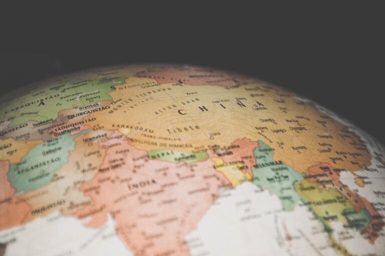
Greenland appears roughly the same size as Africa on Mercator projection maps, yet Africa is actually 14 times larger. You’ll find Greenland measures approximately 836,000 square miles while Africa spans 11.6 million square miles. This dramatic inflation occurs because Mercator projections increasingly stretch landmasses toward the poles, making high-latitude regions appear disproportionately massive compared to equatorial areas.
How Africa Appears Smaller Than It Actually Is
Africa’s true scale becomes evident when you compare it to other continents using equal-area projections like the Gall-Peters. You can fit the United States, China, India, and most of Europe within Africa’s borders simultaneously. Standard classroom maps consistently underrepresent Africa’s size by showing it as comparable to North America, when it’s actually three times larger than the continental United States.
Impact on Educational Understanding of Global Geography
Students develop skewed perceptions of global proportions when exposed primarily to Mercator-based world maps throughout their education. You’ll notice this creates lasting misconceptions about the relative importance and scale of different regions. European and North American countries appear more prominent than they actually are, while tropical and equatorial nations seem diminished, potentially influencing geopolitical perspectives and cultural awareness in subtle but significant ways.
Get durable, tear-resistant posters made in the USA. Each 18" x 29" poster features high-quality 3 MIL lamination for lasting protection.

Alteration of Distance Measurements Affects Navigation and Planning
Map projections create significant distortions in distance measurements that directly impact route planning and navigation accuracy. You’ll encounter these distortions most prominently when comparing projected map distances to actual travel distances.
Great Circle Routes vs Projected Straight Lines
Great circle routes represent the shortest distance between two points on Earth’s curved surface, yet they appear curved on most flat map projections. You’ll notice this effect most dramatically on Mercator projections, where flights from New York to Tokyo appear to curve northward through Alaska rather than following the seemingly straight eastward line across the Pacific. This distortion occurs because the Mercator projection stretches distances increasingly toward the poles, making the curved great circle route actually 2,000+ miles shorter than the apparent straight-line path on the flat map.
Maritime and Aviation Route Planning Challenges
Maritime and aviation professionals face constant challenges when translating map distances to actual travel requirements. You’ll find that fuel calculations, time estimates, and cargo planning become compromised when relying on distorted projection measurements. For example, shipping routes plotted on cylindrical projections can overestimate distances by 15-30% in high-latitude regions, leading to excessive fuel reserves and inefficient scheduling. Aviation charts specifically use conformal projections like Lambert Conformal Conic to minimize these distance distortions for flight planning accuracy.
Commercial and Military Strategic Implications
Commercial shipping companies lose millions annually due to route planning based on distorted distance measurements from inappropriate map projections. You’ll discover that military operations require precise distance calculations for logistics, supply chains, and tactical positioning, making projection choice critical for operational success. Arctic shipping routes particularly suffer from Mercator-based planning, where the Northwest Passage appears much longer than reality, causing companies to miss cost-effective shipping opportunities worth billions in reduced transit times and fuel costs.
Shape Distortion Influences Cultural and Political Perspectives
Map projections don’t just distort physical measurements—they fundamentally alter how you perceive global power structures and cultural relationships. These visual biases shape diplomatic decisions and international understanding in ways that extend far beyond geographic accuracy.
Continental Boundaries and National Territory Representation
Territory visualization directly affects how you assess national power and sovereignty claims. The Mercator projection makes Russia appear 2.2 times larger than Africa, reinforcing perceptions of Russian dominance despite Africa’s actual 1.6 times greater landmass. Arctic nations like Canada and Greenland gain exaggerated visual prominence, while equatorial countries appear diminished. This territorial misrepresentation influences treaty negotiations, resource allocation discussions, and border dispute mediations where visual scale carries psychological weight in diplomatic settings.
Impact on Geopolitical Understanding
Projection choices alter your perception of strategic relationships and global connectivity patterns. Northern hemisphere countries appear more central and accessible on Mercator maps, reinforcing Western-centric worldviews in international relations. China’s true geographic proximity to European markets becomes obscured, while trans-Pacific trade routes appear artificially extended. Military strategists working with distorted projections may misjudge territorial vulnerabilities, alliance formations, and supply chain logistics. These misperceptions directly impact foreign policy decisions and international cooperation frameworks.
Cultural Bias in World Map Selection
Educational and media institutions perpetuate cultural hierarchies through consistent projection choices that favor certain regions. European colonialism historically promoted the Mercator projection, which visually minimizes former colonies while emphasizing European landmasses. Schools using these traditional projections inadvertently teach students that temperate regions matter more than tropical ones. Alternative projections like the Gall-Peters or Winkel Tripel challenge these embedded biases by presenting more balanced continental representations, though adoption remains limited due to institutional resistance and familiarity preferences.
Color and Data Visualization Becomes Skewed Across Projection Types
Data visualization accuracy depends heavily on the underlying map projection you choose. Color gradients and statistical representations become distorted when projection types don’t match your data’s spatial characteristics.
Population Density Mapping Challenges
Population density visualizations suffer significant distortions when you apply uniform color schemes across different projection types. Mercator projections inflate polar region densities by 300-400%, making Greenland appear more populated than India despite having 0.05% of India’s population. Equal-area projections like Mollweide preserve density relationships but compress polar regions, creating misleading visual hierarchies. You’ll find choropleth maps particularly problematic since color intensity corresponds to area size rather than actual population distribution.
Climate Data Representation Issues
Climate data visualization faces severe projection-related challenges that compromise scientific communication. Temperature gradient maps on cylindrical projections stretch Arctic warming patterns across exaggerated landmasses, making 2°C increases appear more dramatic than equatorial changes. Precipitation data suffers similar distortions where high-latitude regions receive disproportionate visual weight despite lower actual rainfall. You must consider that conformal projections preserve temperature isotherms but distort precipitation coverage patterns, while equal-area projections maintain accurate precipitation zones but bend temperature gradients unnaturally.
Economic Statistics Display Problems
Economic data visualization becomes misleading when projection choices don’t account for actual economic zones and trade relationships. GDP per capita choropleth maps on Mercator projections overemphasize wealthy northern countries while minimizing developing tropical economies. Trade flow visualizations suffer when great circle routes appear curved, distorting the visual weight of international commerce patterns. You’ll encounter particular problems with commodity price maps where high-latitude resource regions appear artificially enlarged, skewing perceptions of global market influence and creating false impressions of economic dominance.
Directional Information Gets Compromised in Different Projection Systems
Map projections fundamentally alter angular relationships between geographic features, creating systematic errors in directional measurements. These distortions become increasingly problematic as you move away from a projection’s point of tangency or standard parallels.
True North vs Grid North Confusion
Grid north differs from true north by varying amounts across different map projections, creating navigation errors that compound over distance. The Universal Transverse Mercator (UTM) system shows grid convergence angles ranging from 0° at the central meridian to over 3° at zone edges. You’ll encounter significant bearing discrepancies when using magnetic compass readings on projected maps without applying convergence corrections. Military and surveying applications require precise angular corrections, with some regions showing 5-7° differences between grid and geodetic azimuths.
Compass Bearing Accuracy Problems
Compass bearings plotted on cylindrical projections like Mercator can deviate up to 15° from true bearings in high-latitude regions due to angular distortion. Rhumb lines appear straight on Mercator maps but represent curved paths on Earth’s surface, making compass navigation unreliable for long distances. You’ll find that great circle bearings change continuously along the route, while map projections often display constant bearings that don’t match field conditions. Aviation charts compensate with convergence tables, but recreational users frequently navigate with uncorrected magnetic bearings.
Impact on GPS and Digital Mapping Systems
Digital mapping platforms must constantly convert between coordinate systems, introducing potential directional errors when switching between different projection parameters. GPS receivers calculate positions in World Geodetic System 1984 (WGS84) coordinates but display them using various local projections that can shift directional references by several degrees. You’ll notice routing algorithms sometimes produce suboptimal paths because they rely on projected coordinate calculations rather than spherical geometry. Web mapping services like Google Maps use Web Mercator projection, which creates bearing distortions exceeding 10° in polar regions for navigation applications.
Get fast, accurate GPS positioning for your laptop, PC, car, or boat with this USB receiver. It features a high-performance chip for multi-GNSS support and a magnetic base for easy installation.

Conclusion
Map projections shape your understanding of the world in ways you might never realize. Every time you view a map your perception of geography politics economics and navigation gets filtered through the lens of projection choice.
The distortions aren’t just technical quirks—they’re powerful forces that influence global perspectives and decision-making processes. From shipping routes that cost millions in inefficiencies to cultural biases that persist in classrooms these mathematical transformations carry real-world consequences.
As digital mapping continues to evolve you’ll benefit from developing projection literacy. Understanding these fundamental distortions empowers you to make more informed interpretations of spatial data and geographic relationships. Your awareness of these limitations ultimately leads to better decision-making whether you’re planning travel analyzing global trends or simply trying to understand our complex world.
Frequently Asked Questions
What are map projections and why do they distort reality?
Map projections are methods used to represent Earth’s 3D spherical surface on a flat 2D map. Since it’s mathematically impossible to flatten a sphere without distortion, all maps inevitably alter reality in some way. These distortions affect area, distance, direction, or shape, making the choice of projection crucial for accurate data representation.
How does the Mercator projection distort country sizes?
The Mercator projection significantly exaggerates landmass sizes near the poles while minimizing equatorial regions. For example, Greenland appears similar in size to Africa, despite Africa being 14 times larger. This distortion makes European and North American countries appear disproportionately large compared to tropical nations.
Why do great circle routes appear curved on maps?
Great circle routes represent the shortest distance between two points on Earth’s curved surface. However, when displayed on flat map projections like Mercator, these routes appear curved because the projection distorts the geometry. This can make routes appear longer than they actually are.
How do map projections affect navigation and route planning?
Map projections can cause substantial errors in distance calculations, with some routes appearing 15-30% longer than actual distances in high-latitude regions. This leads to inaccurate fuel calculations, time estimates, and route planning, costing shipping companies millions annually in inefficiencies.
Do map projections influence cultural and political perspectives?
Yes, map projections can reinforce cultural biases and affect perceptions of global power structures. The Mercator projection’s exaggeration of northern countries like Russia while minimizing Africa and other southern nations can subtly influence geopolitical perspectives and international relations discussions.
How do map projections affect data visualization accuracy?
Different projections can dramatically alter how data appears on maps. Population density mapping on Mercator projections can inflate polar region densities by 300-400%, while climate and economic data may be misrepresented, leading to incorrect conclusions about global patterns and relationships.
What problems do map projections create for directional navigation?
Map projections can cause significant errors in compass bearings and directional measurements. The difference between true north and grid north, combined with projection distortions, can lead to navigation errors particularly problematic for military operations, surveying, and long-distance travel planning.
Which map projections provide more accurate representations?
Equal-area projections like Gall-Peters better represent actual landmass sizes, while the Winkel Tripel projection offers a balanced compromise between different types of distortion. However, no single projection can eliminate all distortions, making projection choice dependent on the map’s intended purpose.
Get the perfect fit for your space with our durable and stylish mat! Available in two sizes: 80x55 cm (Small) and 100x69 cm (Medium).