7 Best Community Mapping Methodologies
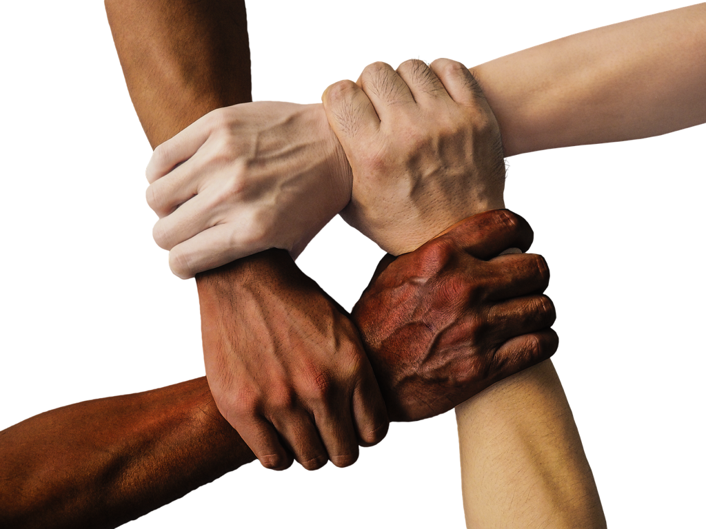
Why it matters: Traditional mapping often excludes entire communities from decision-making processes that directly affect their lives. Participatory mapping changes this dynamic by putting the power of geographic storytelling directly into the hands of local residents and marginalized groups.
The big picture: Seven proven methodologies can transform how you approach community engagement through mapping â from digital storytelling platforms to walking workshops that capture neighborhood knowledge. These techniques help organizations build more inclusive datasets while ensuring that diverse voices shape the maps that influence policy and resource allocation.
Disclosure: As an Amazon Associate, this site earns from qualifying purchases. Thank you!
Understanding the Foundation of Participatory Mapping
You’ll recognize participatory mapping as a fundamental shift from traditional cartographic practices that prioritize professional expertise over community knowledge.
P.S. check out Udemy’s GIS, Mapping & Remote Sensing courses on sale here…
Defining Community-Driven Cartography
Community-driven cartography empowers local residents to create maps using their lived experiences and cultural knowledge. You’re working with communities to document places, boundaries, and resources that matter most to them. This approach combines traditional surveying techniques with indigenous knowledge systems, creating maps that reflect community priorities rather than external agendas. Your role shifts from sole map creator to facilitator and technical advisor.
Benefits of Inclusive Mapping Approaches
Inclusive mapping approaches generate more accurate spatial data by incorporating multiple perspectives and local expertise. You’ll discover hidden patterns and relationships that conventional mapping methods often miss. These methodologies improve data quality through community validation while building local capacity for ongoing spatial analysis. Your maps become powerful advocacy tools that help communities secure land rights, access resources, and influence planning decisions.
Community Asset Mapping: Identifying Local Resources and Strengths
Community asset mapping transforms how you document and leverage existing neighborhood resources by engaging residents as primary data collectors and validators.
Engaging Residents in Resource Identification
Organize neighborhood walking tours where residents identify assets like community gardens, informal meeting spaces, and local businesses that serve as social hubs. Create resident-led mapping sessions using large paper maps where participants mark locations using colored stickers or markers to represent different asset categories. Facilitate door-to-door surveys conducted by trained community members who can access hard-to-reach populations and document resources that outsiders might overlook, such as informal childcare networks or elder support systems.
Documenting Community Assets and Services
Develop comprehensive asset inventories using mobile mapping applications that allow residents to photograph and geotag resources while recording detailed attributes like operating hours, accessibility features, and service capacity. Create standardized data collection forms that capture both tangible assets (libraries, health clinics, transportation hubs) and intangible resources (cultural knowledge, social networks, volunteer systems). Establish community validation processes where residents review and verify mapped assets through neighborhood meetings, ensuring accuracy while building collective ownership of the final asset map database.
Digital Storytelling Maps: Combining Narratives with Geographic Data
Digital storytelling maps transform static geographic data into compelling narratives that capture human experiences within spatial contexts.
Integrating Personal Stories and Spatial Information
Personal narratives anchor abstract geographic data to lived experiences by connecting individual stories to specific locations on your map. You’ll collect audio recordings, written testimonials, and video interviews from community members about their relationships to particular places. Geospatial anchoring techniques link these narratives to precise coordinates using GPS data or address geocoding. Your digital platform should display story markers that users can click to access multimedia content while maintaining clear connections between personal experiences and geographic features.
Using Multimedia Tools for Enhanced Engagement
StoryMapJS and ArcGIS StoryMaps provide user-friendly platforms for combining maps with multimedia content including photos, videos, and audio clips. You’ll embed interactive elements like image sliders, pop-up windows, and scrolling narratives that guide users through geographic storytelling sequences. Mobile data collection apps such as Survey123 and KoBoToolbox enable community members to submit location-tagged stories directly from smartphones. Your multimedia integration should balance file sizes with visual quality to ensure fast loading times across different devices and internet connections.
Experience vivid content on the Galaxy A16 5G's 6.7" display and capture stunning photos with its triple-lens camera. Enjoy peace of mind with a durable design, six years of updates, and Super Fast Charging.

Walking Audits and Mobile Mapping: Real-Time Data Collection on Foot
Walking audits combine traditional field surveying with modern mobile technology to capture comprehensive neighborhood data through systematic ground-truthing. This methodology transforms residents into active data collectors who document spatial conditions as they experience them directly.
Conducting Systematic Neighborhood Assessments
Systematic walking audits require predetermined routes and standardized data collection protocols to ensure comprehensive coverage of your target area. You’ll establish grid-based survey paths that intersect every street segment while maintaining consistent documentation intervals of 50-100 meters. Create assessment checklists covering infrastructure conditions, accessibility features, safety concerns, and community assets to standardize observations across different surveyors. Document environmental factors like lighting quality, sidewalk conditions, and building facades using numerical rating scales that enable quantitative analysis. Train community participants on observation techniques and data recording standards to maintain consistency across multiple survey teams.
Utilizing Mobile Technology for Field Documentation
Mobile mapping applications like KoBo Toolbox and Survey123 enable real-time data capture with automatic GPS coordinates and timestamp verification for each observation. You’ll configure custom forms that combine dropdown menus, photo capture, and voice recording functions to document complex neighborhood conditions efficiently. Leverage offline mapping capabilities to ensure data collection continues in areas with poor cellular coverage while syncing automatically when connectivity returns. Integrate barcode scanning and QR code generation for tracking specific infrastructure elements or community resources across multiple survey sessions. Establish cloud-based data synchronization protocols that allow multiple survey teams to contribute simultaneously while preventing data conflicts and ensuring backup security.
Photo Voice Mapping: Visual Documentation of Community Perspectives
Photo voice mapping transforms traditional cartography by placing cameras directly into community members’ hands. This methodology combines participant-driven photography with geographic data collection to create visual narratives that capture lived experiences within specific spatial contexts.
Empowering Participants Through Photography
Photovoice methodology empowers community members to document their neighborhood experiences through their own lens and perspective. You’ll distribute cameras or mobile devices to participants who photograph locations that hold personal significance, safety concerns, or community assets. This approach shifts mapping control from external experts to local residents who understand nuanced spatial relationships. Training sessions help participants develop basic photography skills while learning to capture images that support geographic analysis. The resulting photographs become primary data sources that reflect authentic community perspectives rather than outside interpretations of local conditions.
Creating Geographic Narratives Through Images
Geographic narratives emerge when you combine participant photographs with location data and personal stories behind each image. Each photograph receives GPS coordinates through mobile mapping apps or post-collection geotagging processes that link visual evidence to specific locations. You’ll facilitate group discussions where participants explain their photographic choices and describe the spatial significance of captured locations. These conversations generate rich qualitative data that provides context for visual documentation. The combined dataset creates powerful advocacy tools that demonstrate community conditions through resident-generated evidence while supporting policy discussions with compelling visual proof of local experiences.
Mental Mapping Exercises: Capturing Cognitive Spatial Perceptions
Mental mapping exercises reveal how community members perceive and navigate their spatial environment through hand-drawn representations of familiar places. This methodology captures cognitive spatial relationships that differ significantly from technical cartographic accuracy.
Facilitating Hand-Drawn Community Maps
Organize drawing sessions where participants sketch their neighborhoods from memory using large paper sheets and colored markers. You’ll provide standardized materials including 18×24 inch paper, pencils, erasers, and colored pencils to ensure consistency across mapping sessions. Guide participants through structured prompts asking them to identify landmarks, pathways, and boundaries they consider important. Document the drawing process by photographing intermediate stages and final maps while recording verbal explanations participants provide about their spatial choices and symbolic representations.
Analyzing Collective Spatial Understanding
Compare individual mental maps to identify recurring spatial elements that appear across multiple participant drawings. You’ll create overlay analysis by digitizing common features like frequently mentioned landmarks, shared pathway preferences, and consistent neighborhood boundaries. Identify spatial distortions where participants consistently enlarge or minimize certain areas, revealing emotional or functional significance of specific locations. Generate composite maps that synthesize collective spatial understanding by combining repeated elements and noting areas where individual perceptions diverge significantly from one another.
Online Collaborative Mapping Platforms: Digital Tools for Remote Participation
Digital mapping platforms eliminate geographic barriers that traditionally limited community participation in cartographic processes. These web-based tools enable diverse stakeholders to contribute spatial data from anywhere with internet access.
Leveraging Web-Based Mapping Technologies
OpenStreetMap’s collaborative editing interface supports simultaneous contributions from multiple users through ID Editor and JOSM applications. You’ll find real-time synchronization prevents data conflicts when community members edit the same geographic areas. Web-based platforms like MapBox Studio and CARTO provide intuitive interfaces for creating custom base maps without requiring technical GIS expertise. These tools integrate seamlessly with mobile applications for field data collection.
Ensuring Accessibility Across Digital Divides
Offline-capable mapping applications bridge connectivity gaps by allowing data collection without constant internet access. KoBo Toolbox and Survey123 synchronize collected data once users reconnect to networks. You can optimize platform accessibility by providing multiple language options and simplified interfaces for users with varying technical skills. Community digital literacy training ensures broader participation across age groups and educational backgrounds.
Focus Group Mapping Sessions: Structured Dialogue Around Geographic Issues
Focus group mapping sessions create structured environments where community members engage in guided conversations about spatial challenges while simultaneously producing geographic data. These facilitated discussions transform community dialogue into actionable cartographic information.
Organizing Facilitated Community Discussions
Plan your focus group sessions around 8-12 participants to maintain productive dialogue while ensuring diverse perspectives. You’ll need large-format base maps printed on 36″ x 24″ paper, colored markers, adhesive dots, and flip chart paper for capturing discussion points.
This 40-count set of Crayola Ultra Clean Washable Markers delivers vibrant color for all art projects. Easily washes from skin, clothing, and painted walls, making them perfect for kids ages 3 and up.

Schedule 90-minute sessions with clear geographic themes like transportation barriers, community safety zones, or resource accessibility. Create discussion guides that move participants from general spatial experiences to specific location-based concerns. Use skilled facilitators who understand both group dynamics and basic cartographic principles to guide conversations effectively.
Translating Group Insights Into Spatial Data
Document participant discussions using both analog and digital methods during sessions. You’ll capture hand-drawn annotations on base maps while recording key quotes and consensus points on separate note sheets.
Transfer physical map markings into GIS databases using coordinate digitization within 48 hours of each session. Convert qualitative observations into quantitative attributes by assigning standardized codes to recurring themes like “safety concern” or “community asset.” Create attribute tables that link participant quotes to specific geographic features, ensuring that community voices remain connected to spatial locations in your final dataset.
Conclusion
These seven methodologies represent a fundamental shift toward democratizing spatial data creation. You’re no longer limited to expensive surveys or expert-led mapping initiatives when you have community members ready to document their own experiences.
The real power lies in combining multiple approaches. You might start with walking audits to identify priority areas then follow up with photo voice mapping to capture deeper community perspectives. Digital platforms ensure your data reaches broader audiences while focus groups help validate findings.
Your success depends on matching methodologies to community needs and technical capacity. Remember that the most sophisticated mapping tools won’t matter if participants can’t access or use them effectively. Building local mapping skills creates lasting impact beyond any single project.
Frequently Asked Questions
What is participatory mapping and why is it important?
Participatory mapping is a community-driven approach that involves local residents in creating maps based on their lived experiences and cultural knowledge. It empowers marginalized communities by giving them a voice in decision-making processes that impact their lives, shifting away from traditional expert-led cartography to inclusive geographic storytelling that reflects community priorities.
How does participatory mapping differ from traditional mapping methods?
Traditional mapping prioritizes professional expertise and external agendas, often overlooking local communities. Participatory mapping combines technical surveying with indigenous knowledge systems, allowing residents to create maps that reflect their actual experiences and needs. This community-driven approach generates more accurate spatial data by incorporating multiple perspectives and local expertise.
What are the main benefits of inclusive mapping approaches?
Inclusive mapping generates more accurate spatial data by incorporating diverse perspectives and local knowledge. It reveals hidden patterns missed by conventional methods, builds local capacity for spatial analysis, and creates powerful advocacy tools for securing land rights and accessing resources. Community validation processes also enhance data quality and foster collective ownership.
What is community asset mapping and how does it work?
Community asset mapping engages residents as primary data collectors to document and leverage existing neighborhood resources. It involves organizing walking tours to identify assets like community gardens, conducting door-to-door surveys, and using mobile apps to photograph and geotag resources. This process helps communities better understand their strengths and available resources.
How do digital storytelling maps enhance community engagement?
Digital storytelling maps combine personal narratives with geographic data, linking individual stories to specific map locations through audio, video, and written content. Platforms like StoryMapJS and ArcGIS StoryMaps enable multimedia integration, while mobile apps allow community members to submit location-tagged stories, creating compelling representations of human experiences within spatial contexts.
What are walking audits and how do they improve data collection?
Walking audits combine traditional field surveying with mobile technology, allowing residents to document spatial conditions in real-time as they experience them. Using apps like KoBo Toolbox and Survey123, communities can conduct systematic neighborhood assessments with GPS verification and offline capabilities, enhancing accuracy and efficiency of data collection.
What is photo voice mapping and how does it empower communities?
Photo voice mapping places cameras in community members’ hands to document neighborhood experiences through photography. Participants capture images of significant locations or safety concerns, shifting mapping control from external experts to residents. Combined with location data and personal stories, these photographs become powerful advocacy tools demonstrating community conditions.
How do mental mapping exercises contribute to participatory mapping?
Mental mapping exercises capture how community members perceive their spatial environment through hand-drawn neighborhood sketches. These drawing sessions reveal cognitive spatial perceptions and emotional significance that differ from technical accuracy. Analyzing collective mental maps helps identify recurring spatial elements and generates composite representations of community spatial understanding.
What role do online collaborative mapping platforms play?
Online collaborative platforms like OpenStreetMap eliminate geographic barriers, enabling diverse stakeholders to contribute spatial data from anywhere with internet access. These tools support real-time synchronization and simultaneous contributions. Offline-capable applications ensure accessibility across digital divides, while digital literacy training promotes broader participation across demographics.
How do focus group mapping sessions work?
Focus group mapping sessions create structured environments for 8-12 community members to engage in guided spatial conversations using large-format base maps and colored markers. Skilled facilitators document discussions and translate insights into spatial data. This methodology transforms community dialogue into actionable cartographic information, ensuring voices are reflected in final datasets.